Jan Janssonius (also known as Johann or Jan Jansson or Janszoon) (1588-1664) was a renowned geographer and publisher of the seventeenth century, when the Dutch dominated map publishing in Europe. Born in Arnhem, Jan was first exposed to the trade via his father, who was also a bookseller and publisher. In 1612, Jan married the daughter of Jodocus Hondius, who was also a prominent mapmaker and seller. Jonssonius’ first maps date from 1616.
In the 1630s, Janssonius worked with his brother-in-law, Henricus Hondius. Their most successful venture was to reissue the Mercator-Hondius atlas. Jodocus Hondius had acquired the plates to the Mercator atlas, first published in 1595, and added 36 additional maps. After Hondius died in 1612, Henricus took over publication; Janssonius joined the venture in 1633. Eventually, the atlas was renamed the Atlas Novus and then the Atlas Major, by which time it had expanded to eleven volumes. Janssonius is also well known for his volume of English county maps, published in 1646.
Janssonius died in Amsterdam in 1664. His son-in-law, Johannes van Waesbergen, took over his business. Eventually, many of Janssonius’ plates were sold to Gerard Valck and Pieter Schenk, who added their names and continued to reissue the maps.
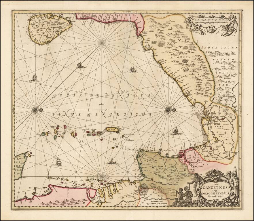
Valk and Schenk's edition of Jansson's engraved map of the Bay of Bengal from Ceylan (Sri Lanka) to Sumatra. This striking large format sea chart was originally published in a Jansson sea atlas. European and Oriental vessels are shown crossing the...
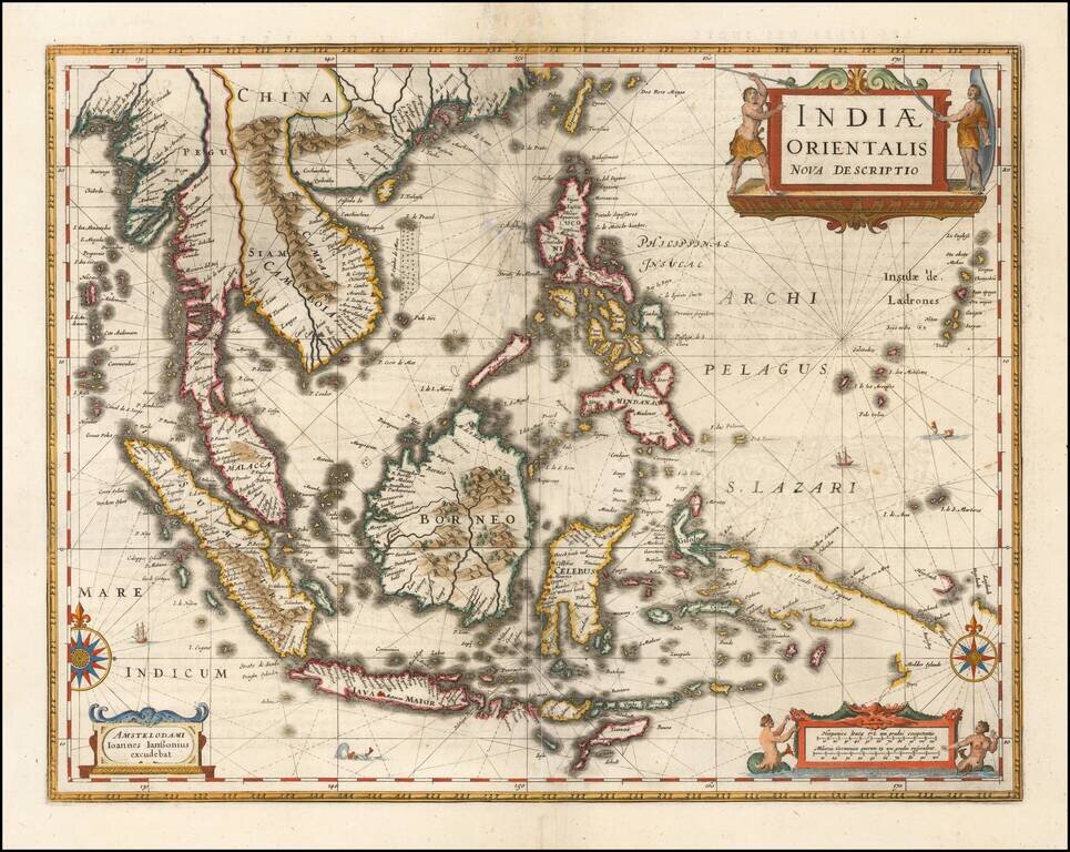
Important early map of Southeast Asia and the Philippines as well as a landmark map in the mapping of Australia, first published by Jan Jansson in 1630. The detail in the Philippines and Southeast Asia is excellent for the period. The map is perhaps...
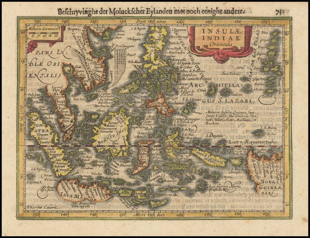
Fine example of Jansson's new map of Southeast Asia and the Philippines, which appeared in his Atlas Minor, first issued in 1628. Jansson has revised and significantly improved this regional map, which had been previously issued by Hondius in 1607,...
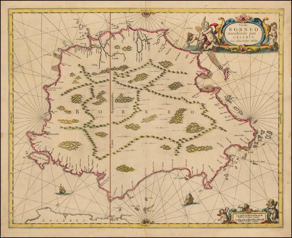
Nice example of Jansson's chart of Borneo, the earliest large format map to focus on the Island.
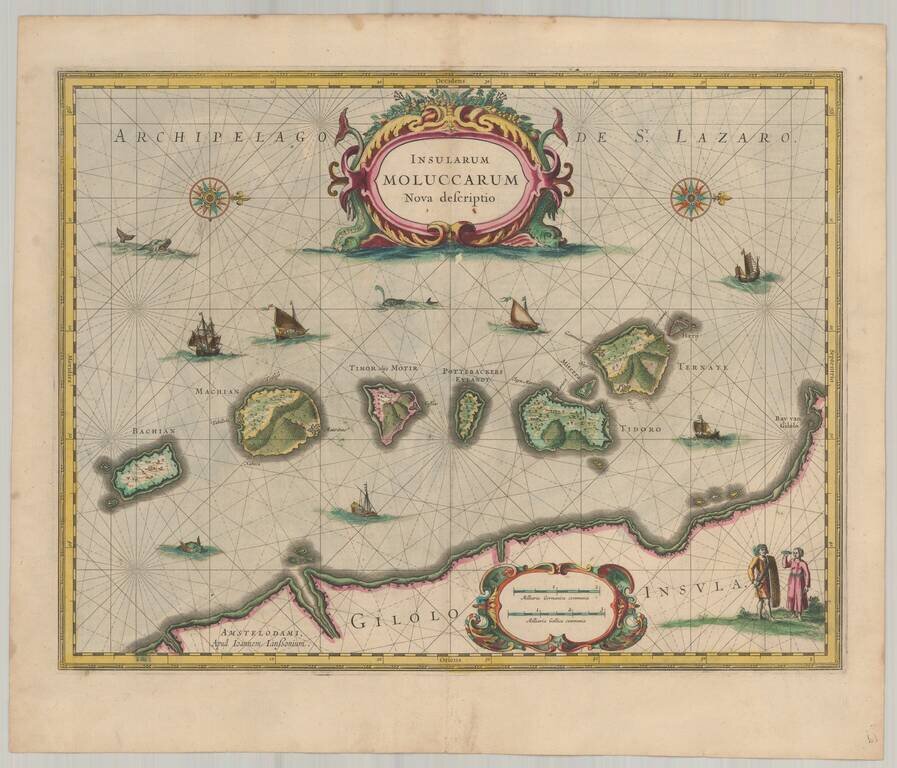
Old color example of Jansson's important and highly decorative map of the Spice Islands. The map features a Moluccan couple in the lower right corner in Europeanized native dress. Indicative of the area's commercial importance, Jansson has filled the...
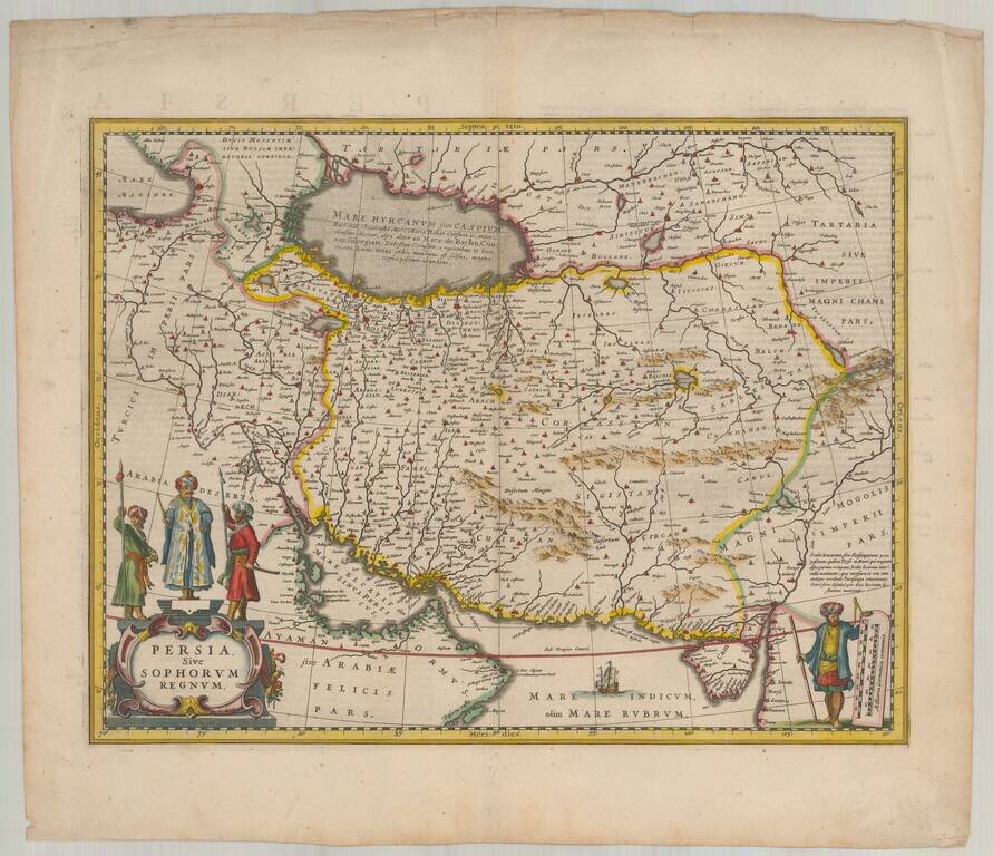
Nice colored example of Jansson's map of Persia. The map extends from the Eastern Mediterranian to Tacalistan and the Indus River and the Dalanguer Mountains and the Cabul Region, with the Red Sea and the Persian Gulf in the South and Caspian and...
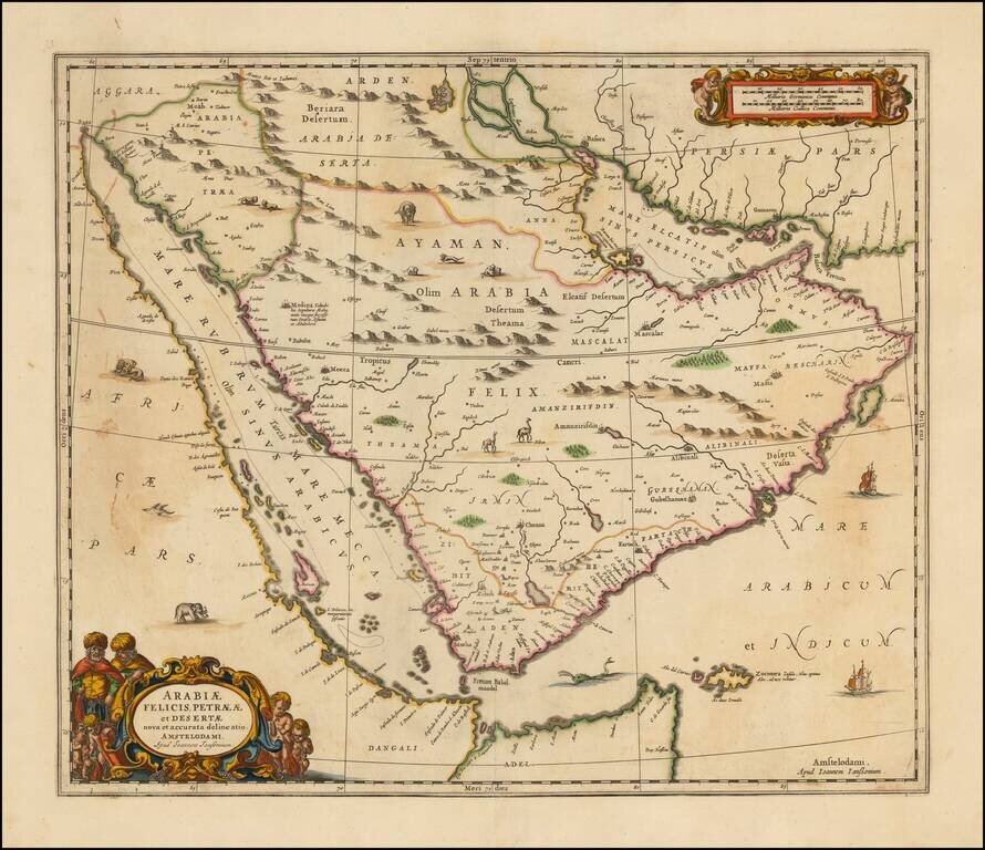
Striking large format map of Arabia and the Red Sea, published by Jansson. The map references the "Mare Elcatif or Sinus Persicus," showing both the Persian and Arab names for the Gulf between Persia and Saudi Arabia. This reflects both the name used...
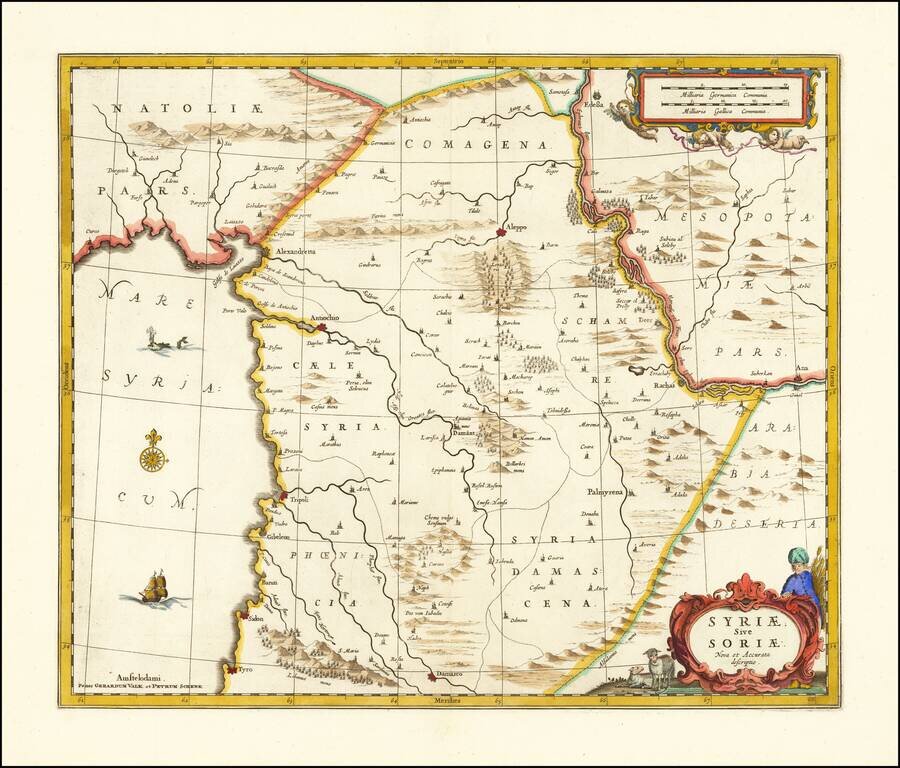
Detailed map of Syria published in Amsterdam by Jansson. The map extends from Damascus and Sidon in the south, to Edessa, Alexandretta, and Antioch in the north as well as to Aleppo, Palmyrena, Damant, etc. The map also extends from the Mediterranean...
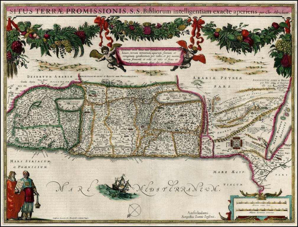
Fine old color example of Jansson's map of the Holy Land, based upon the report of Christian Van Andrichom, then the most influential holy land cartographer.
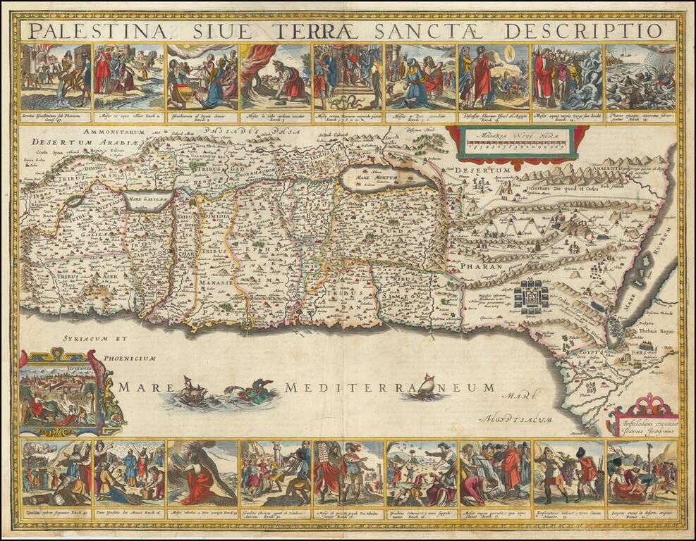
Finely colored and highly decorative map of the Holy Land, embellished with 18 decorative vignettes showing scenes of Moses from Exodus and a view of Jerusalem. Based upon Van Andrichom, the map is oriented to the East, divided into the tribes on both...
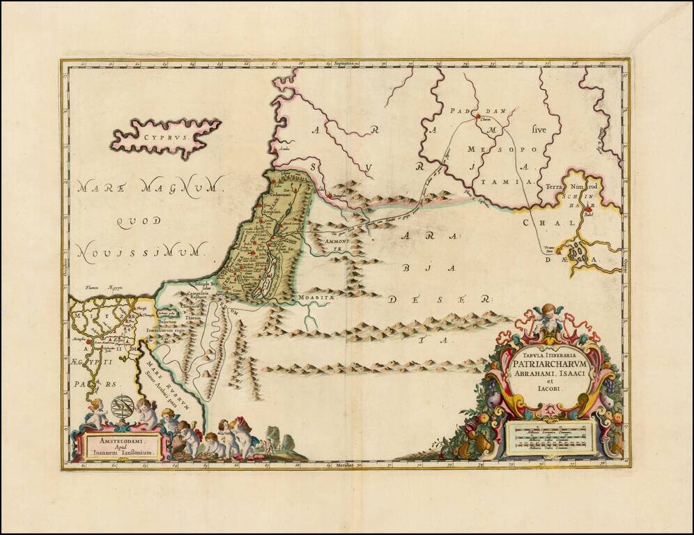
Decorative regional map of the Holy Land, showing the travels of Abraham, Isaac and Jacob. Includes nice details, topography and a line tracing the route travelled.
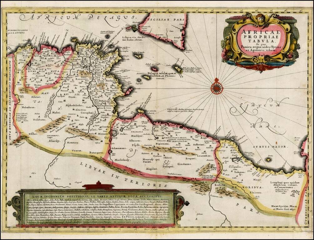
Fine ENGLISH color example of Jansson's map of Sicily and North Africa. Decorative map showing the North African coast (Tunisia), Malta and its neighboring islands, and a part of Sicily. Decorative title cartouche and text box. Maps in early English...
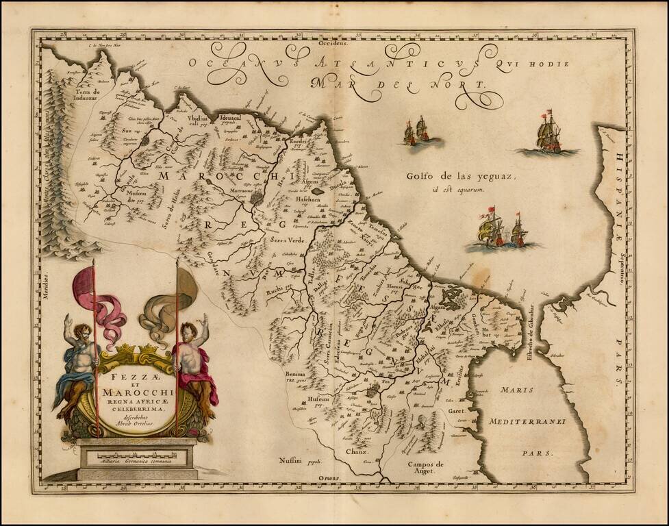
Nice old color map of Morocco, showing large fortified towns of Marakesh, Taradante and Fez, towns, mountains, rivers, lakes, etc. Tanger, Cueta and Rio Rabata also appear. Large decorative cartouche and sailing ships. Ortelius is credited in the...
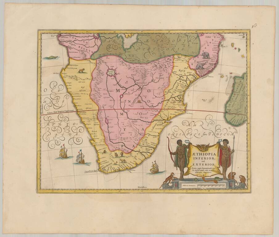
Attractive map of Southern Africa, shortly before the first Dutch settlement in the region. The area shown is from the Congo River basin around the Cape of Good Hope and up the east coast as far as northern present-day Mozambique. Many coastal names...
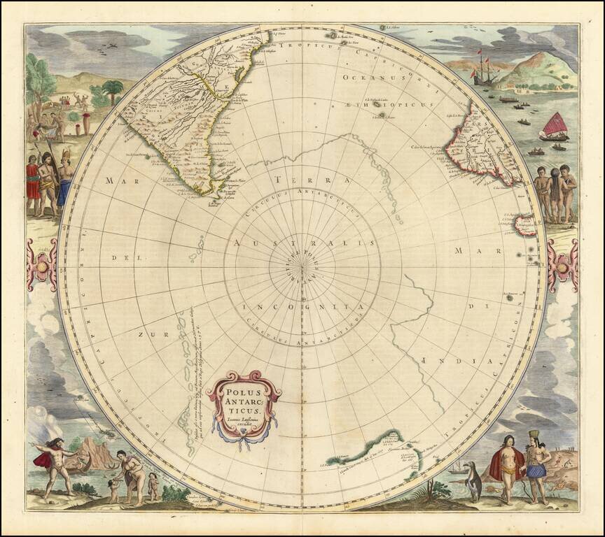
Third state of Hondius' decorative map of the South Polar region, with the name Joannes Janssonius appearing for the first time. The present state predates the first appearance of New Zealand and Van Dieman's Land. The map includes significant...
![[South Polar Regions]](/map/small/43970.jpg)
Decorative example of Jansson's map of the South Polar region, including the earliest appearance of New Zealand and Van Dieman's Land. The supposed coastline of the unknown southern continent continues to appear. Includes notes regarding the...