Map size in jpg-format: 991.401KiB
Click to open in high resolution (open in new tab).
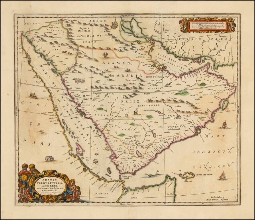
Striking large format map of Arabia and the Red Sea, published by Jansson.
The map references the "Mare Elcatif or Sinus Persicus," showing both the Persian and Arab names for the Gulf between Persia and Saudi Arabia. This reflects both the name used by Ptolemy (150AD). and more modern names. Ptolemy relied upon Indika, written by Flavus Arrianus and Strabo for his use of the term "Sinus Persicus." The earliest recorded Arabic language names for the Gulf were:
In 1546, the Ottoman Turks conquered the area around Basra and invaded the Arabian Coast as far as Qatif, which they occupied, removing the Portuguese from the region. The Turks adopted the names Gulf of Basrah, Gulf of Qatif and Gulf of Arabia. From 1572 onward, the name Mare Elcatif began to appear on maps.
Includes 2 decorative cartouches, lions, camels, elephants, sea monsters and sailing ships.
One of the most decorative of all 17th Century large format maps of Saudi Arabia.
If you are a student, write to us in telegram: @antiquemaps and indicate what material you need and for what work you need a map in high detail. We are ready to provide material on special terms. For students only!

![[Europe, Mediterranean, Asia Minor and the Persian Empire]](/map/small/43558.jpg)
