Jan Janssonius (also known as Johann or Jan Jansson or Janszoon) (1588-1664) was a renowned geographer and publisher of the seventeenth century, when the Dutch dominated map publishing in Europe. Born in Arnhem, Jan was first exposed to the trade via his father, who was also a bookseller and publisher. In 1612, Jan married the daughter of Jodocus Hondius, who was also a prominent mapmaker and seller. Jonssonius’ first maps date from 1616.
In the 1630s, Janssonius worked with his brother-in-law, Henricus Hondius. Their most successful venture was to reissue the Mercator-Hondius atlas. Jodocus Hondius had acquired the plates to the Mercator atlas, first published in 1595, and added 36 additional maps. After Hondius died in 1612, Henricus took over publication; Janssonius joined the venture in 1633. Eventually, the atlas was renamed the Atlas Novus and then the Atlas Major, by which time it had expanded to eleven volumes. Janssonius is also well known for his volume of English county maps, published in 1646.
Janssonius died in Amsterdam in 1664. His son-in-law, Johannes van Waesbergen, took over his business. Eventually, many of Janssonius’ plates were sold to Gerard Valck and Pieter Schenk, who added their names and continued to reissue the maps.
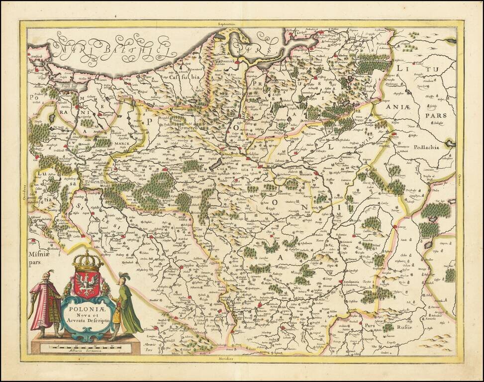
Striking antique engraved map of Poland and parts of Lithuania, Pomerania, and Prussia, published in Amsterdam by Jan Jansson. The map includes a large decorative cartouche and the Coat of Arms of Poland, with a crowned white eagle on a red field.
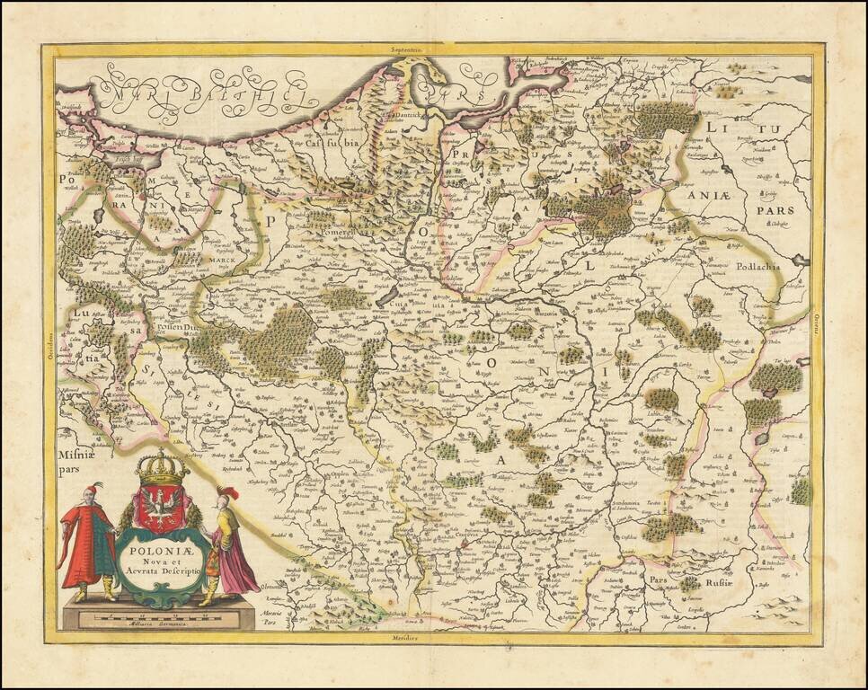
Striking example of Jansson's map of Poland and parts of Lithuania, Pomerania and Prussia. A scarce map of Poland extending from Stettin and Crossen to Cracow, to Lublin and Warsaw and north to the Baltic. Several imposing figures support the...
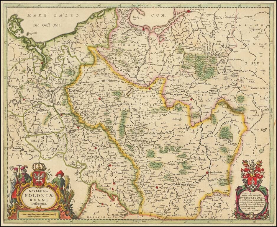
Striking map of Poland and the Baltic states, with two decorative cartouches. Extends east to Lithuania, North To Koningsperg, East to Rugia and South to Dresden, Olmutz, Radibor and Carcovia. Shows Danzig, Wladislaw and Warzovia.
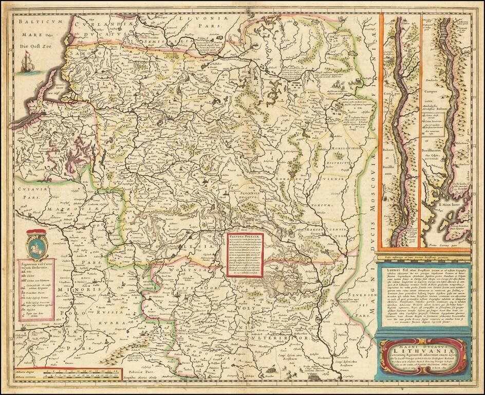
Nice old color example of this important map of Lithuania at its grandest scale (incuding Poland, Ukraine and part of Russia), including a large inset of the Dniepr River, based upon Hessel Gerritsz's four sheet map of the same title. Hessel Gerritsz...
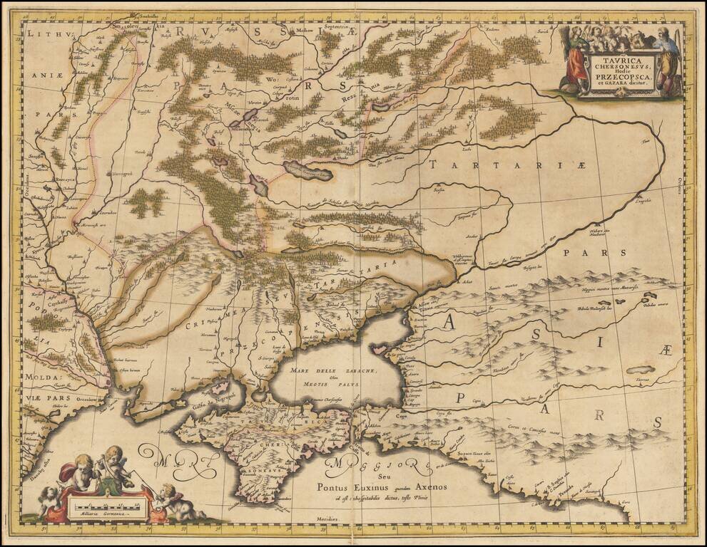
Detailed map of the Ukraine and surrounding regions between the northern coast of the Black Sea and Moscow. Shows ports, fortified cities and the mouths of the Danube. Two decorative cartouches.
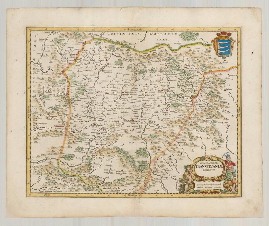
Finely executed map of Transylvania, published in 1665 for Jansson's Atlas Maior. One of the earliest separately published maps of Transylvania.
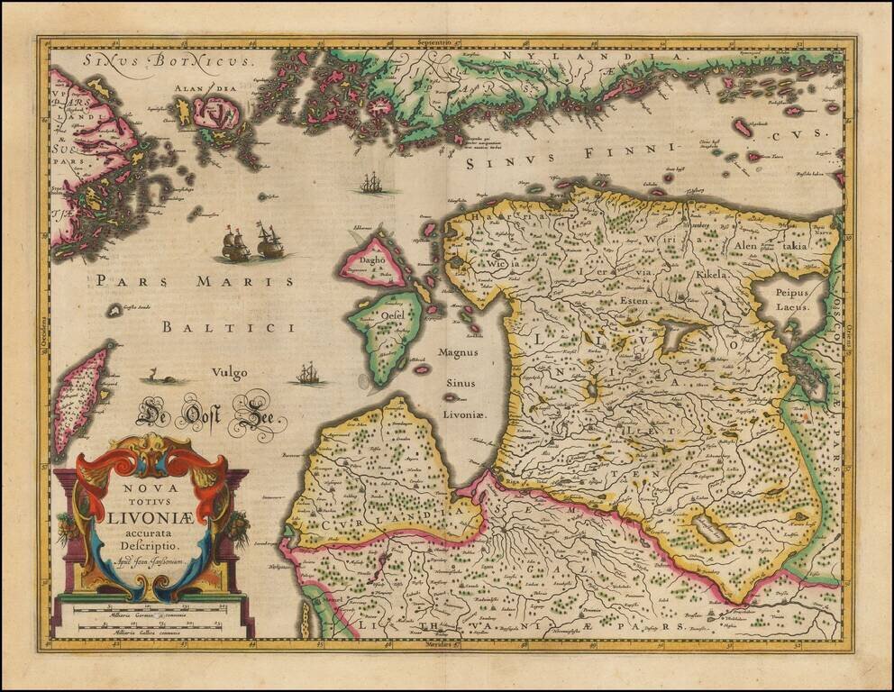
Striking full color example of Jansson's new map of the Balkans and the Sinus Finnicus. Decorative map of Estonia and Latvia. Including the southern tip of Finland and the south eastern tip of Sweden, including Stockholm. Includes a decorative...
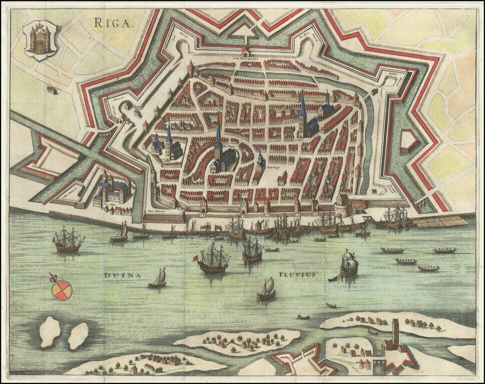
Gorgeous early plan of Riga, including coat of arms and sailing ships in the harbor. The map shows the town plan and the Duina River, with several places identified by name. Jansson's plan appeared in two different publications, Jansson's rare 6...

Nice old color example of Jansson's second map of Istria, with east oriented at the top. Jansson's map is based upon Magini's map of 1620, which appeared in his atlas of Italy, the first modern atlas to focus on Italy. Shows the Istria peninsula,...
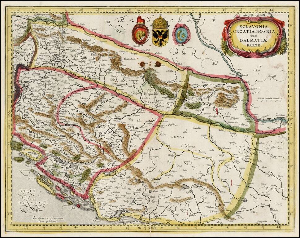
Decorative old color example of this fine map of the Balkans and the Gulf of Venice, with a large decorative cartouche. The map is in original ENGLISH color, which is very rare on the market and easily distinguished from contemporary Dutch color.
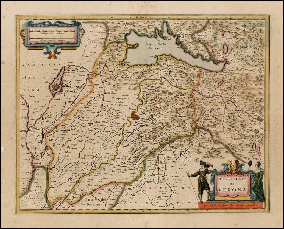
Nice old color example of Jansson''s map of the Territory of Verona, centered on Verona and Lago di Garda. Decorative title cartouche and scale of miles.
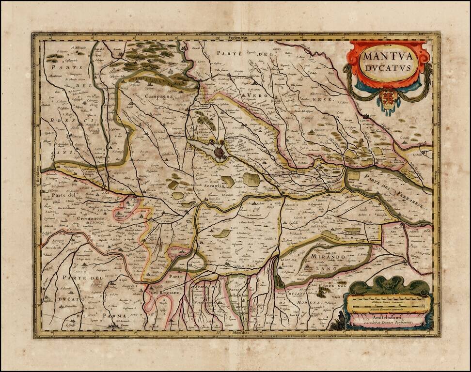
Nice old color example of Jansson's map of the Duchy of Mantua. Includes a decorative cartouche.
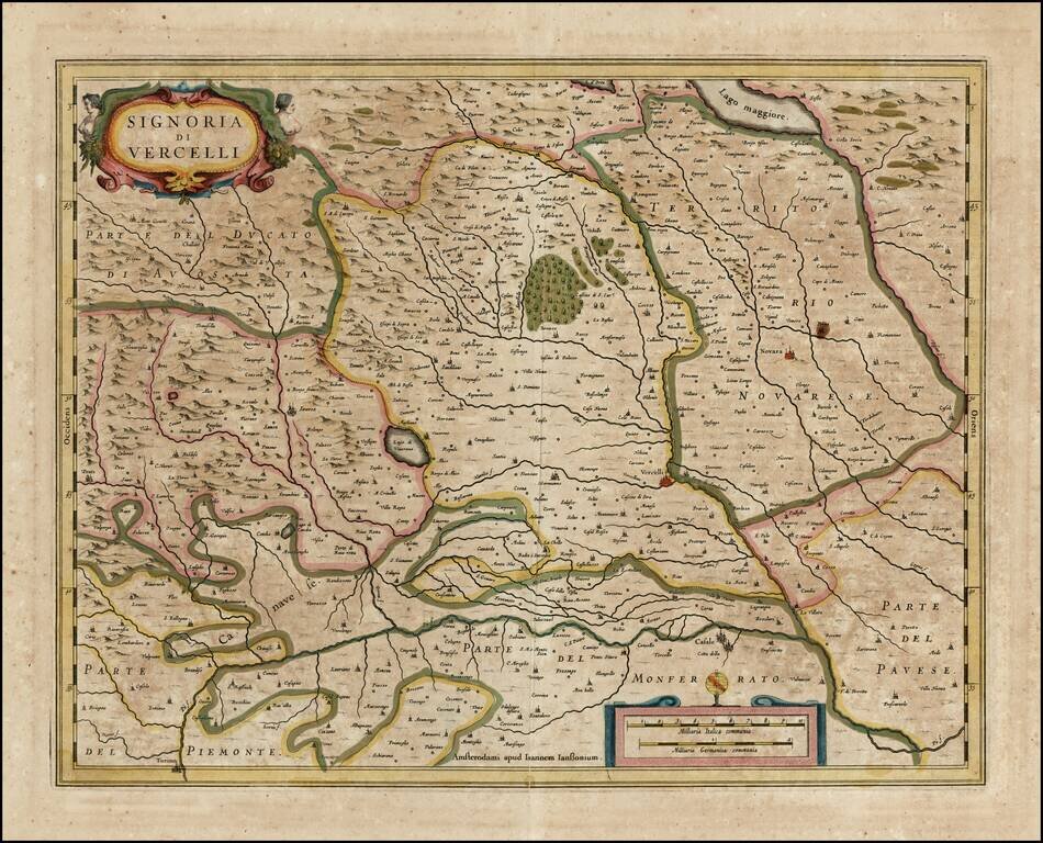
Nice old color example of Jansson's map of the Signory of Vercelli. Includes a decorative cartouche.
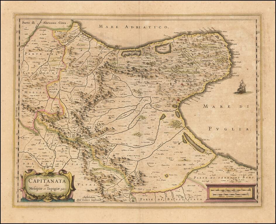
A nice example of Jan Janssonius's circa 1640 double-page engraved map of Foggia, Italy. Johannes Janssonius Johannes Janssonius (1588, Arnhem - buried July 11, 1664, Amsterdam) (born Jan Janszoon, often called Jan Jansson) was a Dutch cartographer...
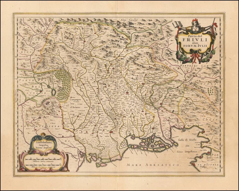
Nice old color example of Jansson's maps of Friuli and the Gulf of Trieste. Includes a decorative cartouche and sailing ships.
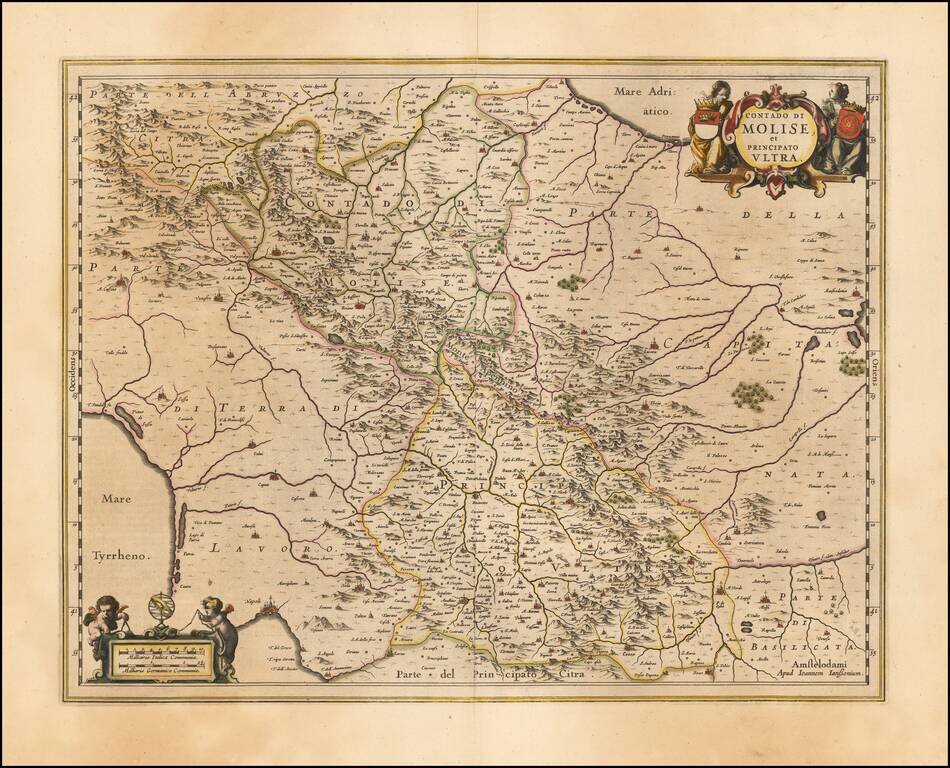
Decorative regional map of Italy, engraved by Jan Jansson. Larger cities include Benevento, Ariano, Avellino, Conza, Troia and Lucera. Napoli appears at the far southwest corner of the map.