Jan Janssonius (also known as Johann or Jan Jansson or Janszoon) (1588-1664) was a renowned geographer and publisher of the seventeenth century, when the Dutch dominated map publishing in Europe. Born in Arnhem, Jan was first exposed to the trade via his father, who was also a bookseller and publisher. In 1612, Jan married the daughter of Jodocus Hondius, who was also a prominent mapmaker and seller. Jonssonius’ first maps date from 1616.
In the 1630s, Janssonius worked with his brother-in-law, Henricus Hondius. Their most successful venture was to reissue the Mercator-Hondius atlas. Jodocus Hondius had acquired the plates to the Mercator atlas, first published in 1595, and added 36 additional maps. After Hondius died in 1612, Henricus took over publication; Janssonius joined the venture in 1633. Eventually, the atlas was renamed the Atlas Novus and then the Atlas Major, by which time it had expanded to eleven volumes. Janssonius is also well known for his volume of English county maps, published in 1646.
Janssonius died in Amsterdam in 1664. His son-in-law, Johannes van Waesbergen, took over his business. Eventually, many of Janssonius’ plates were sold to Gerard Valck and Pieter Schenk, who added their names and continued to reissue the maps.
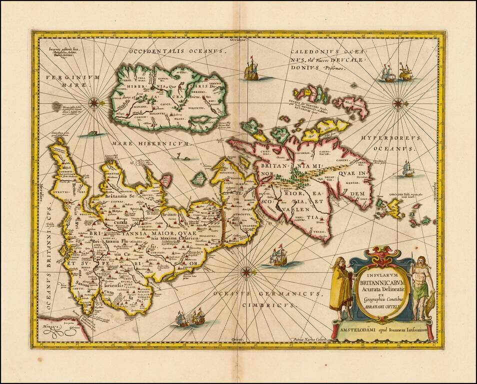
Nice example of Jansson's map of the Ancient British Isles. Includes decorative cartouche, sea monstersa and 7 sailing vessels. Engraved by Peter Van Den Keere. This edition includes rhumb lines.
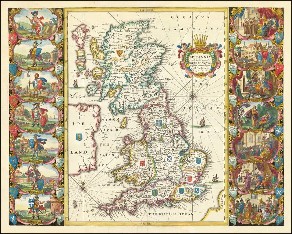
Decorative map of the British Isles, showing the Saxon Kingdoms of Britain in the 5th to 6th Centuries. Jansson's Saxon Heptrarchy map is drawn directly from Joan Blaeu's map of the same title published in 1645, but can be readily distinguished from...
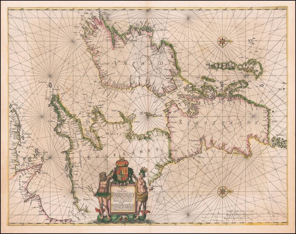
One of the Earliest Sea Charts of the British Isles. Old color example of Jansson's sea chart of the British Isle. Oriented with east at the top, this is one of the earliest sea charts of the entirety of the British Isles. The beautiful title...
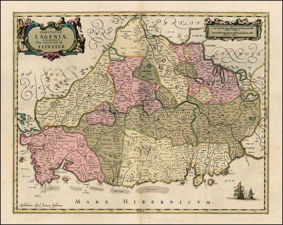
Striking old color example of Jansson's map of the County of Leinster. This example appeared in a composite atlas, issued in the late 17th Century and has no text on the verso.
![[Wales] Cambriae Typus Auctore Humfredo Lhuydo . . .](/map/small/41983.jpg)
Second state of this finely engraved map of Wales, with new decorative cartouche. The map is derived from the Welsh cartographer Humphrey Lhuyd's 1568 map, the first modern map of Wales. The map was revised and made slightly smaller in...
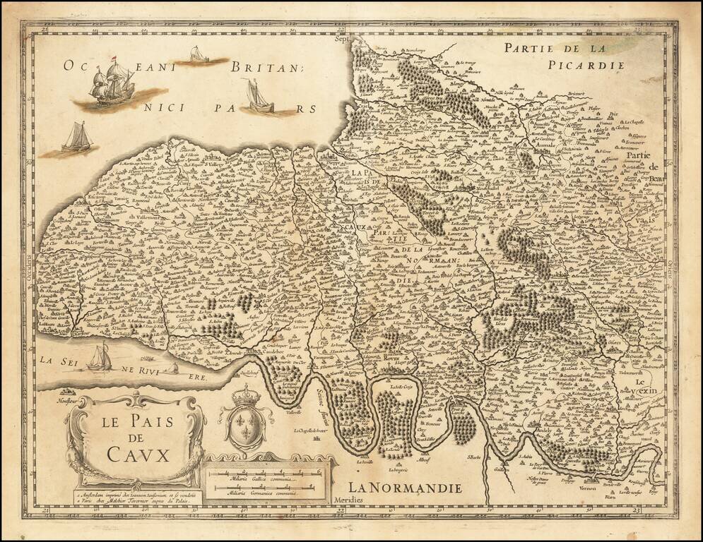
Detailed map of the region, which also bears the name of Melchior Tavernier, the Paris mapmaker and bookseller. Covers the region north of the Seine River to the Atlantic Coast. Include Dieppe, Aumale, Neuschastel, Rouen, etc,
![Territorium Argentoratense [engraved by Petrus Kaerius]](/map/small/12164.jpg)
Striking full color example of Jansson's map of the area around Strassbourg, with a plan of the town, decorative cartouche and two coats of arms. One of the view maps engraved by Petrus Kaerius (Peter Van Den Keere) to be offered by Jansson. French...
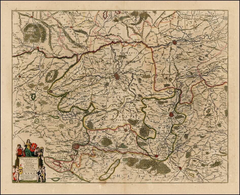
Detailed map of the French part of Flanders, including Douay, Lille, Doornick, Conde, St. Amand. Decorative cartouche.
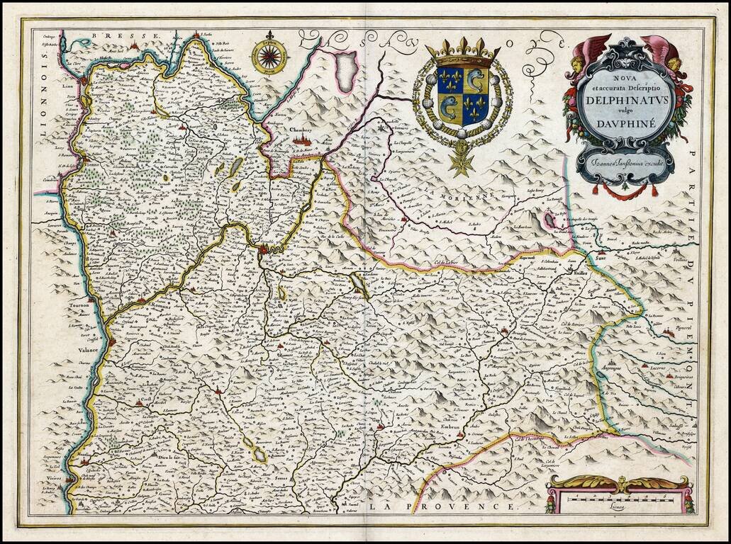
Old Color, gold heightened example of this fine regional map of the wine regions of southeastern France. A decorative map of Dauphiné region in France. Originally a separate province in southeastern France, the area now comprises of the present day...
![[Paris] Lutetia vulgari Nomine Paris, Urbs Galliae Maxima . . .](/map/small/47086.jpg)
Fine example of Jansson' rare town plan of 16th Century Paris, based on Sebastian Munster's map of 1569. Paris began as a small settlement on an island in the Seine, named Lutetia by the Gallii Parisii. This island, seen at the center of the map,...
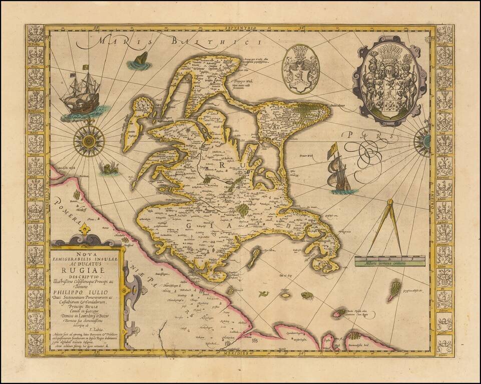
Striking hand-colored example of this decorative map, including two compass roses, sailing ships, sea monsters and massive coat of arms, plus the smaller coat of arms along both side borders, filled with the coats of arms of the island's leading...
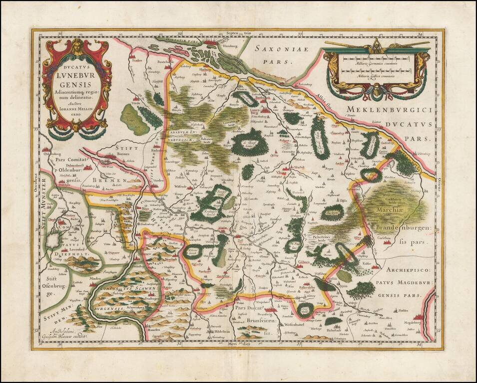
Striking full color example of Jansson's regional map. Extends from Hamburg to Wolfenbuttel, showing the lower Albis River. Bremen, Lunenborg, Nienborg, Brunswig, Magedburg and Oldenburg also appear on the map. Two decorative cartouches.
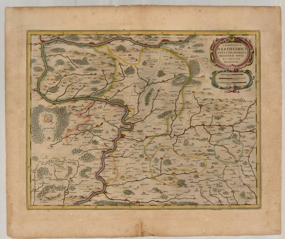
Detailed map of the Wertheim Region, publsiehd in Amsterdam. The map shows Wertheim, Wurtzberg, Carlstadt, Muhlenberg,
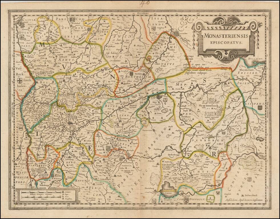
Detailed regional map of the Munster region of Germany, published by Jansson in Amsterdam. The map is centered on Munster and includes Osnabruck, Lingen, Wesel, Coevoerden (Netherlands), and Oldenberg. Includes numerous small coats of arms.
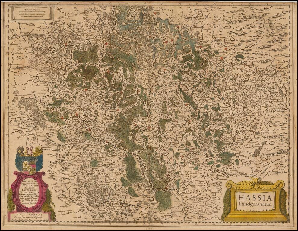
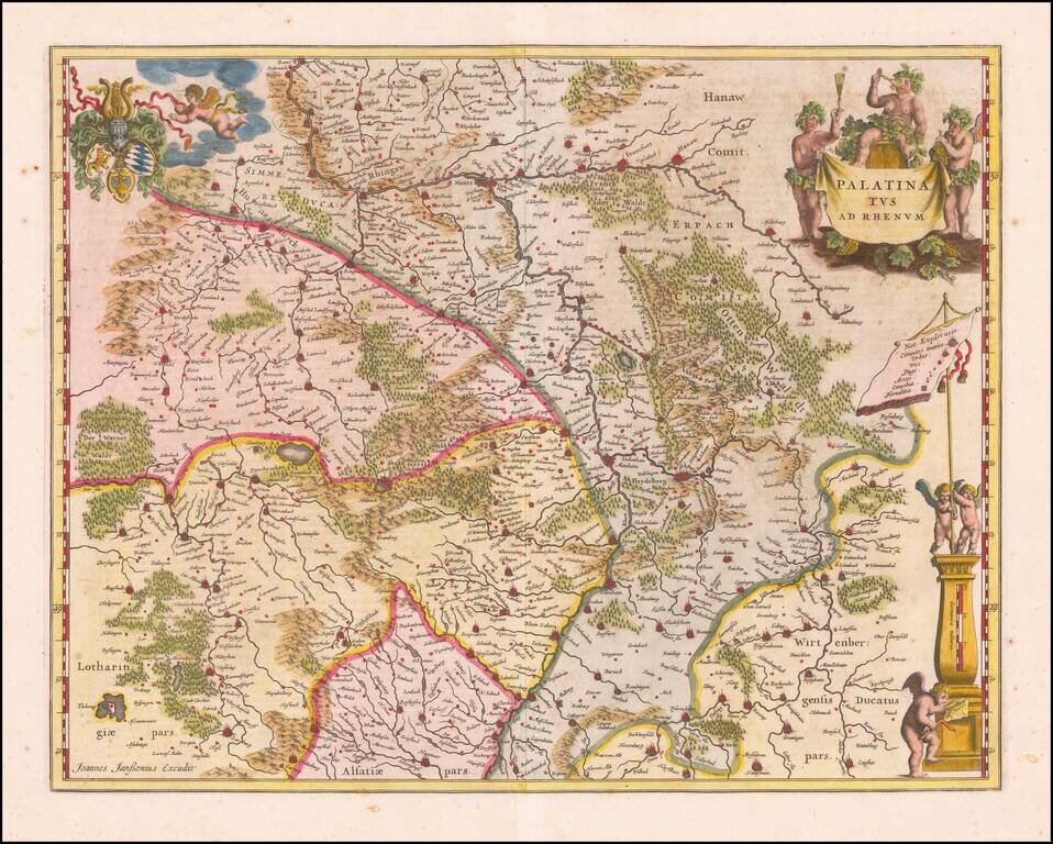
Antique map of Rheinpfalz Finely executed map of southwestern Germany and the Alsace, published by Jansson in Amsterdam. The map is centered on Heidelberg and includes Frankfurt, Mainz, Worms, Manheim, Kaiserslauten, Wiesbaden, Hannau, Offenbach,...