Peter Schenk the Elder (1660-1711) moved to Amsterdam in 1675 and began to learn the art of mezzotint. In 1694 he bought some of the copperplate stock of the mapmaker Johannes Janssonius, which allowed him to specialize in the engraving and printing of maps and prints. He split his time between his Amsterdam shop and Leipzig and also sold a considerable volume of materials to London.
Peter Schenk the Elder had three sons. Peter the Younger carried on his father’s business in Leipzig while the other two, Leonard and Jan, worked in Amsterdam. Leonard engraved several maps and also carried on his father’s relationship with engraving plates for the Amsterdam edition of the Histoire de l'Académie Royale des Sciences.
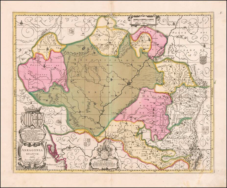
Gorgeous map of Valk & Schenk's map of Aragon, centered on Zaragoza and extending to Balbasdtor, Huesca, Calataiud, Tortosa, Tervel, Albarrazin, Cuenca etc. Shows towns, rivers, mountains, lakes, valleys, etc. Includes 2 large cartouches and 5...
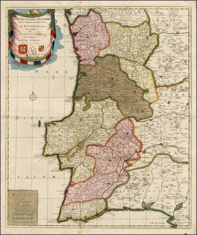
Striking old color example of Schenk's rare map of Portugal, with the coats of arms of Portugal, Algarbia and a Spanish sailing vessell in the cartouche. The map is in fine old color and printed on double thick paper, from a composite atlas of the period.
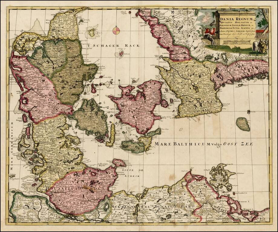
Nice old color example of Pieter Schenk's map of Denmark and surrounding regions, from an early 18th Century composite atlas.
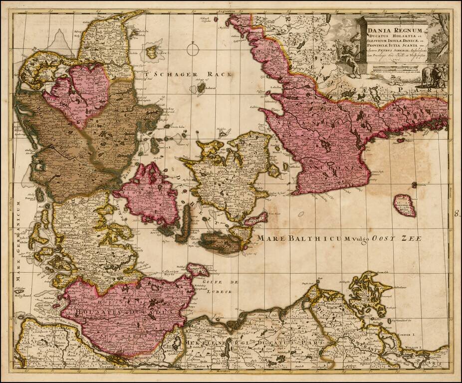
Nice old color example of Pieter Schenk's map of Denmark and surrounding regions, from an early 18th Century composite atlas.
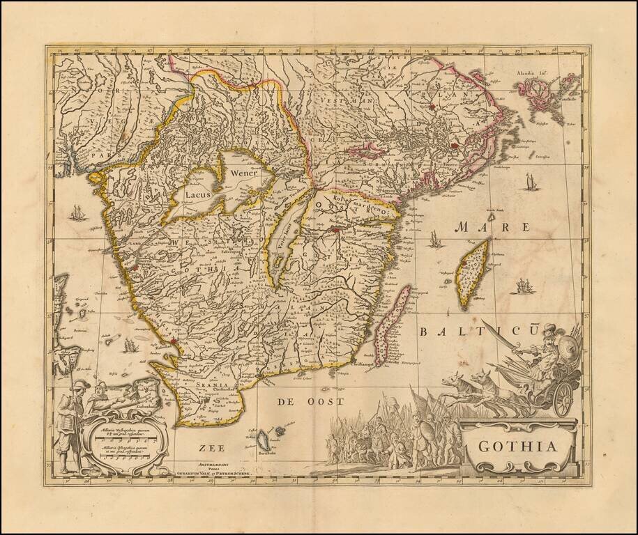
Decorative map of Gothia, published by Valk & Schenk. The map is richly decorated with a large figurative cartouche, scale of miles and sailing ships. Shows the area including Gothenburg, Malmo, Copenhagen, Lund, Helsingborg, Kristianstad,...
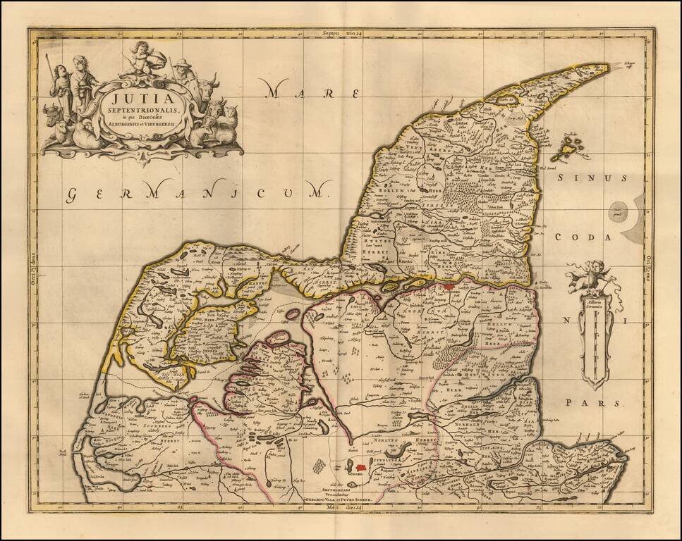
Nice example of Schenk and Valk's map of the northern part of Jutland. Major cities include Viborg and Aalborg.
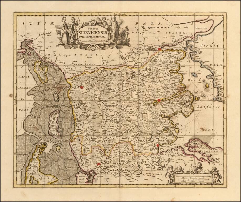
Detailed map of the southernmost part of Denmark, published in Amsterdam by Valk & Schenk.
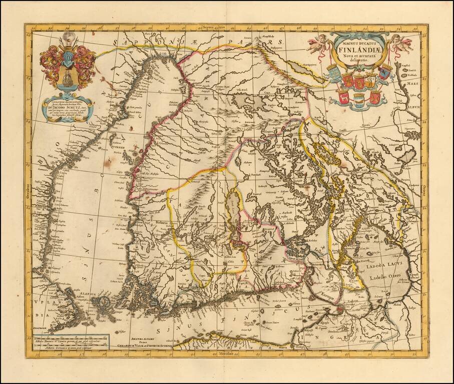
Nice example of one of the earliest maps of Finland, based upon the work of Anders Bure. Originally engraved by Jan Jansson, the copperplate was later acquired by Valk & Schenk. The Valk & Schenk edition is by far the more scarce edition of...
![[Port Mahon, Menorca] Plan de la Fortification Fait par les Anglois sur la Fort St. Philippo Situe a Lembouchire du Port de Mahon dans l'Isle de Minorque.](/map/small/59725.jpg)
Extremely Rare Map of Fort St. Philip in Minorca Rare, fine map of Fort St. Philip (Castle of St. Philip) and the surrounding area in Port Mahón, Minorca, by Peter Schenk. The sharply-geometric star fort sits at the center of the map and is...
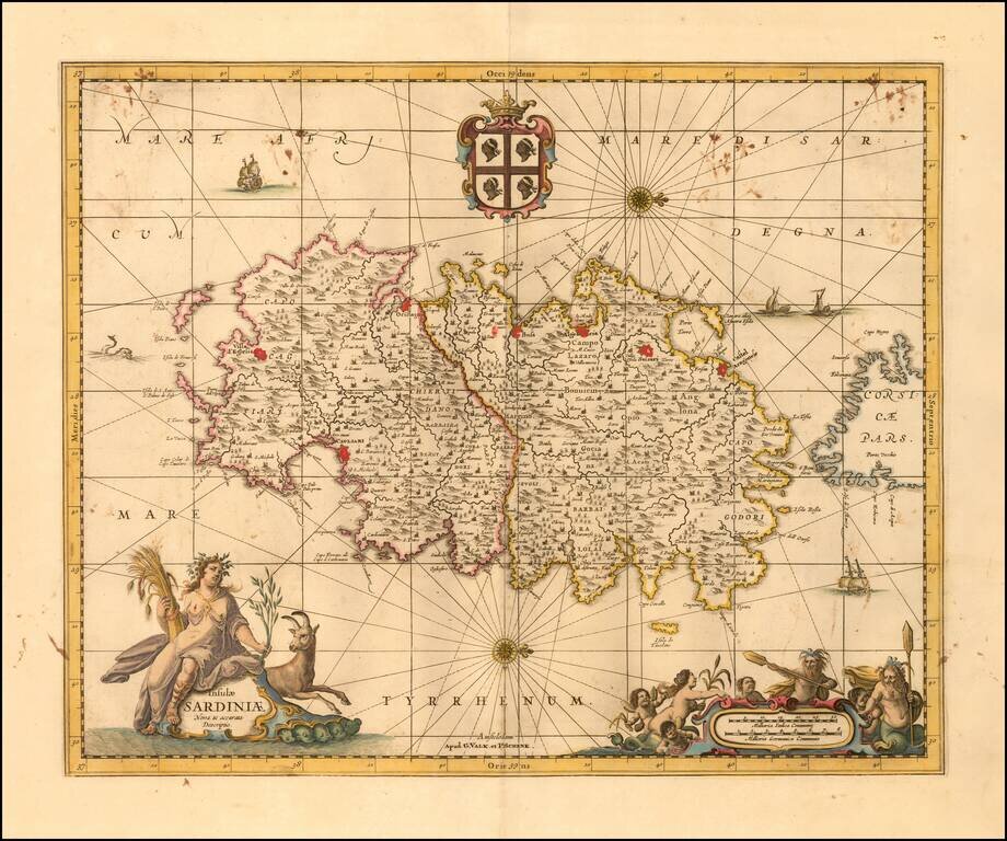
Finely executed map of Sardinia, published in Amsterdam by Valk & Schenk. The map includes a decorative title cartouche, compass rose, coat of arms and second cartouche, along with sailing ships and a sea monster.
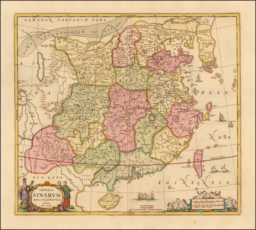
Scarce map of China and Korea, based upon Jansson's map of 1658. China is colored by provinces. Excellent detail throughout the map, which includes the Islands of Formosa and Hainan. The Great Wall of China is shown.
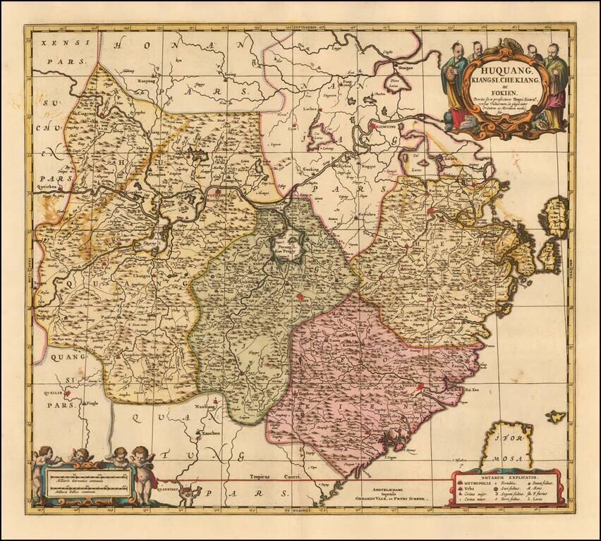
Fine example of the Valk & Schenk edition of Jansson's map of Hunan (Huquang), Jiangxi (Kiangsi), Zhejiang (Che Kiang), and Fujian (Fokien) in eastern China. The map is drawn largely from Blaeu's maps compiled by Jesuit Father Martino Martini who...
![[ Hong Kong / Macao / Canton ] Iunnan, Queicheu, Quangsi et Quantun, Provinciae Regni Sinensi Praefecturae dictae](/map/small/55800.jpg)
Fine example of the Valk and Schenk edition of Jansson's regional map of China, including the Hong Kong - Macao Region . A beautifully engraved map of Southern China covering Hainan and the Pearl River Delta with Macao and the islands around...
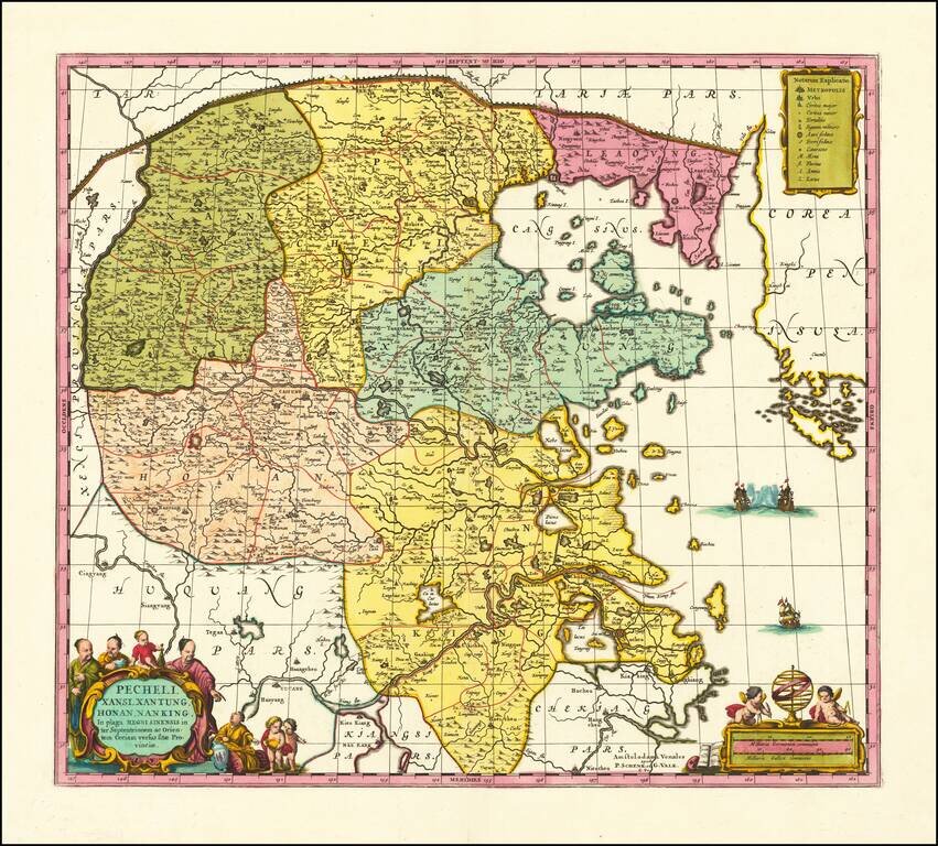
Scarce Valk & Schenk edition of Jan Jansson's highly decorative map of northeastern China and Korea. The present map is very geographically advanced for its time and depicts the provinces of Hebei (Pecheli), Shanxi (Xansi), Shandong (Xantung),...
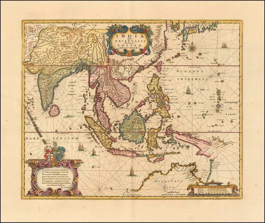
Gorgeous example Valk & Schenk's edition of Hondius' map of Southeast Asia, based upon Blaeu's map of 1635. An important Dutch map of South East Asia, noteworthy for being the second map to include the discoveries made in New Guinea and northern...
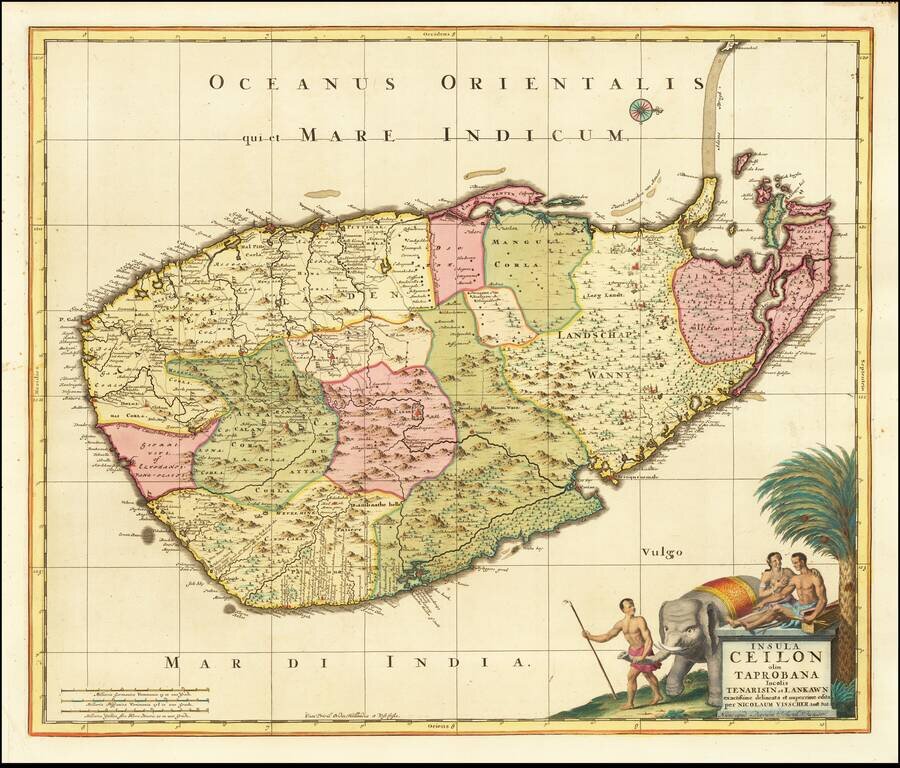
Fine large format map of Sri Lanka, first published in Amsterdam first published by Nicolas Visscher and later re-issued by Schenk. One of the largest atlas maps of Sri Lanka, with a striking cartouche, embellished with an elephant and local Sri...