Peter Schenk the Elder (1660-1711) moved to Amsterdam in 1675 and began to learn the art of mezzotint. In 1694 he bought some of the copperplate stock of the mapmaker Johannes Janssonius, which allowed him to specialize in the engraving and printing of maps and prints. He split his time between his Amsterdam shop and Leipzig and also sold a considerable volume of materials to London.
Peter Schenk the Elder had three sons. Peter the Younger carried on his father’s business in Leipzig while the other two, Leonard and Jan, worked in Amsterdam. Leonard engraved several maps and also carried on his father’s relationship with engraving plates for the Amsterdam edition of the Histoire de l'Académie Royale des Sciences.
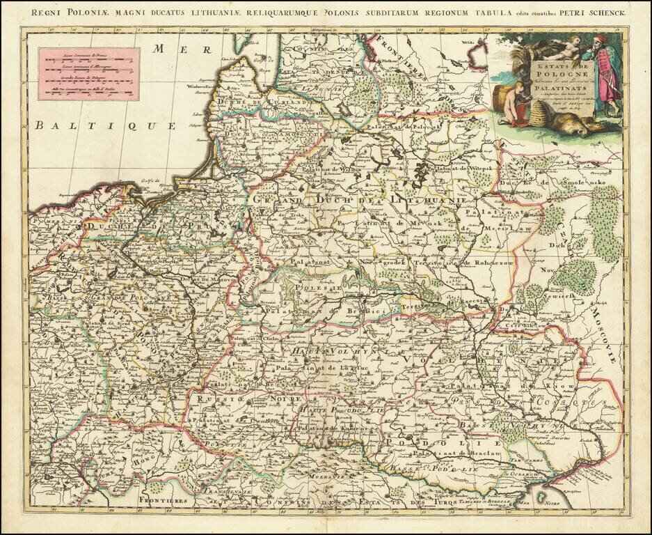
A scarce Pieter Schenk map of Poland, which is attributed to an earlier map published by Sanson. The map extends to the Black Sea and Vienna in the south and to Estonia in the north. The work is a prime example of Schenk's strong engraving style,...
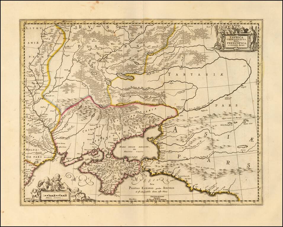
Detailed map of the Ukraine and surrounding regions between the northern coast of the Black Sea and Moscow. Shows ports, fortified cities and the mouths of the Danube. Two decorative cartouches.
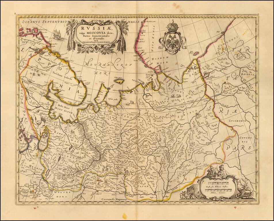
Nice example of the Valk & Schenk's map of the European part of Russia. Includes a Russian Imperial coat of arms and 2 cartouches.
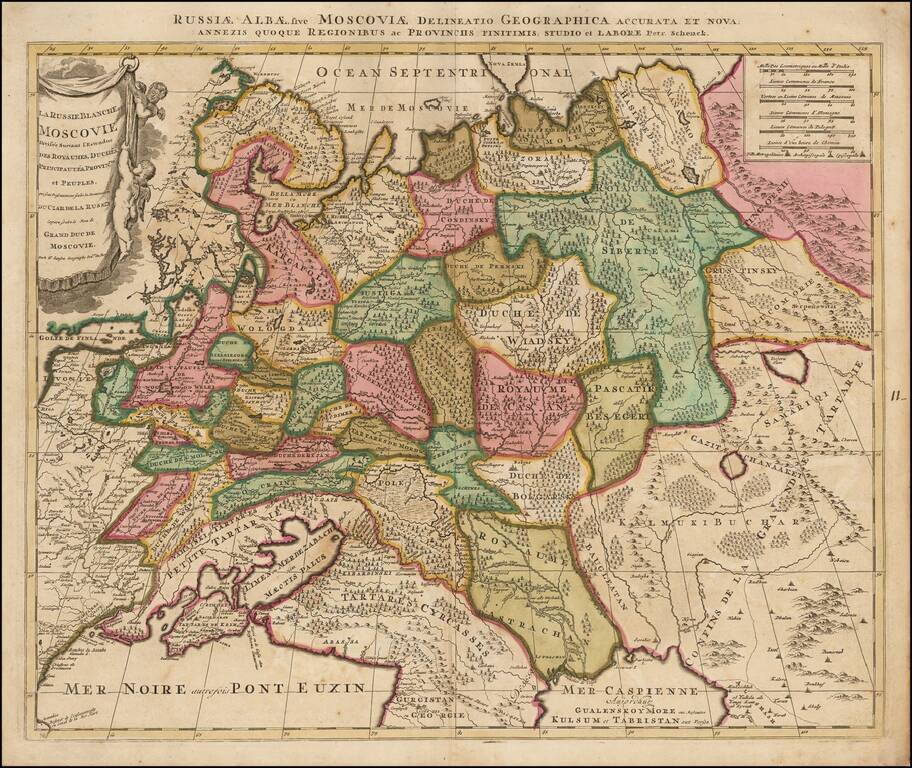
Scarce map of White Russia or Moscovy, published in Amsterdam by Schenk. The map shows the extent of the Czar's Russian Empire in Europe. The political divisions are delineated and the forested areas are graphically shown. Cherubs hang from the...
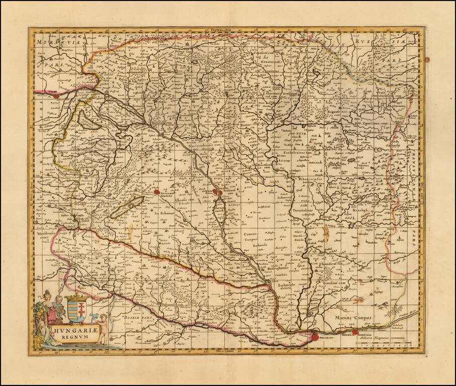
Detailed late 17th Century map of Hungary. Includes decorative cartouche, coat of arms, etc. Originally engraved by Jan Jansson, the copperplate was later acquired by Valk & Schenk. The Valk & Schenk edition is by far the more scarce edition...
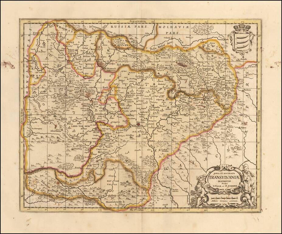
Finely executed map of Transylvania, originally published in 1665 for Jansson's Atlas Maior, and later acquired by Schenk and Valk. One of the earliest separately published maps of Transylvania.
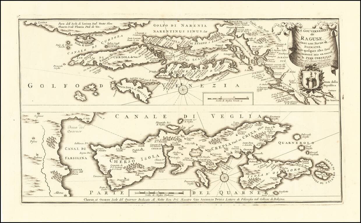
Rare map of the Republic of Ragusa on the Dalmatian coast around Dubrovnik, published in Amsterdam by Peter Schenk Junior. The map covers the area from Kotor to the island Korcula, Hvar and Island Cres and Losinj, with a part of the Istrian coast...
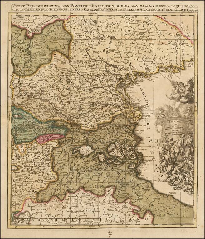
Scarce map of Northeatern Italy, published in Amsterdam by Peter Schenk. The map extends from the Venice area in the east to Belluno and Trento in the north, Reggio and Verona in the west and the northern part of Tuscany.
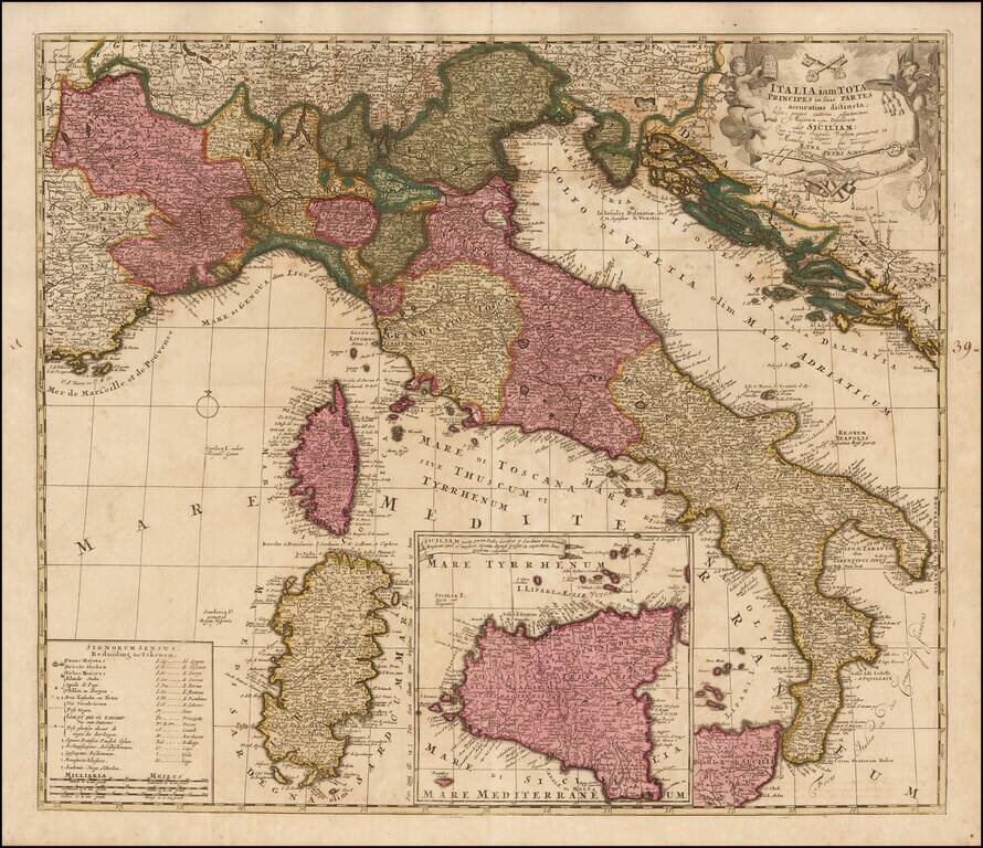
Scare map of Italy, with a large inset map of Sicily, published in Amsterdam by Schenk. Includes a table showing symbols and abbreviations.
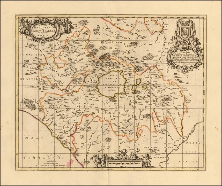
Decorative regional map centered on Lago de Bracciano, just to the North of Rome.
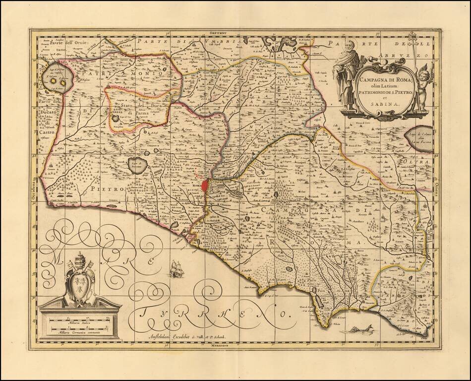
Decorative example of this detailed map of Campagna di Roma and Sabina. The map is centered on Rome. The map includes two elaborate cartouches, including a dedication to Cassiano Del Pozzo and several sailing ships.
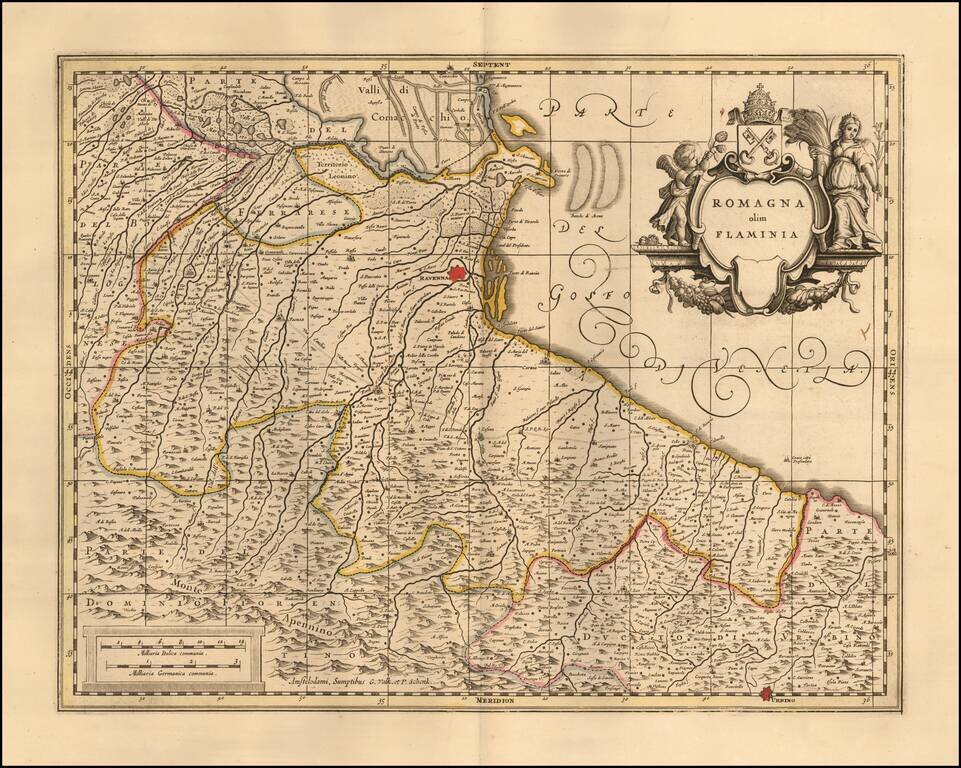
Detailed example of the eastern portion of Emilia Romagna, including the Principality of San Marino.
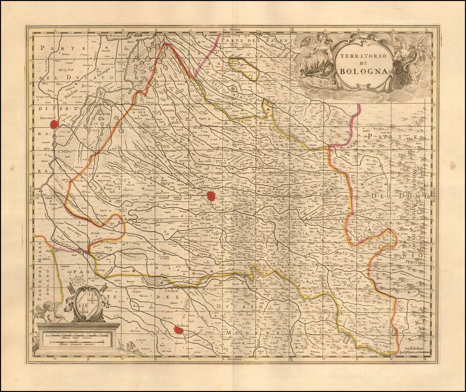
Nice old color example of Valk & Schenk map of the Territory of Bologna. Major towns shown include Bologna, Modena and Ferrara.
![[Corsica, Sardinia, Northern Italy]](/map/small/56055.jpg)
Striking large and highly detailed map of the North part of Italy, with Corsica and Sardinia.
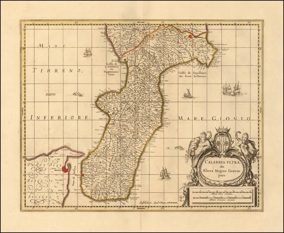
Nice example of Valk & Schenk's map of Calabria and the northern tip of Sicily. Includes sailing ships, a sea monster and decorative cartouche. Larger cities include Reggio Calabria, Bova, Fiumara, Gerace, Oppida, Nicotera, Isola (di Capo...
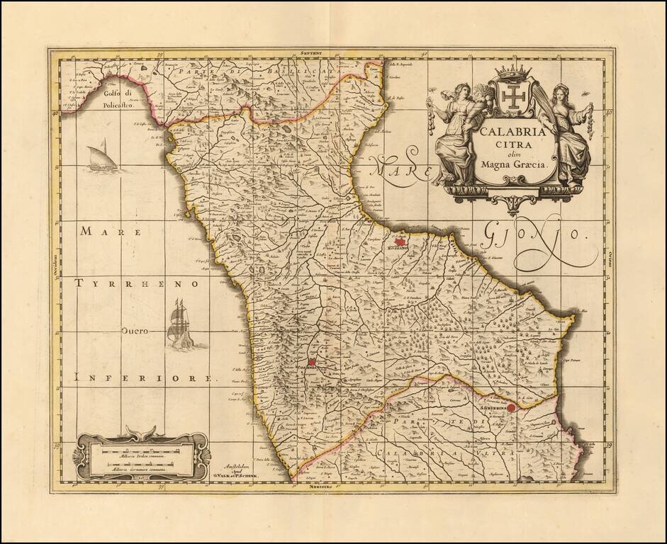
Nice old color example of Valk & Schenk's map of the north part Calabria. Includes sailing ships and decorative cartouche. Larger towns include Cosenza and Rossano.