Peter Schenk the Elder (1660-1711) moved to Amsterdam in 1675 and began to learn the art of mezzotint. In 1694 he bought some of the copperplate stock of the mapmaker Johannes Janssonius, which allowed him to specialize in the engraving and printing of maps and prints. He split his time between his Amsterdam shop and Leipzig and also sold a considerable volume of materials to London.
Peter Schenk the Elder had three sons. Peter the Younger carried on his father’s business in Leipzig while the other two, Leonard and Jan, worked in Amsterdam. Leonard engraved several maps and also carried on his father’s relationship with engraving plates for the Amsterdam edition of the Histoire de l'Académie Royale des Sciences.
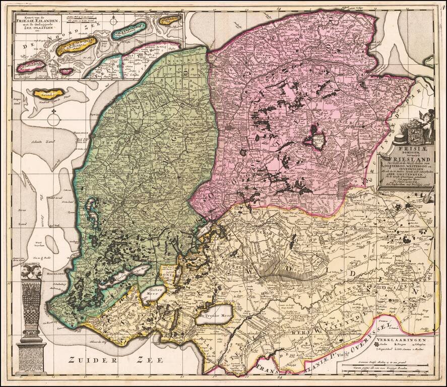
Antique Map of Friesland, in the Netherlands Fine old color example of this rare edition of Schenk's map of the Friesland, on double thick paper. Detailed map of Friesland, Groningen and Drenthe, the northeast provinces of the Netherlands, with...
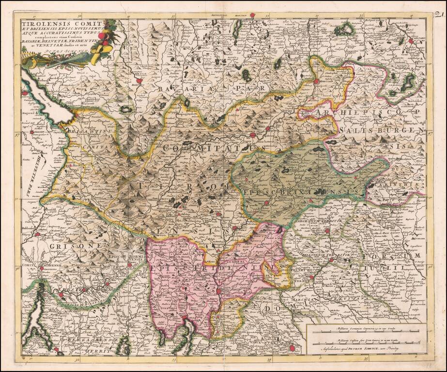
Fine old color example of the Tirolia region, published by Peter Schenk in Amsterdam.
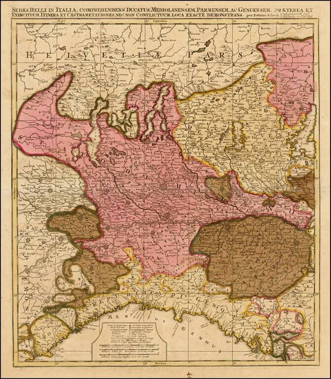
Detailed map of Northern Italy and contiguous parts of Switzerland.
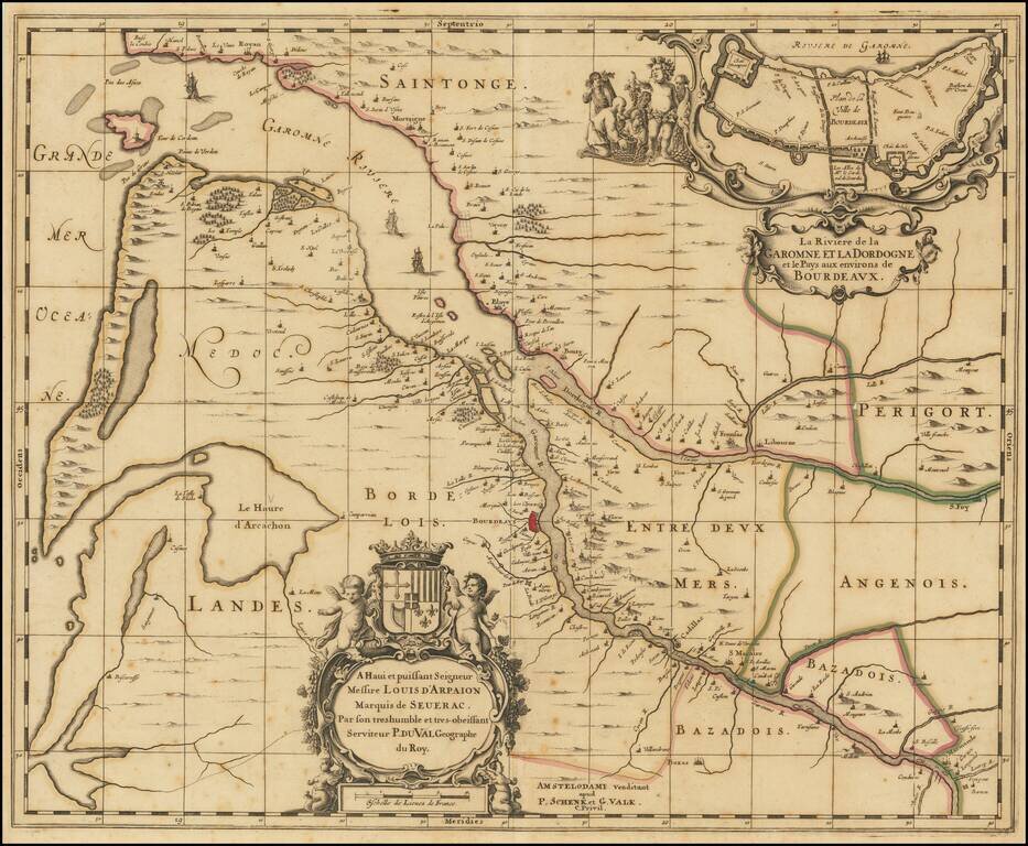
Rare map of Map of the Gironde estuary, published in Amsterdam by Schenk & Valk. The map shows the area where the Dordogne and Garonne rivers meet, and includes a plan of the fortified walls of the city of Bordeaux, along with several elaborate...
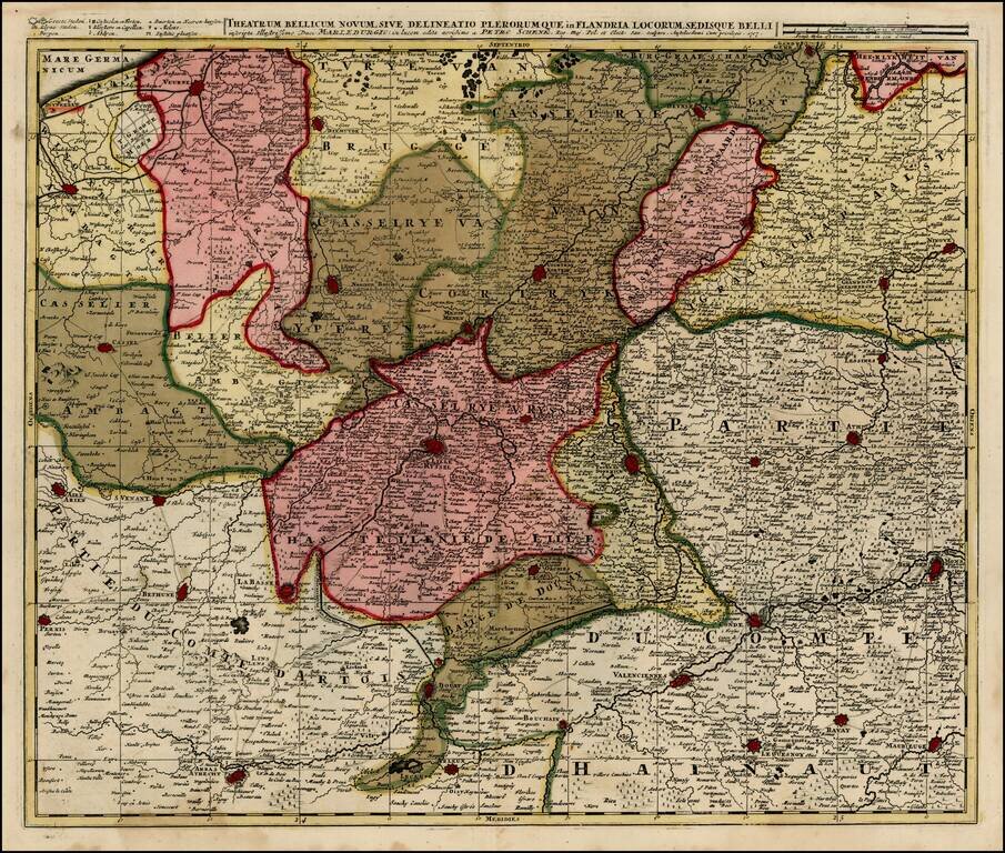
Detailed map of Southern Belgium and Northwestern France, extending from Gend and Veurne in the north to Arras, Arleux and Maubeuge in the south, centered on Lille.
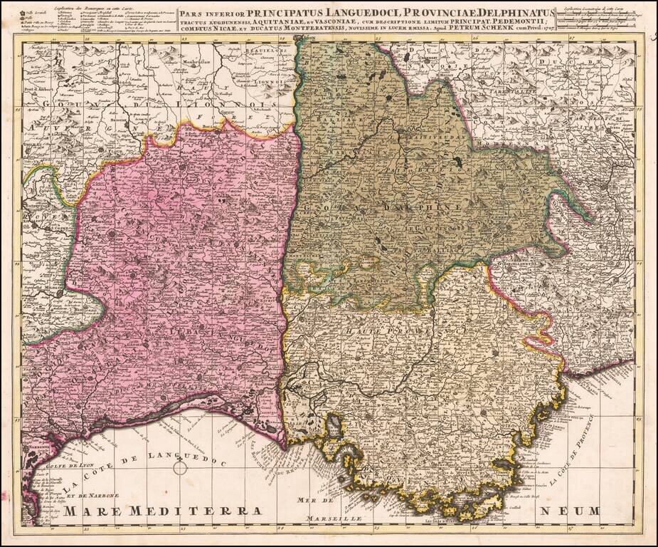
Detailed map of Southeastern France and the contiguous Italian Border (extending to Turin). Fine old color example.
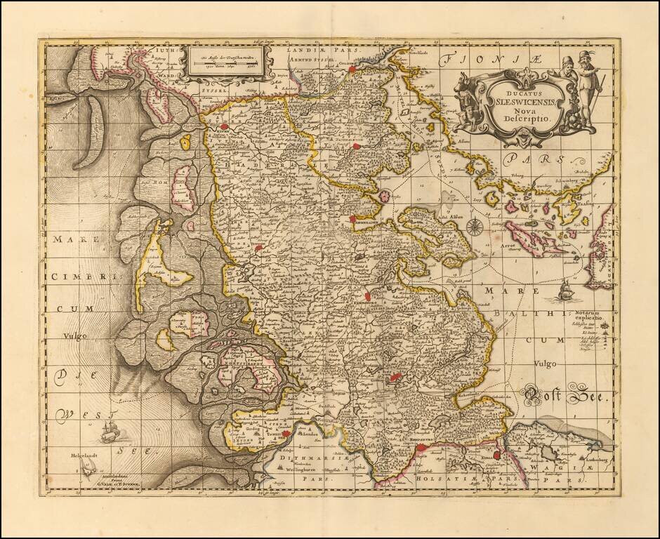
Nice example of Valk & Schenk's detailed map of the Schleiswig-Holstein region, published in Amsteram. Extends from Tonningen, Rendsberg and Kiell in the south to Colding, Rypen and Hadersleben in the north. Other larger towns include Sleswich,...
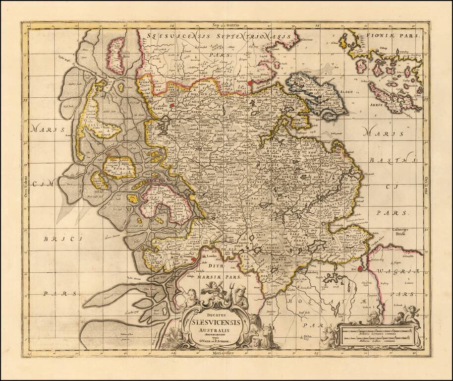
Nice example of Valk & Schenk's detailed map of the Southern part of Schleiswig, published in Amsterdam. Extends from Tonning and Kiell in the south to Tonder and Apenrade in the north. Other larger towns include Sleswich. The detailed depiction...
![Hanc Ger[maniae et P]oloniae de[s ... ]em Serenissim [P]otentissimi Poloniae Regi August offert et inscribit Petrus Schenck](/map/small/64898.jpg)
With Portrait of the King of Poland and Lithuania Large engraved antique map of Poland, Lithuania and the Holy Roman Empire, by one of Amsterdam's most important mapmakers, Peter Schenk. The map includes a portrait of King Augustus II the Strong,...
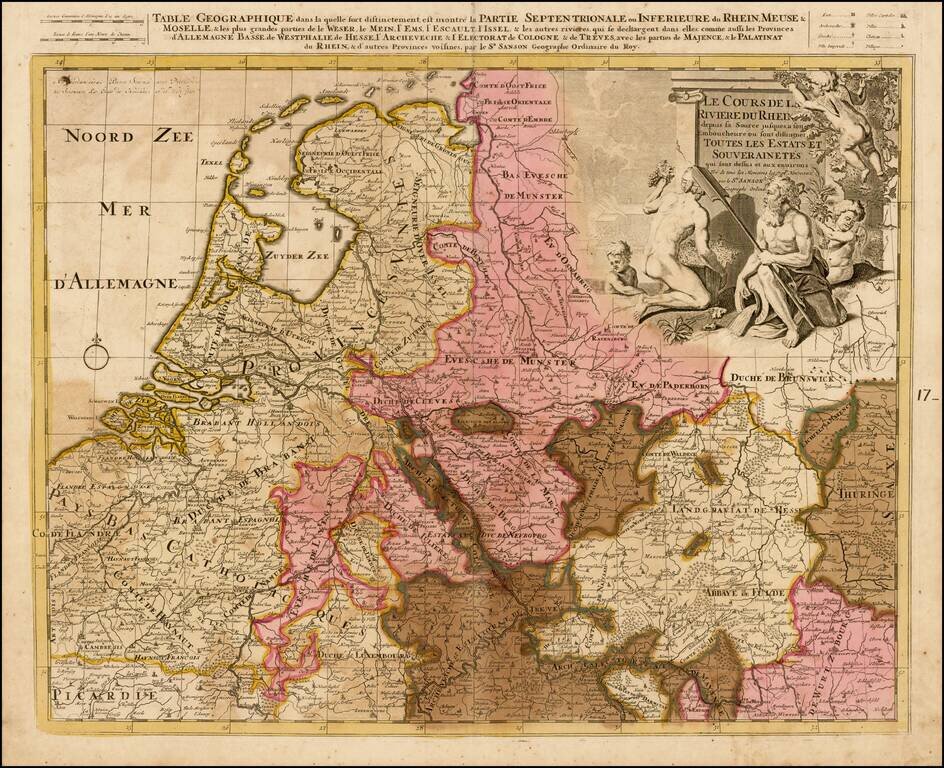
Detailed map the the Low Countries and Germany focusing on the course of the Rhine River.
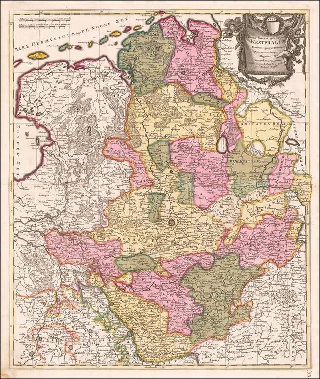
Fine old color example of Schenk's map of the northwestern part of Germany. The map is centered on Munster and extends south to the area arould Cologne, east to the Bishoprick of Paterborn and north to the North Sea.
Detailed map of the region centered on Erfurt. Also includes Gotha, Weimar, Schwartzburg, Halle, Jena, Mulhausen, etc.
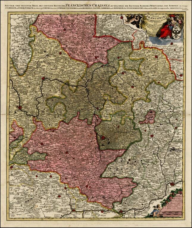
Striking regional map centered on Nuremberg and Bamberg. Extends from the Donau in the South (showing Regensberg, Ingolstatt and Nordlingen) to Eger, Hoff and Amberg in the East and Wurtzberg in the west. Large decorative cartouche w/coat of arms. A...
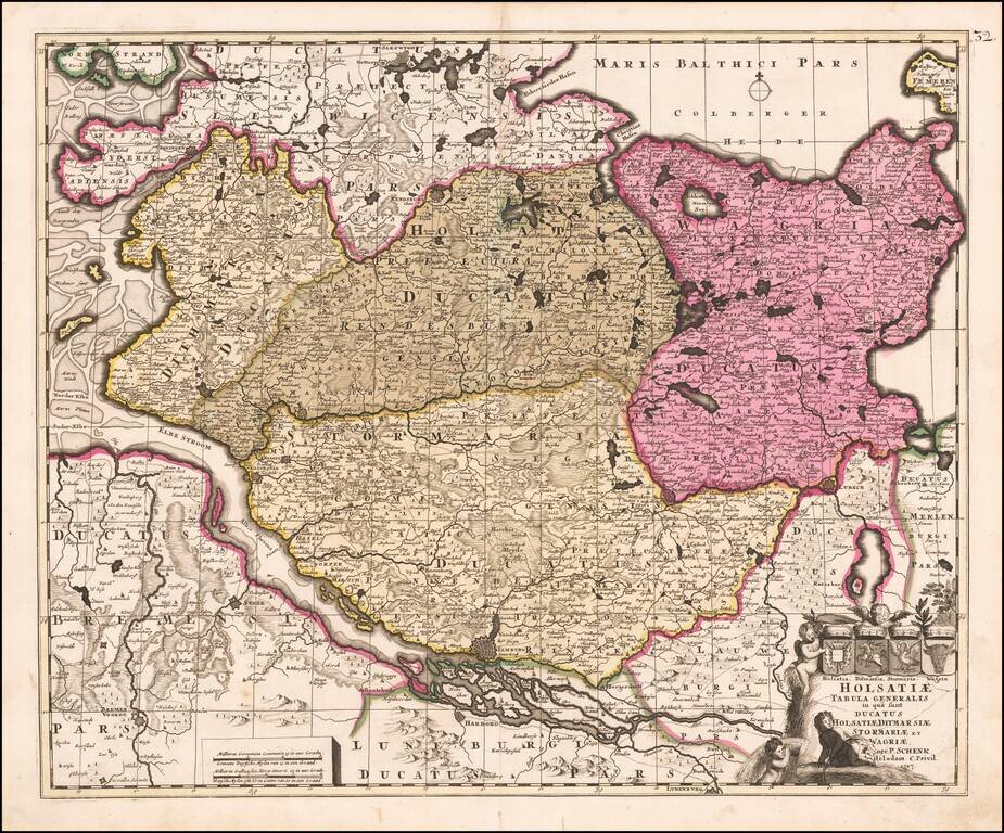
Nice old color example of Peter Schenk's map of Northwestern Germany. Major cities shown include Hamburg, Lubeck, Oldesloh, Kiell and Bremen.
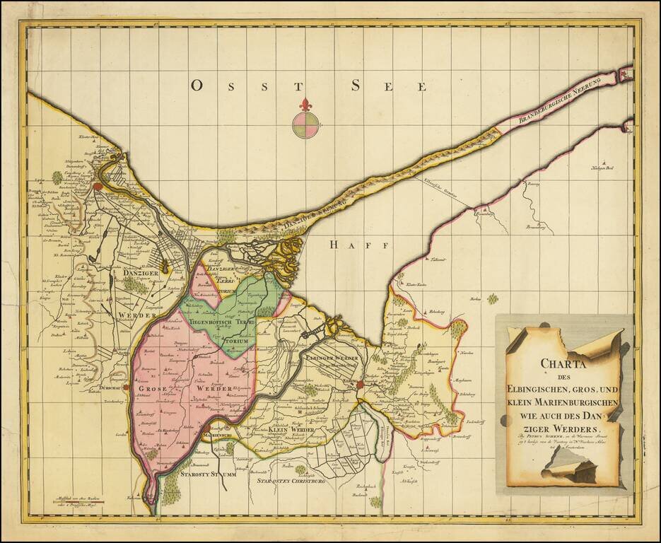
Scarce regional map of the area including Danzig, Elbang and Marienburg (Malbork), published in Amsterdam by Peter Schenk.
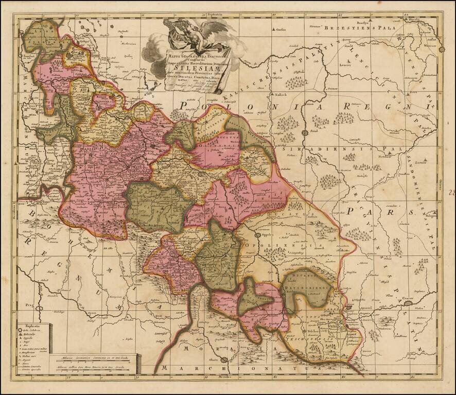
Scarce map of Silesia, in Poland, engraved in Amsterdam by Peter Schenk. The map shows Silesia at the end of the 17th century under Habsburg Rule.