Didier Robert de Vaugondy (ca. 1723-1786) was the son of prominent geographer Gilles Robert de Vaugondy and Didier carried on his father’s impressive work. Together, they published their best-known work, the Atlas Universel (1757). The atlas took fifteen years to create and was released in a folio and ¾ folio edition; both are rare and highly sought-after today. Together and individually, father and son were known for their exactitude and depth of research.
Like his father, Didier served as geographer to King Louis XV. He was especially recognized for his skills in globe making; for example, a pair of his globes made for the Marquise de Pompadour are today in the collection of the Municipal Museum of Chartres. Didier was also the geographer to the Duke of Lorraine. In 1773, he was appointed royal censor in charge of monitoring the information published in geography texts, navigational tracts, and travel accounts.
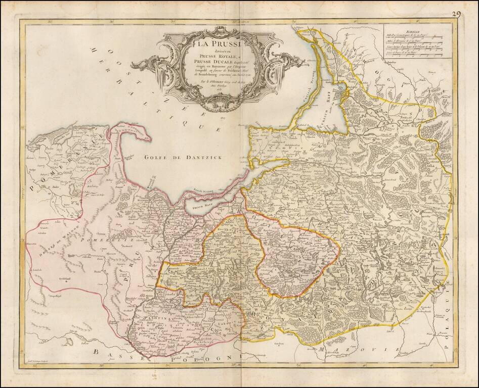
Detailed map of Prussia, including much of Poland and the Baltic Countries, published by De Vaugondy in Paris.
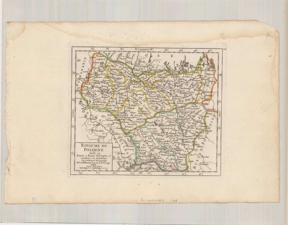
Striking example of De Vaugondy's map of the Kindgom of Poland, from his Atlas Portatif, Universel et Militaire. . . , first published in Paris in 1748.
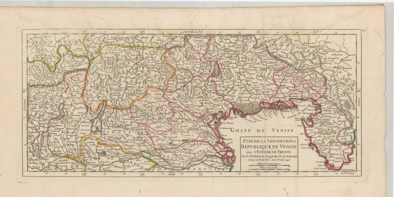
Striking example of De Vaugondy's map of the northeast part of Italy and neighboring Balkan regions, from his Atlas Portatif, Universel et Militaire. . . , first published in Paris in 1748. The map extends from Bergamo and Milan in the west to...
Interesting postal route map of Italy, Sicily, Sardinia & Corsica, from an early edition of DeVaugondy's Atlas Universel. Shows the various postal routes in Italy and Sicily, with the various stops also noted. Includes towns, mountains, rivers,...
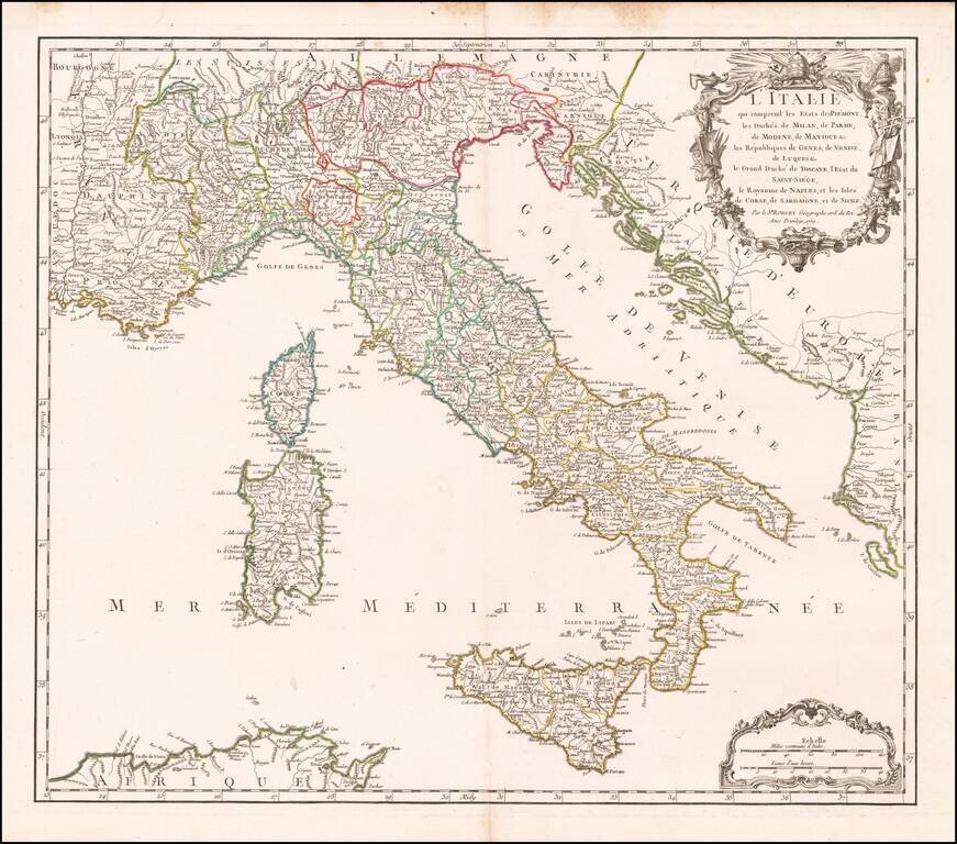
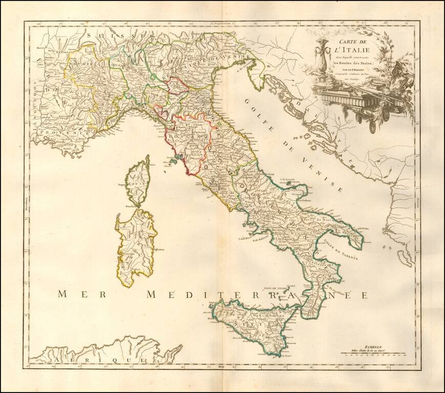
Detailed map of Italy, Sicily, Sardinia & Corsica, from an early edition of DeVaugondy's Atlas Universel. Includes a decorative cartouche. De Vaugondy's atlas was one of the most successful and enduring works of the 2nd half of the 19th Century.
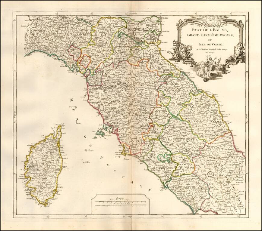
Interesting regional map of Central Italy, Tuscany and Corsica, from an early edition of DeVaugondy's Atlas Universel. Includes towns, mountains, rivers, lakes and a host of other details. De Vaugondy's Atlas Universel was one of the most...
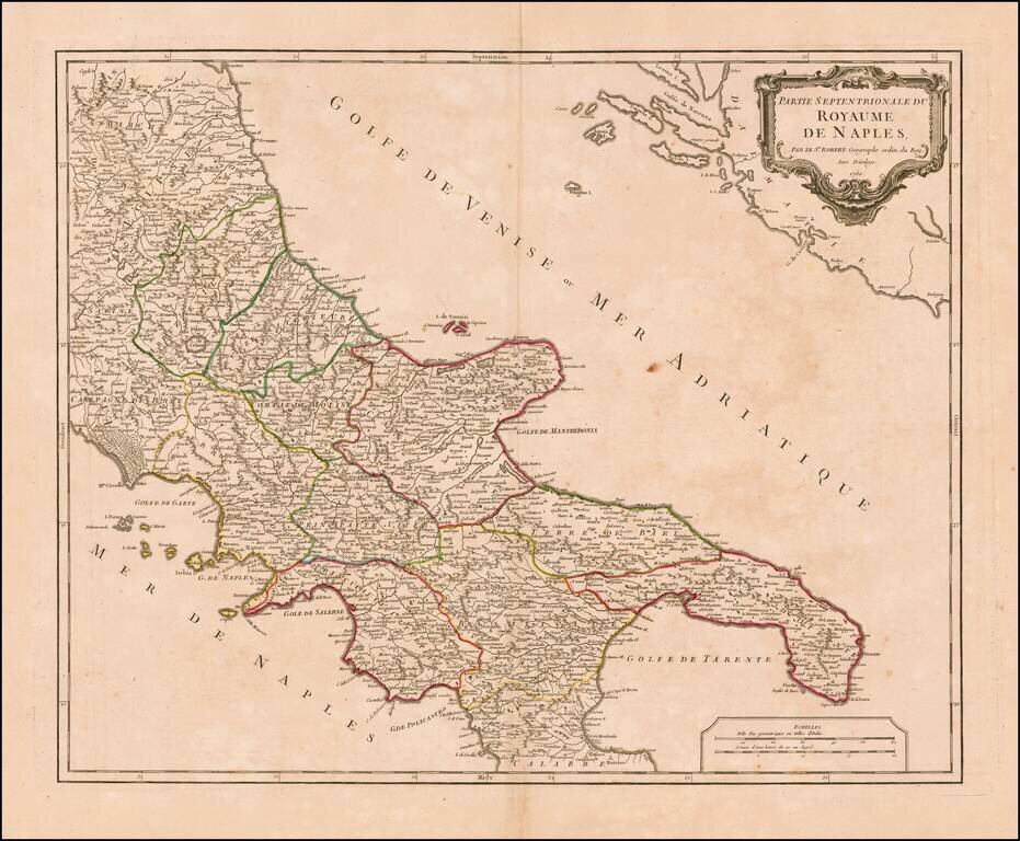
Striking map of the northern portion of the Kingdom of Naples, from an early edition of De Vaugondy's Atlas Universel. Includes towns, mountains, rivers, lakes and a host of other details. De Vaugondy's atlas was one of the most successful and...
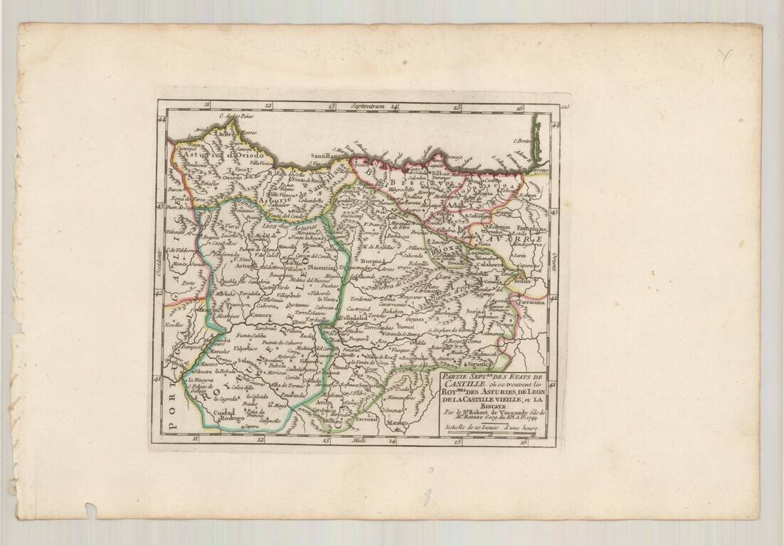
Detailed map of the Castille and the Kingdoms of Asturias, Leon, Old Castille and Biscaya, from De Vaugondy's Atlas Portatif.
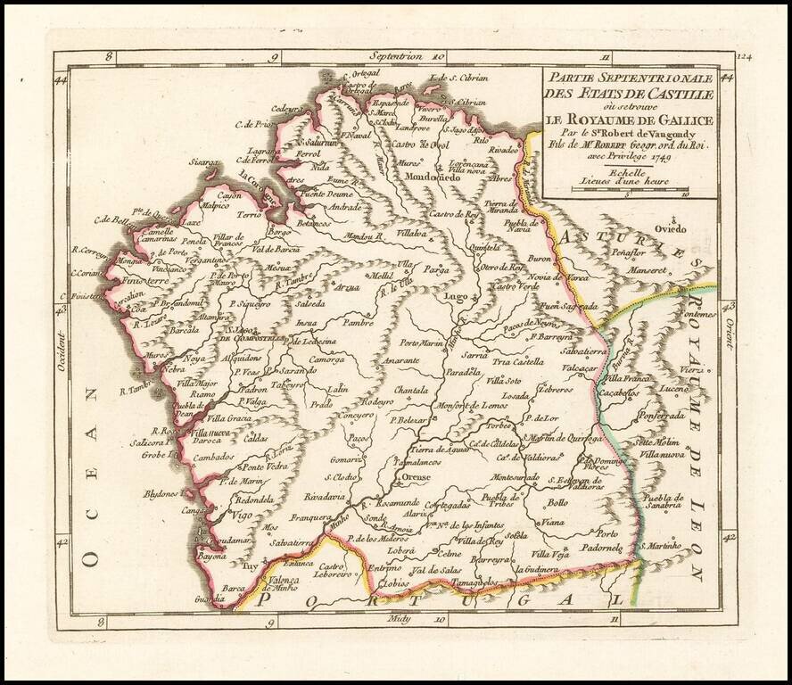
Detailed map of Galicia, published in Paris by the Robert de Vaugondy family of mapmakers.
![Les Isles Canaries . . . [With inset map of the Islands of Madeira and Porto-Santo]](/map/small/70853.jpg)
Detailed map of the Canary Islands, from De Vaugondy's Atlas Portatif, Universal et Militaire. Large inset of Madera and Porto Santo. Lots of place names shown.
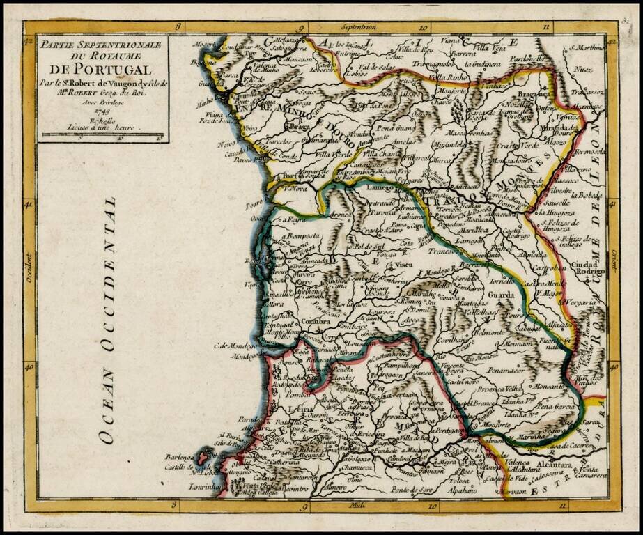
Detailed map of the Northern part of Portugal, from De Vaugondy's Atlas Portatif.
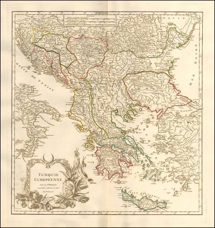
Detailed map of Greece, Romania and the neighboring regions, during the period when the region was still a port of the Ottoman Empire. Includes an elaborate title cartouche. From an early edition of De Vaugondy's Atlas Universel, one of the most...
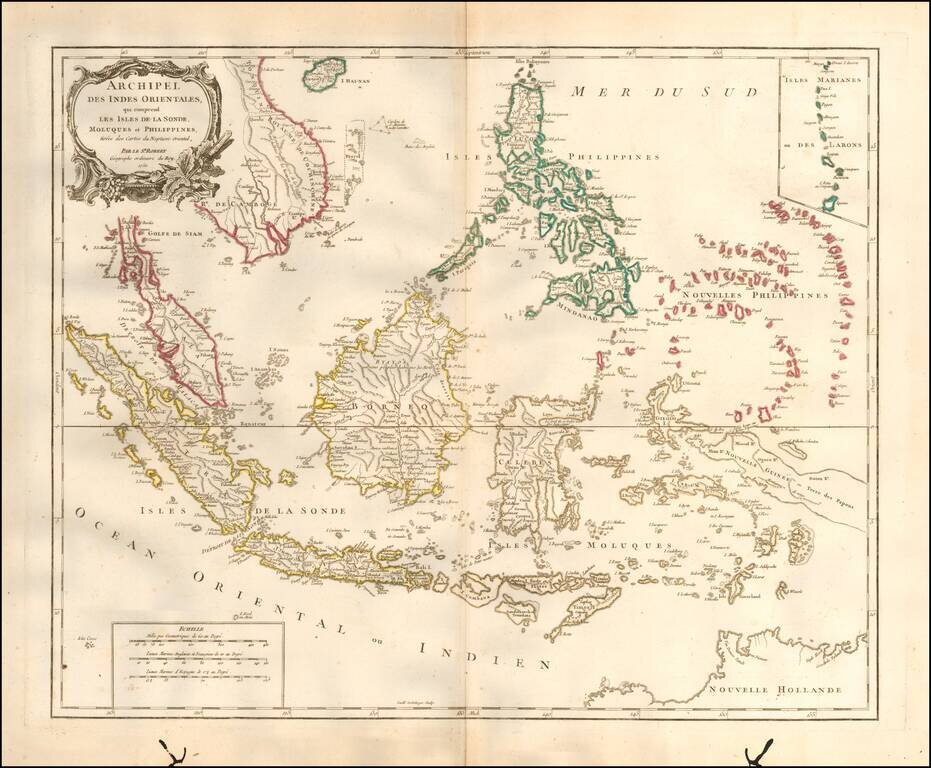
Striking and highly detailed map of the region from Sumatra and Malacca and Southern China to the Philippines, New Guinea and Northern Australia, centered on Borneo. Includes a large inset of the Marianas. Wonderful early detail, derived from the...
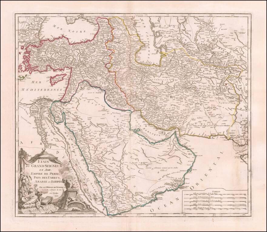
Detailed map of the Turkish Empire, extending to the Black Sea, Georgia, the Caspian, Usbekistan, The Indian Ocean, Saudi Arabia, Egypt and the Red Sea. Large decorative cartouche.
![[Empire of Alexander The Great] Antiquor? Imperiorum Tabula in qua prae caeteris, Macendonia seu Alexandri Magni et Expeditiones exarantur . . .](/map/small/70608.jpg)
Tracking the Expeditions of Alexander the Great Detailed map of the Middle East, Asia Minor and part of Central Asia, showing the region conquered by Alexander the Great. The map detailed the expeditions of Alexander the Great, with a dashed line...
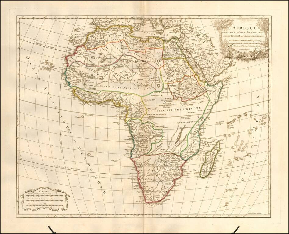
Detailed map of Africa, published in Paris by De Vaugondy in his Atlas Universal. The map reflects the limited knowledge among Europeans in the interior parts of the continent.