logo

1752. Turquie Europeenne . . . 1755

  • Turquie Europeenne . . . 1755

Turquie Europeenne . . . 1755 information:

Year of creation: 
Resolution size (pixels): 
 12047x12802 px
Disk Size: 
 24.7114MiB
Number of pages: 
 1
Place: 
 Paris

Print information. Print size (Width x height in inches):
Printing at 72 dpi 
  167.32 х 177.81
Printing at 150 dpi 
 80.31 х 85.35
Printing at 300 dpi 
 40.16 х 42.67

An example of detailing the file of this map of in a printable high-resolution:

Click to open in high resolution (open in new tab).
Attention! this is just the central piece (central area 960x960 px) of the map file!
This is an example, so that you can see and study the level of detail of a given map. The entire Map will be fully available after payment!

Turquie Europeenne . . . 1755

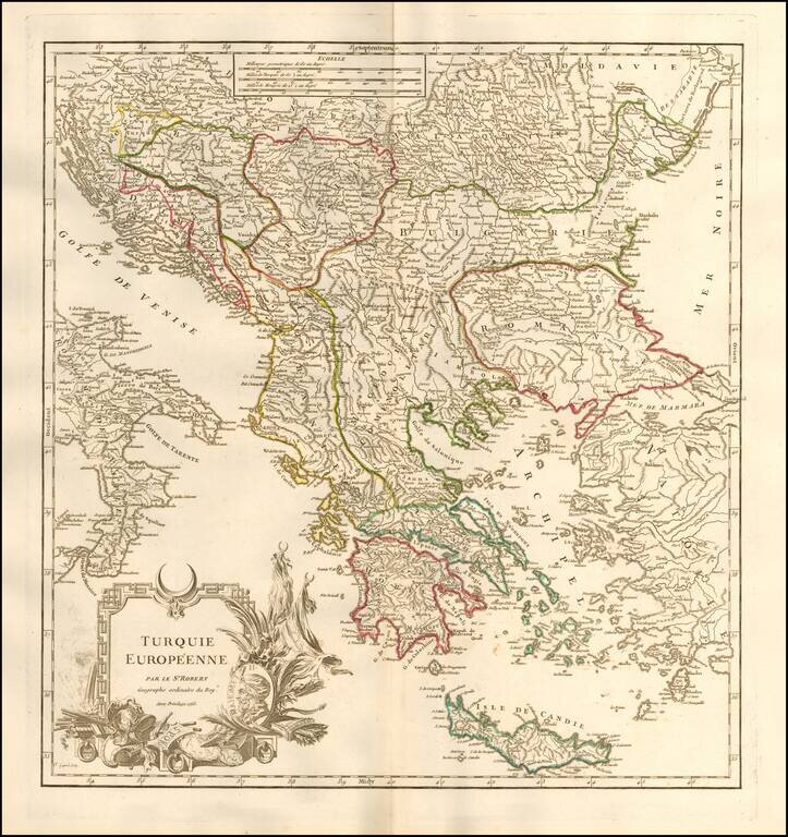
Detailed map of Greece, Romania and the neighboring regions, during the period when the region was still a port of the Ottoman Empire.

Includes an elaborate title cartouche.

From an early edition of De Vaugondy's Atlas Universel, one of the most prolific atlases of the second half of the 18th Century.

Pedley, 385.

Special conditions for students!

If you are a student, write to us in telegram: @antiquemaps and indicate what material you need and for what work you need a map in high detail. We are ready to provide material on special terms. For students only!

Item information:

Year of creation:
Size:
12047x12802 px
Disk:
24.7114MiB
Number of pages:
1
Place:
Paris
Author:
Didier Robert de Vaugondy.
$14.99

Related item