
Attractive promotional travel poster, promoting air travel to Guatemala. The map promotes travel via Pan Am's Clipper Service to Central America.
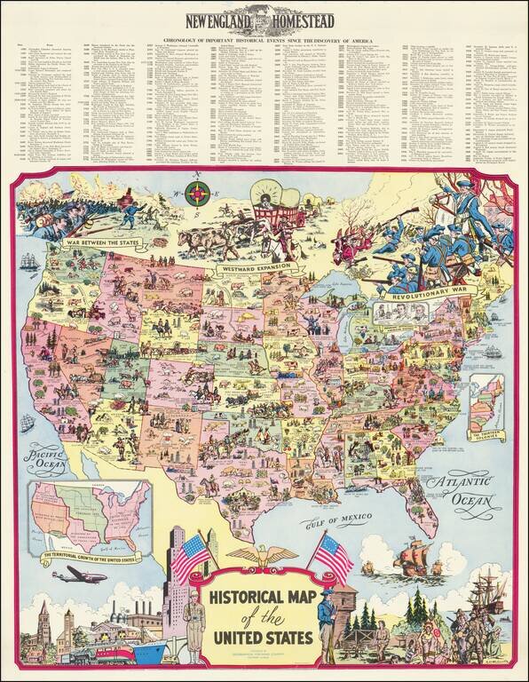
Fine pictorial map of the United States, drawn by R.L. McCollister and published for the New England Homestead Journal. The map presents and exceptionally dense historical montage of events and vignettes illustrating the history of the United States,...
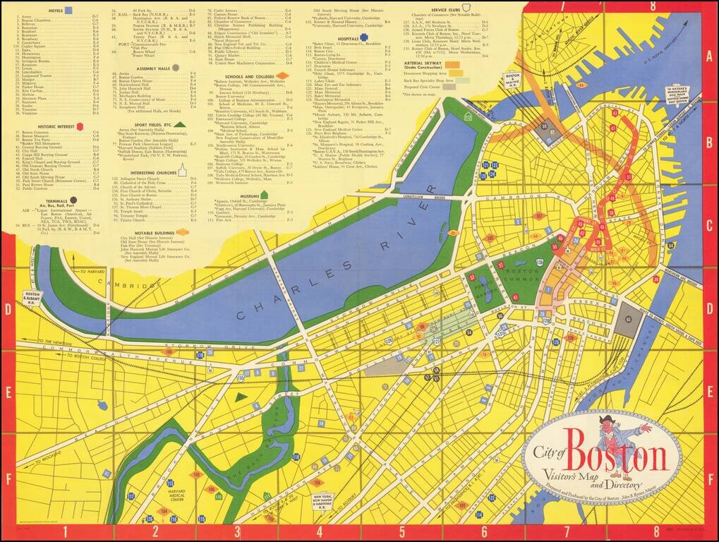
Lively tourist map of Boston, published by Zorigian Studios in Boston. The map was published under the direction of then Mayor, John B. Hynes, who served as mayor of Boston from 1950 to 1960.
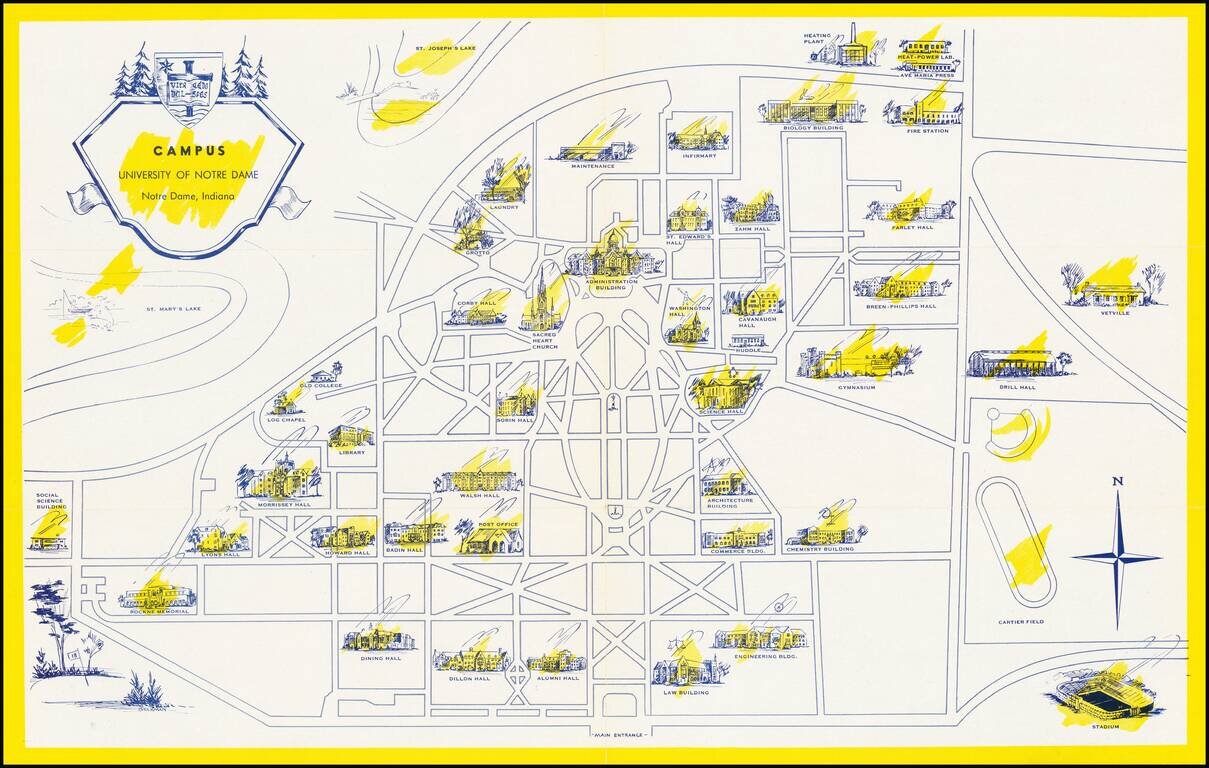
Scarce pictorial map the University of Notre Dame campus in South Bend, Indiana. The recto shows the campus with important buildings, including Notre Dame Stadium (opened in 1930), scattered around the grid of pathways and roads. On the verso, the...
![[Ashland Wisconin]](/map/small/60288.jpg)
Lake Trout Trolling on Lake Superior! Detailed pictorial map of the area around Ashland, Wisconsin, published by the Ashland Chamber of Commerce. The focal point of the map is recreational activities, including hunting, fishing, skiing, boating,...
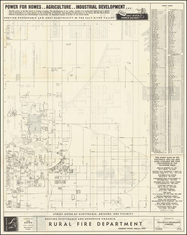
"The West's Most Western Town." Scarce promotional map of the area around Scottsdale, copyrighted by R.S. Knight in 1955. The Salt River Power District promotional text at the top of the map is especially insightful into the mindset of the region in...
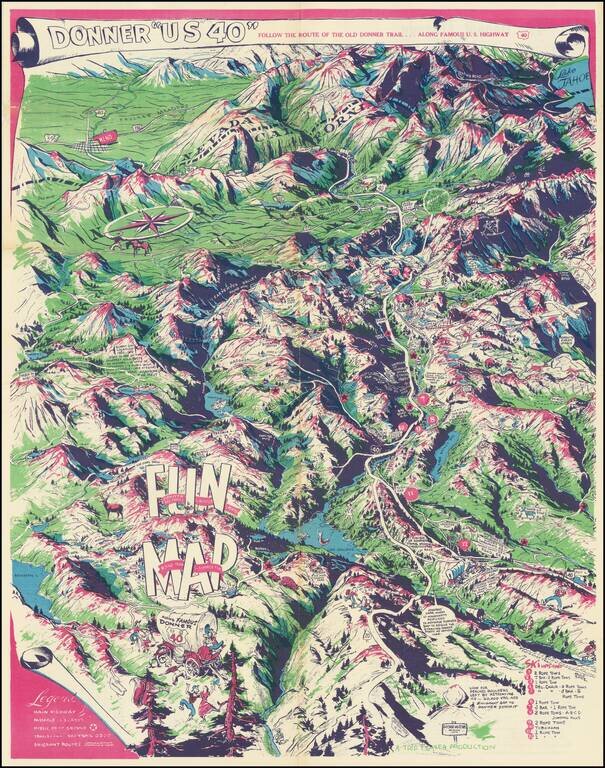
Humorous vintage pictorial map of U.S. Highway 40, the so-called Donner Trail Highway, through the Sierras near the California-Nevada border. The map is mostly focused on the Sierras west of the Nevada border, with Reno in the upper-left corner and...
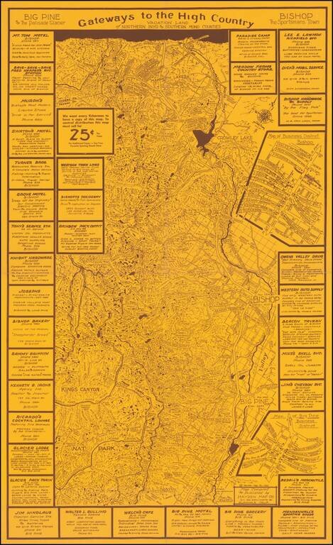
Rare promotional map tracking the John Muir Trail, Owens River and other interesting features in the region and ringed by local advertising. The present map is Emmet Hayden's first map, centered on the Bishop, Big Pine, Mammoth Lakes area, published...
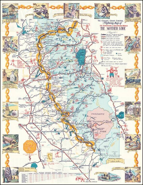
Decorative pictorial map of the Gold Regions of California. Includes 17 decorative vignettes and many annotations. Highly detailed. Includes Smokey The Bear. Difficult to date the map, as estimates of its age range from the 1950s to the early 1980s.
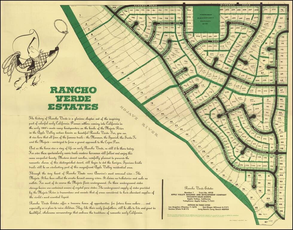
Detailed plan of Rancho Palos Verdes Estates, a planned community in Apple Valley, California. The area is now called Desert Knolls, on the north end of Mojave Narrows Regional Park. Apple Valley is in the High Desert region of San Bernardino County....
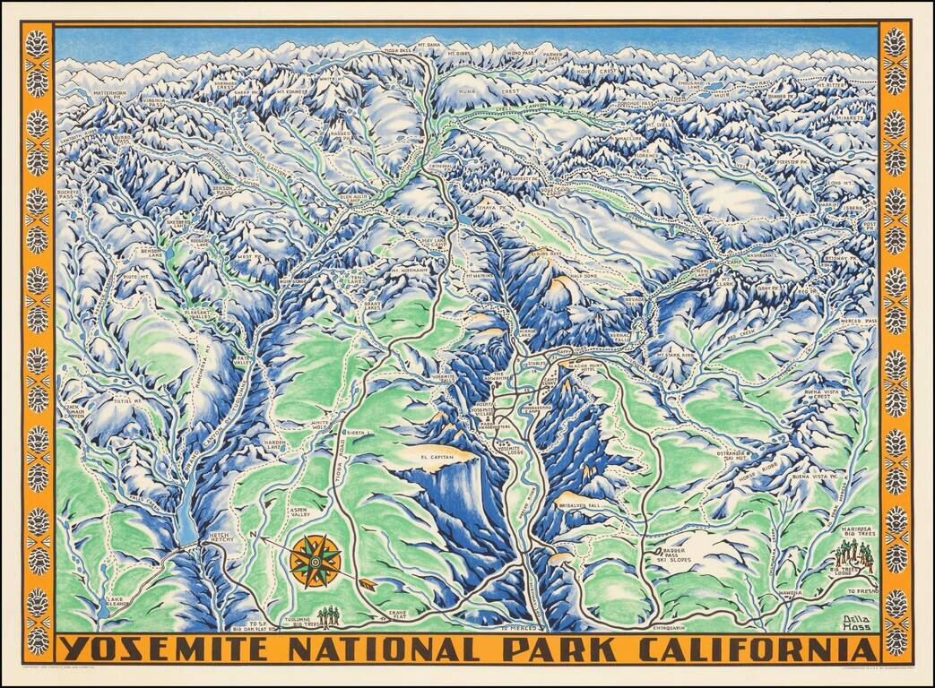
Fine example of the Della Hoss view of Yosemite National Park, published for the Yosemite Park and Curry Co. in 1955. The map provides a fine caricature view of Yosemite, locating many of its major attractions and a few not so famous, such as the...
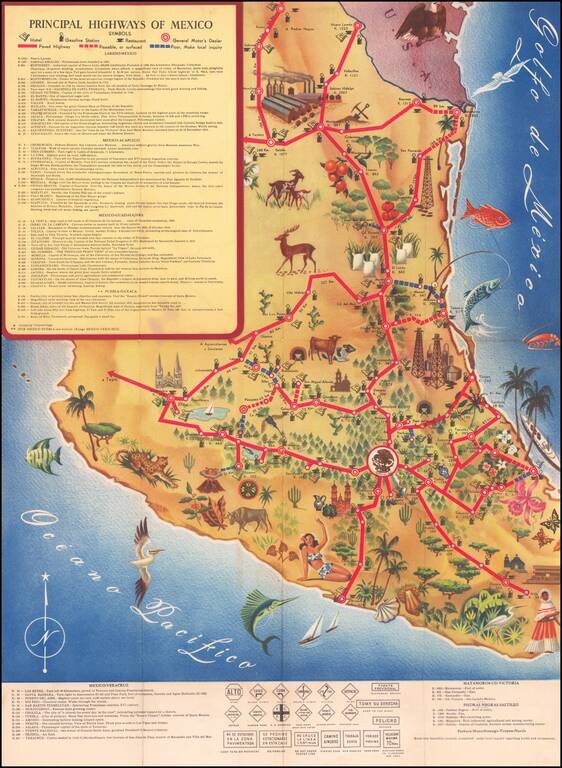
Decorative pictorial map of Mexico, showing the principal roads throughout the country. The map focuses on illustrating the principal resources and points of interest, with a symbol noting the availability of gasoline in major towns. The map was...
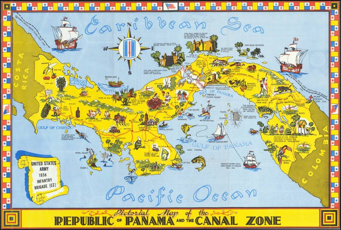
Striking pictorial map of Panama and the Canal Zone. Rich coloring, striking flag border and rich illustrations. Includes a history of Panama and facts about the Canal on the verso, along with photos. Rarity We find a single example on line...
![[Pictographic Map of Moscow] Moscou.](/map/small/37917.jpg)
An attractive and engaging 1950s pictographic map of Moscow, showing the Soviet capital's main sites during the height of the Cold War. This interesting map provides a rare Western-language pictographic map of Moscow, then the capital of the Soviet...
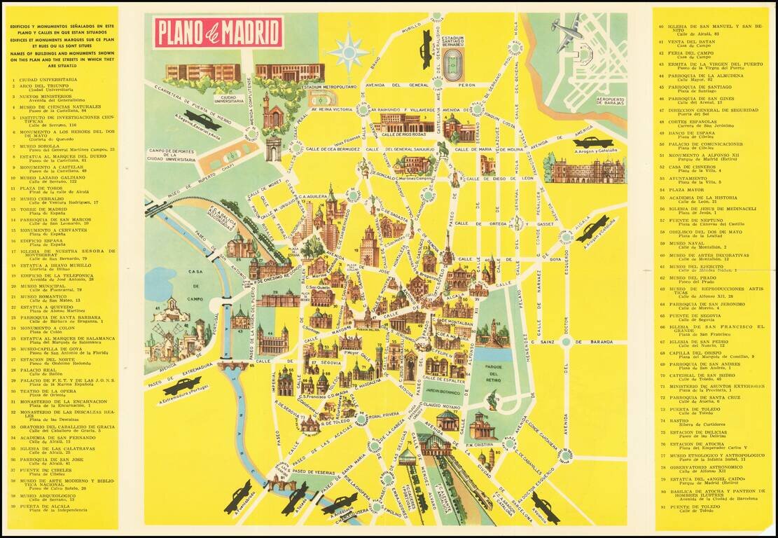
Pictorial Tourist map of Madrid, published for tourists. Features vignettes of Madrid's major monuments and points of interest. Includes advertising for the Hotel Carleton on the verso.
![[Summer Palace / Longevity Hill -- Yihe Yuan park -- Beijing]. 北京颐和园万寿山全景图 /. Beijing Yihe Yuanwan shou shan quan jing tu](/map/small/65637.jpg)
Fine large view of the Summer Palace, Longevity Hill and Kunming Lake, with photographs and tourist information on the verso. Summer Palace The Summer Palace is a vast collection of lakes, gardens and palaces in Beijing. It was an imperial garden in...