Map size in jpg-format: 46.6277MiB
Click to open in high resolution (open in new tab).
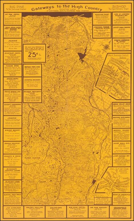
Rare promotional map tracking the John Muir Trail, Owens River and other interesting features in the region and ringed by local advertising.
The present map is Emmet Hayden's first map, centered on the Bishop, Big Pine, Mammoth Lakes area, published by the Hayden Map Company.
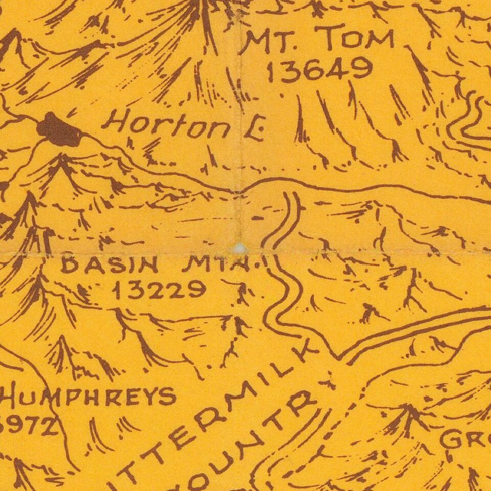
The map is a fine blend of pictorial topography, place names, advertising, and other details. The heights of mountains, locations of lakes and mountain passes and other points of interest are labeled in fine detail.
The map also provides significant detail for the small towns in the region, with inset maps for the commercial districts of Bishop and Big Pine.
One other feature of the map of interest is the inclusion of several unnamed Canals next to the Owens River in the Southern Part of the map.
The Hayden Map Company was founded in the 1930s by Emmet Hayden. In 1927, Emmet Hayden procured a lease in the Inyo National Forest, where he built a four bedroom log cabin which is the Mammoth Lakes Museum today. Emmet was an engineer, surveyor, and mapmaker by training. He put Mammoth Lakes on his 1934 map, titled "A Circle of Enchantment." Originally, the Hayden Map Company did sub-division work in the Los Angeles area. After moving to Mammoth Lakes for his summer residence, he had the idea of being a hunting and fishing guide, which became the Hayden Map Company. Hayden's two earliest maps were the "Three Flags Highway" and "The Circle of Enchantment."
Rarity
The map is unrecorded.
If you are a student, write to us in telegram: @antiquemaps and indicate what material you need and for what work you need a map in high detail. We are ready to provide material on special terms. For students only!
![[Signed Political Satire Artwork] Vietnam ... Vietnam ... Vietnam ...](/map/small/68726.jpg)

