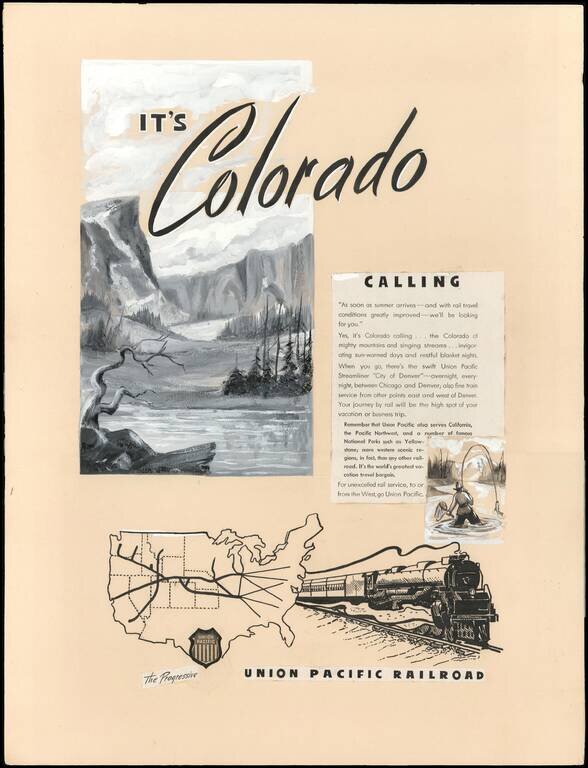
An Interesting Part of U.P.R.R. Advertising and Mapmaking History. This is a circa 1946 manuscript proof for a print advertisement promoting Union Pacific rail service from Chicago, Illinois to Denver, Colorado on the Union Pacific Streamliner 'City...

Striking pictorial map of the United States, by W.P.A. artist Paul Sample. The map provides a fine look at agricultural America, paying tribute to America's farming and ranching traditions from coast to coast. The map was one of three lithographic...
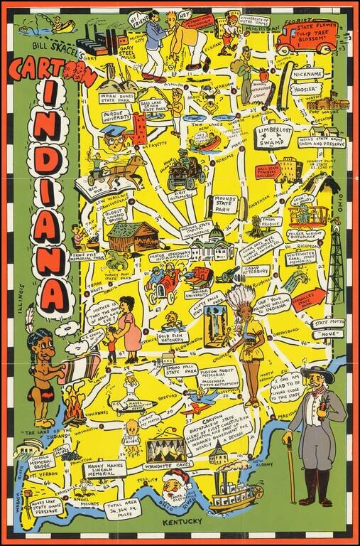
Scarce pictorial map of Indiana. The map provides a whimsical image of Indiana's tourists and other important sites, with roads and distances noted. On verso: photos of scenic views, landmark and text.
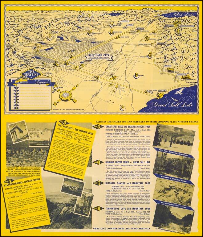
Fine promotional view map of Salt Lake, published for The Grayline. The Legend identifies 8 different tourism lines within the city.
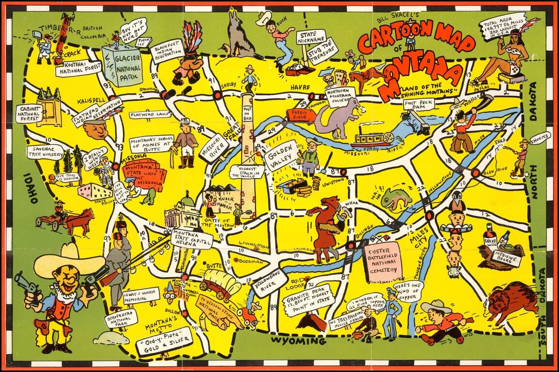
Scarce pictoiral map of Montana, which is printed to become a self mailing letter. The map provides a whimsical image of Montana's iconic national parks, national forest, Indian reservations, roads, trails, waterways, and recreational activities. On...
![[Los Angeles]](/map/small/63225.jpg)
Striking pictorial map of Southern California, appearing on the verso of the menu for the Ollie Hammond's Steak House in Los Angeles, Feb 2, 1946. The map provides a striking birdseye view of Los Angeles and surrounding areas, along with the location...
![[Official Route Map Los Angeles]](/map/small/70212.jpg)
Los Angeles is the Wonderland of the World and to see it properly is to see it by Streetcar and Coach! Fascinating transportation map of Los Angeles, highlighting the lines of the Los Angeles Transit Company. The map is very interesting in that it...
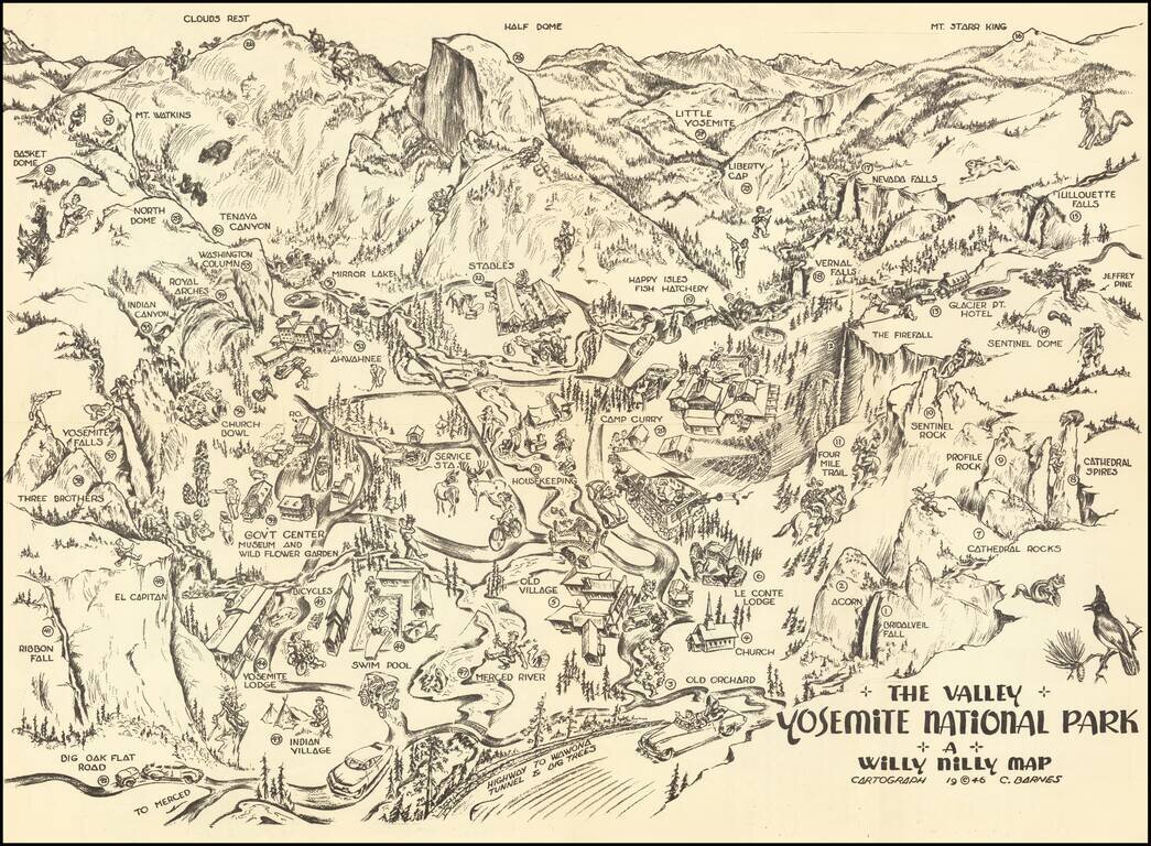
Yosemite Pictorial Rarity Rare self mailing map of Yosemite, published in 1946 by the Willy Nilly Map Company. The map is centered on Camp Curry, with an indoor venue below it having its roof blown off with music and dance. Extends to Clouds Rest,...
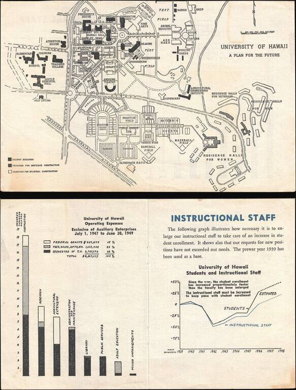
This is a 1946 University of Hawaii map of the Mānoa campus highlighting proposed building projects. Because of the G.I. Bill, which was passed in 1944, American servicemen returning from World War II could pursue higher education at American...
![[Pan American Airways Advertising Map -- Occupied Germany] Reise-Und Transport Verkehrskarte von Deutschland Mit Strassen- Und Eisenbahnmetz Zonen - Und Landergrenzen](/map/small/67100.jpg)
Promoting Pan American World Airways This colorful and attractive map depicts Germany and Central Europe in the immediate wake of World War II. The Allied Powers (United States of America, France, United Kingdom, and the Soviet Union) met at the...
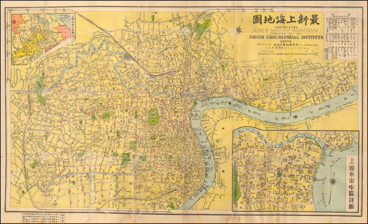
Detailed Shanghai street map from the first half of the 20th century, with an inset map of central Shanghai and Bund. Labeled in Chinese and English-transliteration.
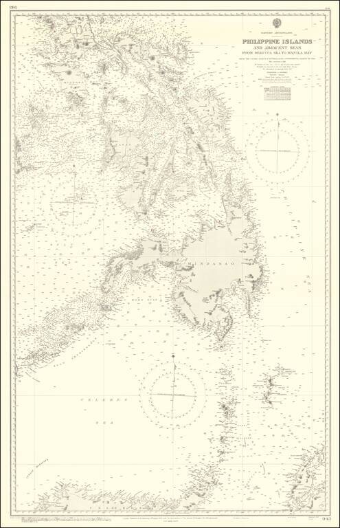
Finely executed British Admiralty Chart of a large portion of the Philippine Islands and regions to the south. The map includes extensive soundings, coastal details, light houses, etc.
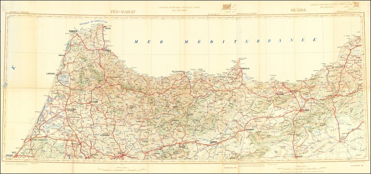
Detailed 2-sheet folding map of the northern part of Morocco, published by the Moroccan Geographical Service. The map focuses on roads and topographical features.
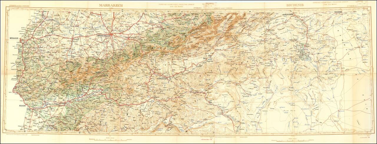
Detailed 2-sheet folding map of the central part of Morocco, published by the Moroccan Geographical Service. The map focuses on roads and topographical features.
![[Cote d'Ivore] Dakar et le Cap Vert Vue cavaliere de la presqu'ilse caput pulcherrimum - dessinee et elumminee par Abou Siril](/map/small/58864.jpg)
A Whimsical View of Dakar Whimsical promotional / pictorial map of the area around Dakar in the Cote d'Ivore. Includes the note "Université de Dakar, Institut Français d'Afrique Noire" on verso. The map is signed by Theodore Monsou.