logo

1946. Fes-Rabat / Oujda

  • Fes-Rabat / Oujda
  • Fes-Rabat / Oujda

Map size in jpg-format: 79.9114MiB

Download "Fes-Rabat / Oujda", in high resolution.

Fes-Rabat / Oujda information:

Year of creation: 
Resolution size (pixels): 
 27924x13116 px
Disk Size: 
 79.9114MiB
Number of pages: 
 2
Place: 
 Morocco

Print information. Print size (Width x height in inches):
Printing at 72 dpi 
  387.83 х 182.17
Printing at 150 dpi 
 186.16 х 87.44
Printing at 300 dpi 
 93.08 х 43.72

An example of detailing the file of this map of in a printable high-resolution:

Click to open in high resolution (open in new tab).
Attention! this is just the central piece (central area 960x960 px) of the map file!
This is an example, so that you can see and study the level of detail of a given map. The entire Map will be fully available after payment!

Fes-Rabat / Oujda

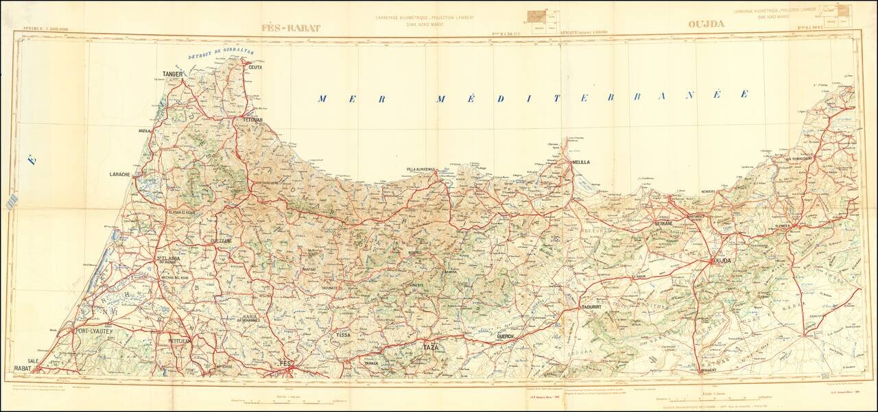
Detailed 2-sheet folding map of the northern part of Morocco, published by the Moroccan Geographical Service.

The map focuses on roads and topographical features.


Special conditions for students!

If you are a student, write to us in telegram: @antiquemaps and indicate what material you need and for what work you need a map in high detail. We are ready to provide material on special terms. For students only!

Item information:

Year of creation:
Size:
27924x13116 px
Disk:
79.9114MiB
Number of pages:
2
Place:
Morocco
Author:
Service Geographique du Maroc.
$21.99

Related item