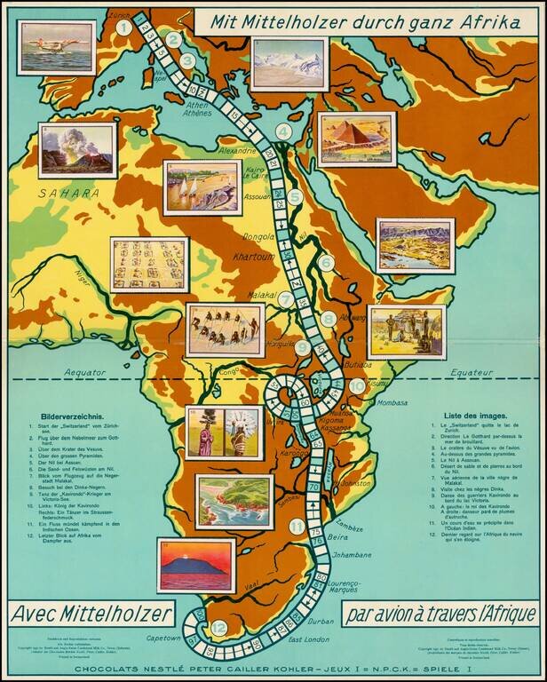
Rare commemorative game board map of Africa for a promotional game published for the Nestle Company, for tracking the trip of Walter Mittelholzer across Africa. Walter Mittelholzer (1894 - 1937) was a Swiss aviation pioneer. He was active as a pilot,...
![[Santa's Telegram]](/map/small/68586.jpg)
Original Pen and Ink Cartoons on Artist's Board This is a great vintage cartoon reciting the many problems faced by Americans, Californians, and others on Christmas Eve, 1931. This is a great example of a work by the famed early 20th-century...
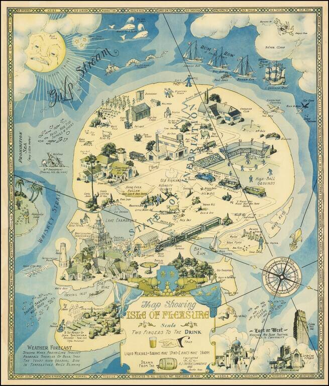
Heinie Lawrence's Rare Allegorical Map of Drink from the Finals Days of Prohibition. Unusual pictorial map, celebrating the joy of drink, issued toward the end of the American Prohibition Era (1920-1933). The map is ornately illustrated with subtle...
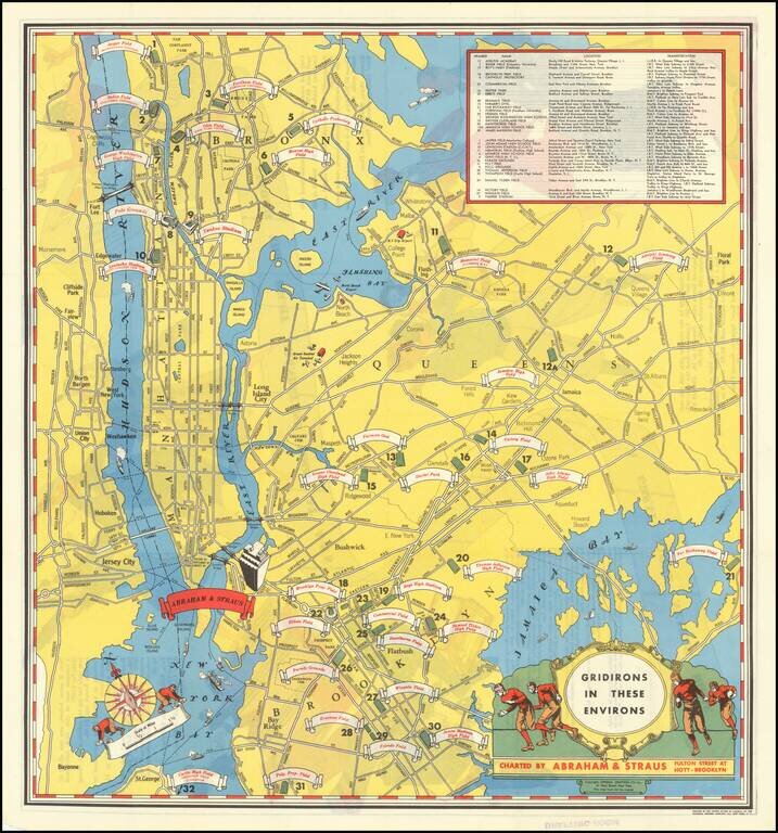
Rare pictorial map of New York showing all of the football stadiums in the city in 1931. The map was published by Brooklyn-based clothier Abraham & Straus to advertise their lines of goods that could be used in the football stands. Key in the...
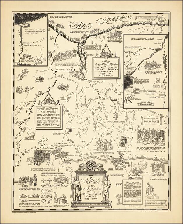
Rare historical pictorial map of the Iroquois League of Nations, consisting of the Mohawks, Cayugas, Oneidas, Senecas and Onondagas and later the Tuscoras, who dominated this region in the 17th and 18th Centuries. The work focuses on the regional...
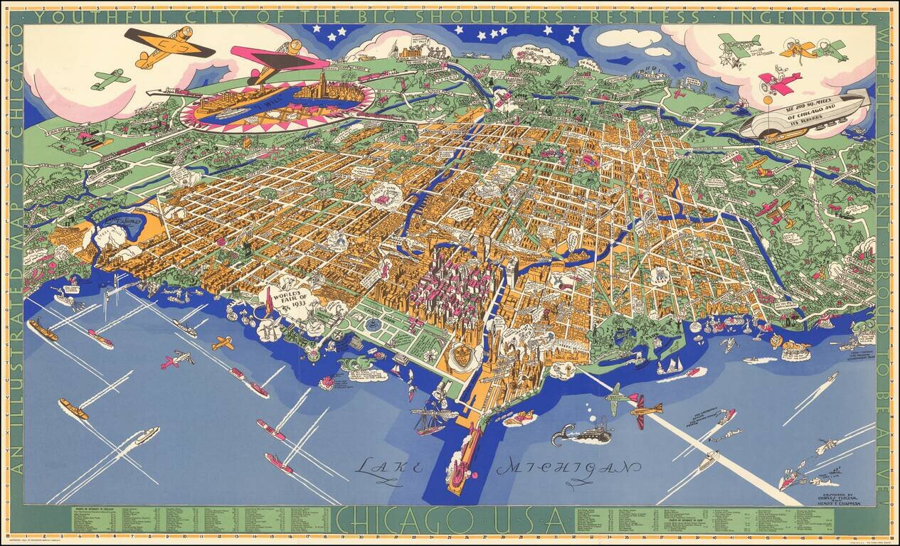
Charles Turzak's Iconic View of Chicago. Nice example of Charles Turzak's remarkable pictorial map of Chicago, with original pictorial folder. This beautiful map of Chicago by Chicago illustrator Charles Turzak, published two years before the...
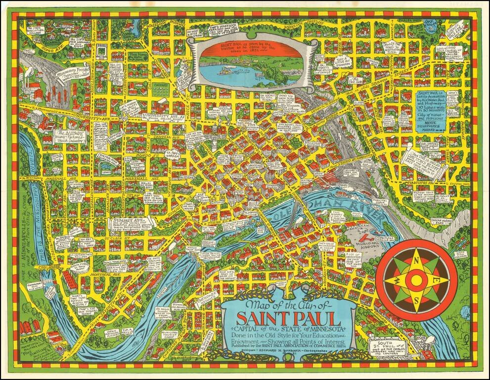
Scarce pictorial map of St. Paul, Minnesota, drawn by Richard Burbank for the Saint Paul Association of Commerce. Includes "Dramatic Moments in Saint Paul's Yesterday" on the verso, along with tourist and promotional text and a fine small birdseye...
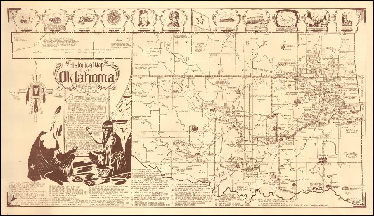
Fine pictorial map of Oklahoma, drawn by H.Z. Sanders for the Oklahoma Natural Gas Company. The map is decorated with small pictorial images showing some of the historical landmarks around the state and famous people. Also included is a legend with...
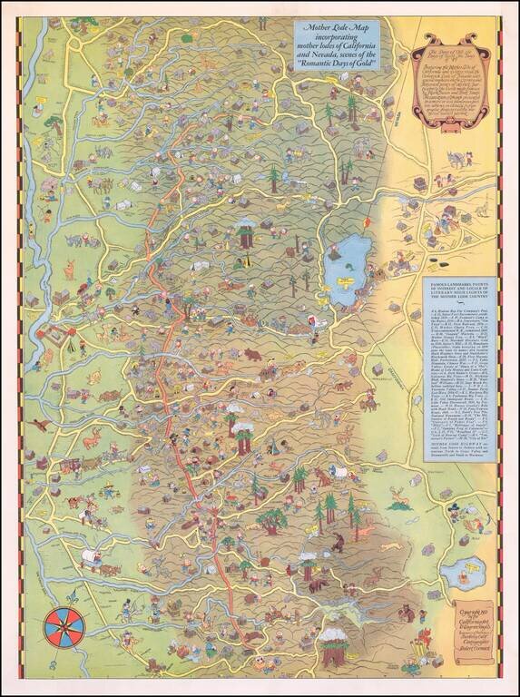
Scarce Pictorial Map of California's Gold Regions, including Lake Tahoe Area. The map extends from the Central Valley to the Comstock Lode, Nevada. A rare map -- the first example we have ever seen on the market.
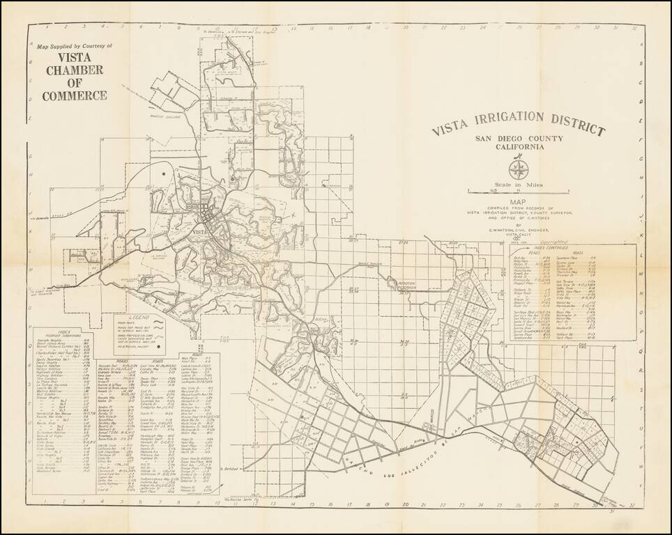
Early San Diego County water map, focusing on the cities of Vista and San Marcos in the North County region. The map was made by C.W. Watson for the Vista Chamber of Commerce. The map shows the initial subdivisions of what is now a major suburb of...
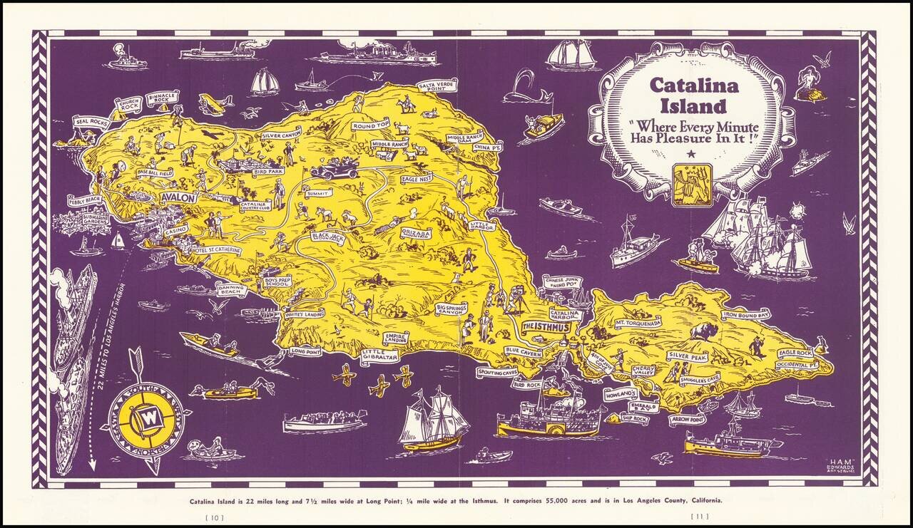
Decorative map of Catalina Island, appearing at the centerpiece of this interesting tourist brochure. The map is scarce. This is the first example we have offered for sale.
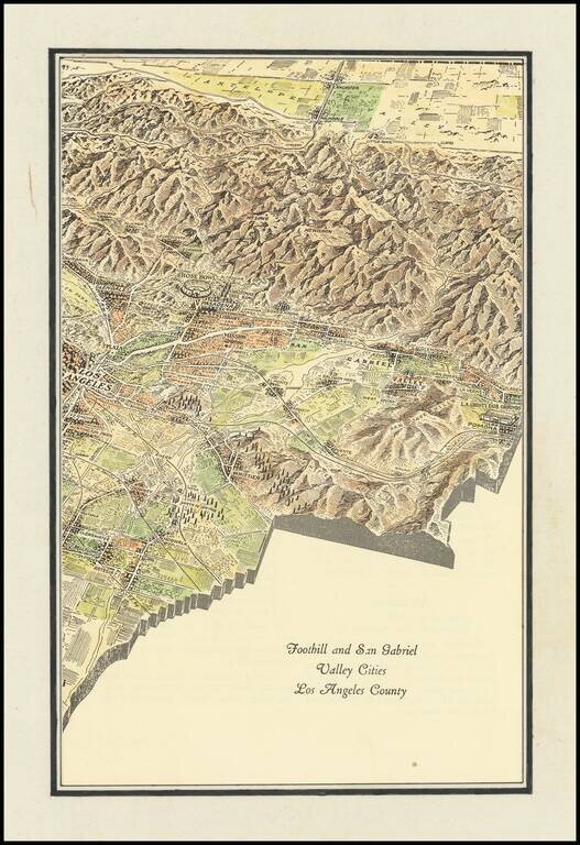
Interesting promotional map of the Eastern portion of Los Angeles County, likely published at about the time of the1932 Olympics. The map is centered on Pasadena and the the San Gabriel Valley, stretching north to Lancaster and south to Artesia and...
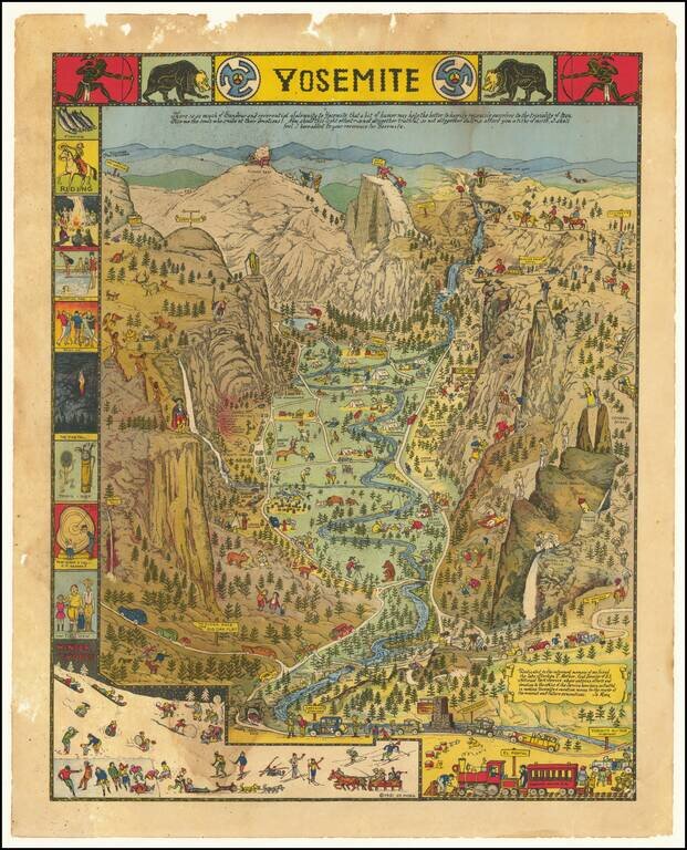
Decorative vintage pictorial map of Yosemite Valley drawn by artist Jo Mora in 1931 and later re-issued in 1941 and 1949. The map shows many humorous scenes and shows the activities common at the time in the Valley. Many landmarks are shown in an...
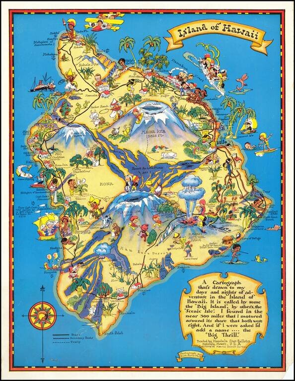
Marvelous whimsical map of the Big Island by Ruth Taylor White one of the most famous pictograph artists of the period. Ruth Taylor White was among the most prolific makers of pictographic maps. Her whimsical style combines her artistic skills with...
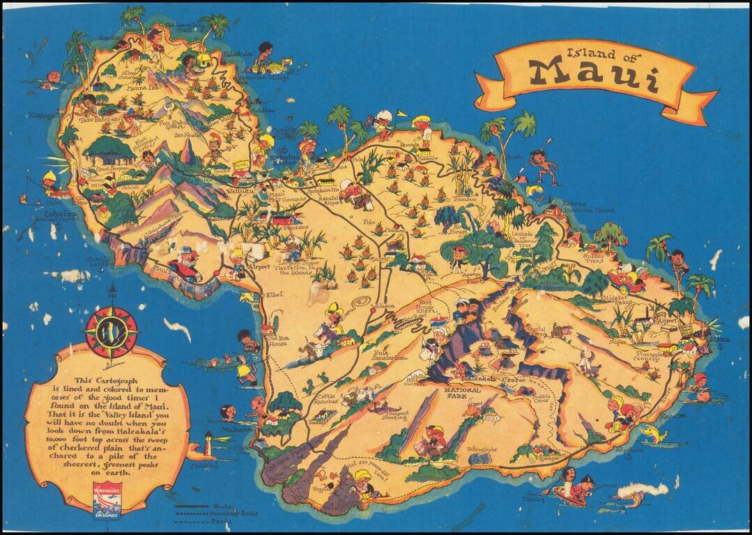
Marvelous whimsical map of Maui by Ruth Taylor White, one of the most famous pictograph artists of the period. Ruth Taylor White was among the most prolific makers of pictographic maps. Her whimsical style combines her artistic skills with local color...
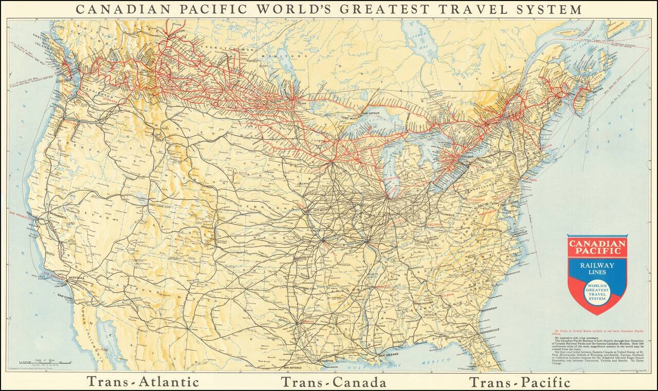
This is a map showing the railway lines of Canada and the US, with the lines operated by the Canadian Pacific Railway highlighted in red. Many different routes crisscross the map, and cities, towns rivers, and more are all named. The verso advertises...