Map size in jpg-format: 57.0205MiB
Click to open in high resolution (open in new tab).
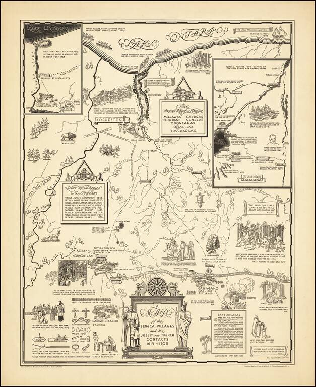
Rare historical pictorial map of the Iroquois League of Nations, consisting of the Mohawks, Cayugas, Oneidas, Senecas and Onondagas and later the Tuscoras, who dominated this region in the 17th and 18th Centuries.
The work focuses on the regional history of the Jesuit and French contacts with the indigenous peoples, as researched by A.M. Stewart and drawn by Helen Erickson in Rochester.
If you are a student, write to us in telegram: @antiquemaps and indicate what material you need and for what work you need a map in high detail. We are ready to provide material on special terms. For students only!

![[Site of A Presidential Assassination] Plan of the Pan American Exposition to be held at Buffalo, New York (May 1 - Nov. 1, 1901)](/map/small/69181.jpg)