
This is an attractive pictorial map of the United States published by the Ford Motor Company as an advertisement for air routes that were supplied in part by their Ford Trimotor aircraft. The map is fascinating, showing domestic and international air...
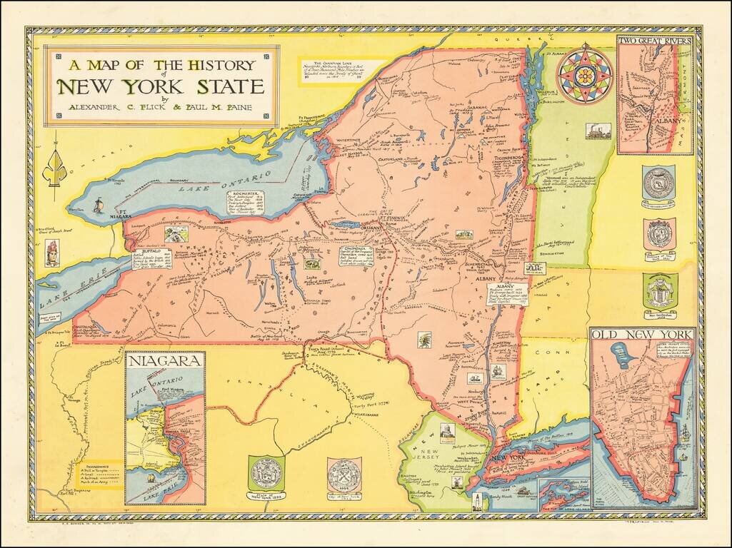
EArly pictorial map of New York State, published by R.R. Bowker in New York. The map provides a history of the state, covering a period of 400 years, including: Giovanni da Verrazzano's discovery of New York Bay in 1524 Dutch settlements of the...
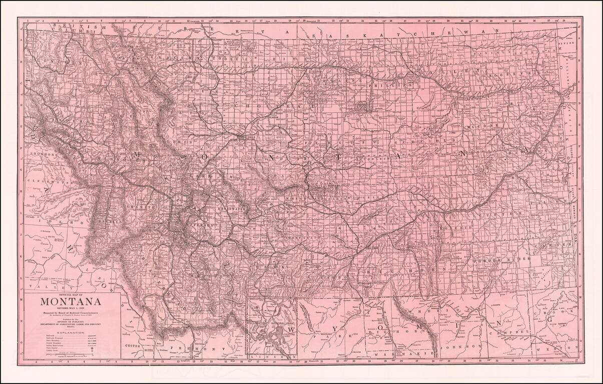
Fine large format map of Montana, published by the Board of Railroad Commissioners. Shows Railroads, Proposed Railroads, and Indian Reservations shown. Automobile Roads on the verso.
![[Los Angeles Urban Planning] . Suggested Treatment For Local Business Centers Along Main Thorofares](/map/small/54561.jpg)
A detailed urban planning model for a commercial street in Los Angeles, prepared by the City Planning Department. The map names Gordon Whitnall as Director of the Board of City Planning Commissioners, Jack W. Simons on behalf of the City Planning...
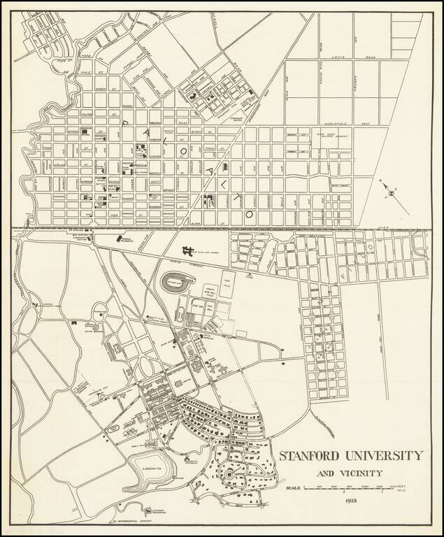
Detailed map of the Stanford University Campus, as it appeared in 1928. The map was likely created for a guide book, although we do not know the source. The map shows a portion of campus in academic use and street map of Palo Alto. The map is very...
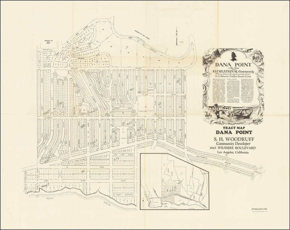
Remarkable oversized tract map of Dana Point, almost certainly the earliest large format subdivision map of Dana Point. The present map, which locates a number of ambitious future improvements, including a country club, polo field, hotel site,...
![[Berkeley] This Is The Map of Berkeley Town Its Streets Go Winding Up & Down An Oak-Covered Camputs It Wears For A Crown With People & Places of Renown](/map/small/69776.jpg)
Rare pictorial map of the area around the campus of the University of California, Berkeley, published in about 1928 by Thomas Brothers and drawn by Virginia Tooker. The map is centered on the Campanile, with California Memorial Stadium at the east,...
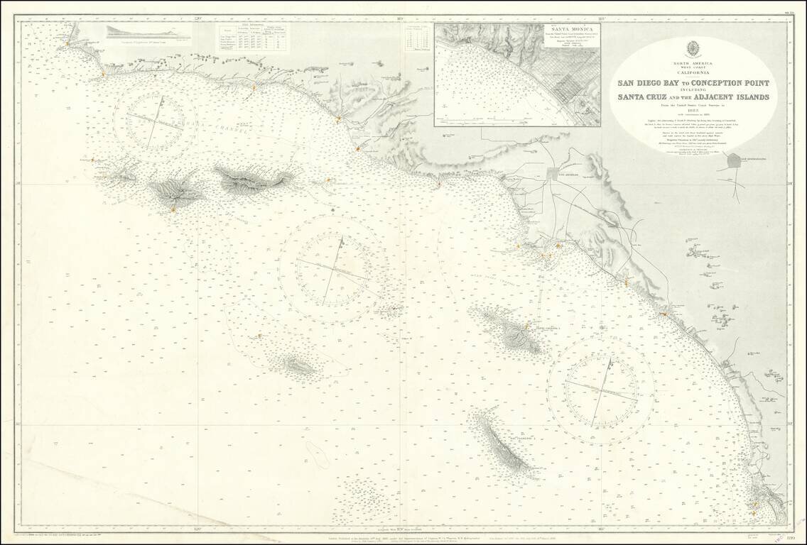
Fine large British sea chart of the Southern California Coastline, published in 1928, with small corrections to 1957. The chart extends from San Diego to Point Conception and Arguello Point, centered on Santa Monica and the LA Basin. Offshore islands...
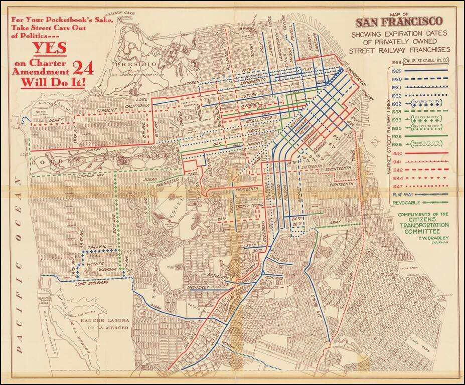
Rare political pamphlet map, promoting a campaign supporting the Yes on Charter Amendment 24, regarding the regulation and renewal of Private Street Railway in the city. The map shows the routes of privately-owned streetcar lines in San Francisco and...
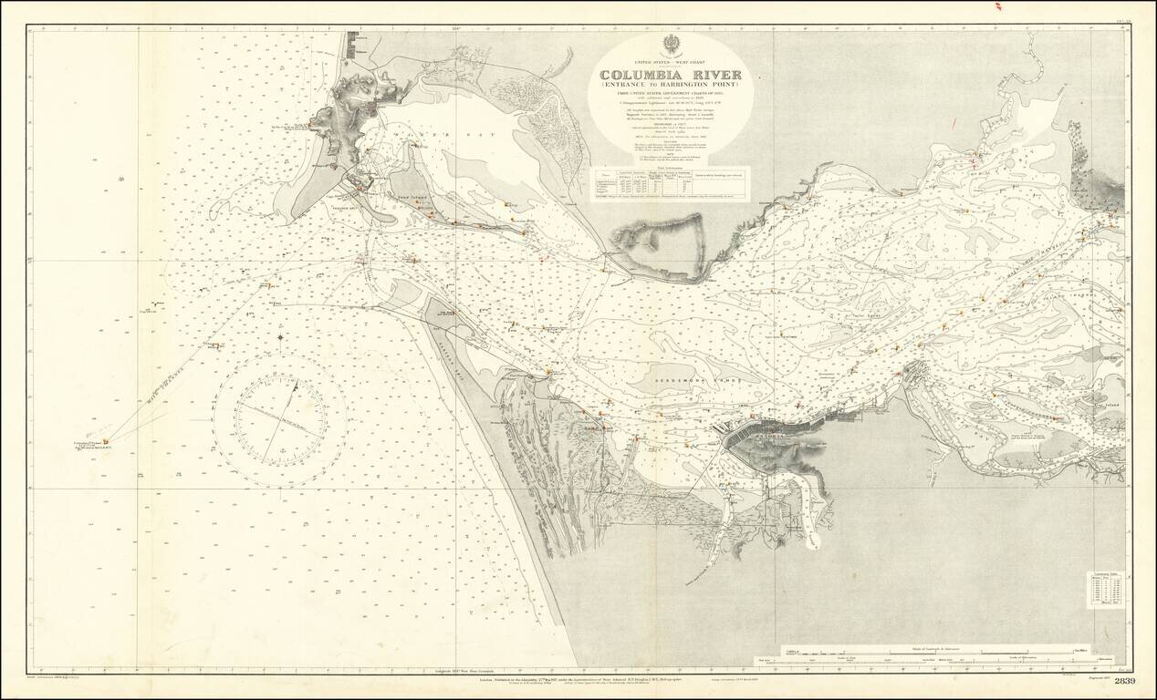
Extremely detailed chart of the mouth of the Columbia River, between the states of Oregon and Washington. The map covers the north and south shore of the Columbia as it exits into the Pacific Ocean. On the north shore, the towns of Ilwaco, Holman, and...
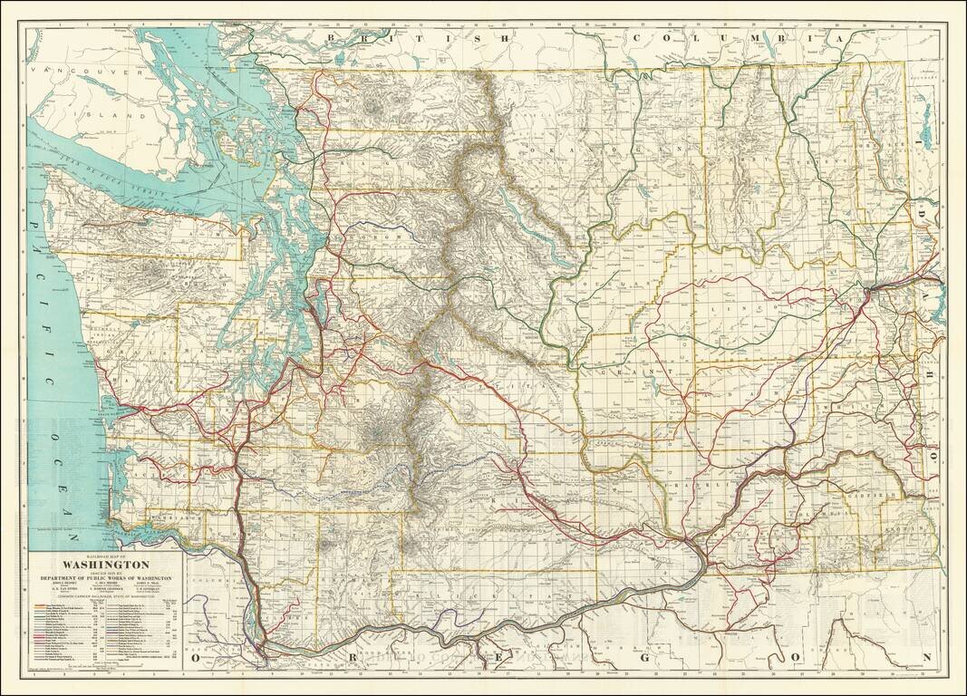
Highly detailed Railroad map of Washington, published by the Washington Department of Public Works First edition of this informative map delineating miles of steam and electric railroads in Washington State during the 1920s. The map shows 40 different...