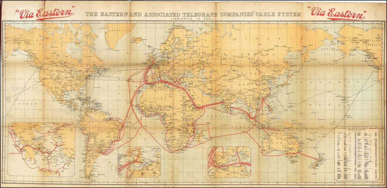
Tracing the Expansion of the Global Telecommunications Network. Fascinating color-lithographed map, showing the coverage of the extensive submarine cable network of the Eastern and Associated Telegraphy Companies in 1926. That company can trace its...
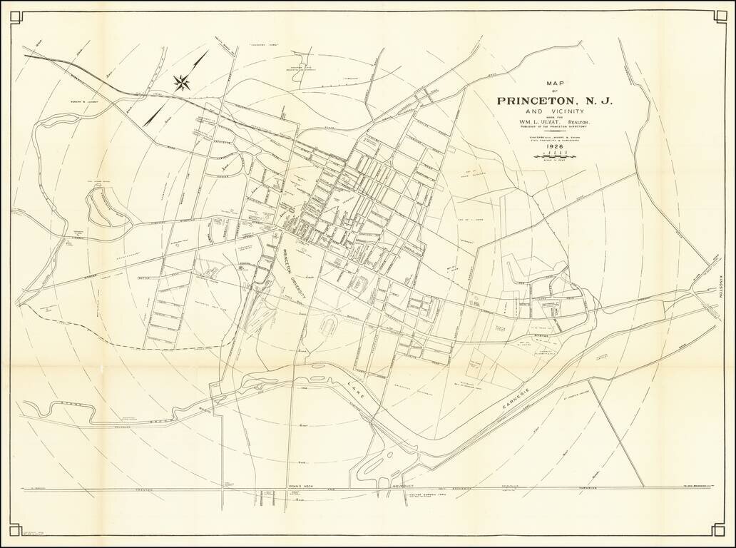
Rare map of Princeton, published in 1926. The map is oriented with Northwest at the top, with concentric circles radiating out from the center of town in 1/4 miles increments. Princeton and many other landmarks located.
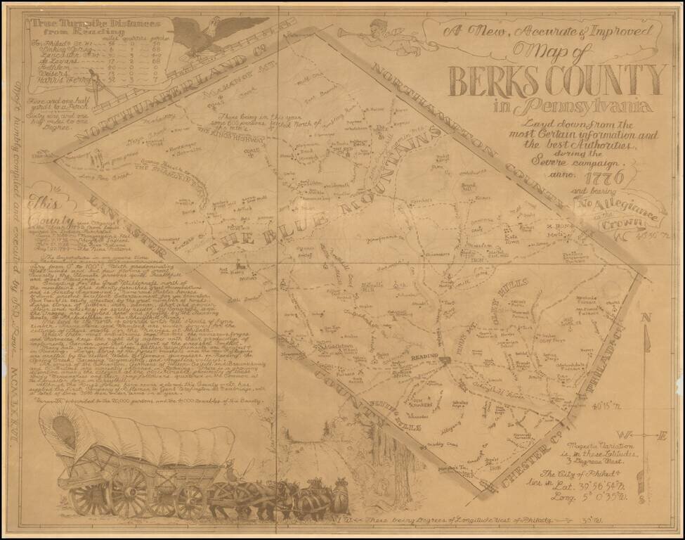
Rare pictorial map of Berks County, Pennsylvania, drawn by J.R. Rowe. The map is well researched and attractively executed, providing a marvelous historical overview of Berks County in Colonial times. The "severe campaign" is a phrase used by George...
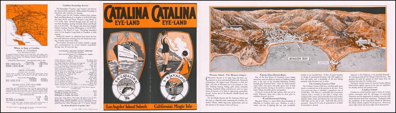
Decorative promotional pamphlet promoting Catalina Island, with a marvelous birdseye view of Avalon Bay, including 2 piers. Interesting early promotional pamphlet with many photographs and early descriptions of the best of Catalina's tourist industry...
![[Los Angeles & Orange Counties] Status of Lands Survey Conducted During 1926 Central Portion of Coastal Plain . . .](/map/small/66323.jpg)
Detailed Irrigation map of a portion of the Los Angeles Basin, published by the California Department of Public Works, Division of Water Rights. A color key identifies: Irrigated areas (green) Unirrigated areas (yellow) Subdivided (urban) areas...
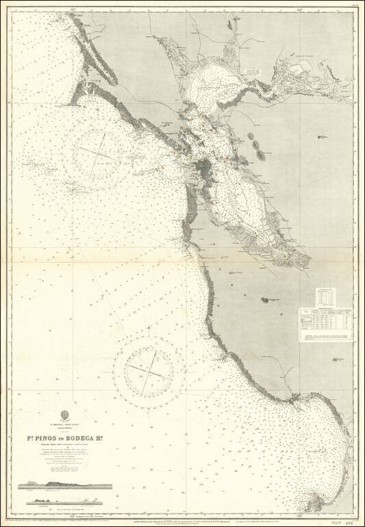
Scarce separately issued sea chart of San Francisco Bay and Vicinity, extending from Monterey Bay to Bodega Bay, with large revisions up to 1926. First issued in the mid-19th century, this map was regularly updated well into the 20th century.
![[Catalina / Avalon] The Island for Rest and the Sport You Love Best](/map/small/70008.jpg)
Striking pictorial view of Avalon Bay, promoting the Wilmington Transportation Company's excursions to Catalina. The view provides a fine overview of the Avalon Area, including the residence of William Wrigley Jr. on the hillside at the left and the...
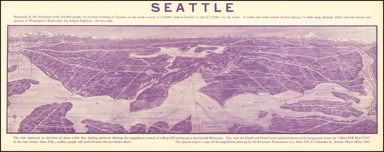
Promotional antique bird's eye view panorama for Seattle, "Metropolis of the Northwest. . . " An exceptional view, centered on Lake Washington, with Everett at the far left and Tacoma at the far right. The map shows the eastern shore of Bainbridge...
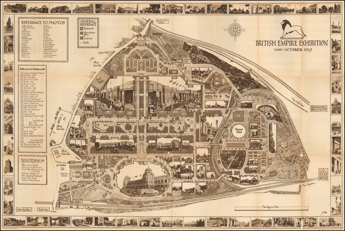
A highly decorative and detailed map of the 1926 British Empire Exhibition, incorporating many photographs of buildings both in the border, and integrated into the map image. The map includes keys to the photos, a general reference key (describing...
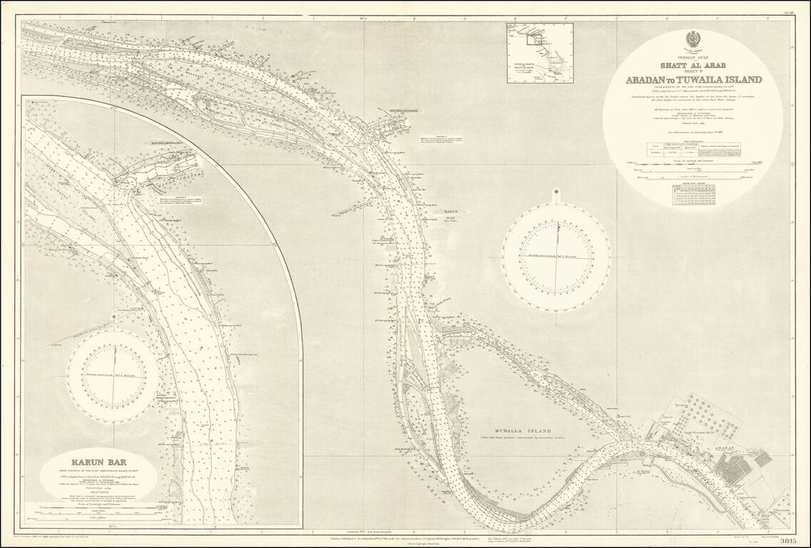
The Largest Oil Refinery In The World Detailed map of a section of the Karun River, on the Iran-Iraq Border, published by the British Admiralty. The map extends to Abadan and the complex of the Anglo-Persian Oil Company, which includes offices,...