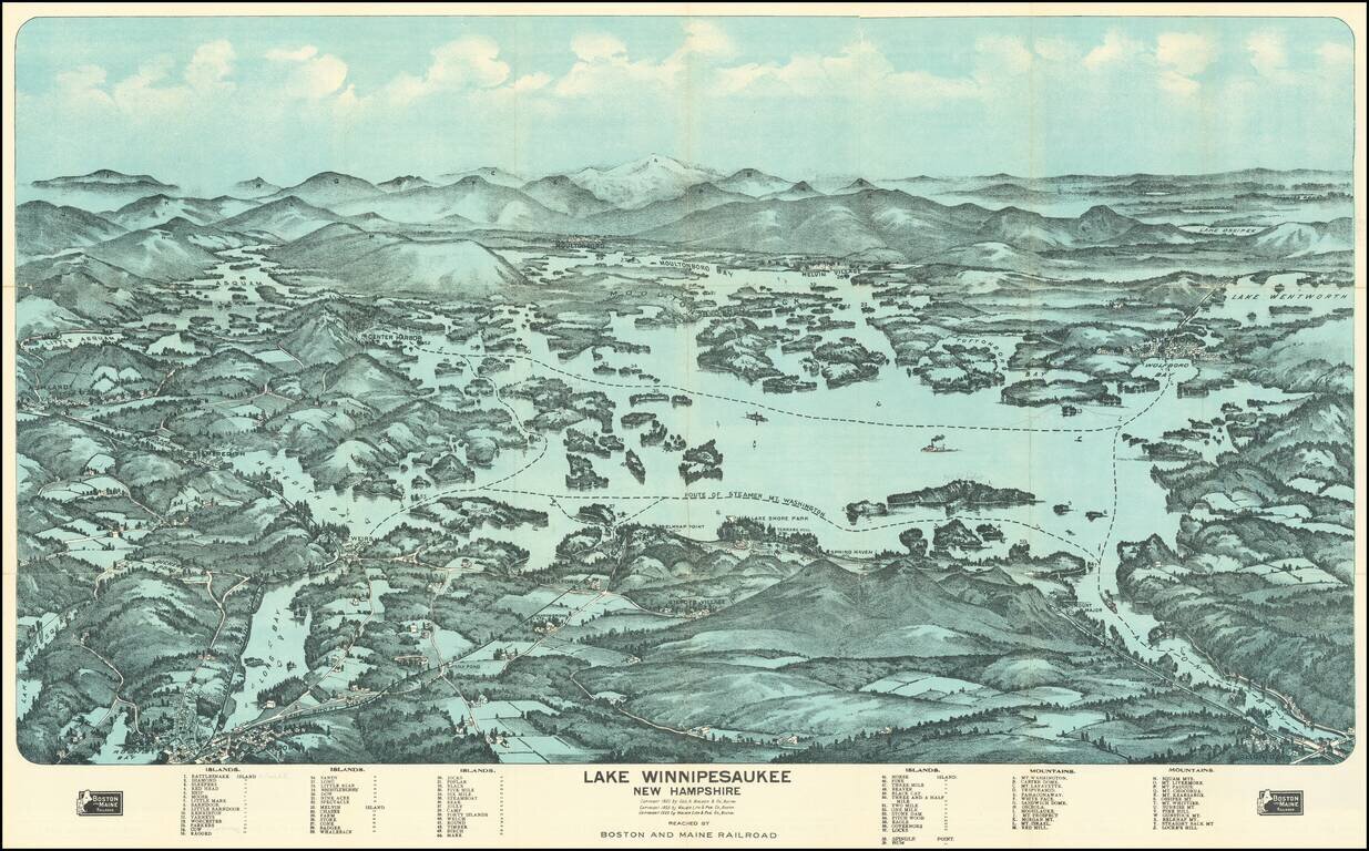
Fine birdseye view style map of Lake Winnipesaukee, published by George Walker & Co, for the Boston & Maine Railroad. The map provides a striking view of the Lake, with major islands, bays and other features named. The key at the bottom of...
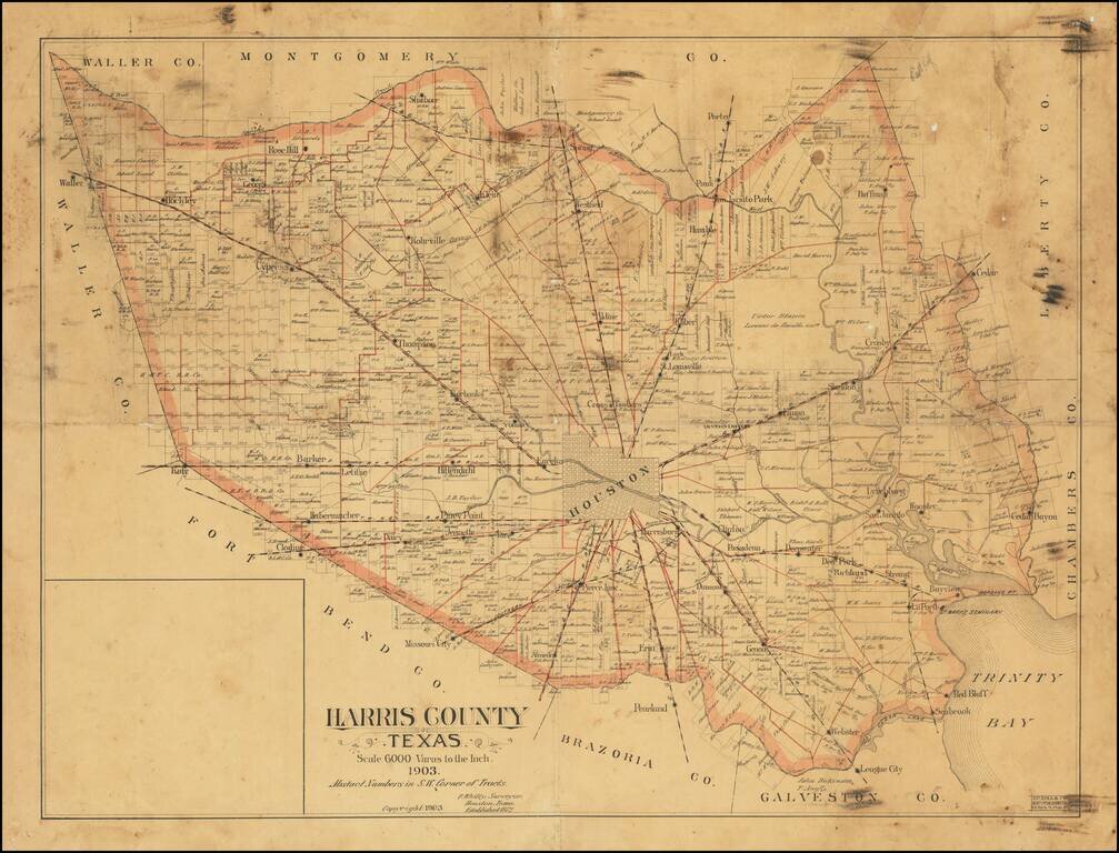
Rare Houston-published antique map of Harris County, Texas, covering the Houston metropolitan area, published by Patrick Whitty, Houston's main surveyor at the end of the 19th century and beginning of the 20th. The map extends from Katy in the west to...
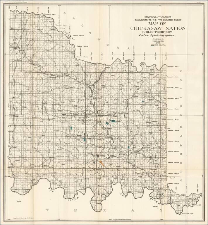
Large format map of the lands allocated to the Chickasaw Nation. The map shows the coal and asphalt deposits in the Chickasaw nation. Also featured are towns, hydrography, and rail road lines.
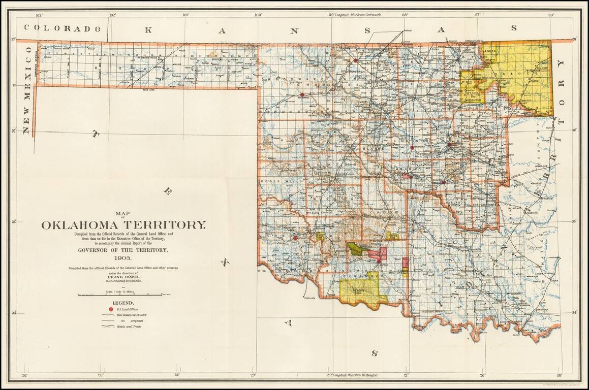
Rare Oklahoma Territory Map -- Pre-Dating Merger with Indian Territory. Rare map of Oklahoma Territory, issued by the Territorial Governor, during the brief period when Oklahoma and Indian Territory were separate Territories of the United States....
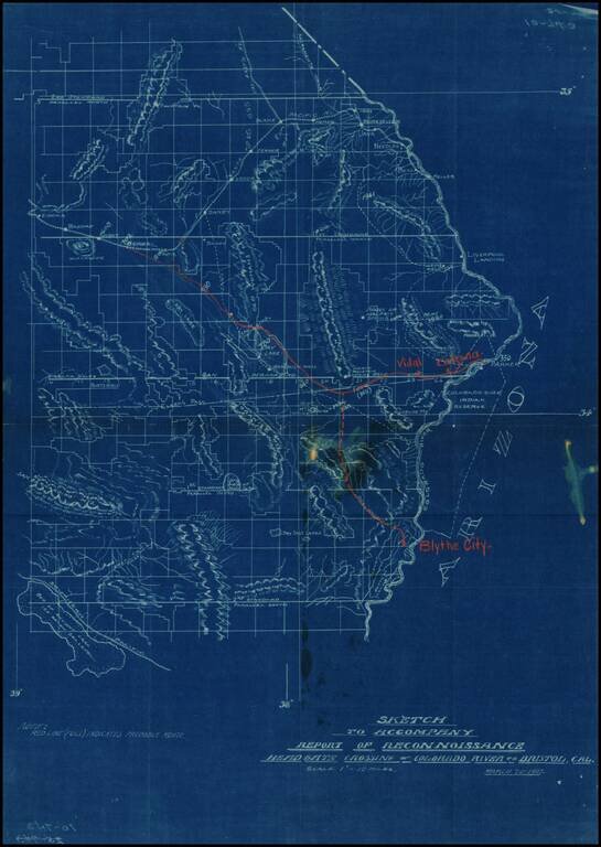
Detailed map of part of Southeastern California (Eastern Imperial and San Bernardino Counties), showing the projected railroad lines connecting Blythe City, Parker, Arizona, and Bengal, on the main line of the Santa Fe Railroad between San Bernardino...
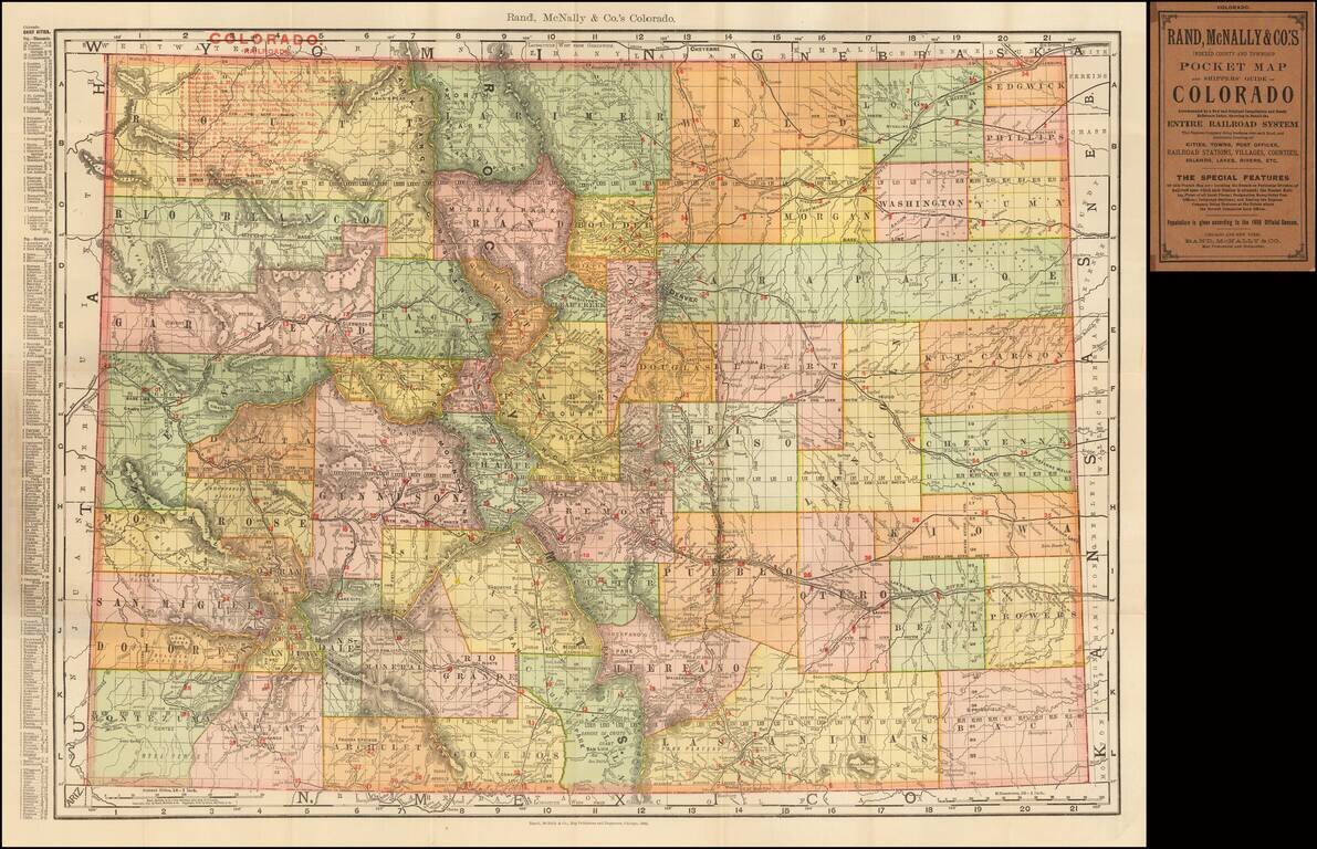
Highly detailed separately issued pocket map of Colorado, showing counties, townships, towns, railroads (numbered), railway stations, rivers, lakes, etc. Includes printed covers and text.
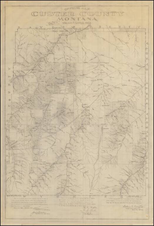
Manuscript Example of the First Map of Custer County, Montana Rare Manuscript Copy of the William Flynn's map of Custer County, Montana, drawn in 1903. This is an exact facsimile copy of the original printed version of Flynn's map of Custer County....
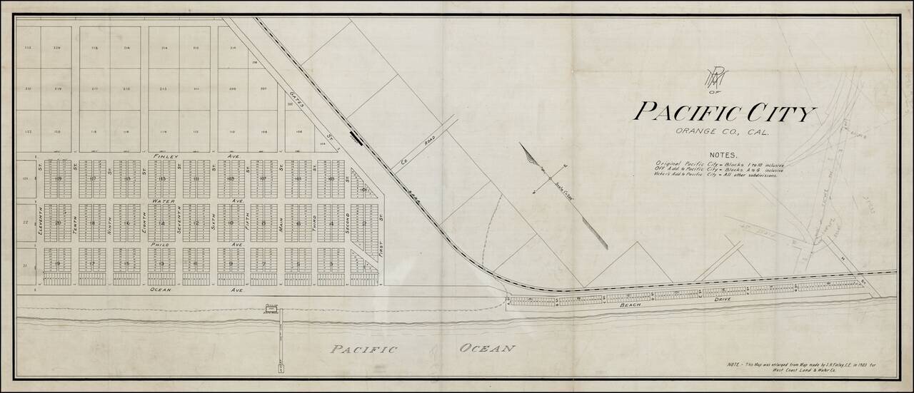
Rare Pacific Electric Railway working map of Pacific City, the first name used for the community which is now Huntington Beach, California, prior to its incorporation in 1909. The map is enlarged from the map made by S.H. Finley, Civil Engineer, in...
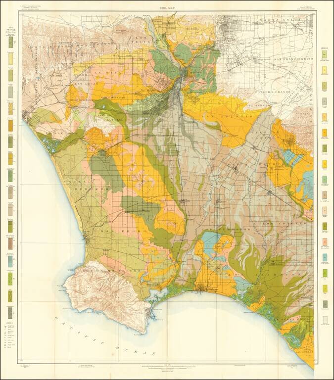
Colorful and highly detailed map of the Los Angeles Basin, drawn from maps by the United States Geological Survey. The map extends from the Sana Monica Mountains to Azusa in the north, to Rancho Las Bolsas (Huntington Beach, area) and Palos Verdes....
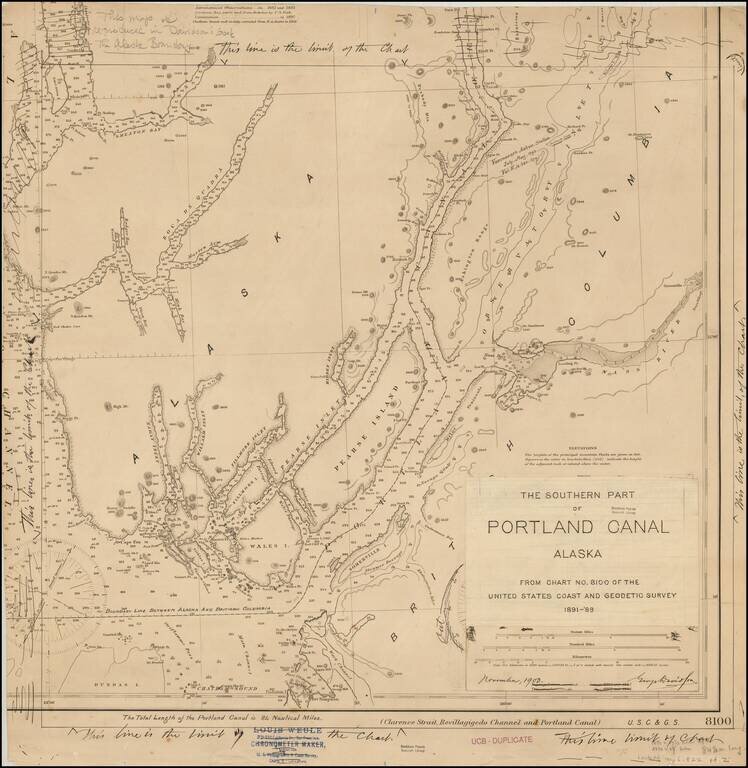
Original artwork for George Davidson's book on the Alaskan Boundary Dispute. The work consists of a US Coast and Geodetic Survey chart amended by George Davidson, for publication in "The Alaska Boundary," published in 1904. In addition to the...
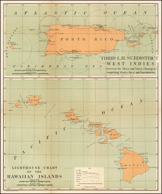
Rare pair of maps showing the lighthouses in Hawaii and the Puerto Rico areas, including proposed light houses, fog lights, light vessels, lighted buoys and a host of other navigational details within the state. This is the first time we have ever...
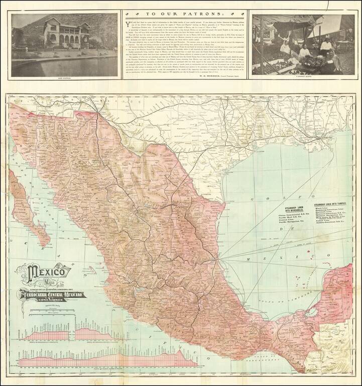
The Mexican Central Railroad Three Years Prior To Its Nationalization Fine early map of the Mexican Central Railway and Connections On the verso are listings of the Steamship Lines into Manzanillo and Tampico and time lines for the major routes. The...
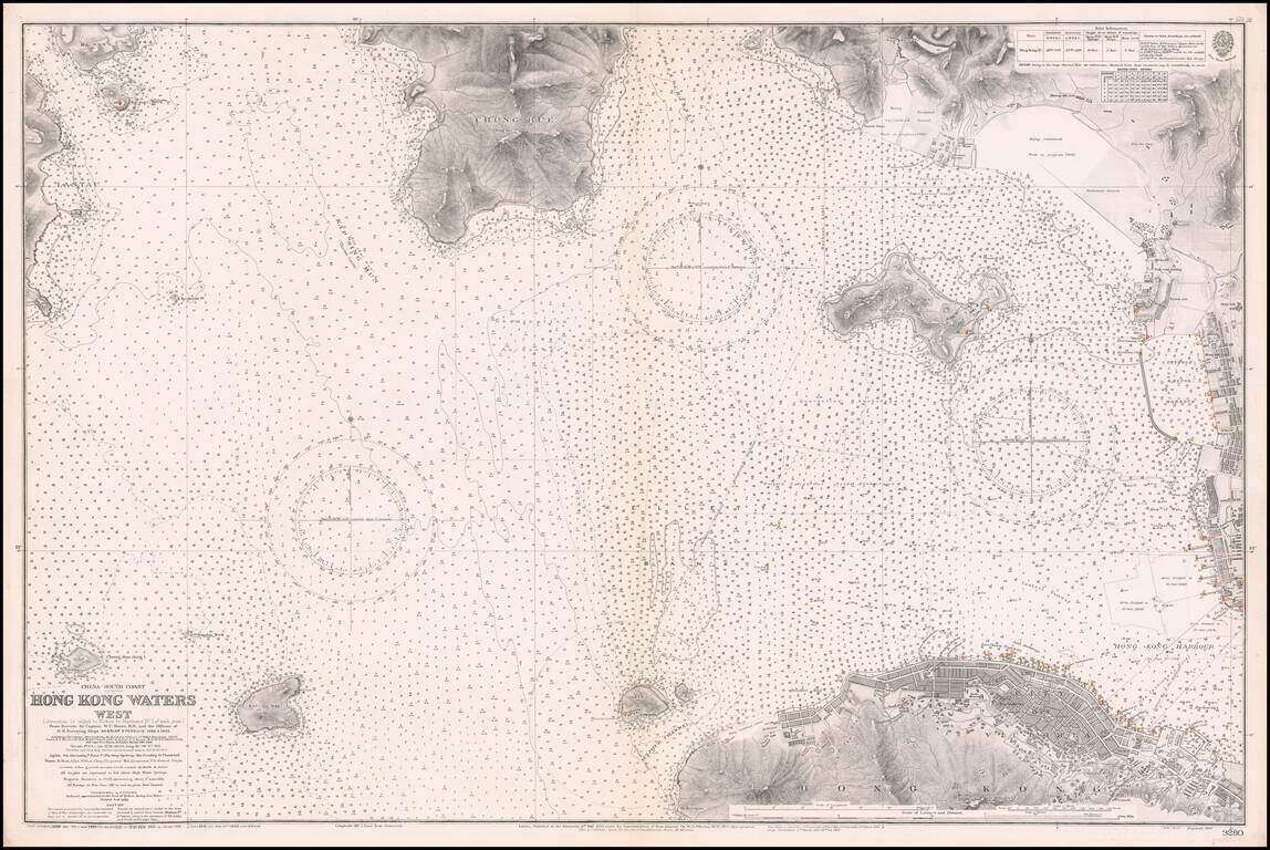
Western Approaches To Hong Kong Harbor A large-scale and detailed sea chart of the western approaches to Hong Kong Harbor, issued by the British Admiralty, including all of Victoria (Central), western Kowloon and extending westwards to Lantau...
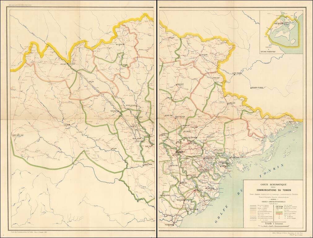
Northern Vietnamese Telegraph Railroad and Postal Map From the French Colonial Period A fine and extremely rare schematic map, emphasizing the means of communication within French Colonial Vietnam. The map is exceptionally detailed, focusing on the...
![[Kenya, Southern Ethiopia & Somalia - Jubaland and Tanaland Provinces] Boran](/map/small/67233.jpg)
Jubaland and Tanaland Provicinces Finely detailed map of Kenya, along with western Somalia and southern Ethiopia. The map extends from Lake Rudolph (Lake Turkana) to Lake Baringo and Afmadow in Somalia. Details include: Railroads completed and in...

Finely executed map of the South Polar regions, published in Leipizig. The map is focused on the many explorations of the Antarctic regions up to several discoveries in 1902 and 1903. Very detailed map of Antarctica with insets and numerous tracks of...