![[Site of A Presidential Assassination] Plan of the Pan American Exposition to be held at Buffalo, New York (May 1 - Nov. 1, 1901)](/map/small/69181.jpg)
The Site of William McKinley's Assassination in September 1901 Finely executed plan of the Pan American Exposition grounds, which were to be held in Buffalo in 1901. As noted, the map shows the revisions of the plan as of August 15, 1900. The map...
![[Wall Map of the World] Mappemonde Dressee et Grave Specialement pour Le Petit Journal D’apres les Documents le Plus Regents . . .](/map/small/70573rd.jpg)
Decorative Wall Map of the World, Illustrating the Manner of Dress of All The Peoples of the World Fine double hemisphere world map, drawn by Menetrier, and engraved and printed by E. Charaire in Paris. The map is a fine example of a World Map as an...
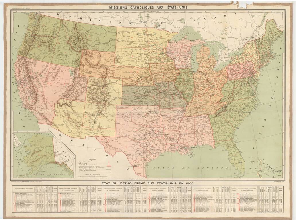
Rare large format map showing the Catholic Missions in the United States, with an extensive table below. The map includes topographical details, locations of Missionaries, Archdiocese, Diocese, Vicariates and Prefectures. There is an extensive...
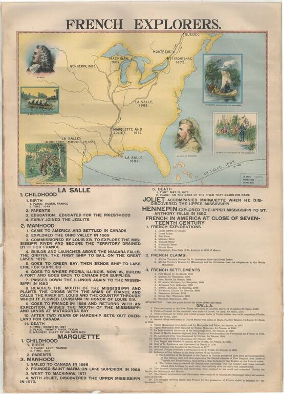
Rare Large Educational Map, With Pictorial Map Illustrating French Exploration of America and Illustrated Historical Chart of the United States. Decorative large format image, printed in color on both sides, almost certainly for educational purposes....
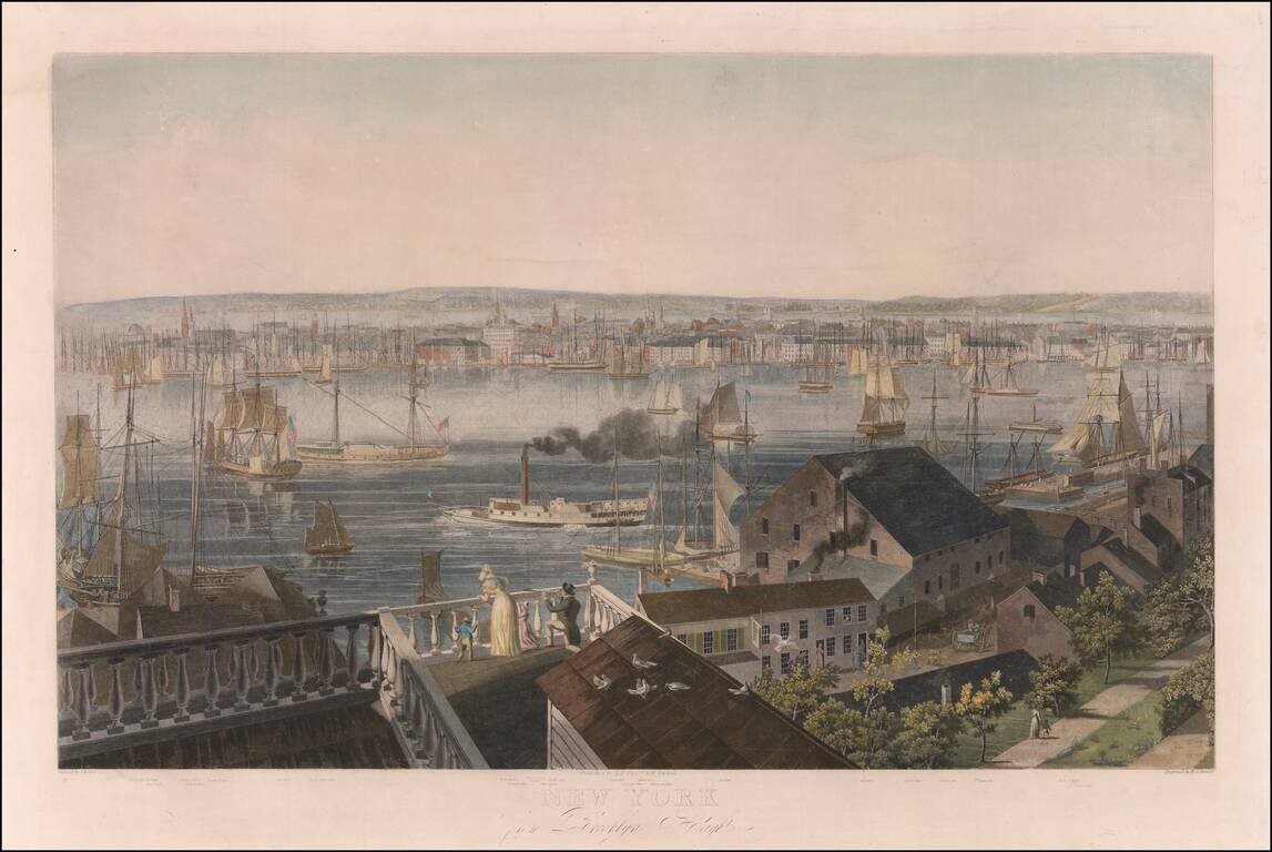
"The Largest and Most Ambitious Print in Bennett's Series of American City Views." Handsome hand-colored example of the Hill-Bennett-Clover view of Manhattan from Brooklyn Heights, among the best views of the city from the first half of the 19th...
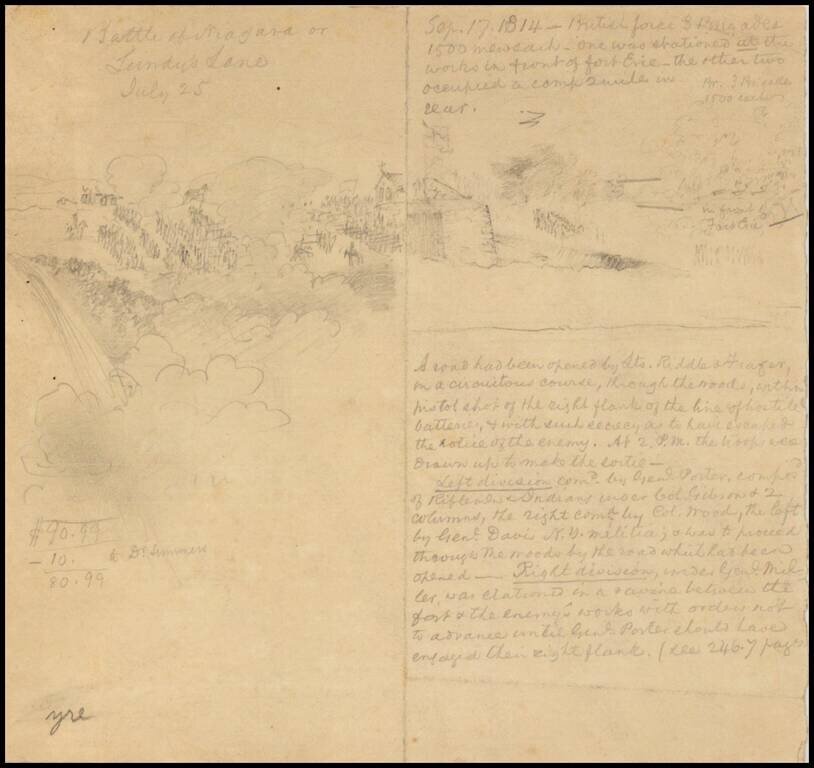
Late-19th or early 20th-century drawing of the Battle of Lundy's Lane during the War of 1812. There is a pencil drawing of the action on the left side of the sheet and a description on the right.
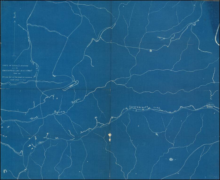
Detailed blueprint map illustrating the location of "Steel's Division" during the Siege of Vicksburg. "Steel" is Frederick Steele (1819 – 1868), a career military officer in the United States Army, who served as a major general in the Union Army...
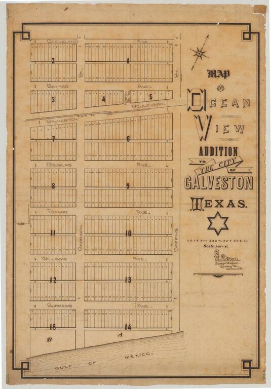
Attractive manuscript plan for an early subdivision in Galveston, Texas, drawn by Galveston-based surveyor R.W. Luttrell. The map shows a Gulf of Mexico-adjacent 15-block addition called the "Ocean View Addition". The addition is centered around the...
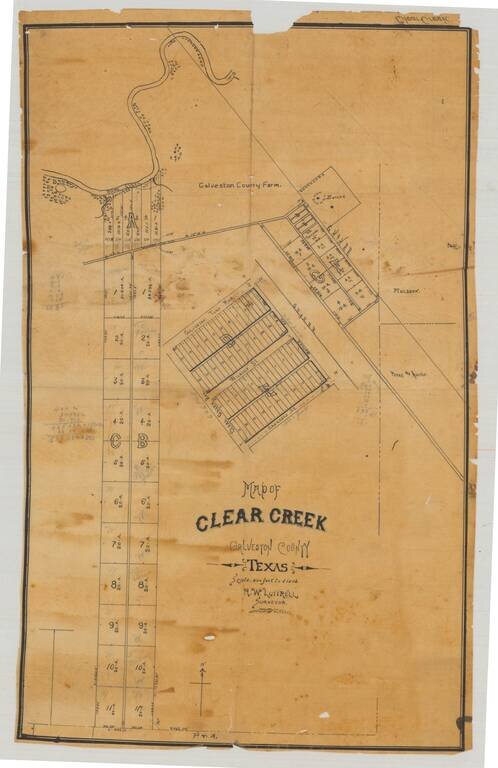
Original manuscript plat map of "Clear Creek", now League City, in Galveston County, Texas, drawn by Galveston-based surveyor R.W. Luttrell probably around 1900. The map shows a series of plots and roads just south of Clear Creek, which enters Clear...
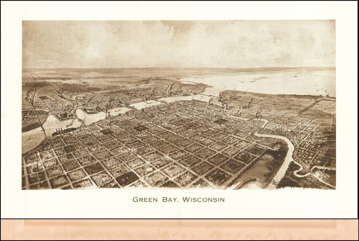
Rare view of Green Bay, published by Barnes-Crosby Company Barnes-Crosby Company Barnes-Crosby was best known for publishing an extensive fine lithograph stereoview series of United States scenes starting in the late 1890’s and continuing for...
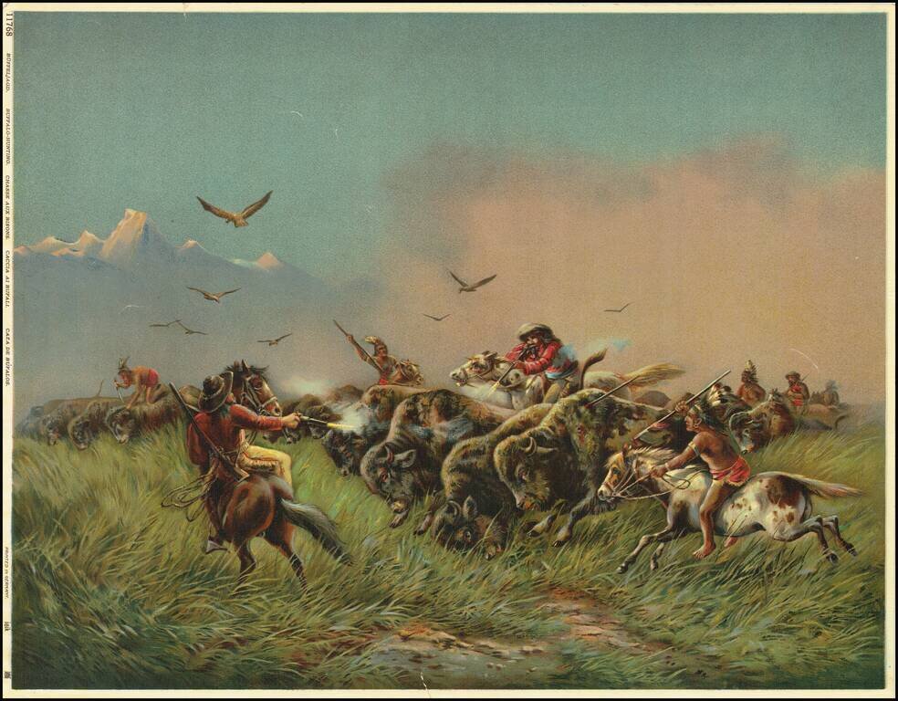
This is a great color-lithograph of a buffalo-hunting scene. The image is heavily romanticized, painting a rosy picture of the American West. Hardened cowboys on bucking horses use guns while Indians spear or stab the buffalo. Raptors fly above the...
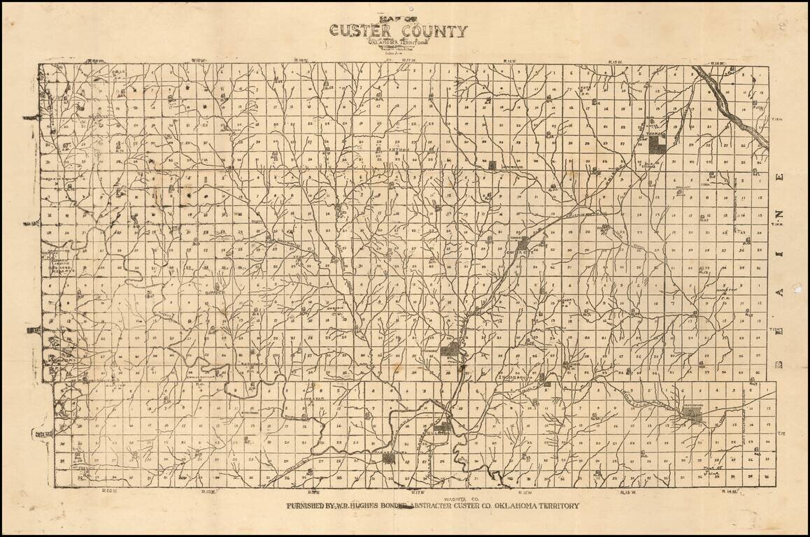
Unrecorded Early Map of Custer County, Oklahoma Territory One of the earliest surviving printed maps of Custer County, Oklahoma Territory. The map is subdivided into townships, with each lot subdivided into 36 numbered sections. Several towns are...
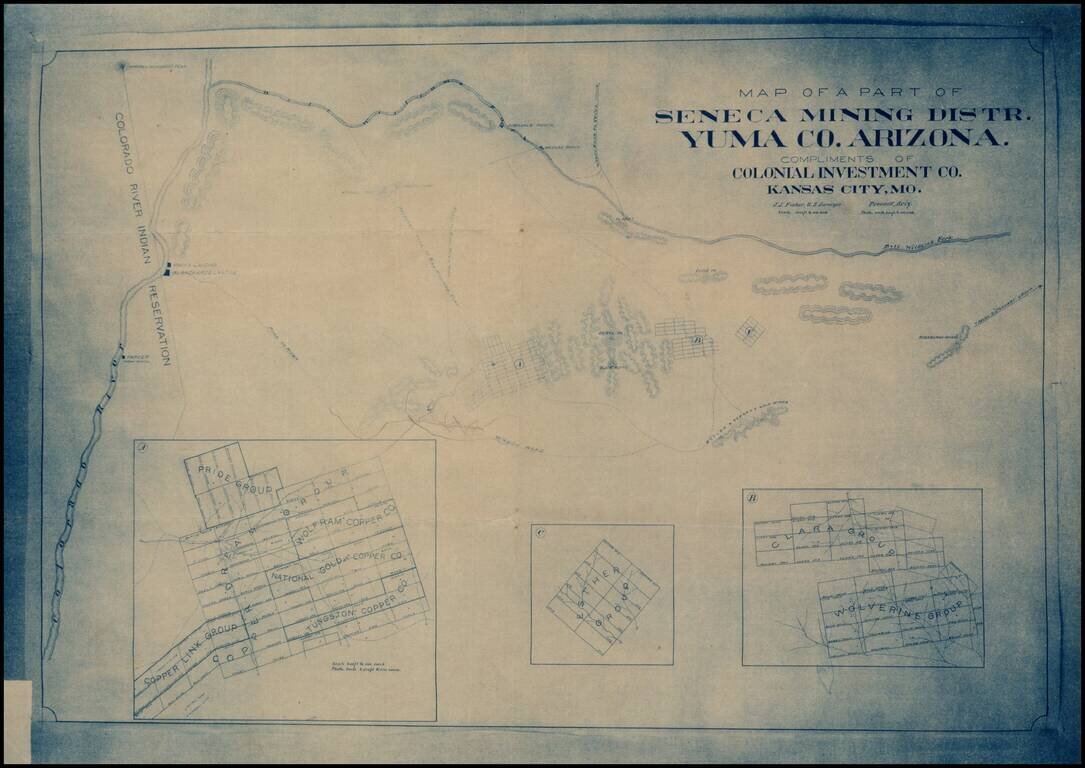
Early blueprint copy of part of the Seneca Mining District in Yuma County, showing the lands south of the Bill Williams Fork and east of the Colorado River.
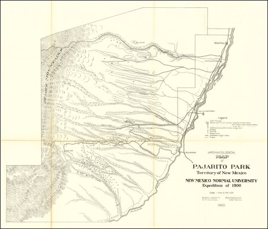
Highly detailed map of what is now Bandelier National Monument bounded on the northwest by the Jemez Mountains and on the east and south by the Rio Grande. On the northeast are Espanola and Santa Clara Pueblo. This map shows topography, names all the...
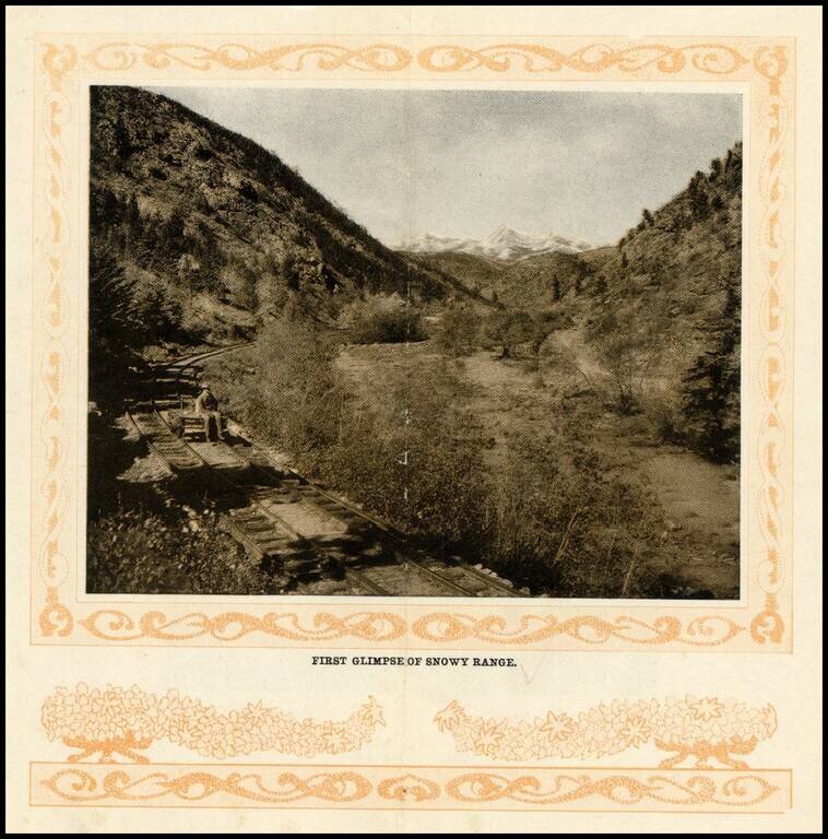
Early photographic view of the Snowy Range in Colorado, from the turn of the Century.
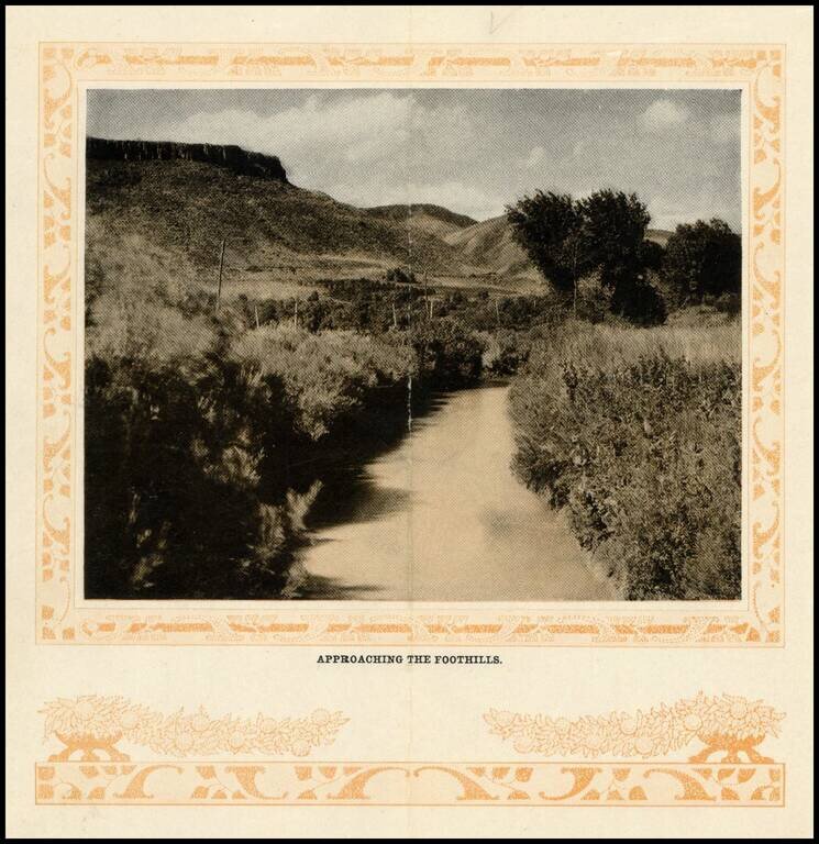
Early photographic view of the foothills on route to Georgetown, Colorado, from the turn of the Century.