![[San Carlos / Edgewood Park] Map of a Portion of The Brittan Ranch, San Mateo. Surveyed by J.J. Cloud, Co. Surveyor. April 1885](/map/small/66630.jpg)
A Beautiful Tract of Valley Land 3/4 mile from Redwood City at the base of the Coastal Range . . . Fine map of a large portion of San Carlos, California, showing the subdivision of John Wesley Brittan's Ranch in San Mateo County, in 1885. The map...
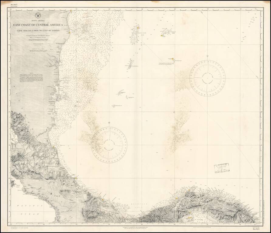
Detailed chart of the Mediterranean Coast of Panama, Costa Rica and Honduras, published by the US Coast & Geodetic Survey. The chart provides a highly detailed coastal treatment of the region, along with the offshore islands, soundings, sailing...
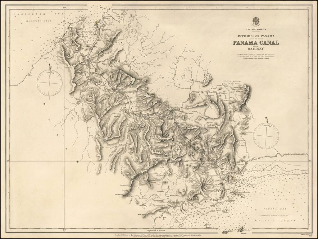
Highly detailed map of the Isthums of Panama, published by the British Admiralty. Extending from Mosquito Bay in the Caribbean Sea to Panama Bay in the Pacific, the map provides a remarkable topographical treatment of the region. This British Admiralty...
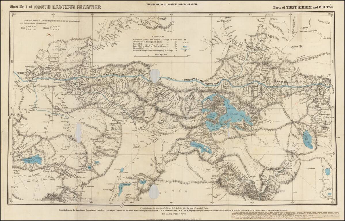
Rare Map of Northern India From the Trigonometrical Survey of India Highly detailed map of parts of Tibet, Sikhim and Bhutan, from the Trigonometrical Survey of India, printed in Dehraban in February of 1885. The map was part of the survey of the...
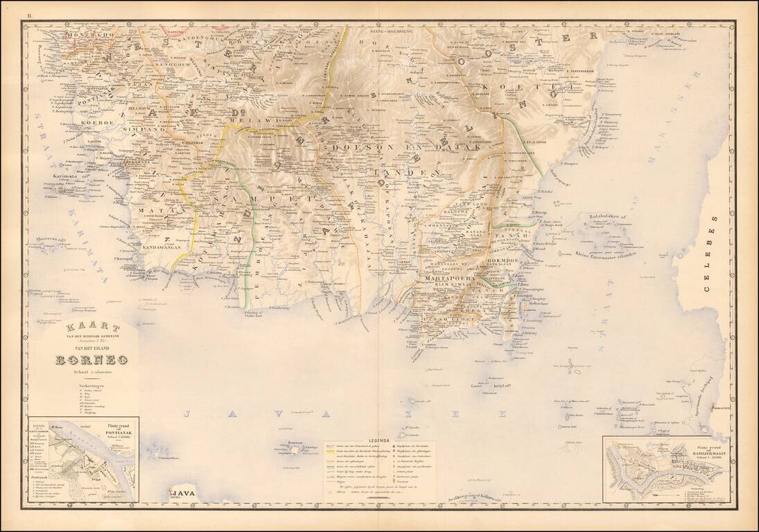
Fine map of southern Borneo, from Stemfoort's Atlas der Nederlandsche bezittingen in Oost-Indië naar de nieuwste bronnen samengesteld en aan de regering opgedragen. A fine highly detailed map, with topographical details, plance names and regional...
![[Sumatra] Kaart van Zuid Sumatra Residentien Benkoelen, Lampongsche Distrikten en Palembang.](/map/small/51736.jpg)
Attractively color-printed map of the southern tip of Sumatra, from Stemfoort's Atlas der Nederlandsche bezittingen in Oost-Indië naar de nieuwste bronnen samengesteld en aan de regering opgedragen. A fine, highly detailed map, with topographical...
![[Sulawesi] Kaart van Zuid West Celebes bevattende deGouvernemts. de Leenroerige en Een Gedeelte der Bondgenootschappelijke Landen behoorende tot het Gouvernements van Celebes en Onderh . . .](/map/small/51902.jpg)
Southwestern Sulawesi Attractively color-printed map of the southern tip of the southwestern part of Sulawesi, from Stemfoort's Atlas der Nederlandsche bezittingen in Oost-Indië naar de nieuwste bronnen samengesteld en aan de regering opgedragen....
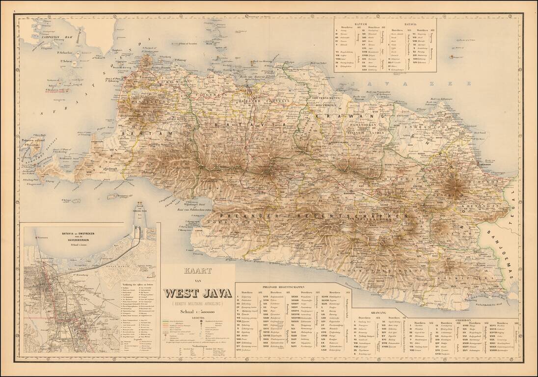
West Java Attractively color-printed map of Western Java, with a large inset of the Harbor of Batavia and environs, from Stemfoort's Atlas der Nederlandsche bezittingen in Oost-Indië naar de nieuwste bronnen samengesteld en aan de regering...
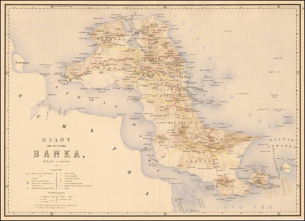
The Island of Banka Attractively color-printed map of Banka from Stemfoort's Atlas der Nederlandsche bezittingen in Oost-Indië naar de nieuwste bronnen samengesteld en aan de regering opgedragen. A fine, highly detailed map, with topographical...
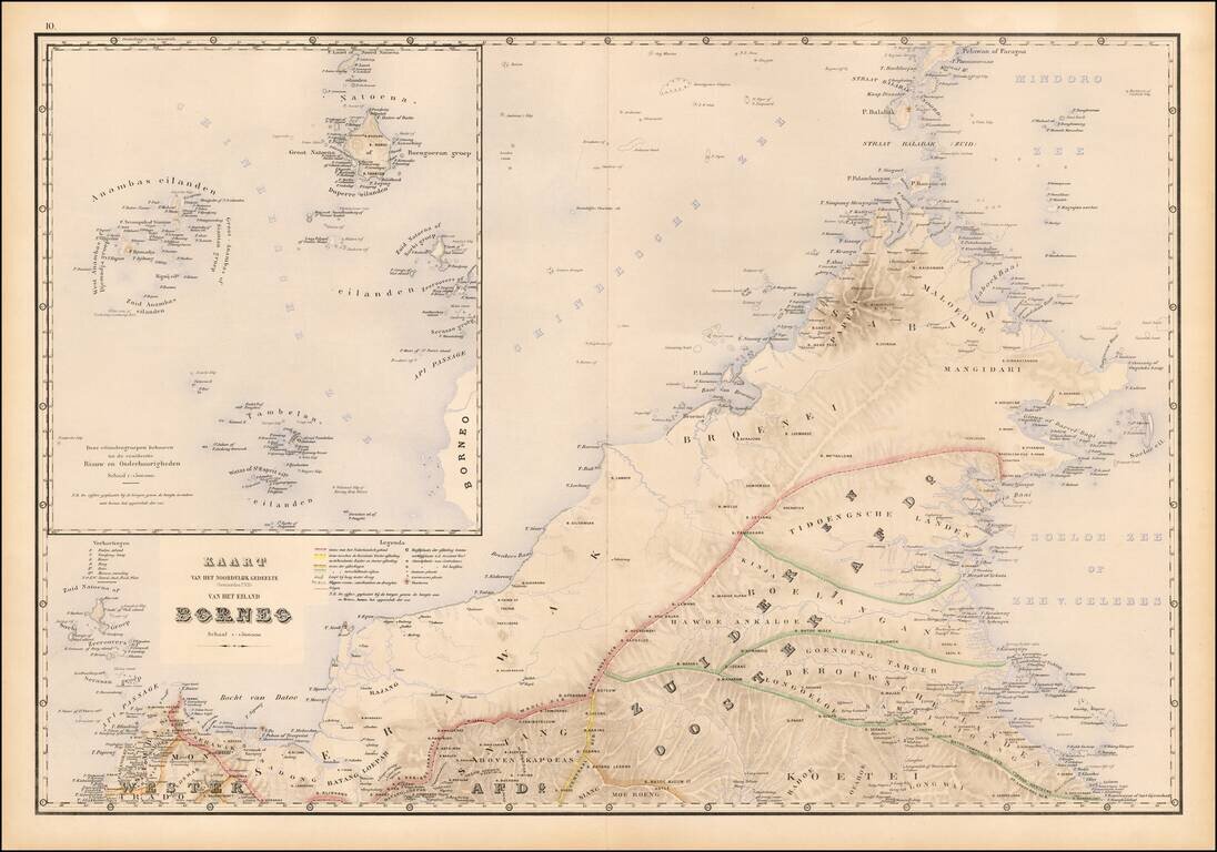
Fine map of northwestern Borneo, from Stemfoort's Atlas der Nederlandsche bezittingen in Oost-Indië naar de nieuwste bronnen samengesteld en aan de regering opgedragen. The map extends from the Api Passage and Sambas to Berouwsche Landen and north to...
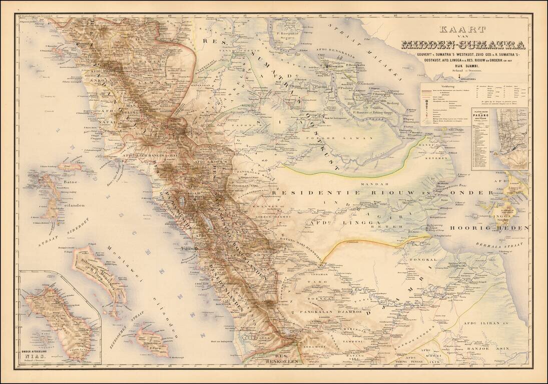
Detailed map of the central part of the Island of Sumatra, Stemfoort's Atlas der Nederlandsche bezittingen in Oost-Indië naar de nieuwste bronnen samengesteld en aan de regering opgedragen. The map extends from Sibolga on the west coast of Sumatra in...
![Планъ Современнаго Іерусалима [Plan of Contemporary Jerusalem.]](/map/small/56472.jpg)
Rare, large format, color-lithographed Russian map of Jerusalem published in 1885 by the Russian Imperial Orthodox Palestinian Society. The map is printed in five colors, with topography shown by contour lines. It records information of use to Russian...
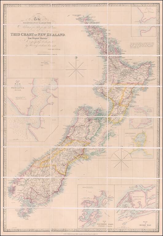
Previously Unrecorded, Late State of the Best General Map of New Zealand then Extant Important, previously-unrecorded state of the famous McDonnell-Wyld map of New Zealand, published by James Wyld Jr. in London in ca. 1885. This seems to be the...
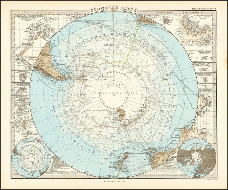
Very detailed map of the south polar regions, illustrating the great precision of Stieler's work. Remarkable amount of explorer details, including: Cook 1772-75 Bellinghausen 1819-21 Wedell 1822-23 Biscoe 1830-32 Kemp 1834 Ballen 1839...