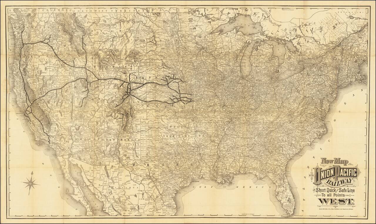
Unrecorded Edition of Map Issued For The Exclusive Use of the Union Pacific Railroad Company Rare case map of the United States, tracking the growth of the Union Pacific Railroad across America. The map shows the whole of the United States...
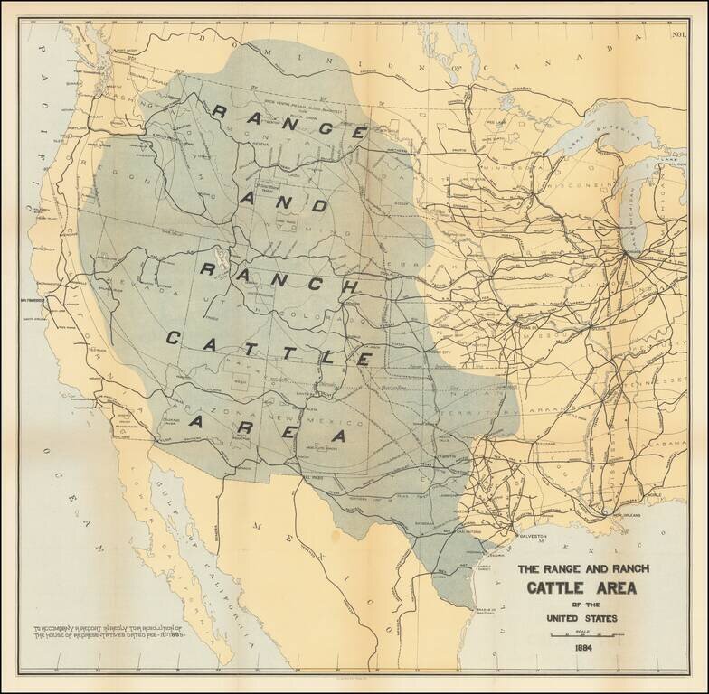
Rare map of the US, focusing on the Ranch and Cattle Industry. From Nimmo's Report on the Internal Commerce of the United States. Nimmo's book is held to be perhaps the most important of the cattle books. Nimmo's essay on the range and ranch cattle...
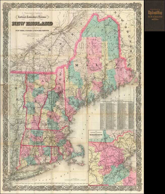
Colton's large-scale folding map of New England, with an inset map of the eastern portion of Massachusetts. The map provides an excellent level of detail, especially with regard to the railroad lines, which are illustrated and named. Hand-coloring is...
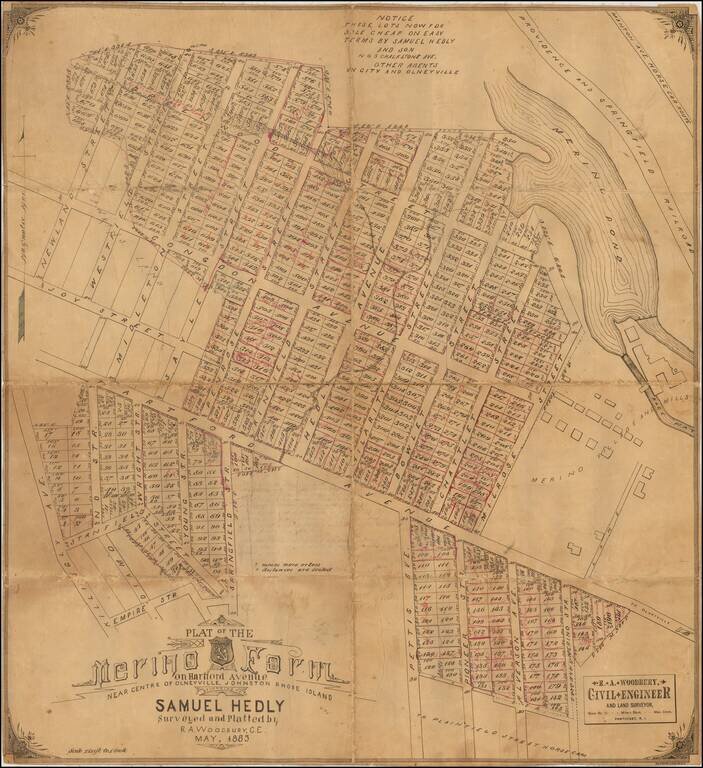
Detailed plat of the center of Harford, Rhode Island, with annotations reflecting what would appear to be the progress of lot sales. The map shows the subdivision of the area which had for decades been the location of the Merino Mill and the Merino...
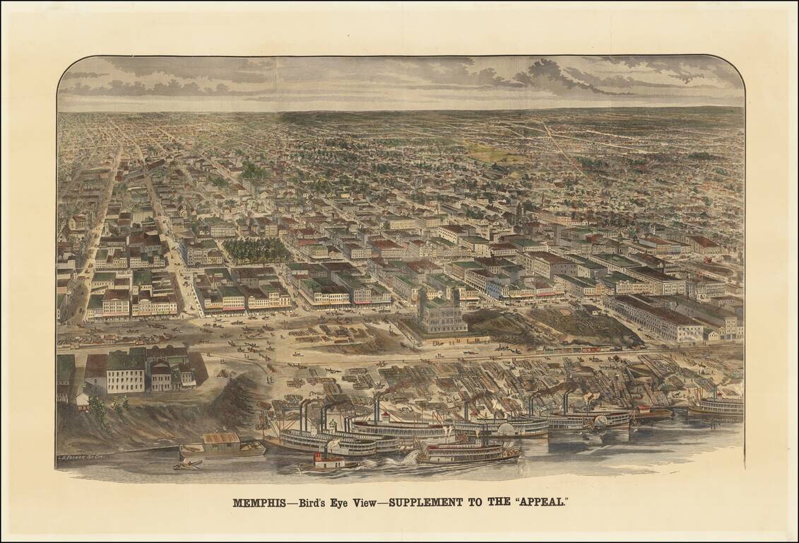
An Early Memphis Birdseye View Published in Memphis Rare view of Memphis, Tennessee, published as a supplement to the Memphis Appeal, October 15, 1887. The map shows an up-close view of the paddlewheeler's on the river, with a bustling waterfront...
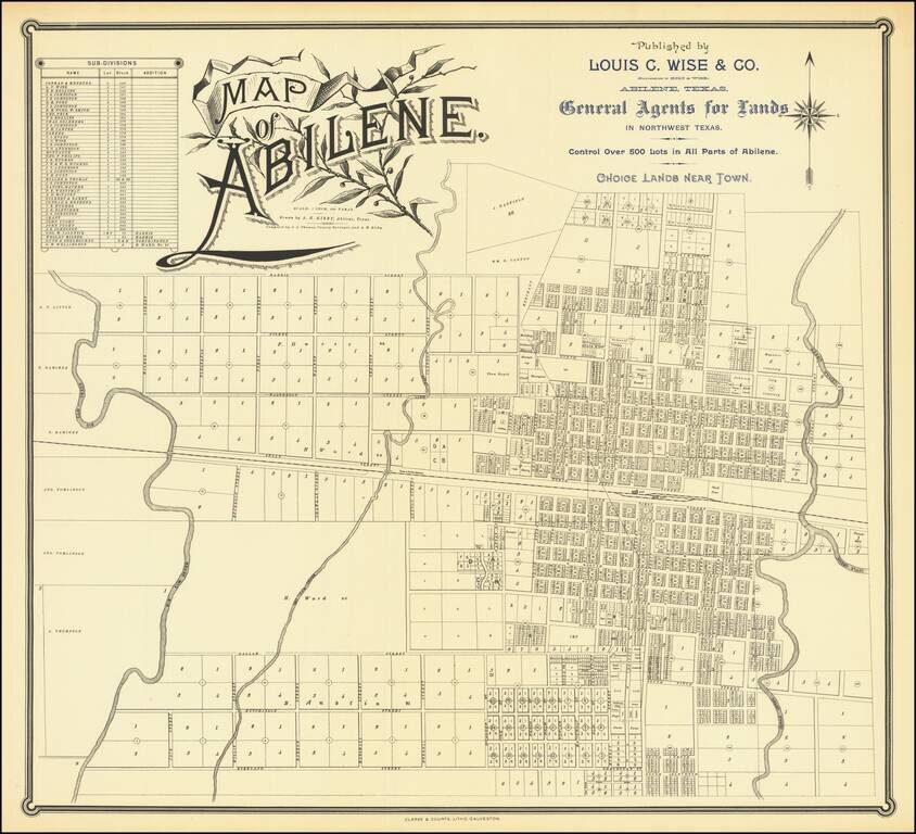
Rare Texas City Plan Flawless uncirculated example of this rare map of Abilene Texas, drawn by A.H. Kirby and compiled by J.A. Thomas, County Surveyor, quite likely the earliest printed map of the city. Printed by Clarke & Courts of Galveston,...
![[Eastern Sheet -- Ohio] Post Road Map of the States of Ohio and Indiana with Adjacent Parts of Pennsylvania Michigan Illinois Kentucky and West Virginia Showing Post Offices With The Intermediate Distances and Mail Routes In Operation On the !st of Febru](/map/small/44153.jpg)
Eastern Sheet (Ohio and parts of Kentucky, etc.) of W.L. Nicholson's Postal Map, published in 1885. Beginning with David Burr in the 1830s, the tradition of the American regional postal map became a centralized service provided from Washington, D.C....
![[Union Pacific Railway Map]](/map/small/55008.jpg)
Fine large format map of the routes of the Union Pacific Railroad, published in May 1885 by Rand McNally & Company. The map is colored by counties and locates rail lines, stations and other details. The wide black lines locate the lines of the...
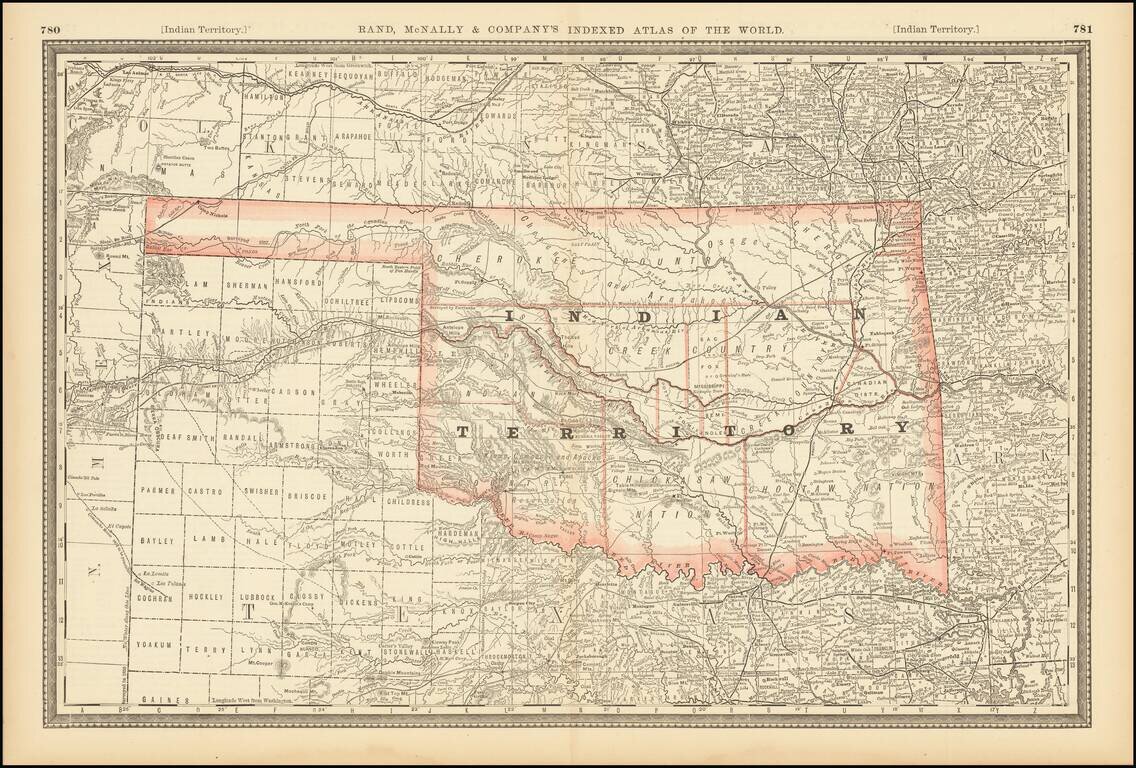
Large format detailed map of Indian Territory, showing towns, rivers, railroads, mountains, lakes, etc. Includes the various Nations, and a number of early details.
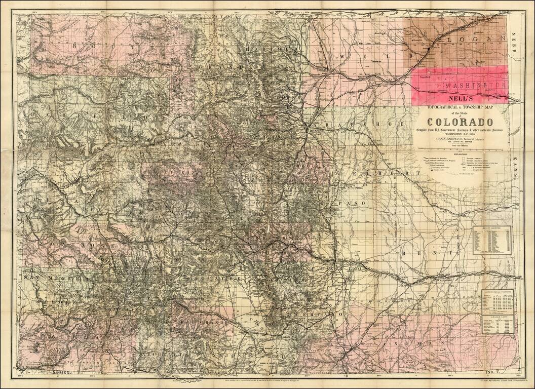
The rare 1885 edition of Nell's map of Colorado. A remarkably detailed map, certainly the most complete of Colorado to appear after statehood (1876). The map meticulously depicts the geographical and topographical details of the state, including...
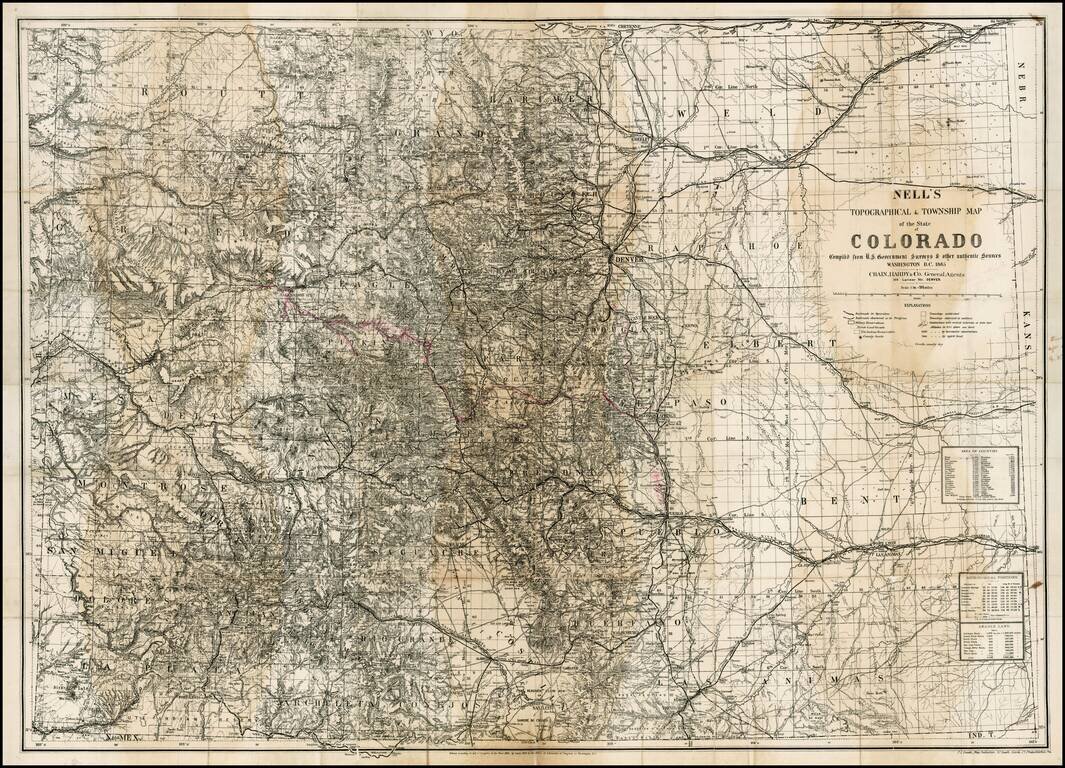
The rare 1885 edition of Nell's map of Colorado. A remarkably detailed map, certainly the most complete of Colorado to appear after statehood (1876). The map meticulously depicts the geographicaland topographical details of the state, . including...
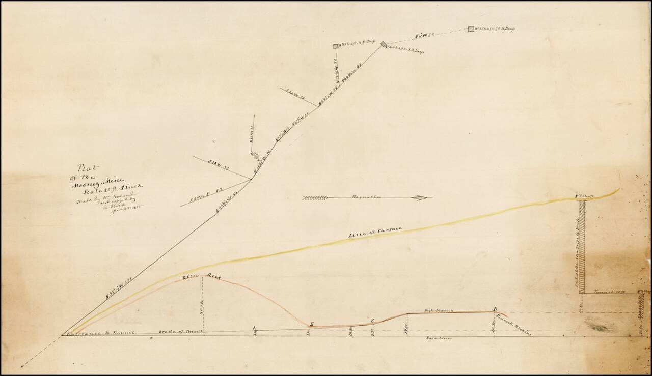
Plat of the Mooney Mine in El Dorado County, California, about 2 miles northeast of the town of Newton. In the Mines of El Dorado County by Doug Noble (2002), it is reported that this mine was only worked from 1894 to 1895. There are several other...
![Wm. T. Coleman & Co.'s Map of the State of California [and] Wm. T Coleman& Co's. Skeleton Map of Columbia River Canneries, Showing Their Location.](/map/small/69974.jpg)
Exceptional Chromolithographic Promotional Maps Rare promotional maps of California the Columbia River Basin one verso, promoting the shipping business of pioneer California Businessman William Tell Coleman. The California map locates several...

Detailed map of California, colored by Counties. The map pre-dates Orange, Riverside and Imperial Counties.
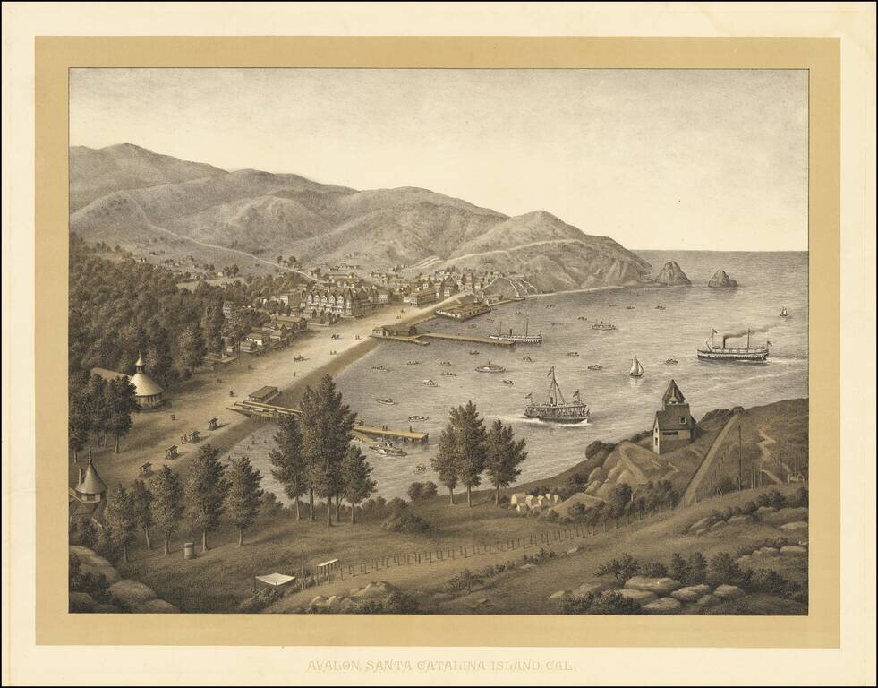
Rare birdseye view of Avalon, on Catalina Island, which was most likely lithographed in the 1880s by Kurz & Allison, prior to the acquisition of the island by the Banning Brothers in 1892. Juan Cabrillo originally discovered and claimed Catalina...
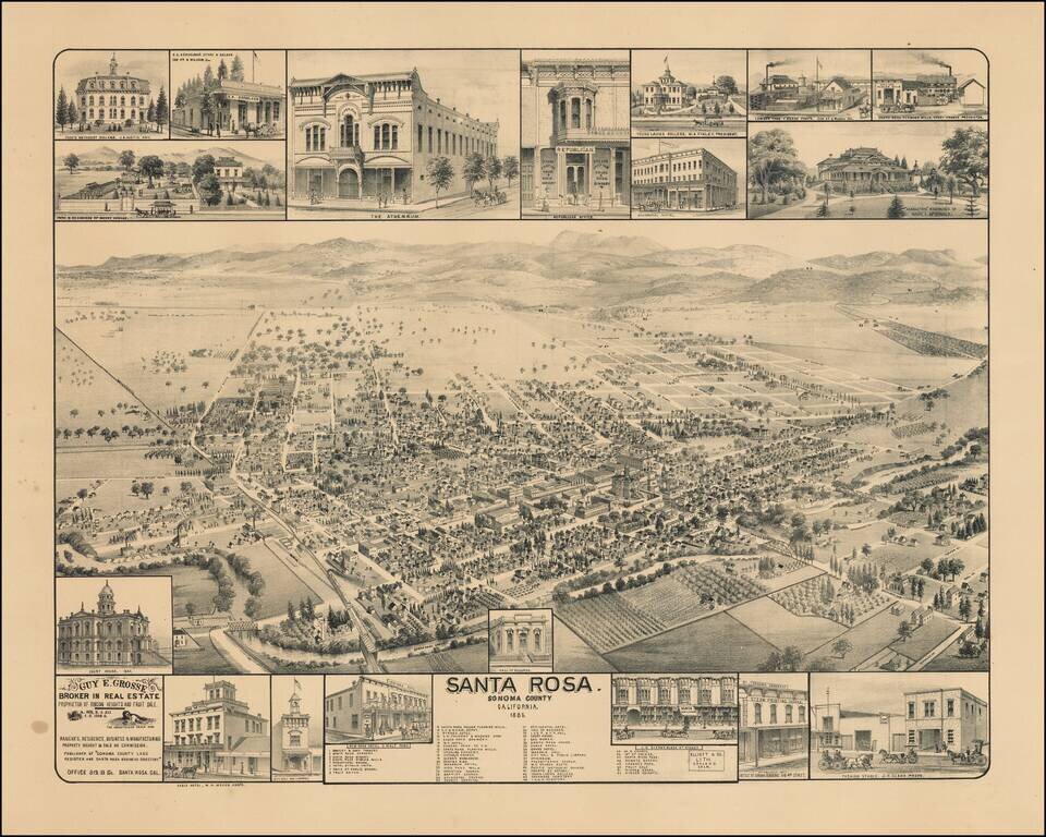
Scarce birdseye view of Santa Rosa, California, published by Elliott & Co. in Oakland, California. Rare bird's-eye view of Santa Rosa, north of San Francisco, produced for Guy E. Grosse, "Broker in Real Estate, Proprietor of Rincon Heights and...