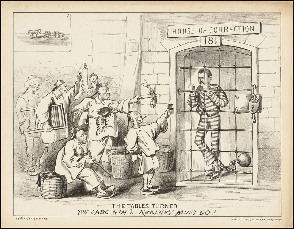
Graphic broadside showing anti-Chinese activist Denis Kearney behind bars, while being tormented by a group of Chinese men, following his arrest for inciting a riot. "The Chinese Must Go!" was the slogan of the Working Man's Party of California during...
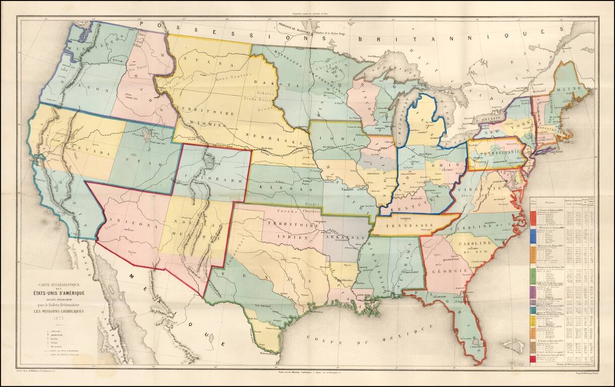
Rare large ecclesiastical map of the United States, focusing on the 11 Catholic Provinces in the United States. Includes an extensive statistical table at the right side of the map. The map shows the Catholic dioceses and bishops' residences, but not...
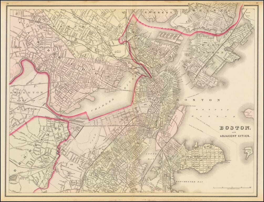
Wonderful double page map of Boston and the neighboring cities, published by OW Gray. The map shows marvelous local details throughout. Extends to Brookline, Cambridge, Somerville, Everett, Chelsea, etc. From one of the leading American map publisher...
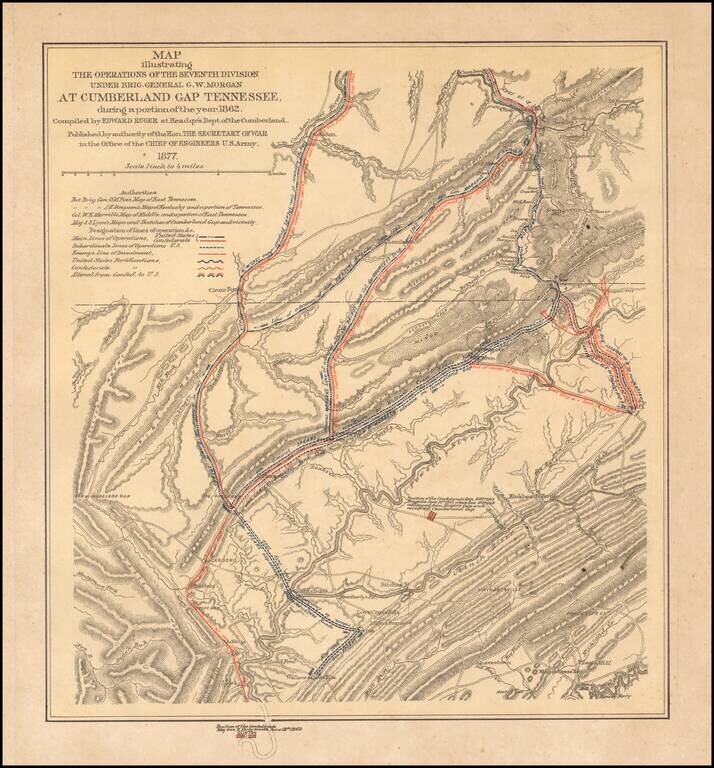
Interesting color-printed battle plan showing the operations of General G. W. Morgan in the Cumberland Gap, Tennessee. General Morgan's actions resulted in the capture of the Cumberland Gap for the Union. The Union occupied the Gap for three months....
![Gray's New Map of Georgia [Savannah Inset]](/map/small/71184.jpg)
Detailed map of Georgia, published by OW Gray. The map is colored by counties and showing townships, towns, villages, post offices, lakes, forts, roads, railroads (projected and completed), Light Houses, Light Ships, etc. Large insets of the town of...
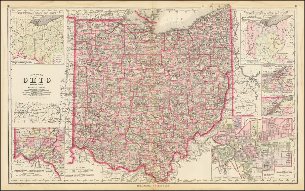
Highly detailed map of Ohio, published by OW Gray. The map is colored by townships and showing towns, roads, railroads, Post Offices, etc. Insets of Cleveland, Toledo, Columbus, Cincinnati and two smaller maps of the state.
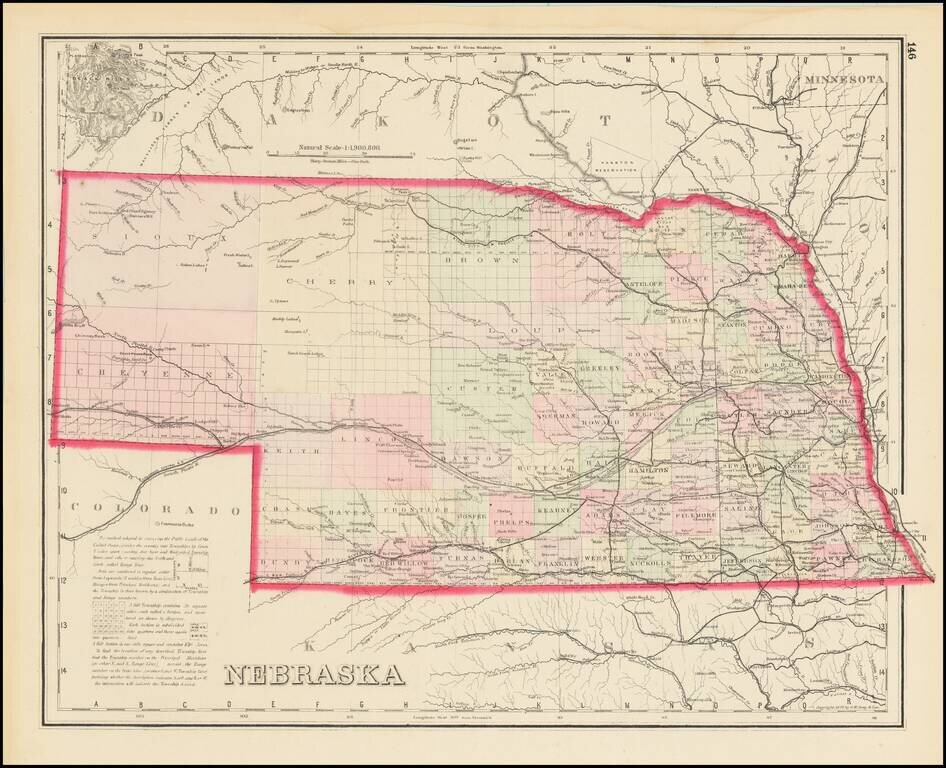
Scarce Late State Detailed map of Nebraska, colored by counties and showing townships, roads, railroads, towns, etc. The present example adds a number of western counties which did not appear in the earliest editions of this map.
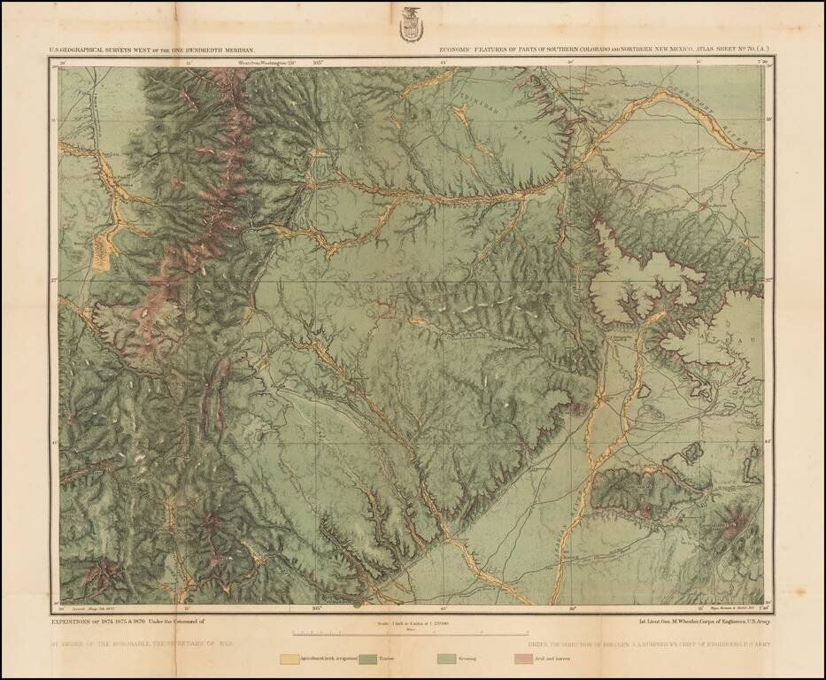
Detailed topographical map showing the region bounded by the Taos, New Mexico area in the southwest, San Luis, Colorado and Trinchera Peak in the northwest, Purgatory River and Trinidad Colorado in the Northeast and the area just south of Laughlin Peak...
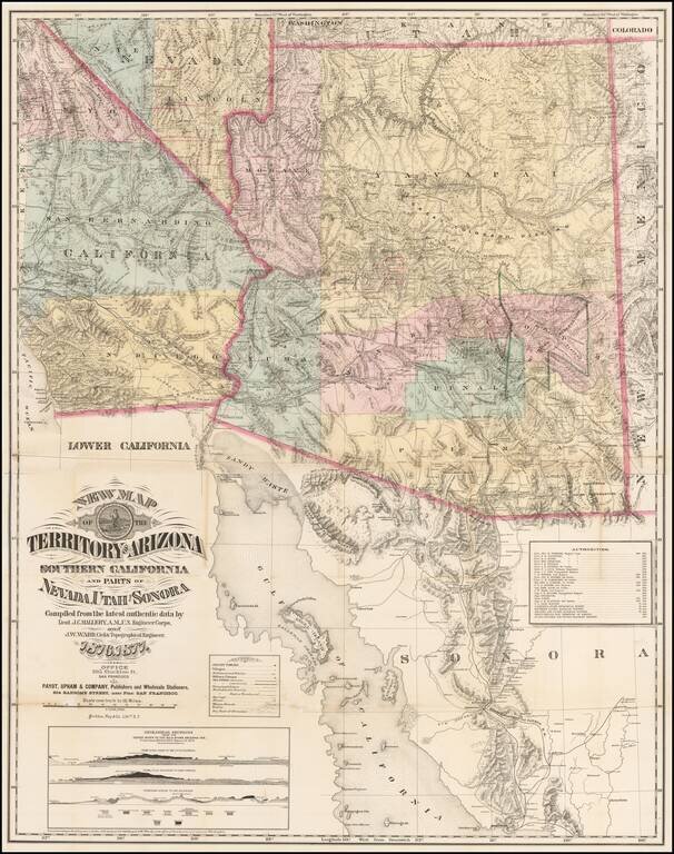
The Finest Large Format Map of Arizona, Southern California and Southern Nevada from the 1870s. Large and striking map centered on Arizona with pieces of the adjacent states and territories, at a time when Arizona was undergoing a mineral boom, and...
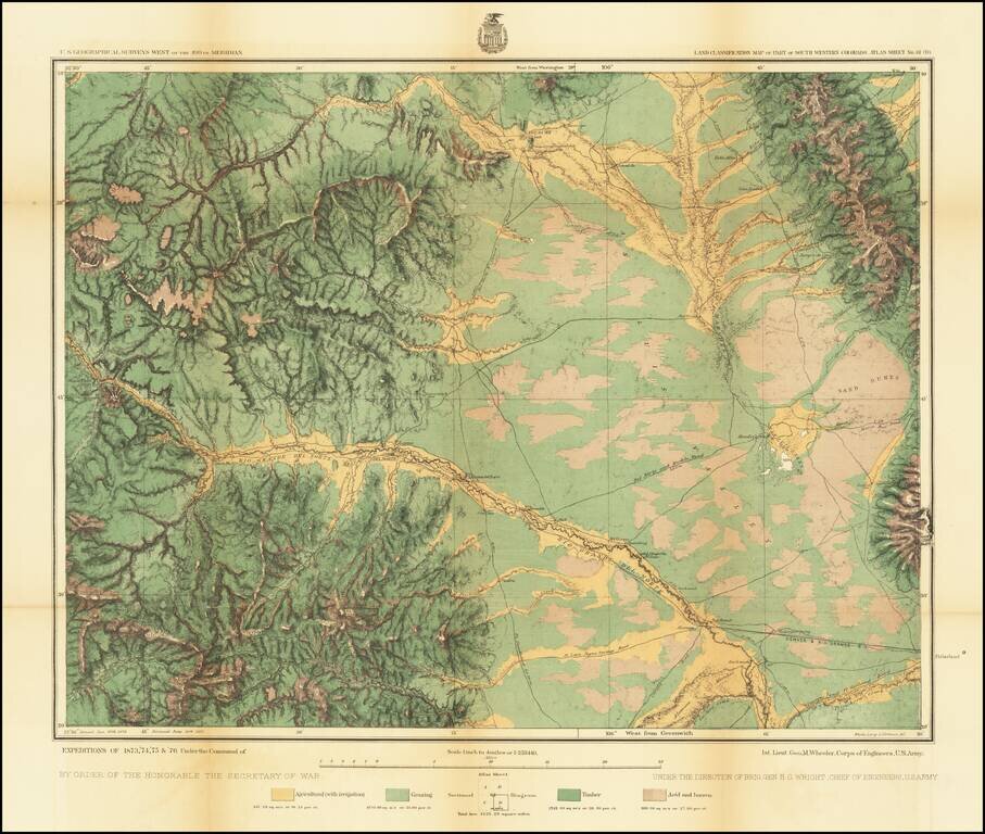
Detailed topographical map showing the region centered on Saguache County, Colorado. Shows towns, roads, mountains, rivers, lakes, hydrographical details, etc. The map was generated during the Wheeler Survey. The Wheeler Survey was a survey of a...
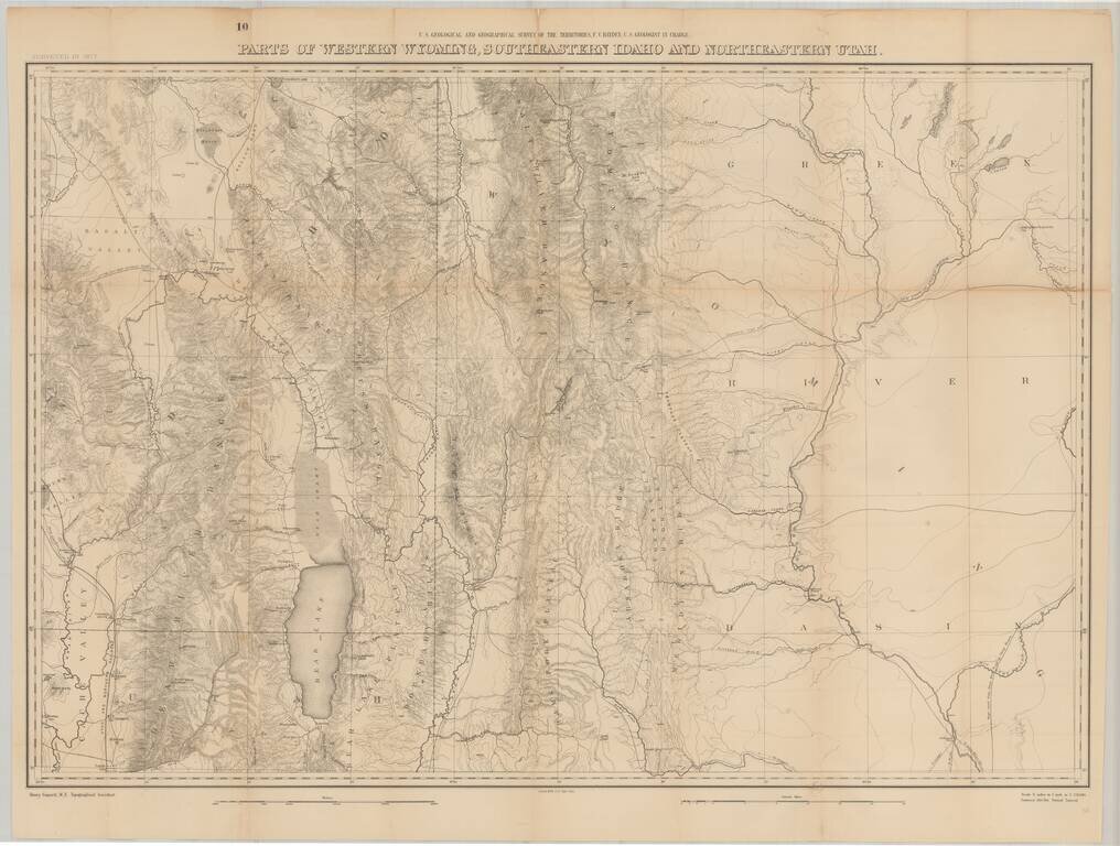
Fine large format map of the region just south of Yellowstone National Park, as surveyed in 1877 by the Hayden Survey. The map extends from Logan, Utah and the Black Foot Marsh (now Reservoir) in the West, to Fremont Lake Wyoming, and the confluence...
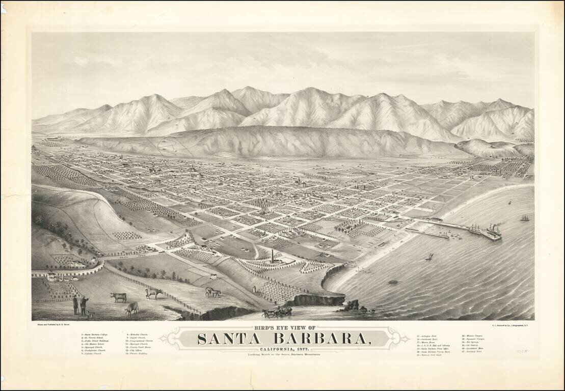
The First Large Scale View of Santa Barbara Rare early two-stone lithographed view of Santa Barbara, drawn and published by E.S. Glover and printed in San Francisco by A.L. Bancroft & Co., lithographers. Published in 1877, Glover's view of Santa...
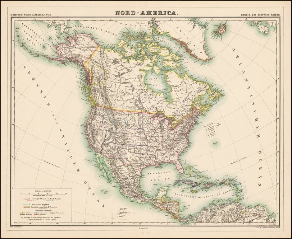
Detailed map of North America, with most of the Western Territories now named and in their proper configurations. The Northwest Passage is well illustrated. The region above British Columbia is Stekeen Colony, named for the Stikine River. Stikine...