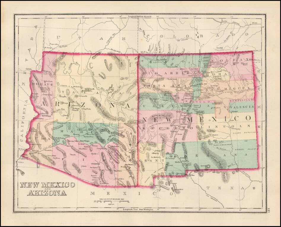
Detailed map of New Mexico and Arizona, showing a number of newly formed counties and transitional borders in both states. The Southern Pacific is shown running from Yuma, across Arizona with a line splitting off at Deming, and extending to Frontera...
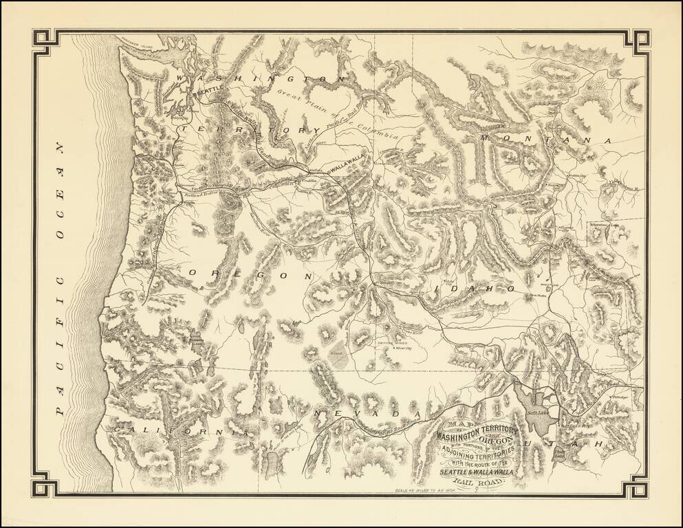
The First Map Printed in Seattle -- Seattle & Walla Walla Rairoad Map With Manuscript Corrections Likely In the Hand of the Maker Fine example of this rare map of the Pacific Northwest, illustrating the proposed route of the Seattle & Walla...
![California and Nevada [Yosemite, Sacremento and SF Vicinity Insets]](/map/small/63484.jpg)
Highly detailed map of California and Nevada, with insets of the Yosemite Valley, Sacramento and SF Bay Vicinity. One of the earliest atlas maps to include an inset map of Yosemite and a plan of Sacramento. Many interesting early details, including...
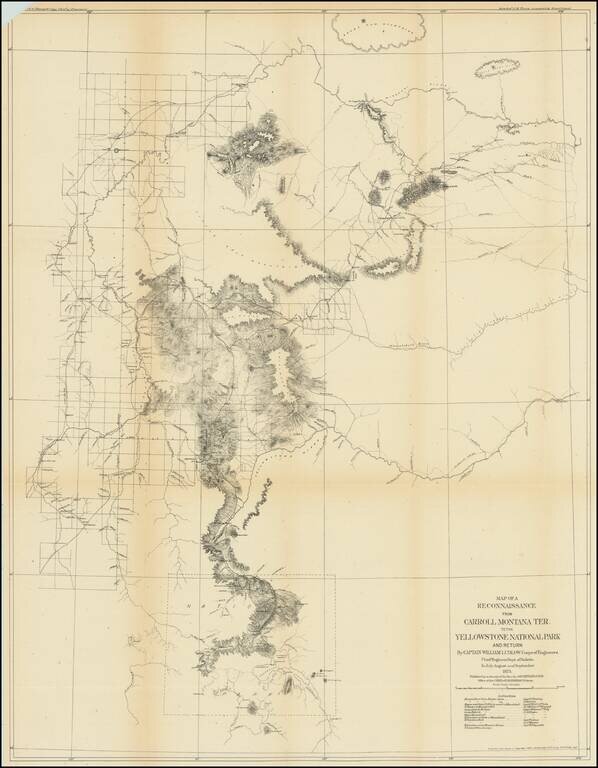
Captain William Ludlow's Expedition To Yellowstone From Montana in 1875 Important early exploration and survey of the route from Carroll, Montana to Yellowstone, undertaken by Captain William Ludlow in 1875. Carroll, Montana was described by Ludlow...
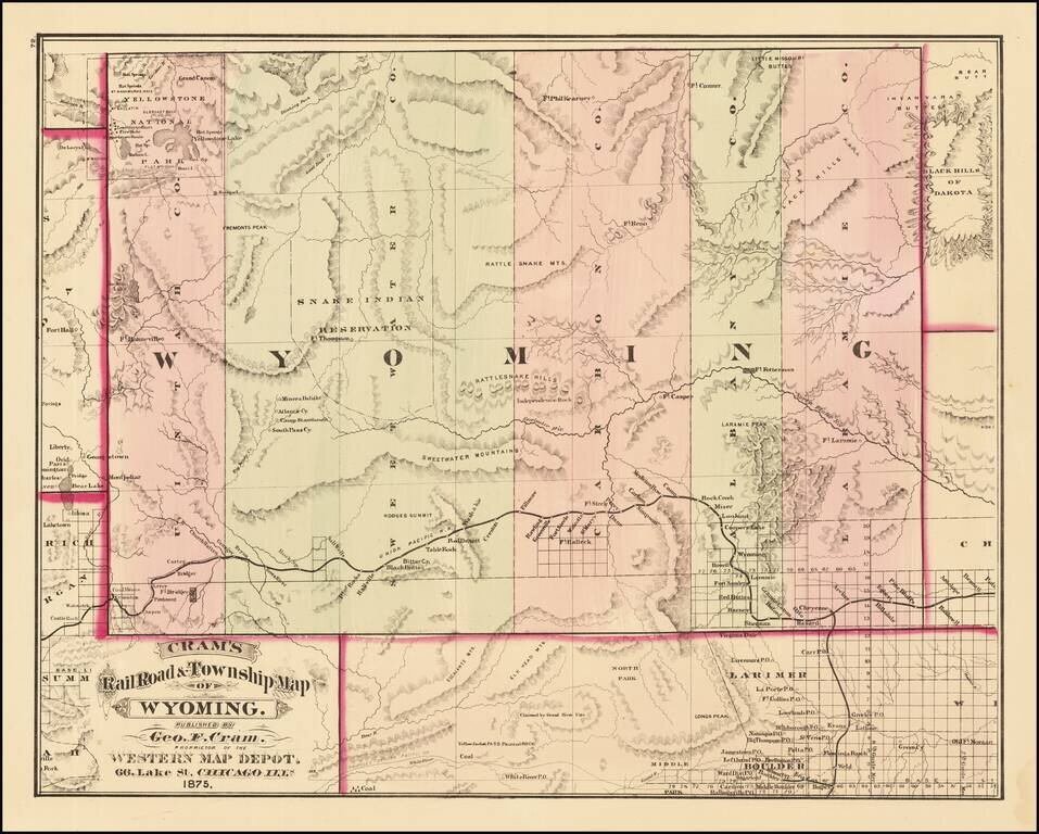
First edition of Cram's first map of Wyoming Territory. One of the few obtainable maps of Wyoming showing only 5 counties, illustrating the earliest township surveys within the Territory. The map shows Wyoming shortly before Custer's expedition...
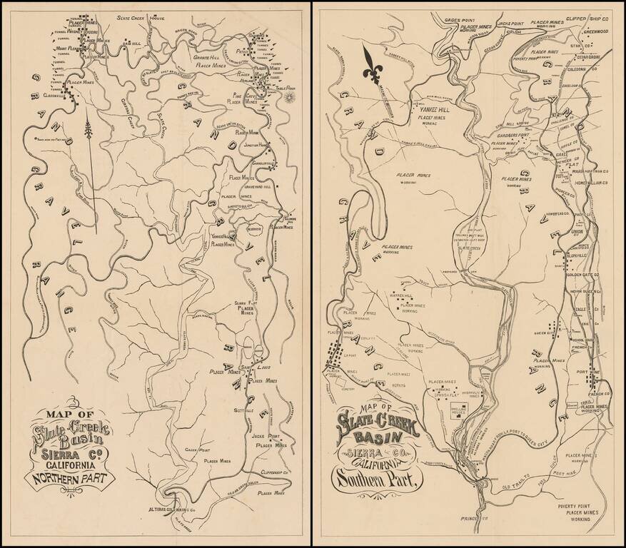
Fine Pair of California Gold Country Maps. Scarce pair of maps showing a portion of Sierra County, in California's Gold Region, with valuable information on individual mines and tunnels.
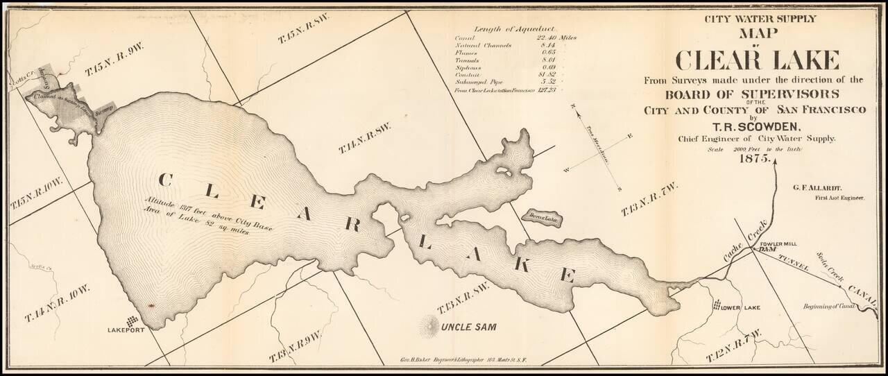
Fine early map of the Clear Lake Area, by George H. Baker, acknowledged as one of early California's leading artists and lithographers whose pioneering work documented California's earliest history. The map would seem to have been prepared for a...
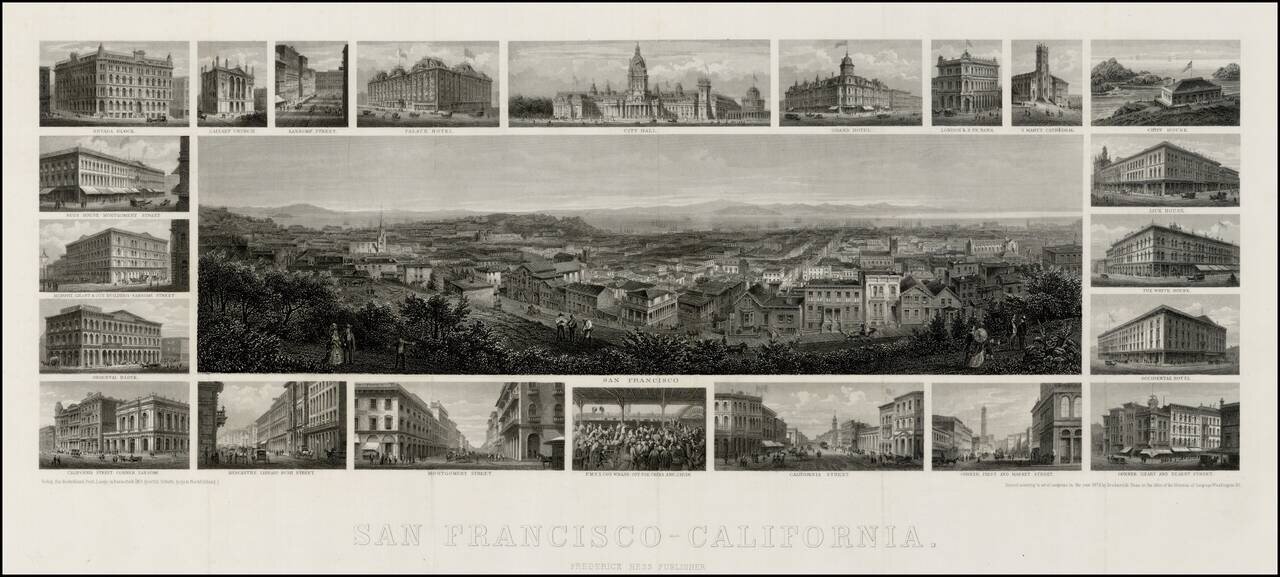
Unrecorded 1875 edition of Frederick Hess's fine steel engraved view of San Francisco, with 22 vignettes of San Francisco buildings. Very rare steel-engraved view of San Francisco with surrounding vignettes of various architectural landmarks of the...
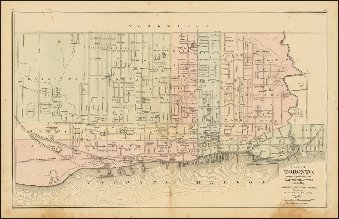
Detailed map of Toronto, colored by Wards, from Tackabury's Atlas of the Dominion. Locates a number wharfs, buildings, railroad lines and other details. Toronto was originally named York, changing its name in 1834. The map shows Toronto during a...
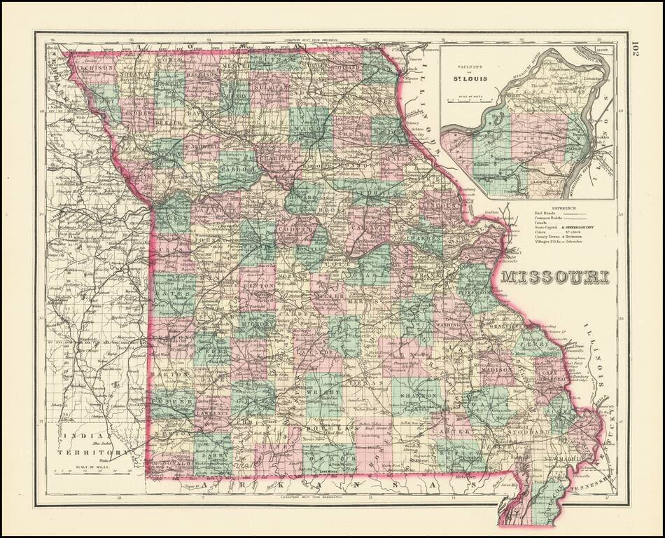
Detailed map of Missouri, hand colored by counties. Includes a large inset map of St. Louis. Excellent detail throughout, including counties, townships, towns, rivers, roads, railroads and a host of other details.
![West Indies and Central America [Bermuda inset]](/map/small/63774.jpg)
Detailed map of Central America and the Caribbean, hand colored by islands. Includes inset of Bermuda.
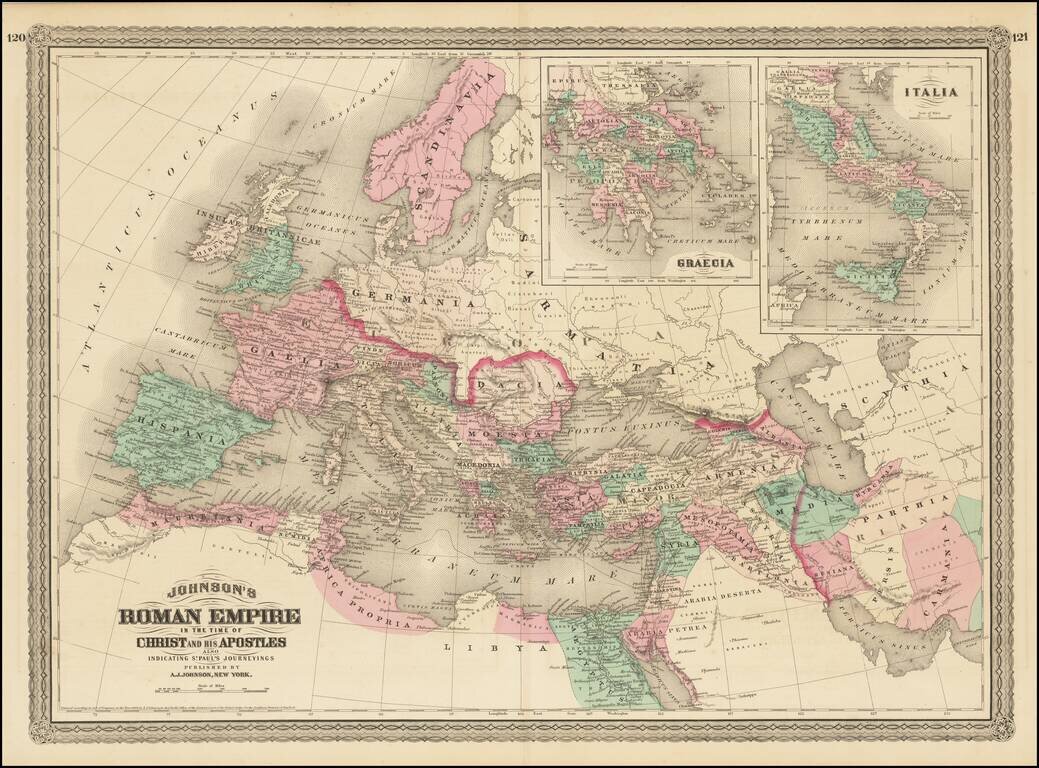
Large format map of the Roman Empire with insets of Roman Greece and Roman Italy. Includes ancient place names, rivers, mountains, etc. Decorative borders. A marvelous historian's map.
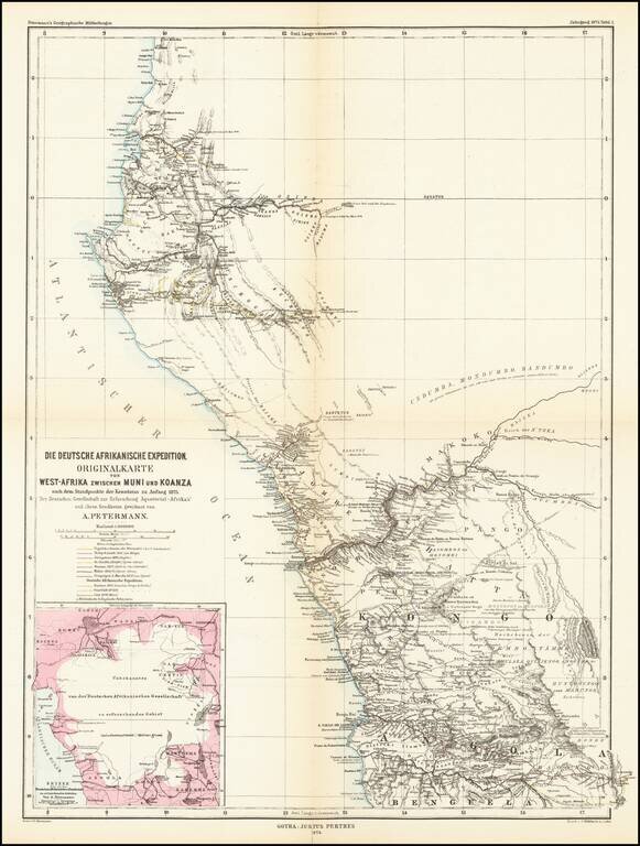
Detailed map of West Africa, showing explorers routes in the region. The map shows the expeditions between Muni River Region (Equatorial Guinea) to Koanza River Region of northern Angola. The map shows the routes of the following explorers: 16th...
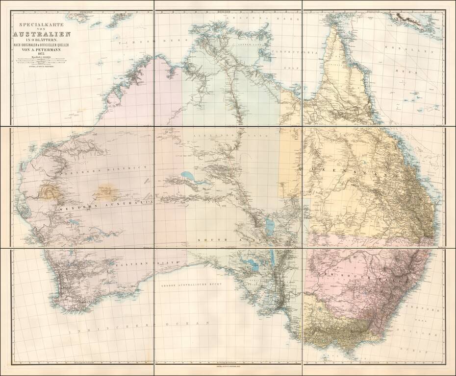
Scarce 9 sheet map of Australia, published by Augustus Petermann. Large map of Australia showing towns, river system, railways and telegraph lines and county boundaries. The map features the routes taken by a number of important overland explorers,...
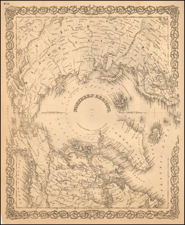
Detailed map of the regions around the North Pole. The Northwest and Northeast Passages are delineated and most of the coastlines of North America, Europe and Asia are shown with relative accuracy.

First Site of Stanford's Rare Map of the Polar Regions Fine example of Edward Stanford's map of the North Polar Regions, featuring the furthest most points reached by numerous exploring expeditions. Published on December 2, 1878, the map notes the...