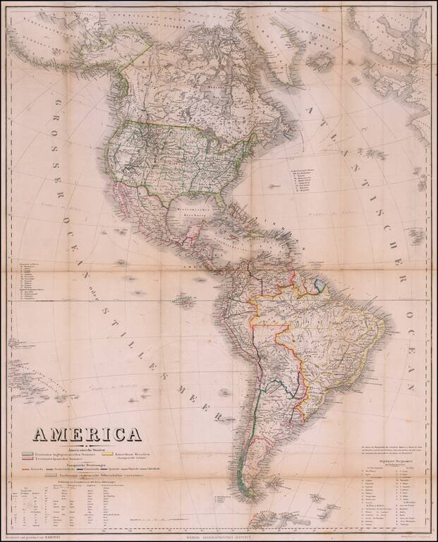
Rare Pocket Map of America, Celebrating World Conferences in Antwerp & Moscow Rare separately published map of America, published by the Weimar Geographische Institut, in conjunction with the International Geographical Conference in Antwerp of...
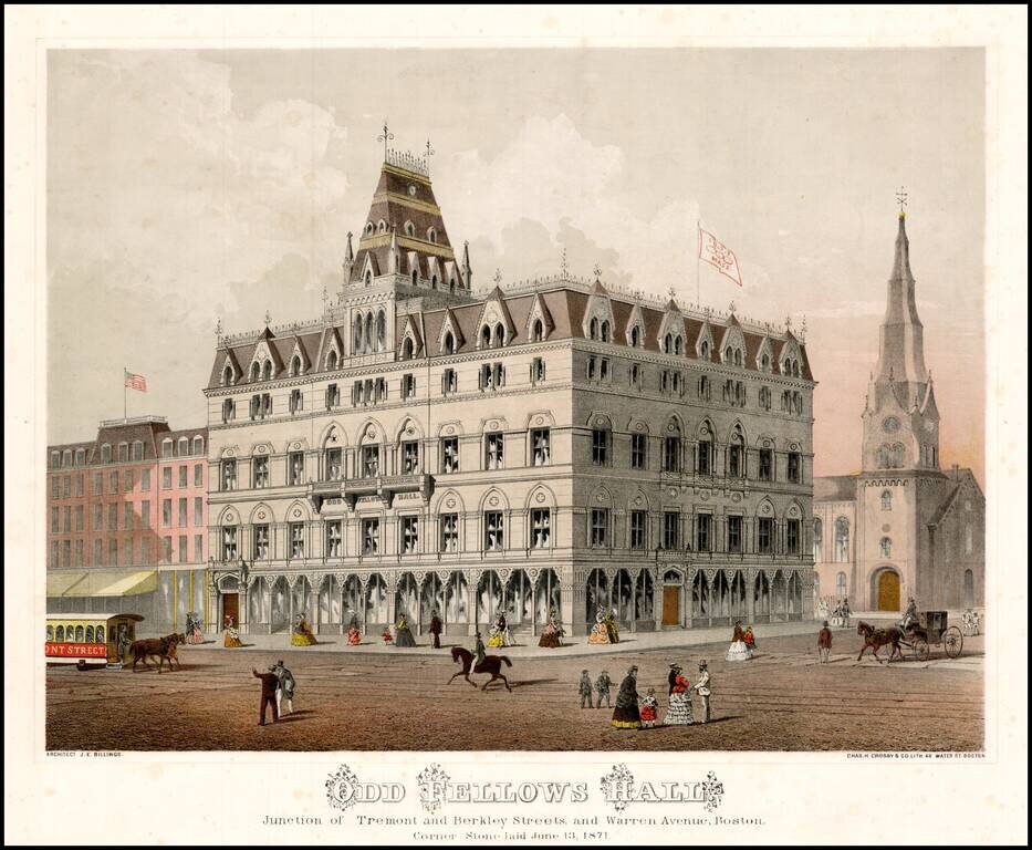
Striking chromolithographic view of the recently completed Odd Fellows Hall in Boston. The credit includes the name of the architect, J.E. Billings.
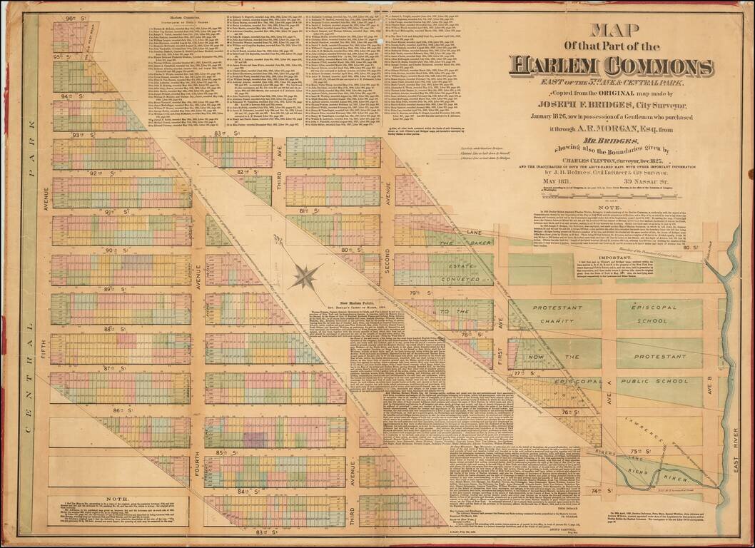
Rare Antique Map of Part of Harlem, New York City. Superb large format, separately issued map of parts of the Upper East Side and Harlem in Manhattan, by one of New York's most fascinating mapmakers, John Bute Holmes. This map shows a strip of land...
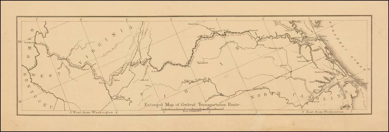
Detailed map showing the ransportation routes from the Ohio River to the James River. The map is ordinarily one of 4 maps on a single sheet. This example is likely an offprint, which was issued separately.
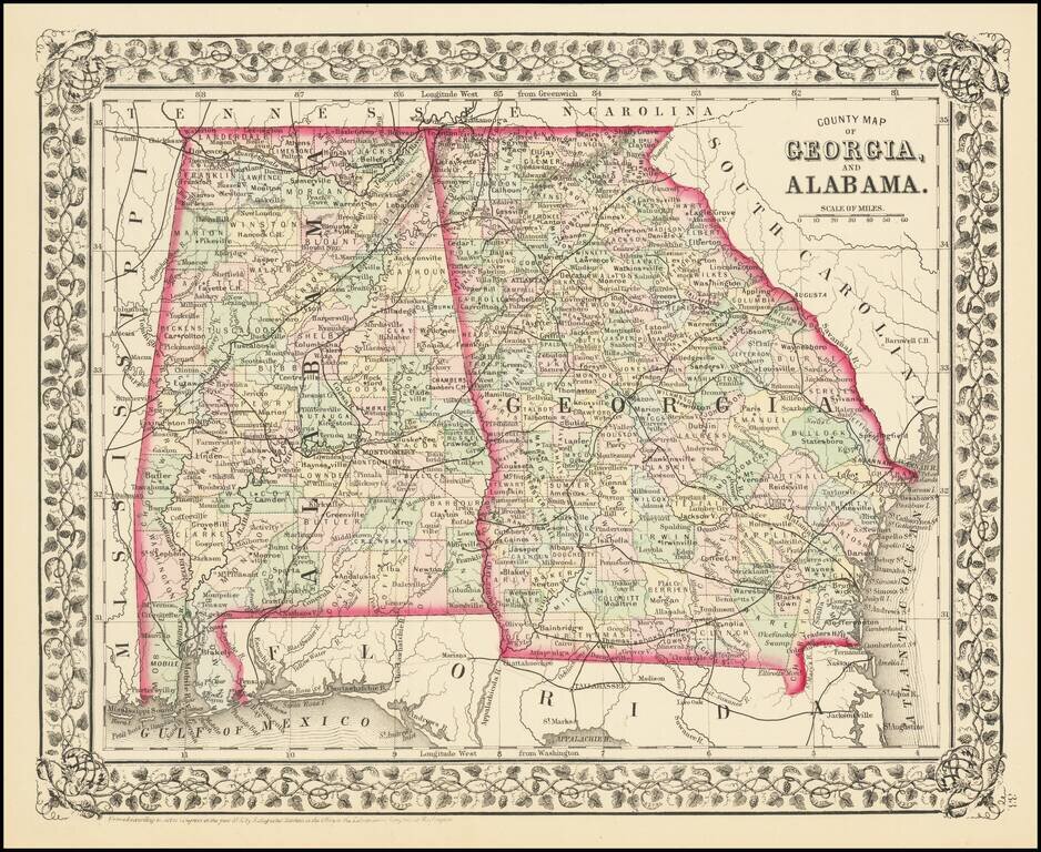
Detailed map of Georgia and Alabama, published by SA Mitchell Jr. The map is colored by counties and shows towns, roads, railroads, forts, proposed railroads, etc. Includes a decorative grapevine border.
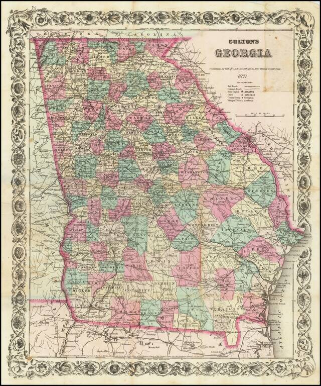
Separately Published Map of Georgia Scarce separately published pocket map edition of GW & CB Colton's map of Georgia. Shows roads, railroads, towns, villages, post offices, rivers, lakes, stations and a host of other details. Decorative border....
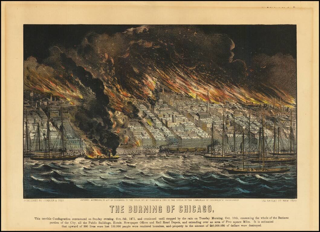
Hand-colored antique lithograph view of the burning of Chicago in 1871, issued by the famed lithography publishers Currier & Ives. The text below the image reads: "This terrible conflagration commenced on Sunday evening, Oct. 8th, 1871, and...
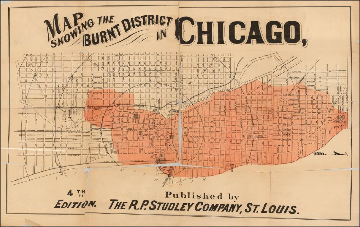
Rare map of Chicago, focusing on the parts of town which were affected by the Great Chicago Fire, October 10, 1871. The map shows in fine detail (in red) the areas affected by the fire. The map identifies streets, buildings, railroads, parks and...
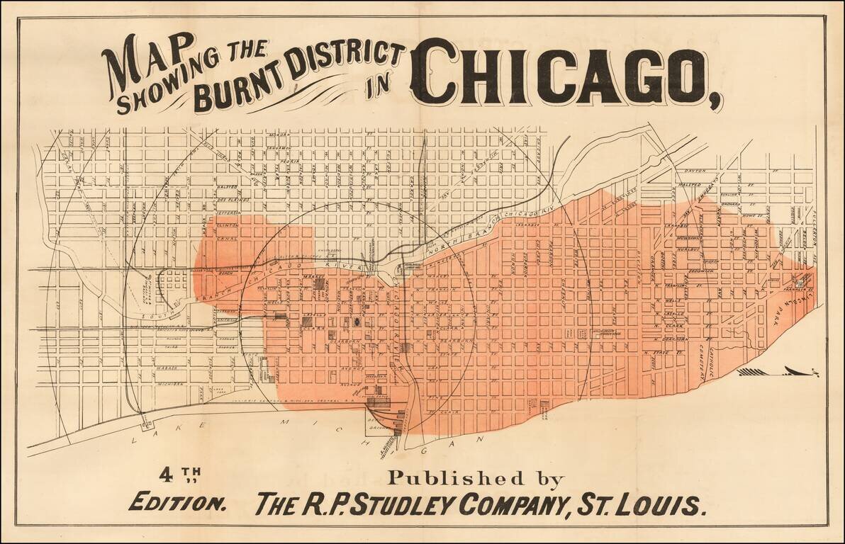
Rare map of Chicago, focusing on the parts of town which were affected by the Great Chicago Fire, October 10, 1871. The map shows in fine detail (in red) the areas affected by the fire. The map identifies streets, buildings, railroads, parks and...
Rare map of Chicago, focusing on the parts of town which were affected by the Great Chicago Fire, October 10, 1871. The map shows in fine detail (in red) the areas affected by the fire. The map identifies streets, buildings, railroads, parks and...
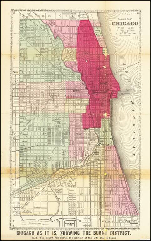
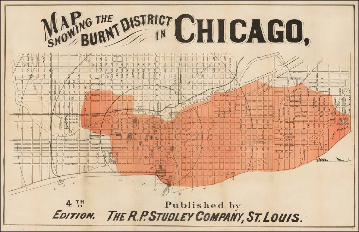
Detailed Plan of Chicago Showing the Area Ravaged by the Great Chicago Fire Scarce map showing the area affected by the Chicago Fire of 1871, with the "Burnt District" colored in red. The map has each street labeled, along with the rivers flowing...
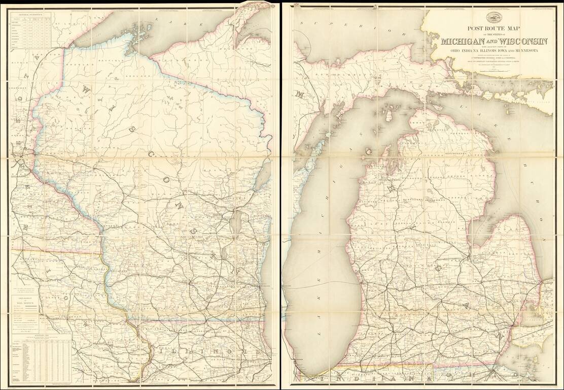
Superb and very rare official post route map of Michigan and Wisconsin from 1871. The map shows all of Michigan and Wisconsin, with coverage to adjacent areas including Chicago, the Twin Cities, and Toledo. The map differentiates between seven kinds...
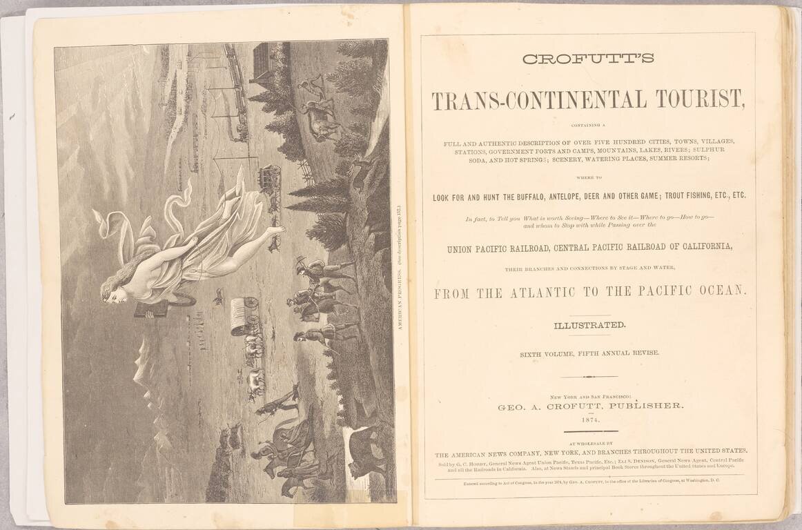
One of the Best Visual Records, In a Single Volume, of American Westward Expansion. This edition of Crofutt's Tourist is an extensive work, showing and describing many of the sites a traveler of the late 19th century would have visited in the US,...
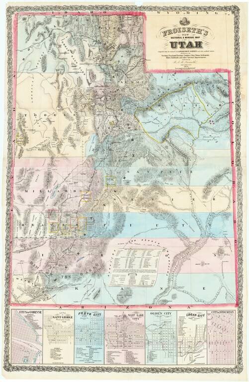
"A Pioneer Masterpiece -- Wonderful In Its Detail" (Carl Wheat) An exceptional large map of Utah, published by B.A.M. Froiseth in Salt Lake City and printed by A.L. Bancroft in San Francisco. The map is remarkably detailed, with particular artistry...
![[Nevada and parts of California, Utah and Arizona] Explorations and Surveys South of Central Pacific R.R. . . . Preliminary Topographical Map Map Embracing in Skeleton a Portion Only of the Notes from Surveys . . . 1871 (with original text)](/map/small/68848.jpg)
Detailed map of the Southwest, prepared at the outset of the Surveys West of the100th Meridian. The map is one of the few maps executed by Louis Nell during this time working for the War Department Topographical Engineers. Nell would later settle in...
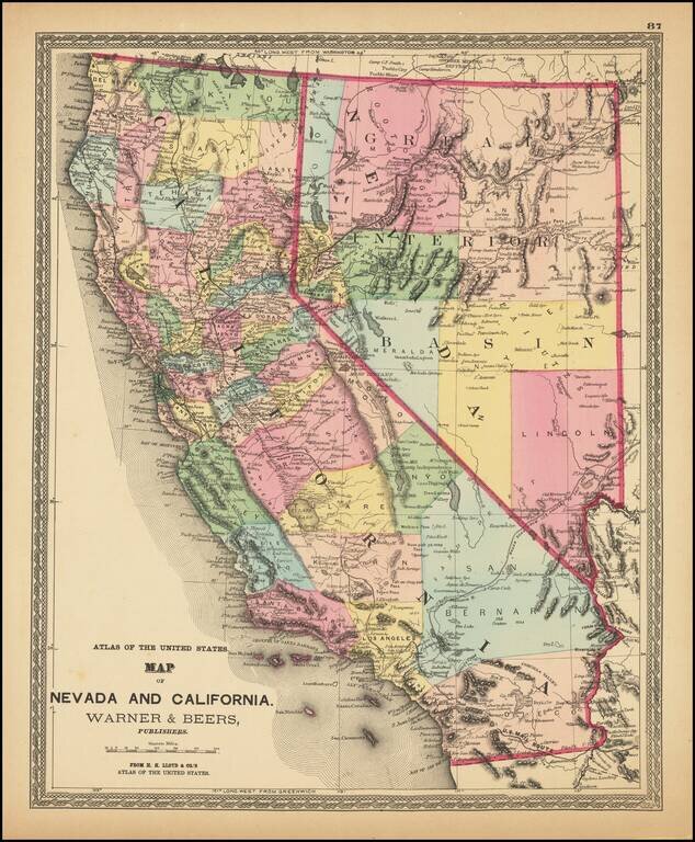
Fine example of HH Lloyd's striking map of California and Nevada. The map is colored by counties, and shows the US Mail Route, Wagon Route from LA to Salt Lake, Old Telegraph and Express Route, Transcontinental railroad lines, and other roads. Locates...