
Detailed map of the Greek Islands, showing towns, mountains, rivers, roads, lakes, gulfs, bays, etc. Decorative border. A terrific regional map, from JH Colton, one of the most prolific American mapmakers of the mid-19th Century.
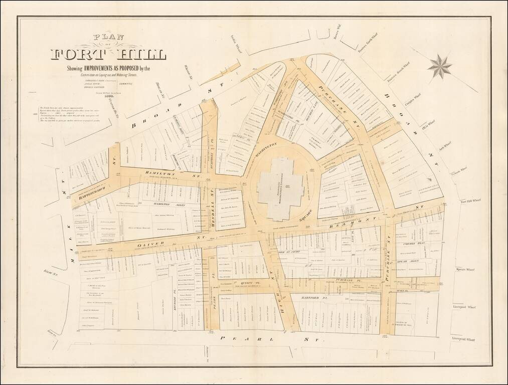
Fascinating large format map of part of downtown Boston, published for the Common Council. Detailed planning map showing part of downtown Boston, near the modern day Aquarium, Harbor Towers, Norman B. Leventhal Park, and Boston Harbor Sailing Club....
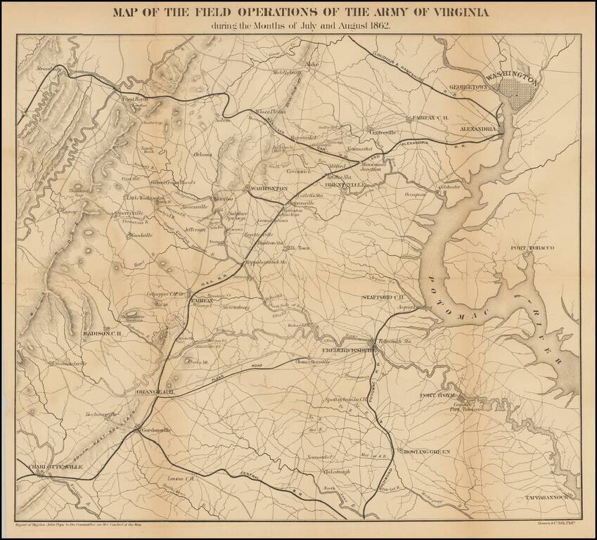
Detailed map of the Theater of War in Virginia. Washington D. C. is at the upper right. Charlottesville, Virginia is at the lower left. Shows roads, railroads, place names and terrain features. General Pope was the new commander of Federal forces in...
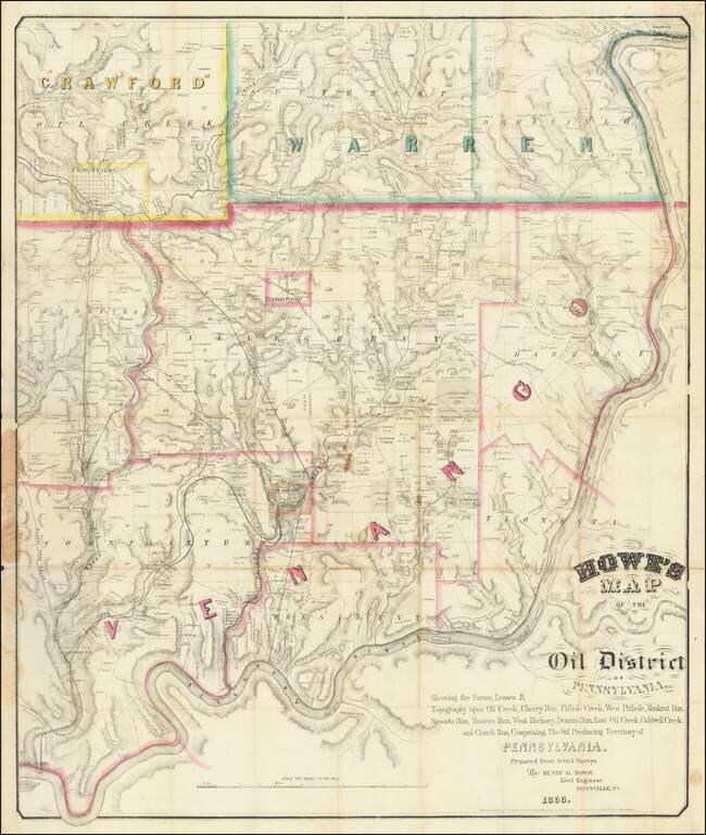
The First American Oil Boom. Rare Titusville-published map of the Pennsylvania Oil Region, the location of the first major oil boom in U.S. history. The map covers portions of Venango, Warren, and Crawford counties, which are outlined in pink, green,...
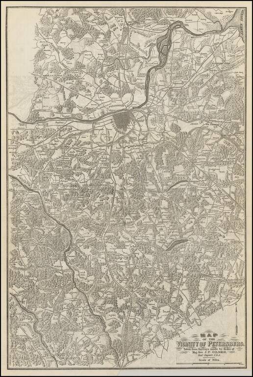
Scarce map of the vicinity of Petersburg, extending from the region just north of the James River to the state line with North Carolina. The map is exceptionally detailed and shows towns, court houses, roads, railroads, rives, woods and the names of...
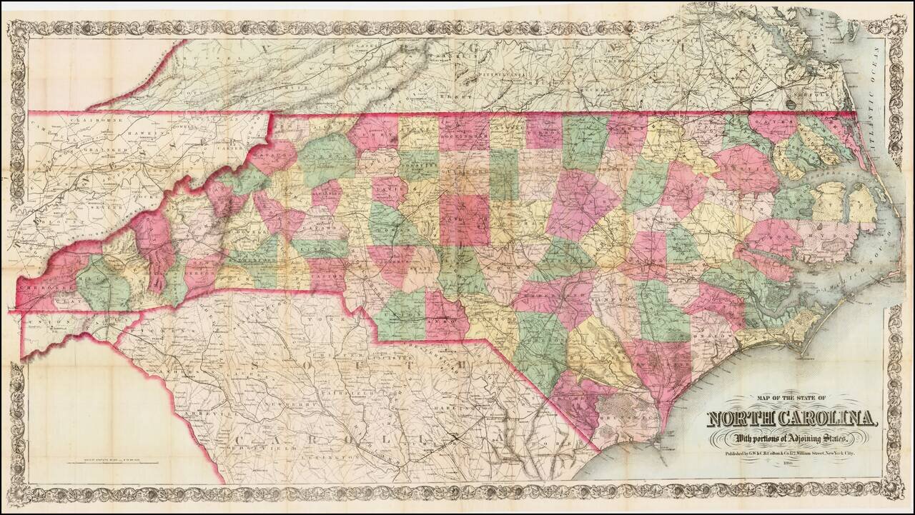
First edition of this scarce large format map of North Carolina, colored by counties, published by GW & CB Colton in New York, on a scale of 6 inches = 50 miles. Colton's map of North Carolina is one of the most detailed and largest commercial...
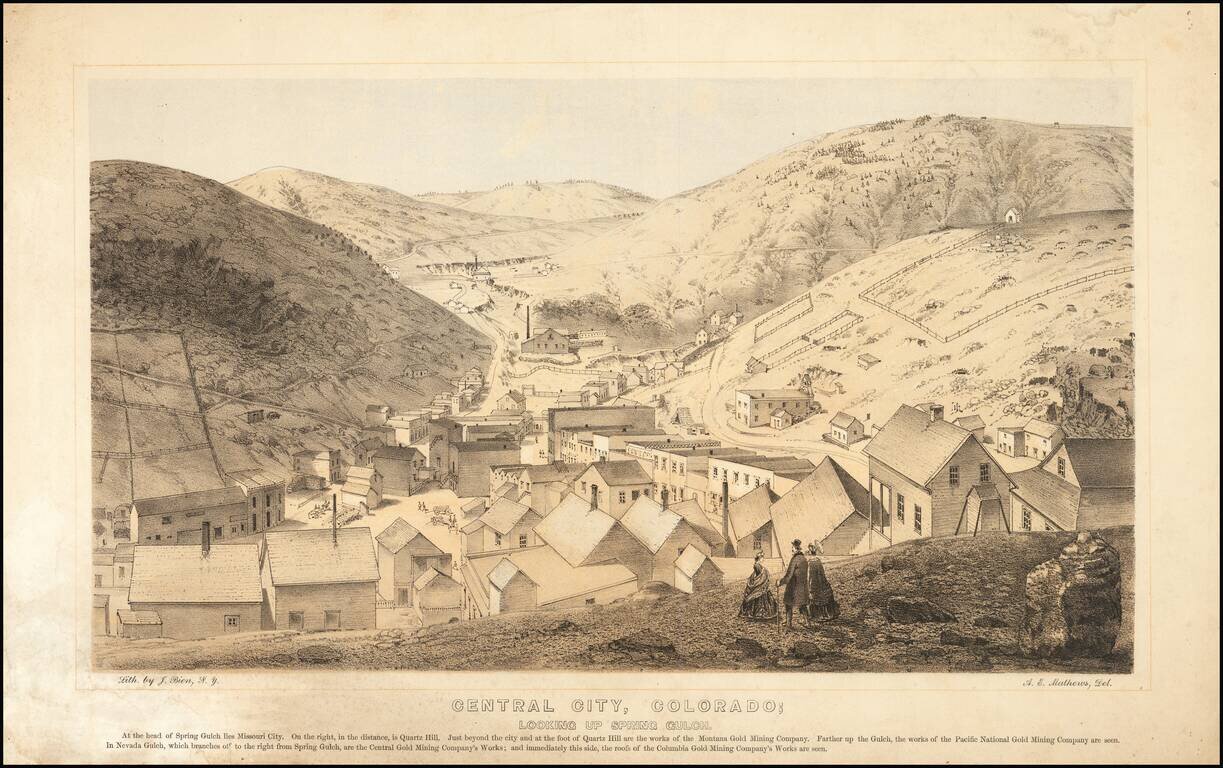
Nice example of this important early birdseye view of Central City, Colorado, from Alfred Edward Mathews Pencil Sketches of Colorado, published in 1866. The map shows Central City during its early boom period, looking toward Missouri City and Quartz...
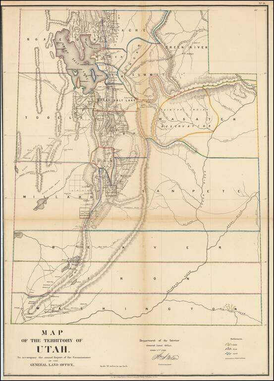
Important early map of Utah engraved by Major & Knapp for the General Land Office. This is perhaps the most detailed and accurate of all early Utah maps. The extent of the township surveys are noted. Gold, Iron & Lead mines are noted. Very...
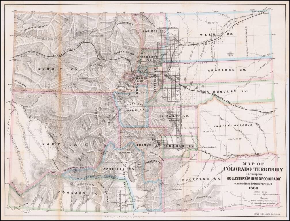
Detailed Map of Colorado Territory in 1866, with original text. Scarce map of Colorado Territory, showing sixteen counties and a large Indian Reserve. The reserve is divided into Cheyenne and Arapahoe tribes. Extensive watershed information and...
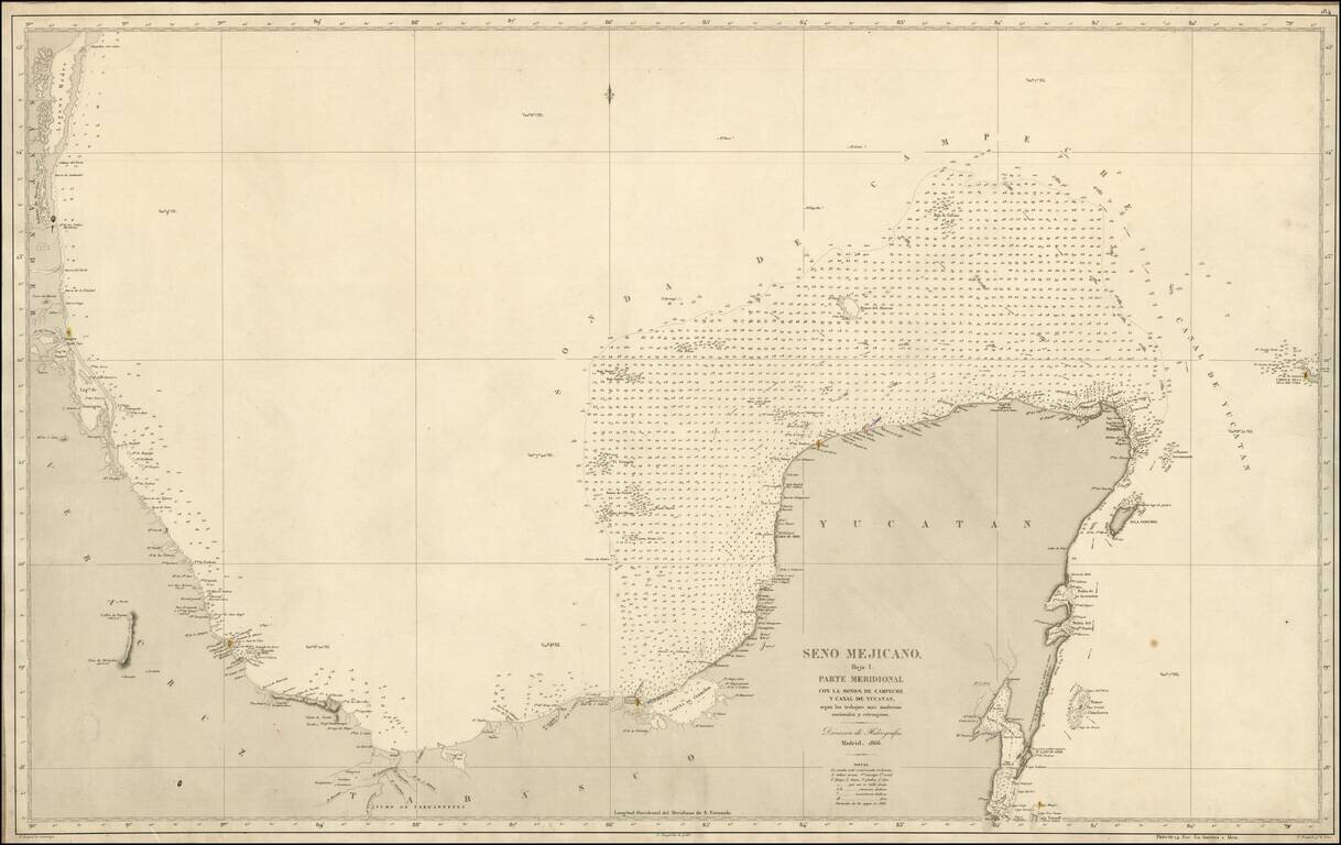
Scarce separately issued Spanish Sea chart of the Coast of Mexico, from Santander to Yucatan. Highly detailed, including soundings and lighthouses.
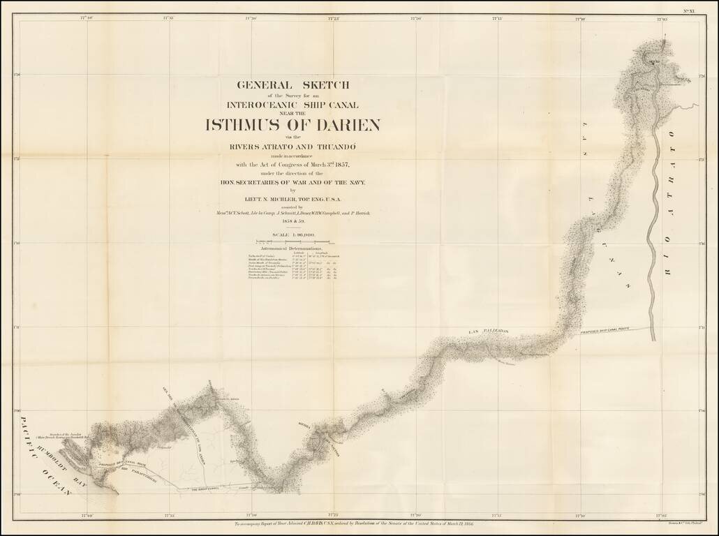
The Canal Survey of Napoleon Garella Scarce map of the Isthmus of Panama, illustrating a proposed Canal from the Atlantic to the Pacific Ocean, prepared to illustrate the Report of Rear Admiral Charles Henry Davis. Map shows towns, roads, physical...
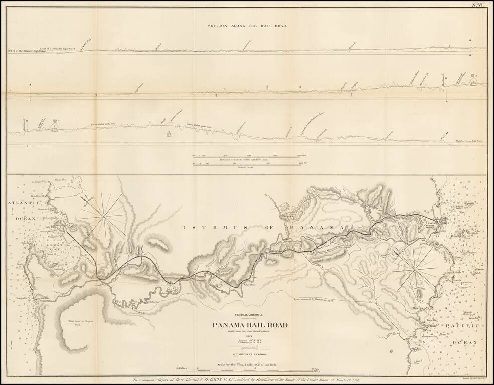
Detailed map of the proposed route of the Panama Railroad, from Manzanilla Island to Panama City, as surveyed by G.W. Hughes in 1849. The map also identifies the route examined by Garella in 1844 and a profile view above. At the outset of the...
![Patagonia [with] South Orkney [with] Falkland Islands [with] South Georgia Island](/map/small/56763.jpg)
Interesting map of Patagonia, with several insets of islands in the region, each of which is rarely given this much detail in a map.
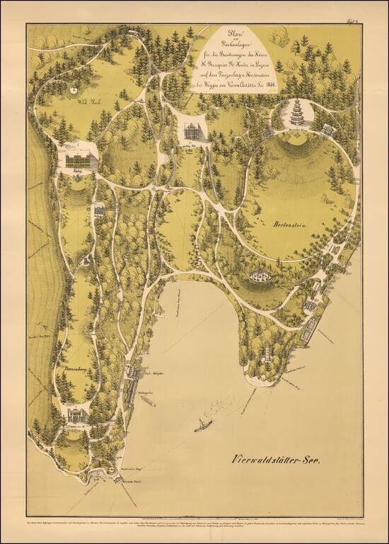
“The Charmingest Place We Have Ever Lived In” (Mark Twain) Fine illustration of the grounds of Hotel Hertenstein on Lake Lucerne, as drawn by German landscape architect Franz Xaver Heissinger. Visted by Mark Twain, King Ludwig and Queen Victoria,...
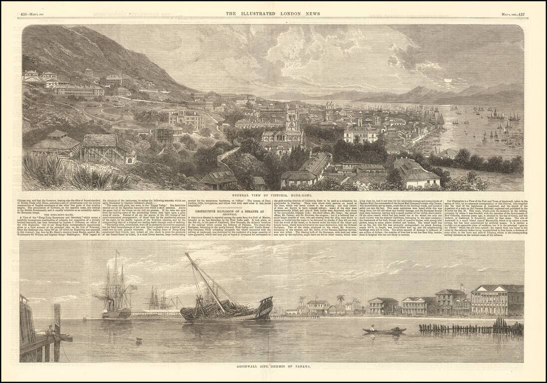
Fine early view of Victoria, Hong Kong, published by the Illustrated London News. The short article below notes that the view illustrates the Race Course and Cemetary, based upon an image furnished by Captain J. Colborne, an officer of the 11th...
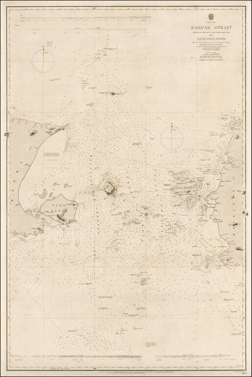
Rare example of this authoritative sea chart of the Gaspar Strait, Indonesia, a critical point of passage for navigation en route from Singapore to the Sunda Strait. This fine sea chart details the Gaspar Strait that runs between the islands of Bangka...