![[Greek Map of the Americas.] ΧΑΡΤΗΣ ΤΗΣ ΑΜΕΡΙΚΗΣ ΕΚ ΤΟΥ ΑΤΛΑΝΤΟΣ ΤΟΥ ΗΡ. ΛΑΖΑΡΙΔΟΥ ΕΝ ΑΘΗΝΑΙΣ 1861. [Map of the Americas... Lazaridou in Athens 1861]](/map/small/55792.jpg)
Fredonia in Texas! Fascinating Greek Map of the Americas, Published in Athens During the American Civil War. Lithographed folding map of the Americas entirely in Greek. Published in Athens by Lazaridou in 1861, during the American Civil War. The...
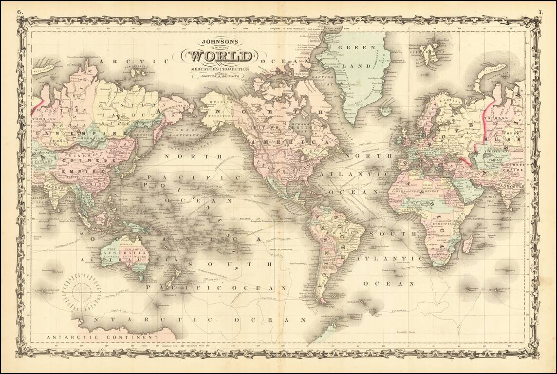
Detailed map of the world, hand colored by counties and showing a number of major explorers and shipping routes throughout the world. Still an incomplete knowledge of the Antarctic. A wonderful decorative map.
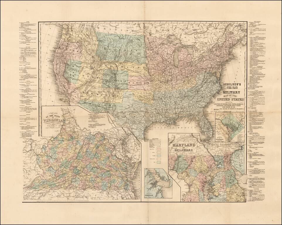
Rare Civil War era map of the United States, published in Philadelphia by Charles Desilver. The map includes inset maps of Washington D.C., Virginia, Maryland and Delaware, and the Vicinity of Annapolis. Includes a list of all the Military Forts and...
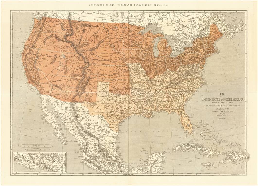
This is a scarce map of the United States, issued as a supplement to the Illustrated London News in 1861. The map is well detailed and shows the US split according to slave and free states. The map was clearly prepared in anticipation of the Civil War,...
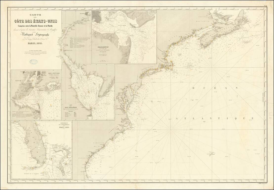
Rare separately published French chart of the region from Nova Scotia to Florida, with large inset maps of Florida, New York Harbor, Charleston and the Delaware Bay. The map was apparently used either for contemporary navigation or a survey off the...
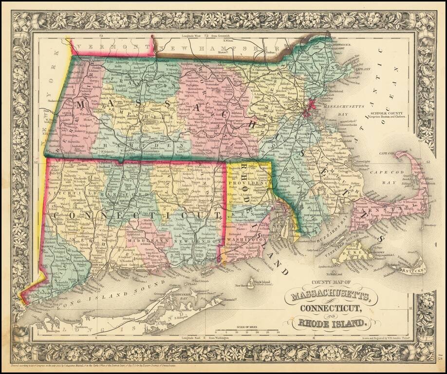
Detailed map of Southern New England, colored by counties and showing towns, railroads, rivers and other details. SA Mitchell Jr. acquired his father's former business from DeSilver in 1860 and relaunched a very successful atlas publishing business...
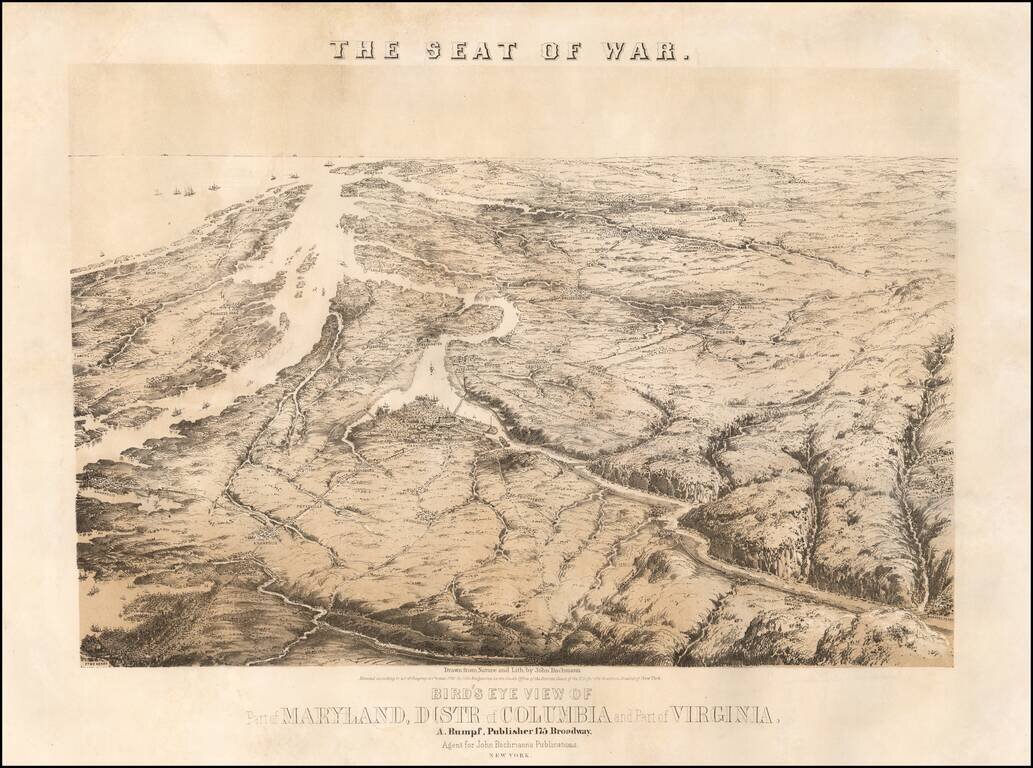
John Bachmann's celebrated series of bird-eye views of the U.S. Civil War, depicting the Virginia-Maryland theatre on the eve of conflict. This magnificent bird's eye view captures the Virginia-Maryland theater of the United States Civil War...
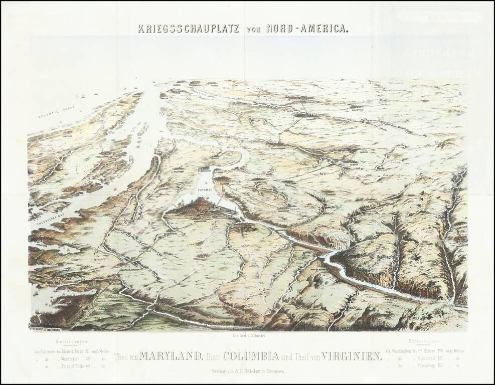
Rare Birdseye View of the Theater of War in the Chesapeake Region Extremely rare birdseye view of the Chesapeake region, centered on Washington DC and the Potomac. The view is very reminiscent of John Bachmann's views of the same region and were...
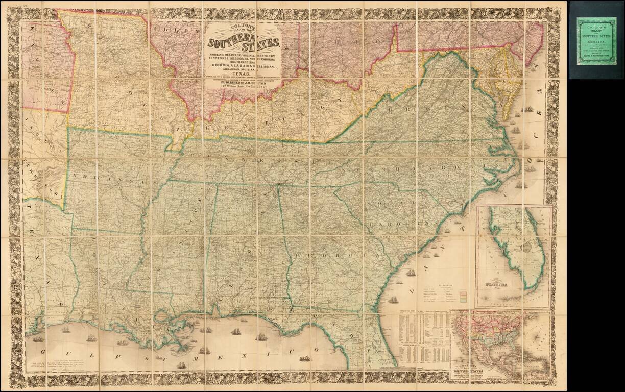
Second edition of Colton's detailed large format map of the Southern Plains and Midwestern States, at the outset of the American Civil War. Finely detailed map, one of the most commercially successful maps published by Colton during the 1860s.
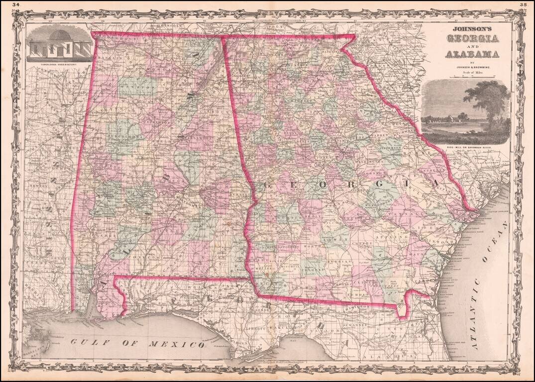
Detailed map of Georgia and Alabama, hand colored by counties, from one of the leading American map makers of the Civil War Period.
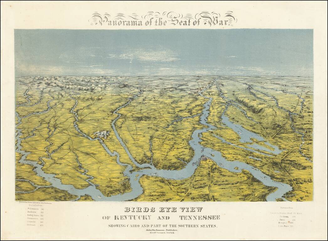
A Southern Rarity Rare regional birds eye view of Kentucky, Tennessee and parts of contiguous states, published by John Bachmann. The area shown is bounded by Cape Girardeau and the Mississippi River in the Southwest, Evansville and the Ohio River in...
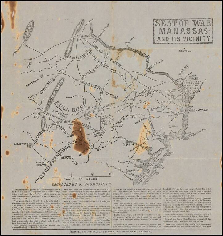
Rare Confederate broadside map related to the Battle of Bull Run, published for the Richmond Enquirer in the aftermath of the battle. Lithographed or wood-engraved map of northern Virginia, from Washington, D.C. to Warrenton. The map names Alexandria...
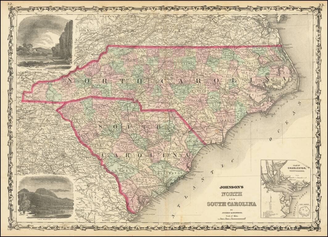
Attractive map of the Carolinas, published by Johnson & Browning. The map is colored by counties and showing towns, railroads, lakes, rivers, forts, swamps, islands, etc. Large inset plan of Charleston and Fort Sumter and large vignettes of Table...
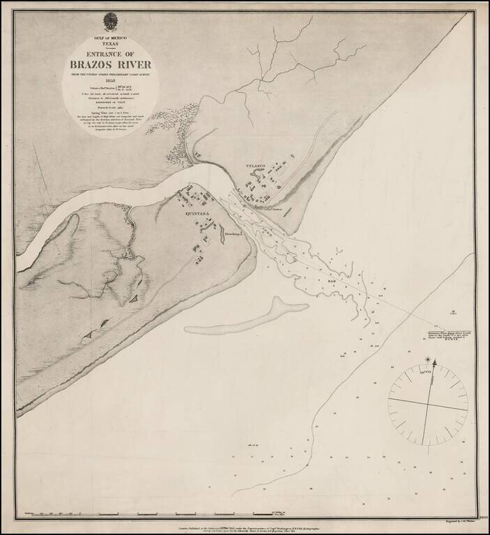
Extremely rare British Admiralty Sea Chart of the Mouth of the Brazos River, first surveyed by the US Coast Survey in 1858. The mouth of the river includes the towns of Velasco and Quintana, including an Observation Station and PIlots Range and...
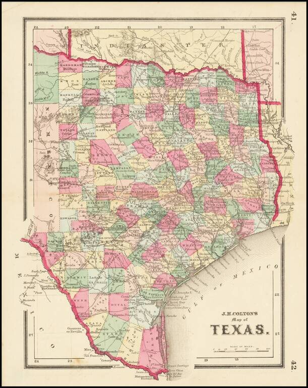
Scarce map of Texas, published at the beginning of the American Civil War. We have dated the map based upon the configuration of Edwards County, which lasted until January 1862.
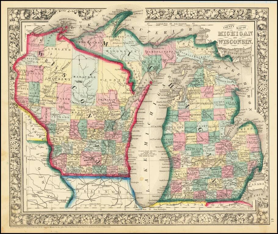
Attractive map of Michigan and Wisconsin, published by SA Mitchell Jr. The map is colored by counties. Shows early railroads, proposed railroads, towns, rivers, Indian region, etc. Decorative floral border.