Map size in jpg-format: 111.133MiB
Click to open in high resolution (open in new tab).
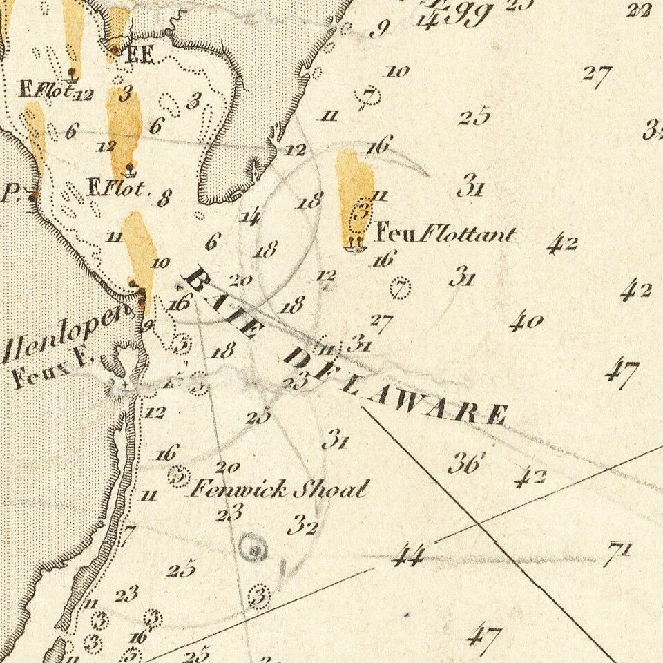
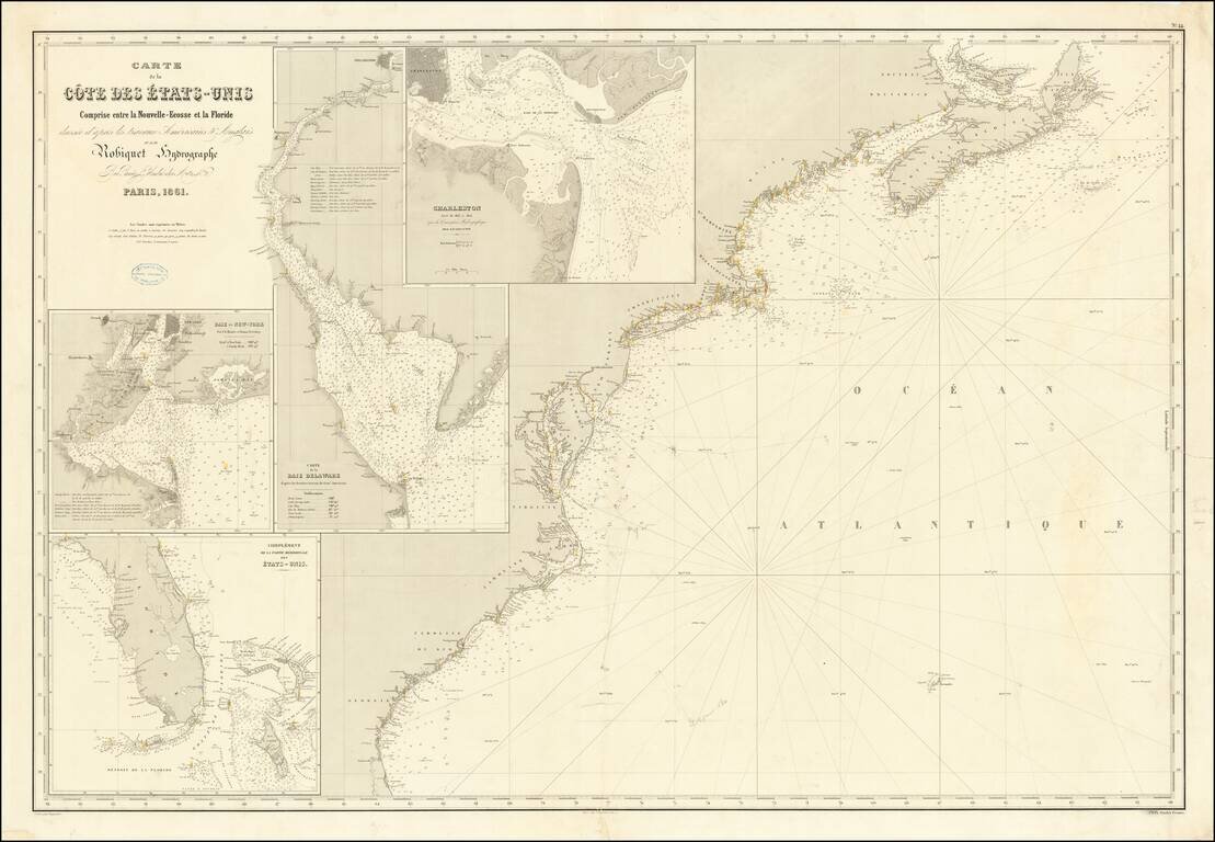
Rare separately published French chart of the region from Nova Scotia to Florida, with large inset maps of Florida, New York Harbor, Charleston and the Delaware Bay. The map was apparently used either for contemporary navigation or a survey off the mid-Atlantic coastline, as there are pencil notes and triangulations shown between the Delaware Bay, the Chesapeake and the region just west of Bermuda, executed by a skilled hand. The map is extremely detailed, including soundings, rhumb lines, and many coastal features. The lighthouses along the Eastern Seaboard are noted in yellow. Includes a small stamp from the original map and chart seller, in Marseille. Robiquet's American coastal charts rarely appear on the market.
If you are a student, write to us in telegram: @antiquemaps and indicate what material you need and for what work you need a map in high detail. We are ready to provide material on special terms. For students only!
![[The First Maps in a la poupée Printed Color] Cartes en Couleur des Lieux Sujets aux tremblements de Terre Dans toutes les parties du Monde Selon le Sisteme de l’impulsion Solaire](/map/small/52293op.jpg)

