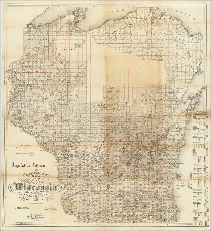
Unrecorded "Legislative Edition" Rare (unique?) separately published "Legislative Edition" of Silas Chapman's map of Wisconsin. The map noted that it is "Engraved & printed by L. Lipman, Practical Lithographer" in Milwaukee, with additional...
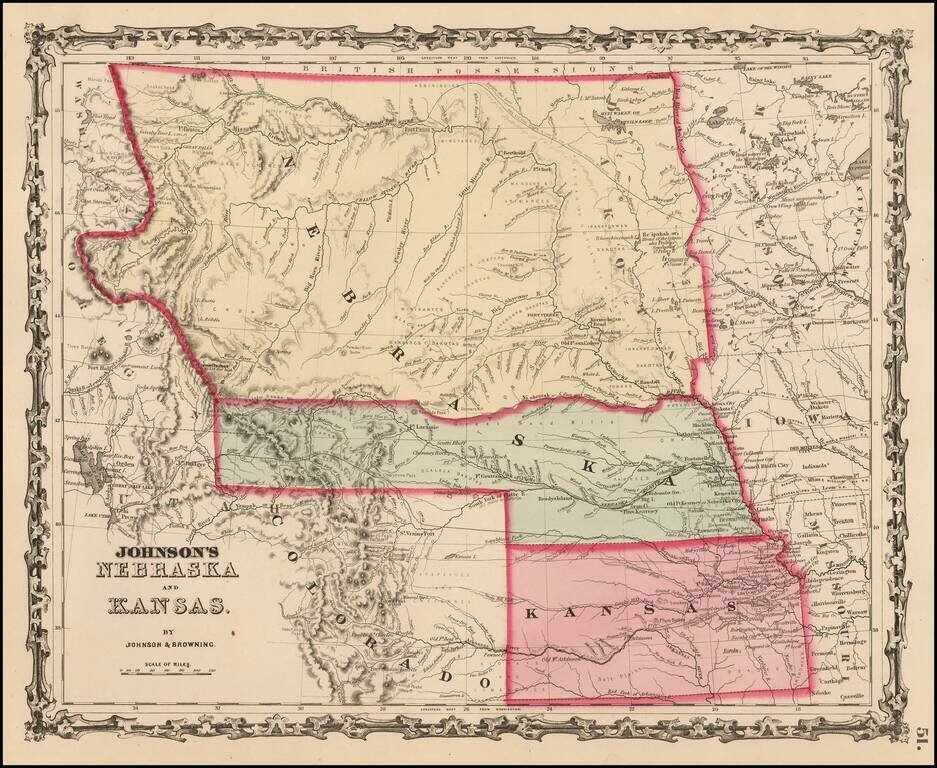
Early map in the series of Johnson's maps of this region, the first edition to include Colorado Territory. In this edition, Kansas extends to the Rocky Mountains and Nebraska extends to Oregon Territory and Canada. In the next edition, Kansas gives...
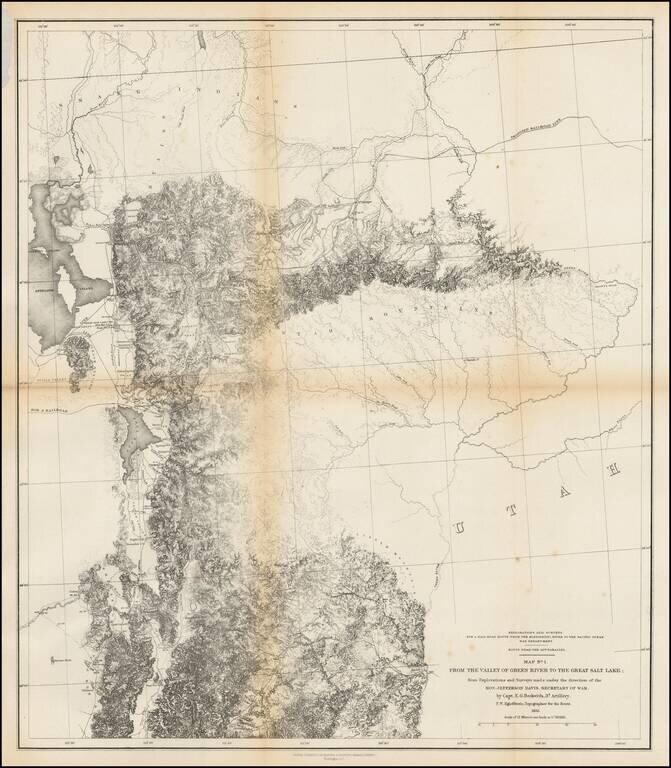
Finely detailed map of the area from Brown's Hole east of today's Vernal to the Great Salt Lake and south to below Fillmore. The map locates the Emigrant Road to California. Several Proposed Railroad lines are shown. One crosses the Green River near...
Detailed map showing parts of Wyoming, Colorado, New Mexico and South Dakota, extending west to Rocky Mountains, the Rio Grande River, San Luis Valley and Cheyenne area Shows the proposed raiload lin along the South Fork of the Platte River, extending...
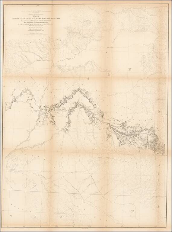
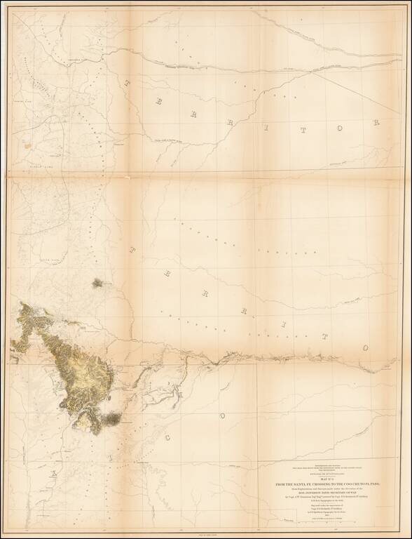
Detailed map extending from Bridger's Pass in the north to New Mexico, centered on the Sawatch and Wasatch Mountains. Shows proposed railroad line through Bridger Pass in Northeast Utah Territory, including parts of present day Colorado and Wyoming...
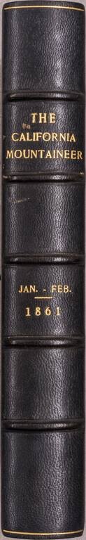
Six (of seven) issues of an important early California periodical, which ran for seven issues (from January to July of 1861). After seven issues, it merged with the recently-sold Hutchings’ Illustrated California Magazine; the combined Magazine and...
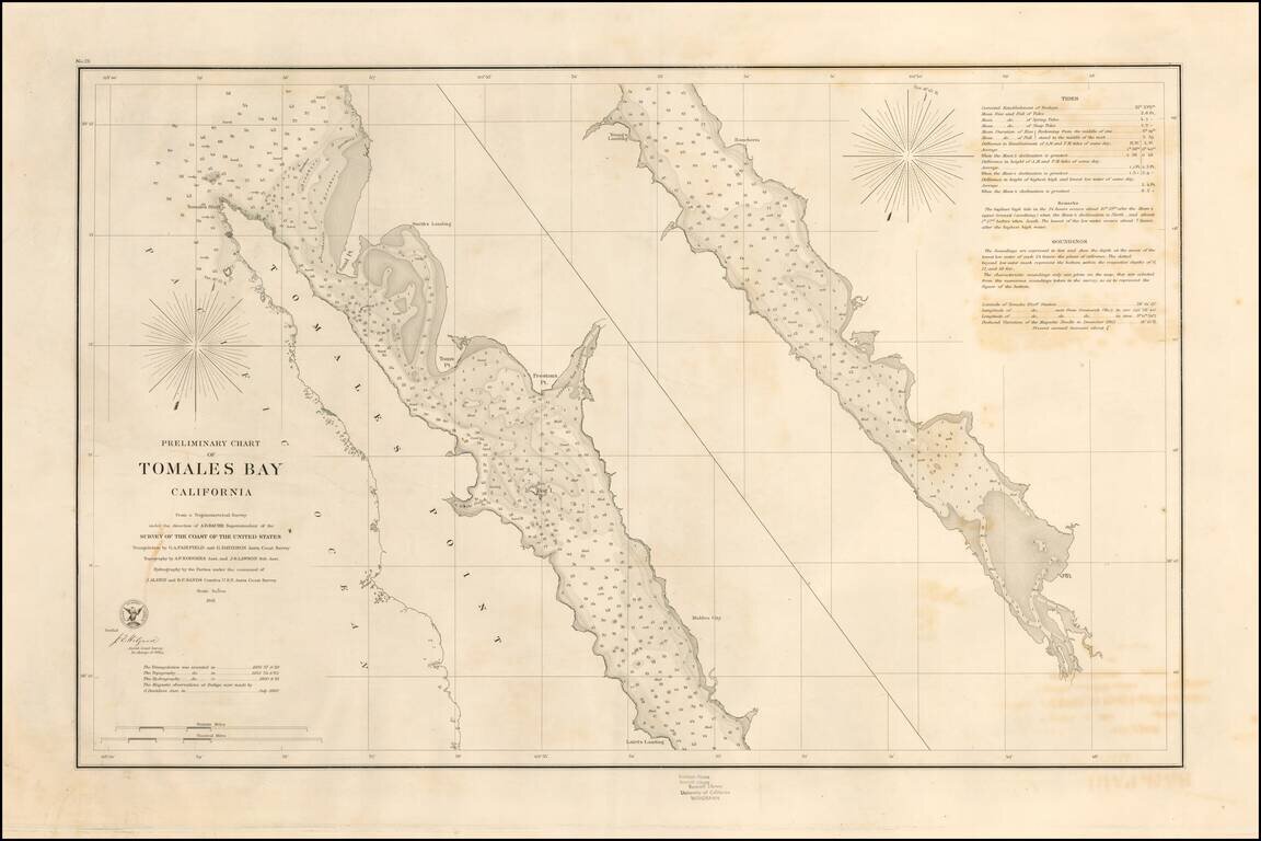
Rare separately pubilshed thick paper example of George Davidson's copy of the US Coast Survey Chart of Tomales Bay, first published in 1861. Tomales Bay's history is quite interesting, having been discovered by the English in the 16th Century,...
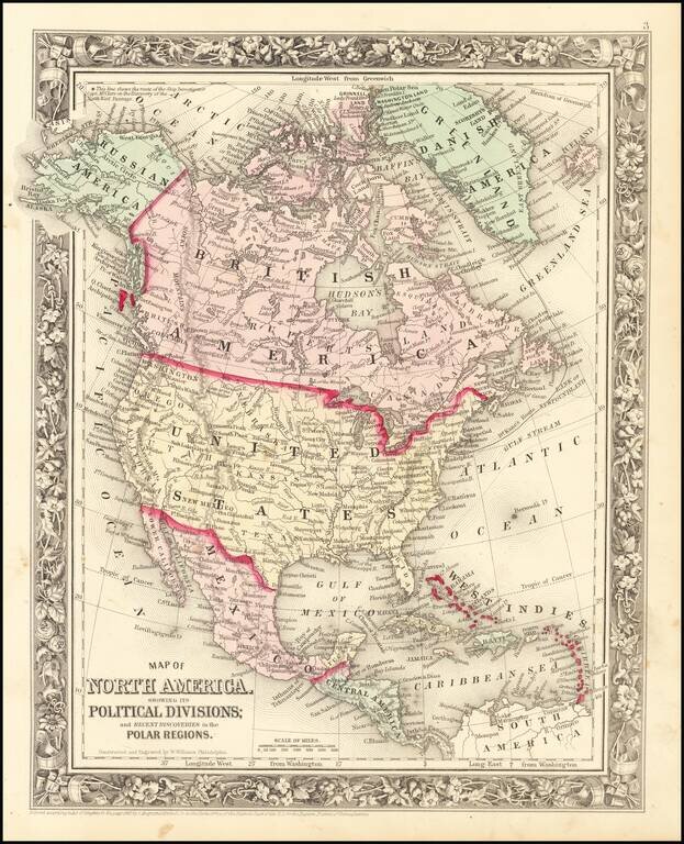
Decorative map of North America, colored by country. Shows recent discoveries in Russian America, including McClure's northwest passage aboard the Investigator. Locates cities, rivers, mountains, forts, lakes, etc. Decorative border.

Detailed lithographed map of the Mexican State of Campeche on the western side of the Yucatan Peninsula, published in Mexico in 1861. The map differentiates between eight (!) different kinds of settlements, including haciendas, rancherias, villas,...
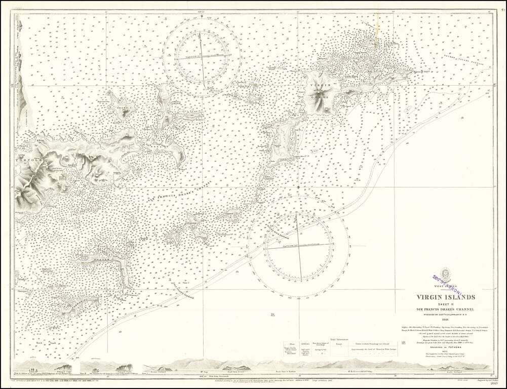
Finely detailed map, extending from Virgin Gorda and Necker Island in the northeast to Tortola and Norman Island in the west, centered on Sir Francis Drake's Channel. Includes profile views across the bottom and the top left. This is one of the...
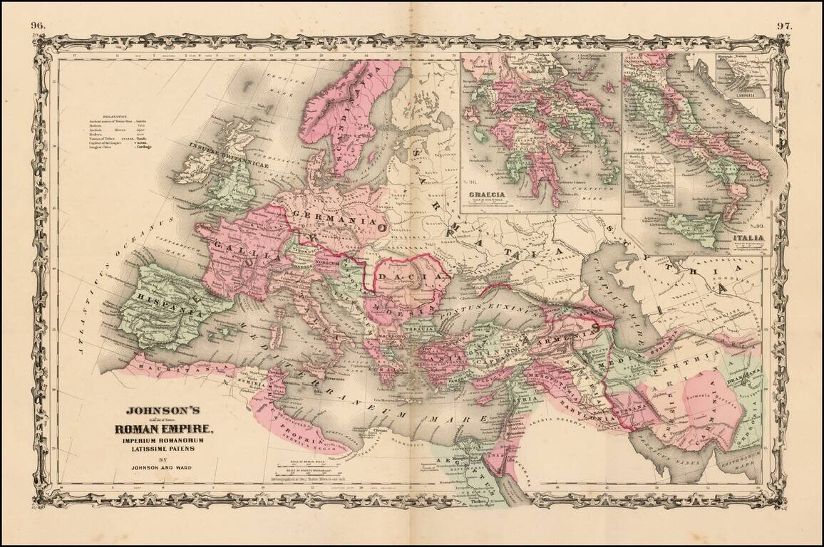
Large format map of the Roman Empire with insets of Roman Greece and Roman Italy. Includes ancient place names, rivers, mountains, etc. Decorative borders. A marvelous historian's map.
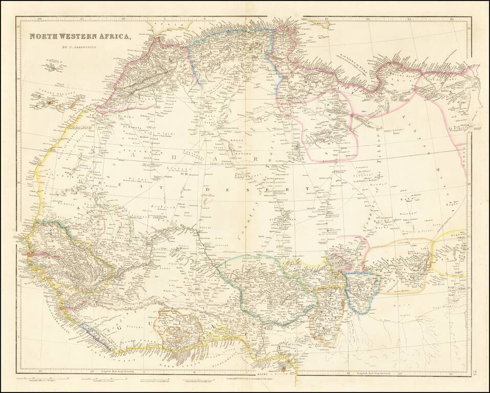
Detailed map of north and west Africa, published by John Arrowsmith in his London Atlas. The map is dominated by the Sahara Desert. In the Sahara, map is cris-crossed with early trading routes, oasises, and the location of Desert Wells.
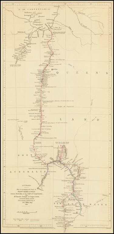
Route Map of the Burke and Wills Expedition Across Australia Detailed map showcasing the route of the Burke and Wills Expedition, which appeared in the Journal of the Royal Geographical Society to accompany an account of the expedition. The map shows...