logo

1860. Carte Des Colonies etablies dans la partie sud-ouest de la Russie

  • Carte Des Colonies etablies dans la partie sud-ouest de la Russie

Carte Des Colonies etablies dans la partie sud-ouest de la Russie information:

Year of creation: 
Resolution size (pixels): 
 15882x11936 px
Disk Size: 
 36.3531MiB
Number of pages: 
 1
Place: 
 Paris
Author: 

Print information. Print size (Width x height in inches):
Printing at 72 dpi 
  220.58 х 165.78
Printing at 150 dpi 
 105.88 х 79.57
Printing at 300 dpi 
 52.94 х 39.79

An example of detailing the file of this map of in a printable high-resolution:

Click to open in high resolution (open in new tab).
Attention! this is just the central piece (central area 960x960 px) of the map file!
This is an example, so that you can see and study the level of detail of a given map. The entire Map will be fully available after payment!

Carte Des Colonies etablies dans la partie sud-ouest de la Russie

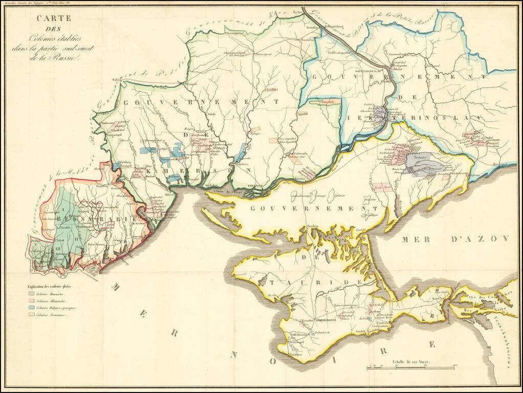
Detailed map of the Crimea and northern part of the Black Sea and Sea of Azof, locating colonial settlement in the region.

The map is divided by Governments as created by the Imperial Russian Government in 1802 (and abolished in 1925). The settlements showing include:

  • Mennonite Colony
  • German Colony
  • Bulgarian-Greek Colony
  • Serbian Colony

Special conditions for students!

If you are a student, write to us in telegram: @antiquemaps and indicate what material you need and for what work you need a map in high detail. We are ready to provide material on special terms. For students only!

Item information:

Year of creation:
Size:
15882x11936 px
Disk:
36.3531MiB
Number of pages:
1
Place:
Paris
Author:
Conrad Malte-Brun.
$14.99

Related item