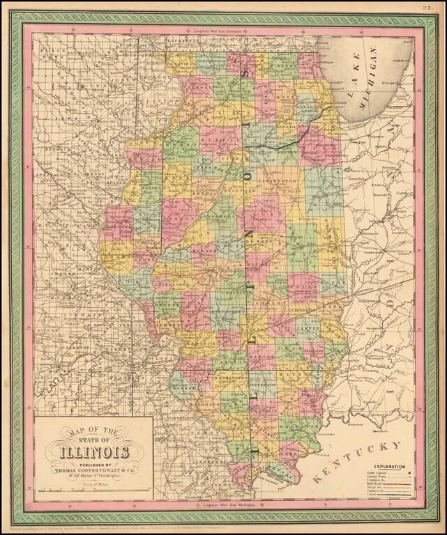
Detailed and interesting map, hand colored by county and showing towns, rivers, lakes, railroads, roads, distances, forts, etc. An exceptional example.
1852 edition of Peck & Messinger's map of Illinois, hand colored by County, published in 1852. Peck & Messenger's map of Illinois was one of the most enduring map legacies of the midwest, with issues dated as early as 1836 and still in...
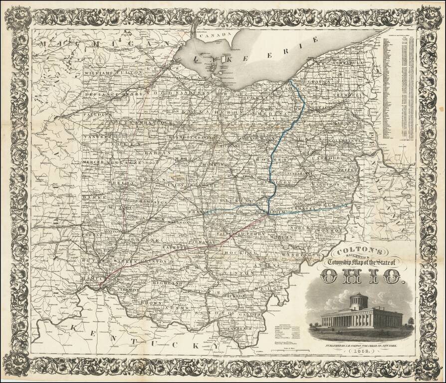
First Edition! Detailed engraved folding map of Ohio, issued by J.H. Colton in 1852. The map shows the "new" Ohio Statehouse building. Ohio had planned to build a new statehouse building for years, but the project took on urgency in 1852 when the old...
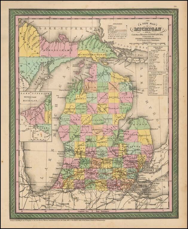
Detailed and interesting map of Michigan, hand colored by county and showing towns, rivers, bays, lakes, railroads, roads, distances, etc. Tables of Steam Boat routes and distances. A nice example of this increasingly difficult map to obtain, from an...
![[Mormon State of Deseret] Nord America mit Westindien](/map/small/69513.jpg)
Detailed map of North America, published in Weimar in 1852. The map identifies the newly formed Territories of the western United States. Most notable is the location of the massive Utah oder Deseret Terr. (Utah or Deseret Territory). To the south,...
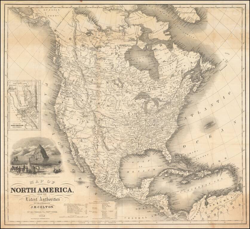
Striking Gold Rush era map of North America, published by J.H. Colton. The map includes an inset of the Gold Regions of California and a large vignette of Pyramid Lake, in Upper California. The routes to the west and the Oregon Trail are highlighted,...
![(California-Mexico Border Survey) Datos de los trabajos astronómicos y topográficos. [bound with:] Variedades de la civilizacion, nueva epoca (Tomo I)](/map/small/70777.jpg)
The First Survey of the New Border of California and Mexico. "The first detailed printed account of the regions traversed by Salazar, the surveyor for the Mexican border commission . . . Salazar's duties only took him to San Diego and to the...
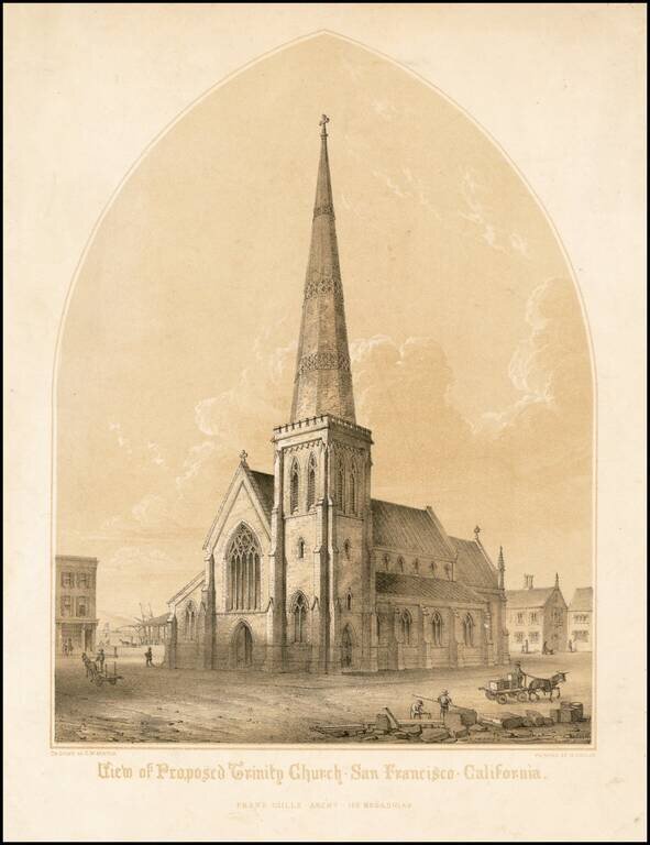
Rare early view of the proposed design for Trinity Church, as proposed by Architect Frank Gills, drawn by G.W. Burton and lithographed by Michelin in San Francisco. The Trinity Episcopal Church was organized in 1849, and first held services in a...
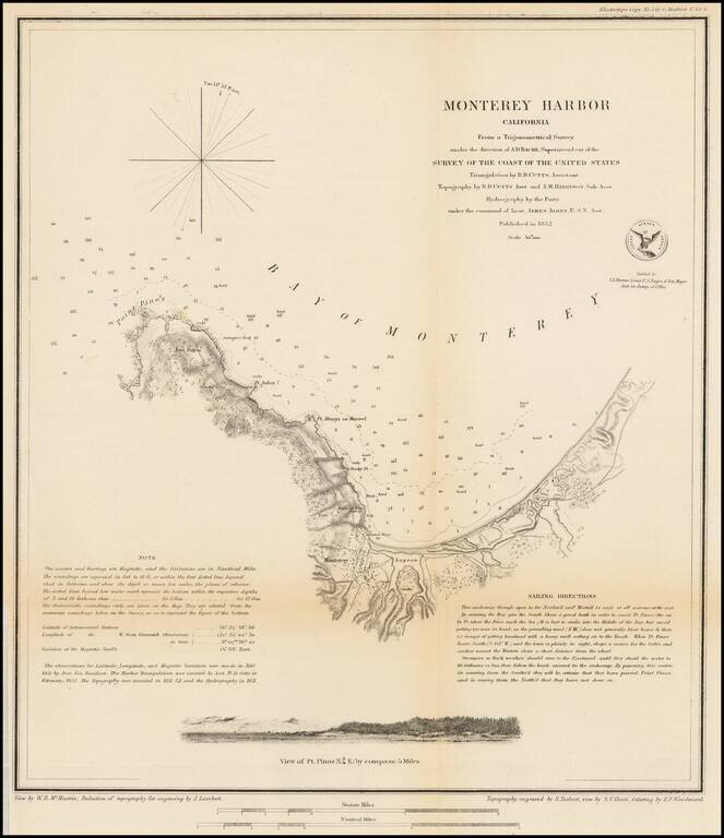
Nice example of this important early survey of Monterey Bay, published by the United States Coast Survey. Incudes a profile view of Pt. Pinos. Shows a Monterey town plan, Point Pinos, Pt. Anlon, Pt Almejor Mussell, the Lagoon, Fort, Ruins of the old...
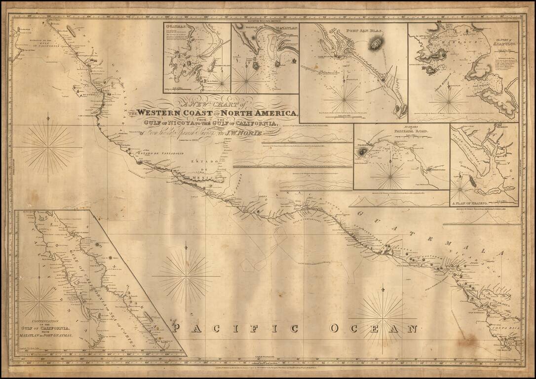
Engraved sea chart covering the area from Cape Blanco, Costa Rica, to the mouth of the Gulf of Mexico, with an inset map titled "Continuation of the Gulf of California, from Mazatlan to Port Guymas." The map includes the following harbor map insets:...
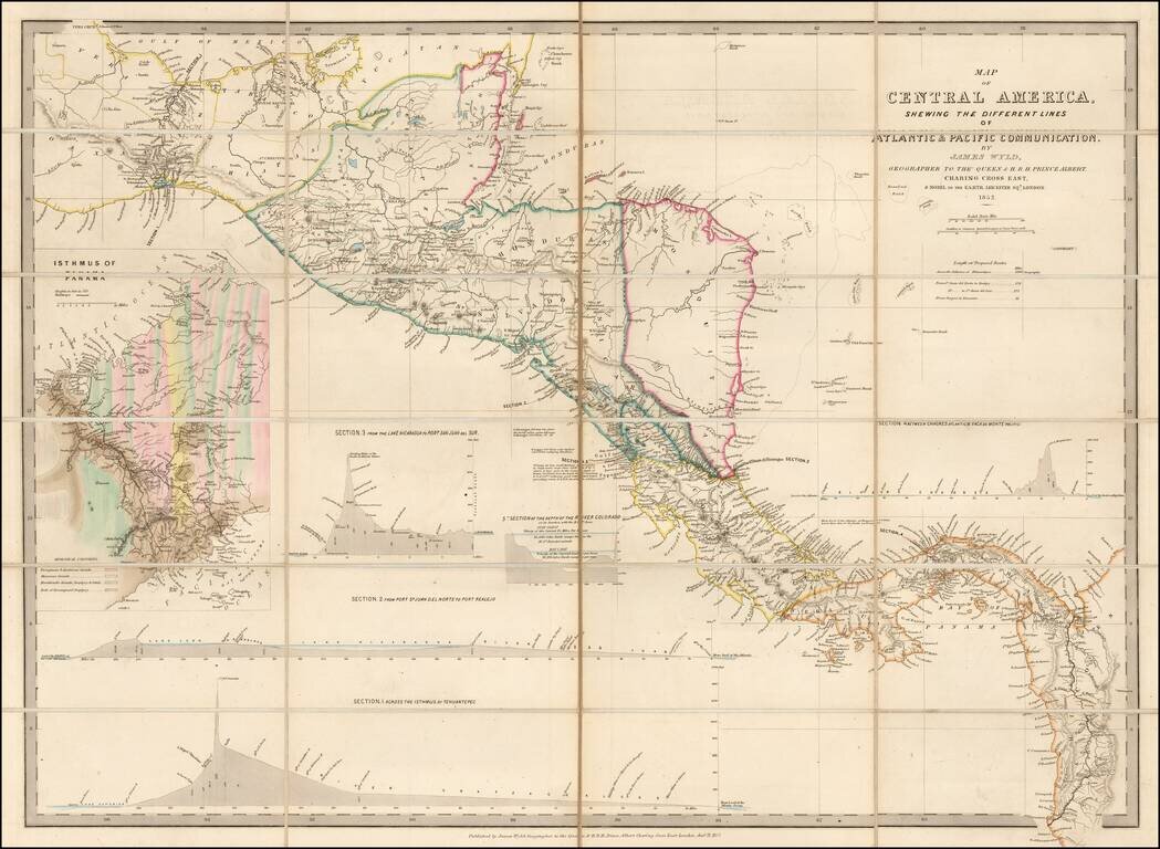
Early Edition of Wyld's map of Central America -- Including the first geological survey of Panama. Fine map of Central America, which includes the first geological survey of Panama published in London by James Wyld. This is the earliest edition of...
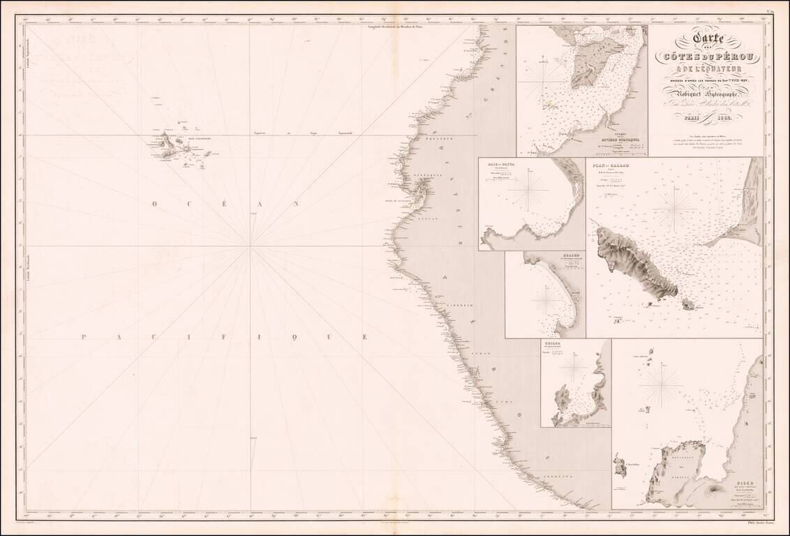
Rare French sea chart of the mouth of the coast of Peru, published in Paris by Aime Robiquet. The Galapagos Islands appear in the west. The map includes large insets of: Entrance to Guayquil River Payta Bay Callao Huacho Chica Pisco Rare...
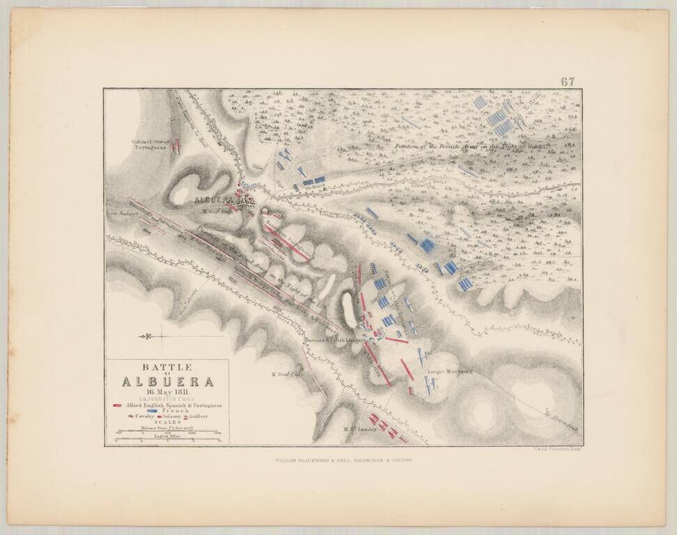
Detailed battle plan of the Battle of Albuera on May 16, 1811, prepared by Alexander Keith Johnston, F.R.G.S. The map is oriented with East at the top of the map, and shows the French (in blue), and the Allied English, Spanish and Portugese Forces (in...