Map size in jpg-format: 1.30555MiB
Click to open in high resolution (open in new tab).
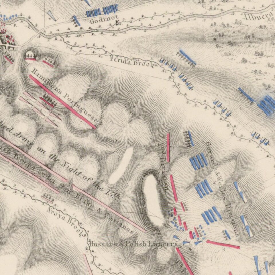
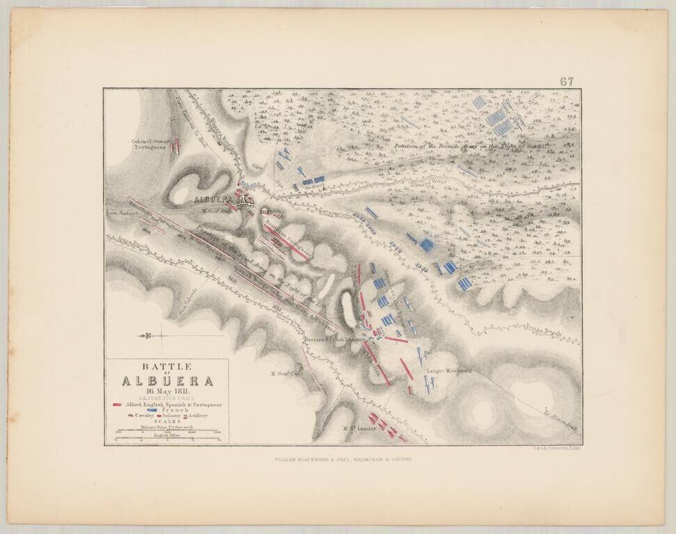
Detailed battle plan of the Battle of Albuera on May 16, 1811, prepared by Alexander Keith Johnston, F.R.G.S.
The map is oriented with East at the top of the map, and shows the French (in blue), and the Allied English, Spanish and Portugese Forces (in red), witn Cavalry, Infantry and Artillery positins each with their own colored symbols.
The Battle of Albuera was a battle during the Peninsular War. A mixed British, Spanish and Portuguese corps engaged elements of the French Armée du Midi (Army of the South) at the small Spanish village of Albuera, south of the frontier fortress-town of Badajoz, Spain.
The opposing armies met at the village of Albuera. Both sides suffered heavily in the ensuing struggle and the French eventually withdrew on 18 May. The allied force was too battered and exhausted to pursue, but was able to resume the investment of Badajoz. One month later, in June 1811, the Allies were forced to abandon their siege by the approach of the reconstituted French Armies of Portugal and Andalusia.
If you are a student, write to us in telegram: @antiquemaps and indicate what material you need and for what work you need a map in high detail. We are ready to provide material on special terms. For students only!
![(Pro-Spanish Republic Political Broadside) [Lift The Embargo Against The Spanish Republic] President Roosevelt says . . .](/map/small/50218.jpg)

