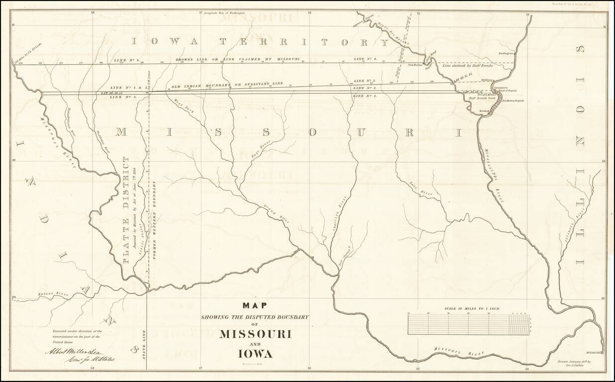
The Iowa-Missouri Boundary Dispute Detailed map illustrating the boundary dispute between Missouri and Iowa, drawn by George A. Leakin, accompanied by the report to the House of Representatives dated December 31, 1842, regarding the Northern Boundary...
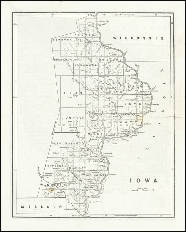
Rare early map of the surveyed portions of Iowa, from an early example of Morse's Cerographic Atlas of the United States. Includes a number of counties, towns, rivers, etc. The map shows the settled portions of Iowa Territory, four years after it...

Nice example of Lizars map of Canada, Alaska and the Polar Regions. Excellent early map of Canada, Alaska and the Northwest part of America and contiguous regions covered by Lewis & Clark. The map provides a fine treatment of the search for the...
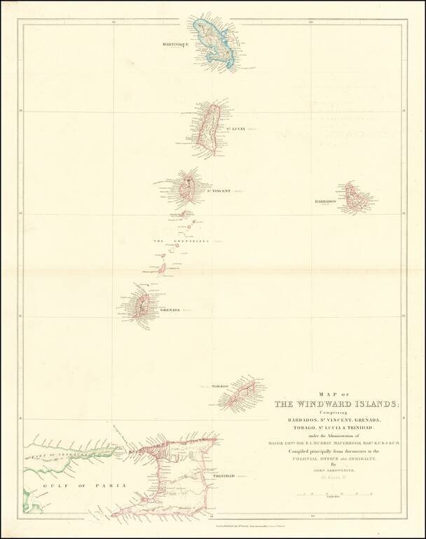
Scarce map of the Windward Islands, published by John Arrowsmith.

Fine set of 4 dissected maps of South American regions, in a custom slip case, formerly owned by Admiral Sir Edwin Gennys Fanshawe of the British Admiralty. E.G. Fanshawe is perhaps best remembered for a series of over 100 watercolors in the...
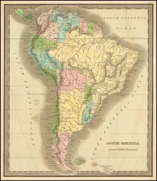
Elegantly colored map of South America, from one of the most interesting early 19th century American map publishers. South America is depicted at the end of its Revolutionary Period, with the Spanish presence now ended. The territorial divisions...
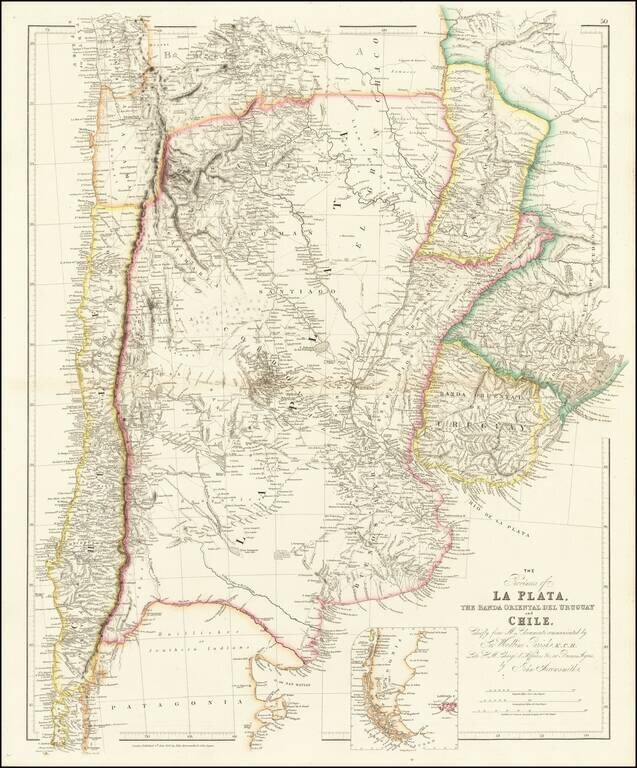
Shows Darwin's expeditions during the second voyage of the Beagle. A highly detailed map of Argentina, Chile, Uruguay and Paraguay, with an inset of Patagonia, published by John Arrowsmith, London's leading mid-19th century map maker. The map is...
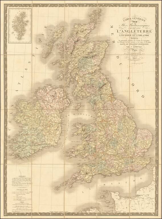
Fine early edition of Andriveau Goujon's large format map of the British Isles. The map shows railroads, canals, postal routes, etc. A nice wall map sized map.
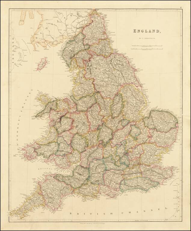
Arrowsmith's Map of England This is a striking example of Arrowsmith's map of England. The map is very detailed, naming thousands of towns and showing many roads, railways, rivers, mountains, and more. Wales is included in this map entitled England....
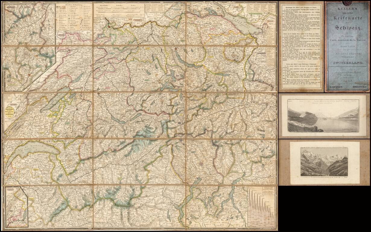
Detailed map of Switzerland, published in Zurich by Heinrich Keller. The verso of the map includes two paste down views and a key/explanation in 3 languages (German, French and English), explaining certain details on the map. This is the second...
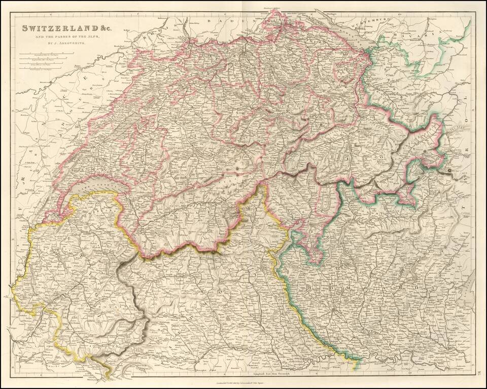
Finely detailed map of Switzerland published by John Arrowsmith, London's leading mapmaker of the mid 19th Century. The map shows towns, roads, rivers, mountains, cantons and a host of other details.
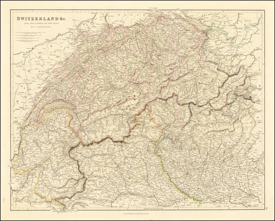
Finely detailed map of Switzerland published by John Arrowsmith, London's leading mapmaker of the mid 19th Century. The map shows towns, roads, rivers, mountains, cantons and a host of other details.
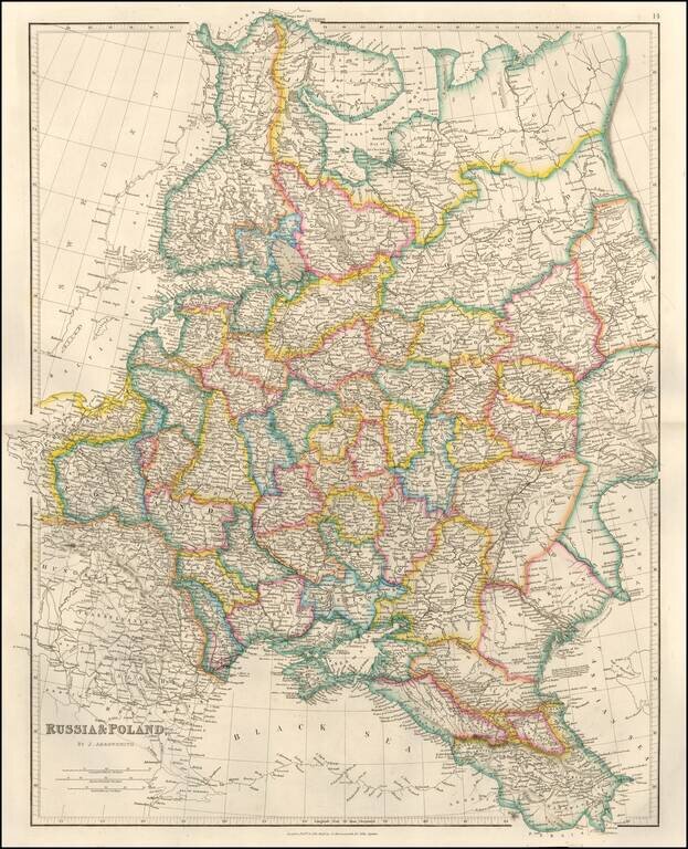
Detailed map of Russia, Belarus, Ukraine, Poland and the Baltic region, published by John Arrowsmith, London's leading mapmaker of the period. The map appeared in Arrowsmith's London Atlas.
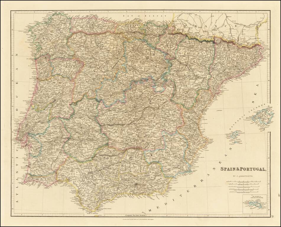
Detailed map of the Iberian Peninsula, published in London by John Arrowsmith. The map appeared in Arrowsmith's London Atlas.
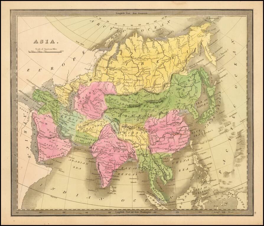
Striking full color example of Greenleaf's map of China, which first appeared in David Burr's Universal Atlas, in 1836. Burr's Atlas was perhaps the most elegant American commercially published atlas of its time, utilizing wonderful wash colors and...
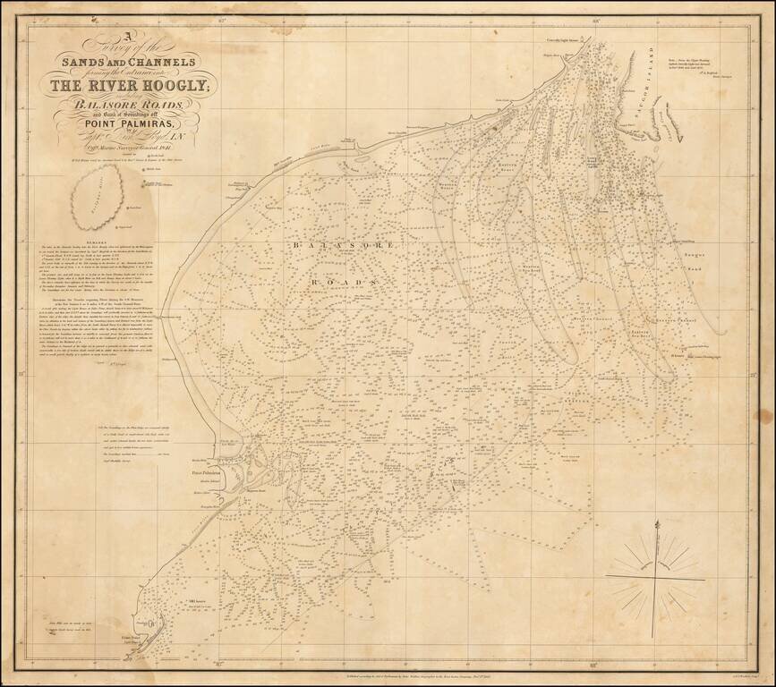
Rare sea chart of the mouth of the Hoogly River, published by John Walker, Geographer of the East India Company. The chart is based upon a rare chart by Richard Lloyd, originally lithographed by T. Black in Calcutta. The chart shows the area just...