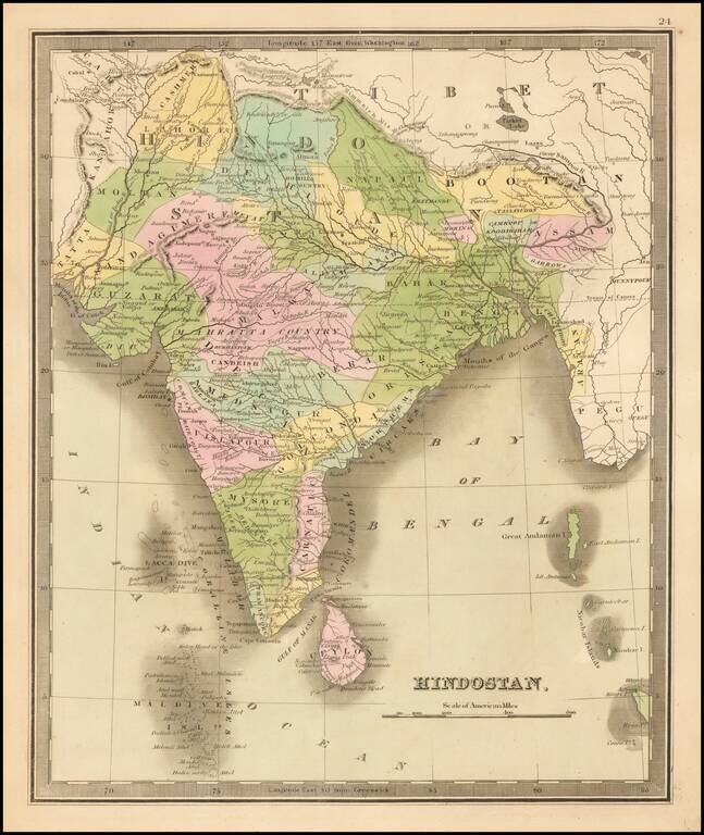
Striking full color example of Greenleaf's map of India, which first appeared in David Burr's Universal Atlas, in 1836. Burr's Atlas was perhaps the most elegant American commercially published atlas of its time, utilizing wonderful wash colors and...
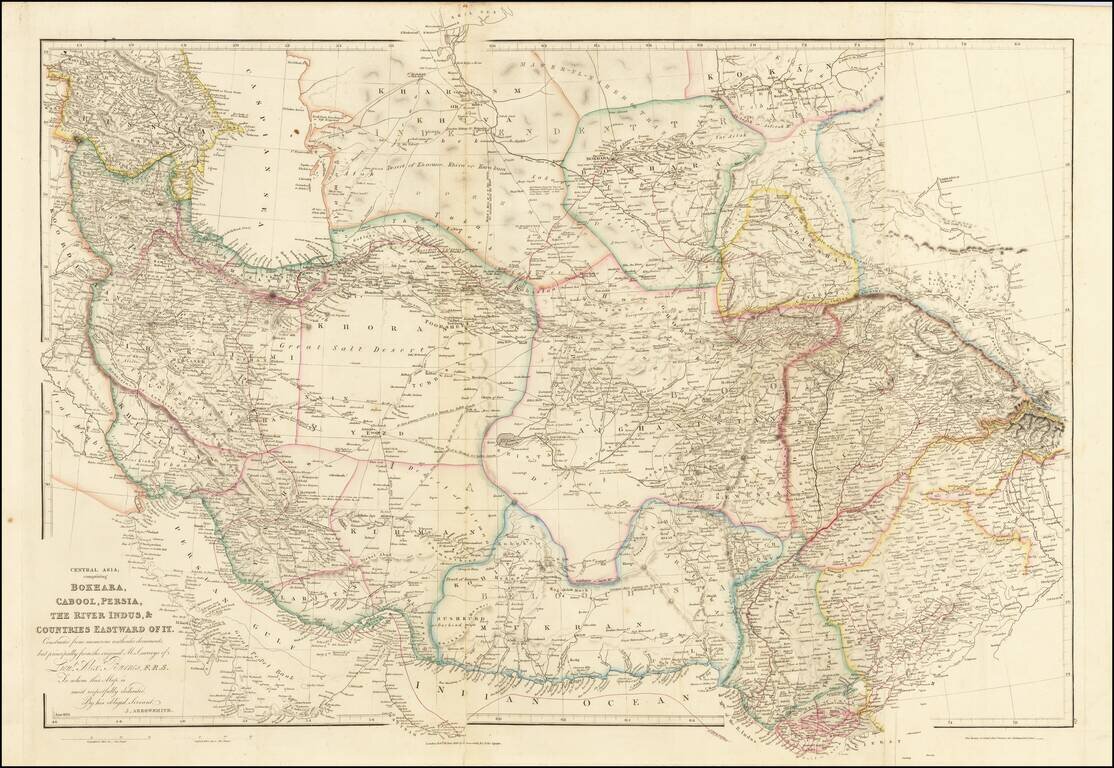
Fine example of Arrowsmith's map of the Iran and Pakistan, published by John Arrowsmith. The map illustrates the routes of Lieutenant Alexander Burnes through the region. Sir Alexander Burnes KT FRS (1805 – 1841) was a British explorer and diplomat...
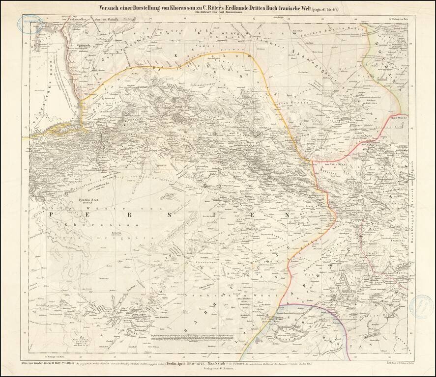
One of two "Earliest maps known to me that indicate a greater readiness to modernize the content of maps of Iran"--Sonja Brentjes, Scientific Historian at the Max Planck Institute. Very Rare. This is a very rare attractive map of the northeastern...
![[Africa] (2 maps - Ancient & Modern)](/map/small/70579.jpg)
Interesting pair of maps of Africa, showing the ancient and modern features. The pair of maps was prepared by Arrowsmith in an atlas intended to provide a comparison of ancient and modern regions.
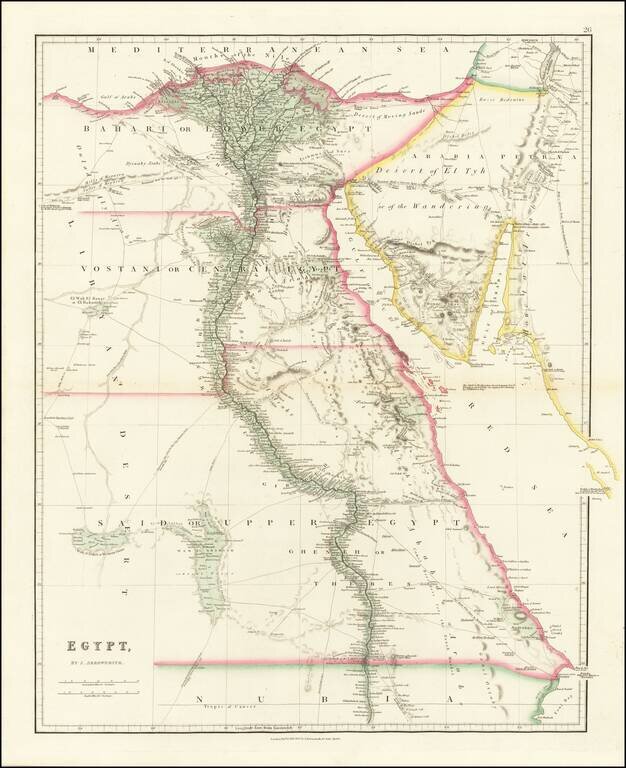
Fine example of John Arrowsmith's map of Egypt, from his London Atlas. Includes significant details along the Nile, caravan and trade routes, etc. Interesting notes include "Desert of Moving Sands," "Djewaby Arabs" and "Camel Breeders for the Esneh...
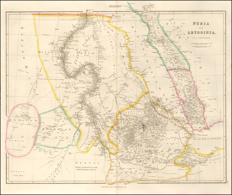
An attractive map of the region centered on the Red Sea and the upper Nile, starting at the first cataract. The map extends to Somalia, Sudan, and Darfur in the west and to Yemen and the Sea of Bab-El-Mandeb in the east. Numerous towns, mountains,...
![[Untitled View of the Coast of Saint Helena]](/map/small/37759hs.jpg)
Historically interesting sketch view of the coast of Saint Helena, attributed to Jean-Baptiste Henri Durand Brager; signed with initials on the lower right side. Durand-Brager (1814 - 1879), was the official artist accompanying the official French...
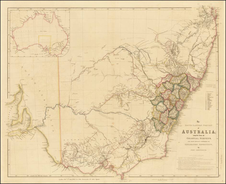
Finely detailed map of the Southeastern part of Australia, by John Arrowsmith. This is the second of the two maps which would be utilized to illustrate the extraordinary growth of this part of Australia during the early period of the Australian Gold...
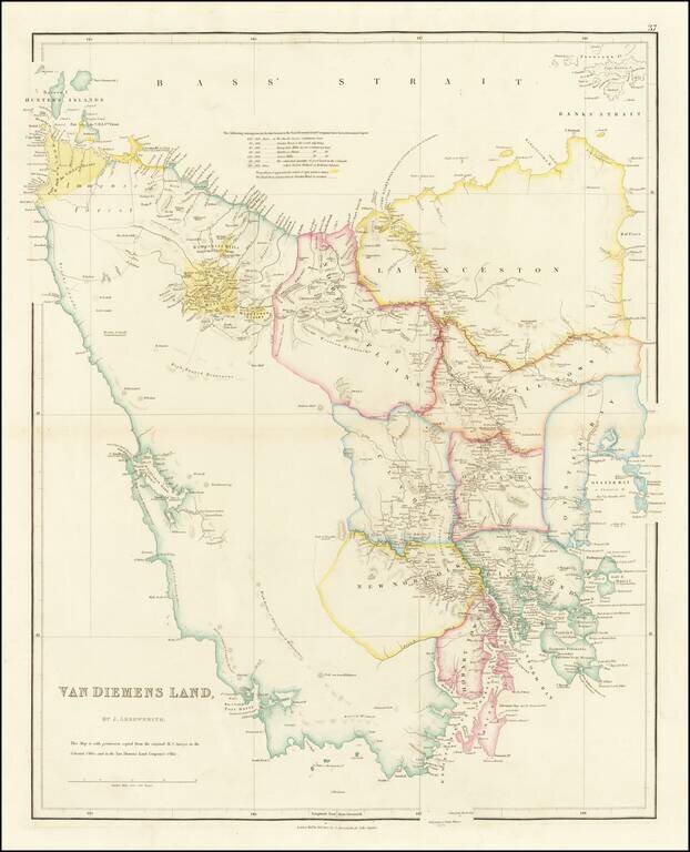
Fine example of Arrowsmith's map of Tasmania, and one of the earliest separate maps of the island. Abel Tasman (1609? - 1659), a Dutch navigator, discovered the island in 1642 and named it Van Diemen's Land. At the time, Van Diemen's Land was still a...
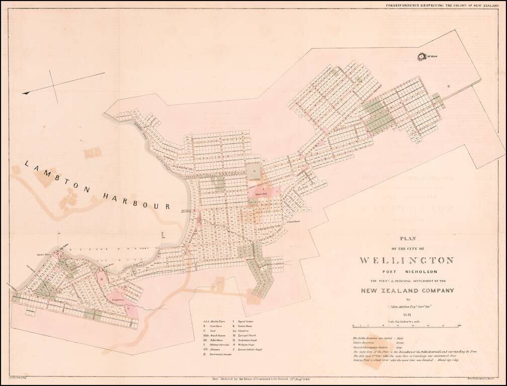
The Earliest Obtainable Map of Wellington, New Zealand Early plan of Wellington, the Capital of Museum, based upon the manuscript survey map drafted in 1840, under the direction of Felton Mathew, the first Surveyor General of New Zealand. The map is...
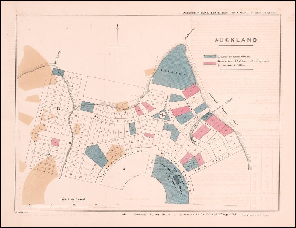
The Earliest Obtainable Map of Auckland, New Zealand Early plan of Auckland, New Zealand, from the Correspondence respecting the Colony of New Zealand, published by the House of Commons in London. The map shows allotments in the area between Albert...
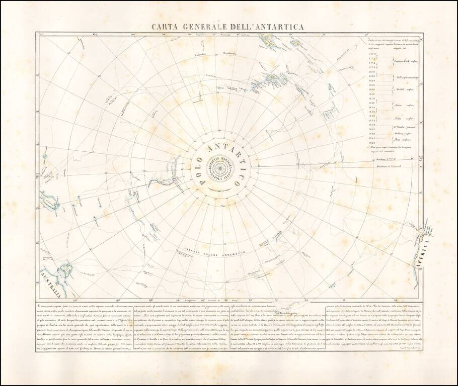
Rare map of the Antarctic regions, by Neapolitan mapmaker, Benedetto Marzolla. The map shows the tracks of South Polar Explorers, from Captain James Cook, in 1772, to Ross, in 1842. Voyages depicted are: Captain James Cook 1772-1775 Fabian Gottlieb...