Map size in jpg-format: 109.547MiB
Click to open in high resolution (open in new tab).
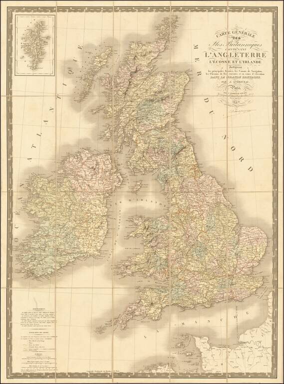
Fine early edition of Andriveau Goujon's large format map of the British Isles.
The map shows railroads, canals, postal routes, etc.
A nice wall map sized map.
If you are a student, write to us in telegram: @antiquemaps and indicate what material you need and for what work you need a map in high detail. We are ready to provide material on special terms. For students only!


