Map size in jpg-format: 1196270B
Click to open in high resolution (open in new tab).
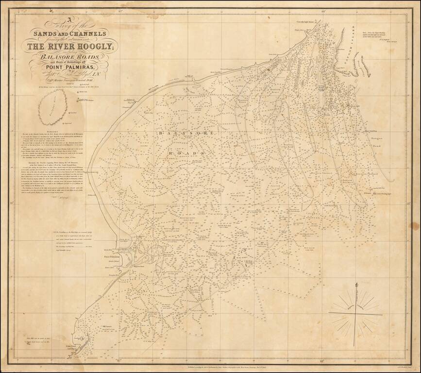
Rare sea chart of the mouth of the Hoogly River, published by John Walker, Geographer of the East India Company.
The chart is based upon a rare chart by Richard Lloyd, originally lithographed by T. Black in Calcutta.
The chart shows the area just south of Calcutta, including Saugor Island and the Cowcolly LIght House.
If you are a student, write to us in telegram: @antiquemaps and indicate what material you need and for what work you need a map in high detail. We are ready to provide material on special terms. For students only!

![Il Disegno Della Terza Parte Dell' Asia [Gastaldi's Wall Map of SE Asia with extra panels!]](/map/small/30554hbp.jpg)
