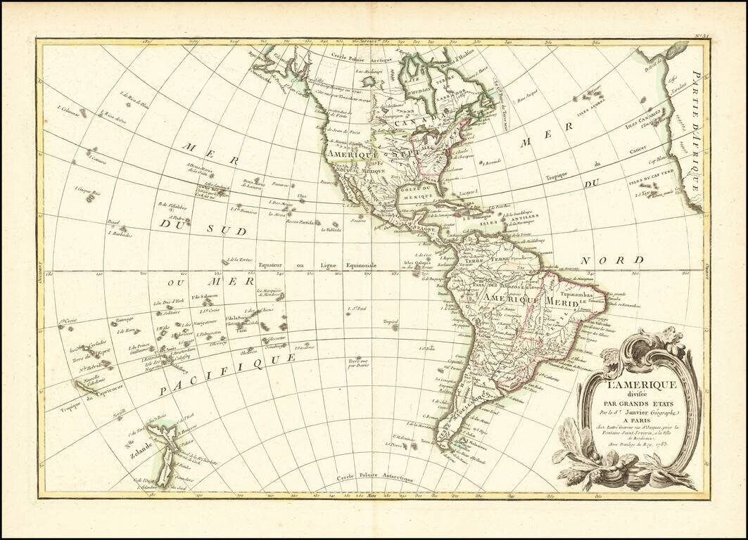
Fascinating Alaska Configuration 1783 edition of Janvier's map of America, issued in the same year that the United States was formally granted its independence from England. The mythical Sea of the West is no longer shown, replaced by a curious...
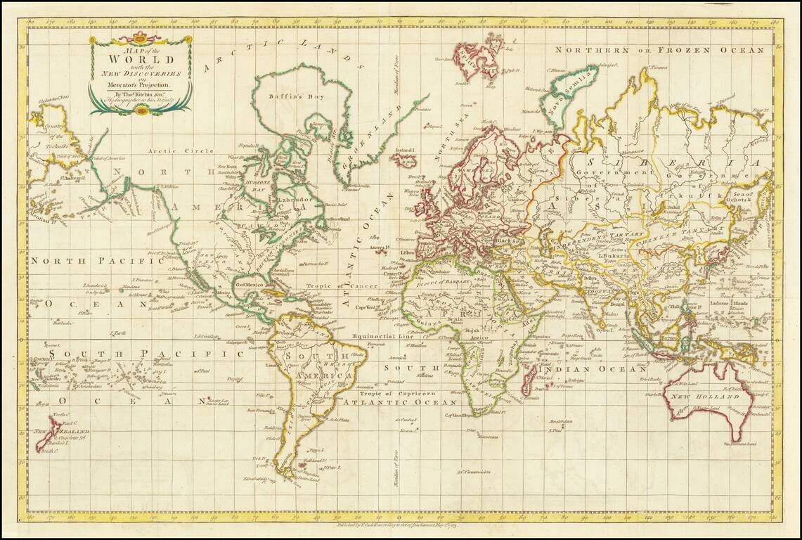
A World Map Immediately Following The Discovery of Hawaii Finely executed map of the World, focusing on the recent discoveries of Captain James Cook in his 3 Voyages of exploration which spanned the preceding decades. This map presents an interesting...
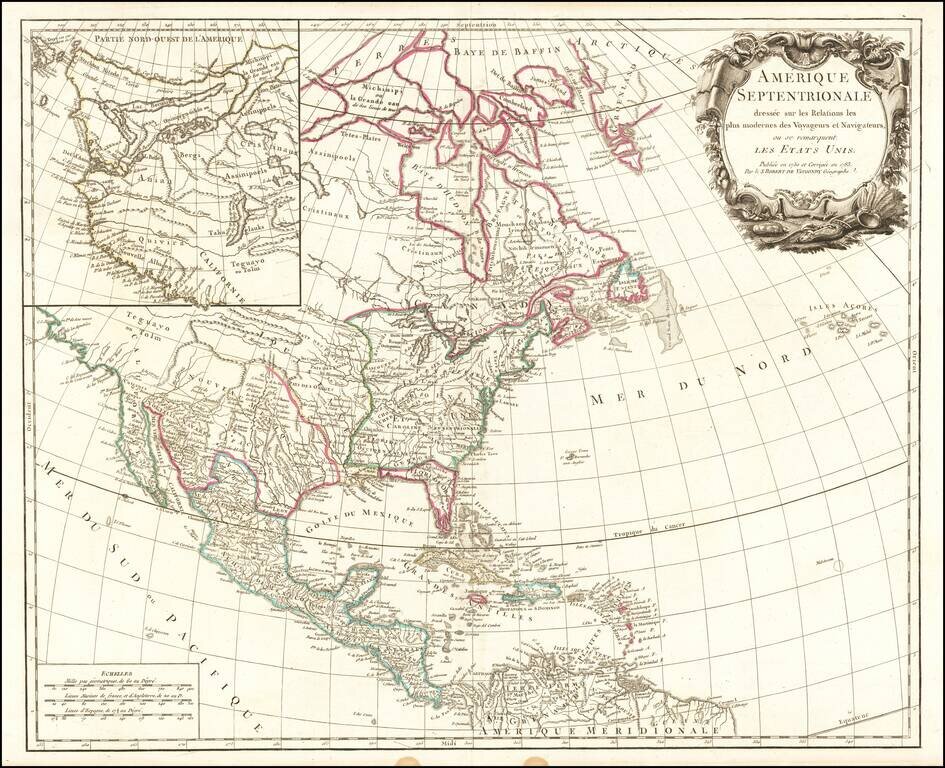
Scarce late state of De Vaugondy's map of North America, published in Paris. First issued in the 1750s, this edition has been updated to include the newly formed United States. Florida is shown as an archipelago and the coastline of California is...
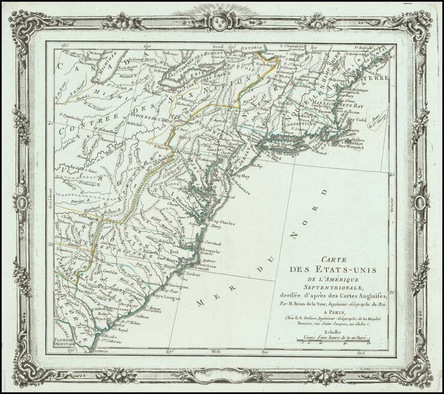
One of the Earliest Maps to Name the United States Brion de La Tour's map is one of the earliest obtainable maps to name the United States (Etats Unis de L'Amerique Septentrionale). The map shows the 13 Colonies, pre-dating the appearance of Vermont....
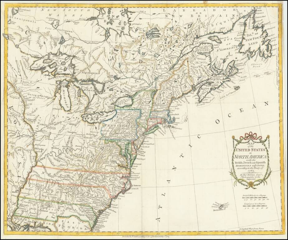
One of the earliest obtainable English Maps to name (and recognize) the newly independent United States of America. The map shows the United States extending to the Mississippi River, with the former colonial claims now Independent States. The states...
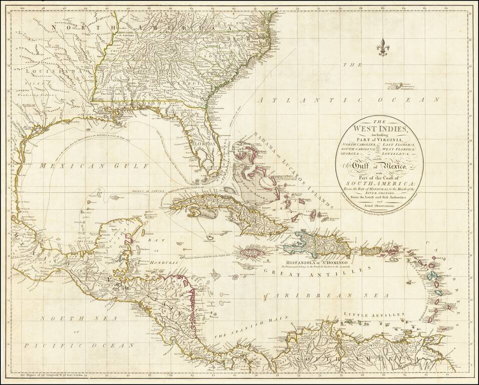
John Cary's First Printed Map Nice example of John Cary's map of the Southeastern United States, Florida and the Caribbean, published on August 1, 1783. Published in August, 1783, the map was issued one month prior to the signing of the Treaty of...
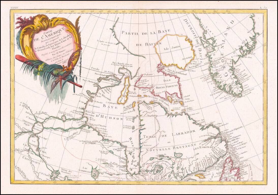
Detailed map of Canada and Hudson's Bay. Includes decorative cartouche and excellent detail throughout. Extends from Lake Winnipeg to the Eastern Seaboard.
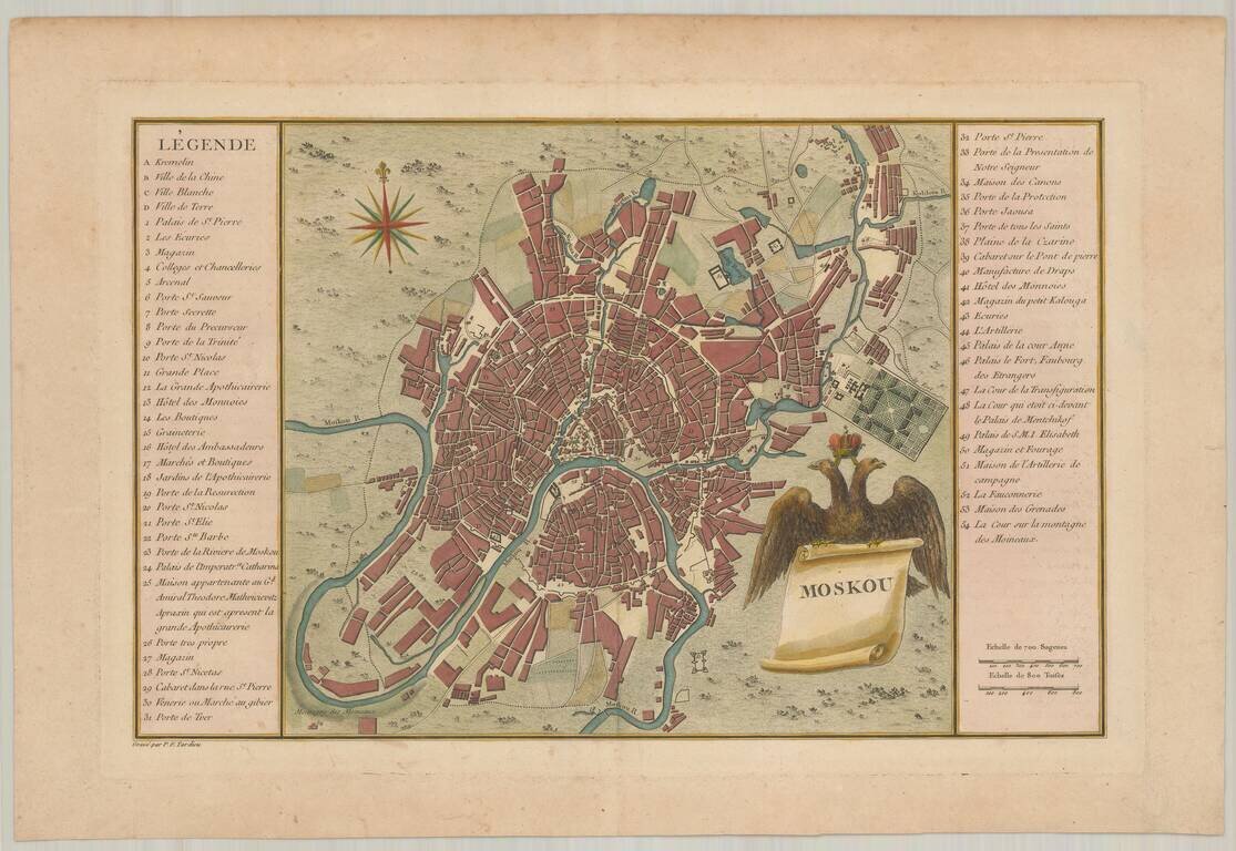
Finely engraved map of Moscow, published in Tardieu's Histoire physique, morale civile et politique de la Russie Ancienne.
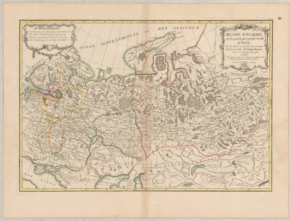
Detailed map of Russia, extending from Scandinavia and Baltics to nearly the Pacific. Shows forests, rivers, towns, mtns, lakes, etc. 2 decorative cartouches. The map is based upon the rescently completely Atlas of Russia, for which the famous French...
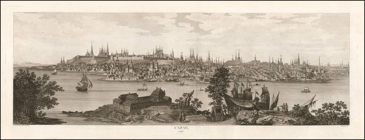
Rare 18th-century View of Kazan. Large engraved view of Kazan from across the Volga River, showing the elevated citadel and the many church spires. The view was published in Historique physique, morale, civile et politique de la Russie Ancienne....
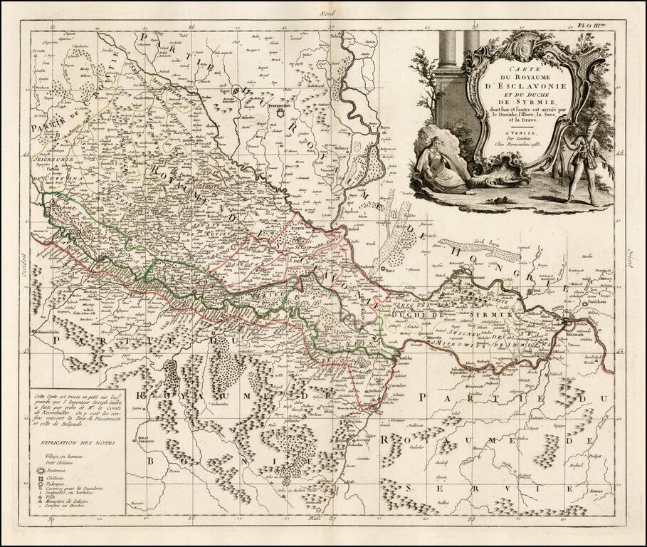
Fine map of Slovenia, published in Venice by Paolo Santini. The map is dissected by the Danube River and shows the region south and west of the Danube, extending south to Bosnia and part of Serbia but with greatest focus on the region north on the...
![L'Italie divisee en ses differens Etats… [2 sheet map]](/map/small/66173.jpg)
Attractive pair of maps Italy, Corsica, Sardinia, Sicily and Malta, showing extraordinary details. Large decorative title carouche.
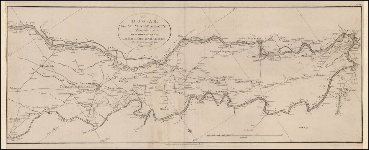
Scarce map of a charting of a section of the Ganges and Jumnah Rivers. The Ganges is shown flowing from the Betoor area from Culpy on the Jumnah. James Rennell (1742-1830) , Often referred to as "The Father of Indian Surveying," Rennell was a...