Map size in jpg-format: 1011.96KiB
Click to open in high resolution (open in new tab).
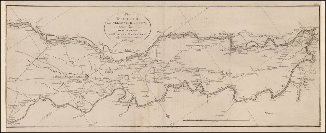
Scarce map of a charting of a section of the Ganges and Jumnah Rivers.
The Ganges is shown flowing from the Betoor area from Culpy on the Jumnah.
James Rennell (1742-1830) ,
Often referred to as "The Father of Indian Surveying," Rennell was a topographer was the East India Company from 1764 to 1777, and head of the survey of Bengal from 1767 to 1777.
His first job was assistant Draughtsman or Surveyor for Alexander Dalrymple's journey for the East India Company from Madras to the Philippines, in 1762-63. In 1764, he was recommended to the Governor of Calcutta and as an engineer officer in the Bengal army. His first task was to examine the rivers of Bengal and to navigate the waterways to Calcutta to join with the Ganges. In 1765 the Governor R. Clive commissioned him to produce a map of Bengal, and in 1767, Clive returned with an early draft of Rennel's cards back to England. After his appointment as Surveyor-General in 1767 he was in charge of the compilation of maps from photographs.
In 1777, Rennel retired ranked of a major and returned to England. He became a member of the Royal Society in 1784, and in 1791, he received the Copley medal. He was advisor for the East India Company, and "Counselor for all geographic questions. "
If you are a student, write to us in telegram: @antiquemaps and indicate what material you need and for what work you need a map in high detail. We are ready to provide material on special terms. For students only!

![Il Disegno Della Terza Parte Dell' Asia [Gastaldi's Wall Map of SE Asia with extra panels!]](/map/small/30554hbp.jpg)
