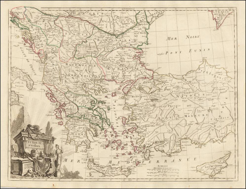
Scarce regional map centered on Greece, Turkey, The Balkans and the Black Sea, published in Venice by Francois Santini. One of the most detailed maps of the region published in the mid-18th century.

Detailed map of Istria, from Remondini. Detailed map of the region, with decorative cartouche.
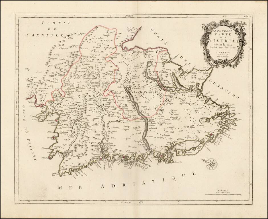
Scarce regional map of Istria, published in Venice by Francois Santini. Unlike many of the maps in Santini's atlas, this regional map of Italy is not drawn from De Vaugondy and is based upon Italian sources. One of the most detailed maps of the...
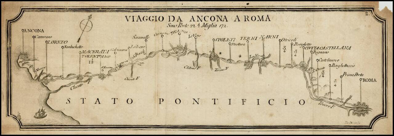
Rare postal roads map, showing the post roads from Rome to Narni, Terni, Spoleti, Foligno, Macerata, Loreto and Ancona. Includes distances, rivers and some topographical features.
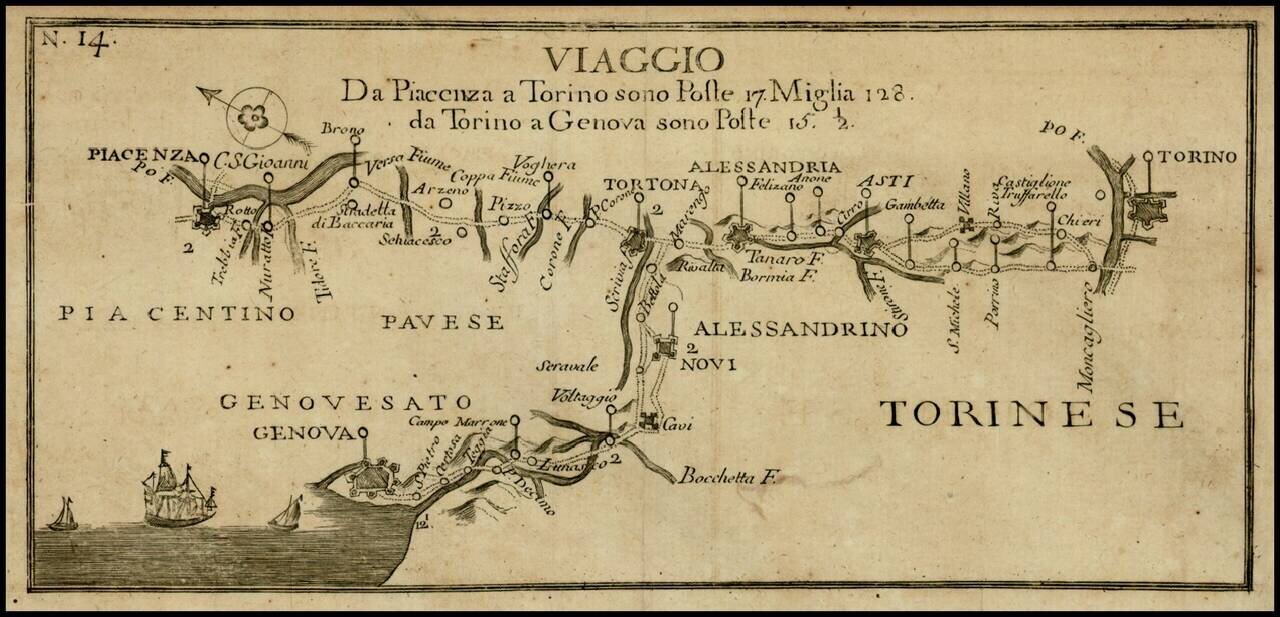
Rare postal roads map, showing the post roads from Torino to Genoa and Torino to Piacenza. Includes distances, rivers and some topographical features.
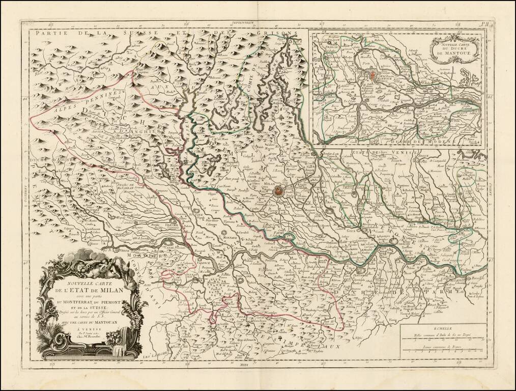
Scarce regional map of the State of Milan and environs, published in Venice by Francois Santini. Unlike many of the maps in Santini's atlas, this regional map of Italy is not drawn from De Vaugondy and is based upon Italian sources. Includes a large...
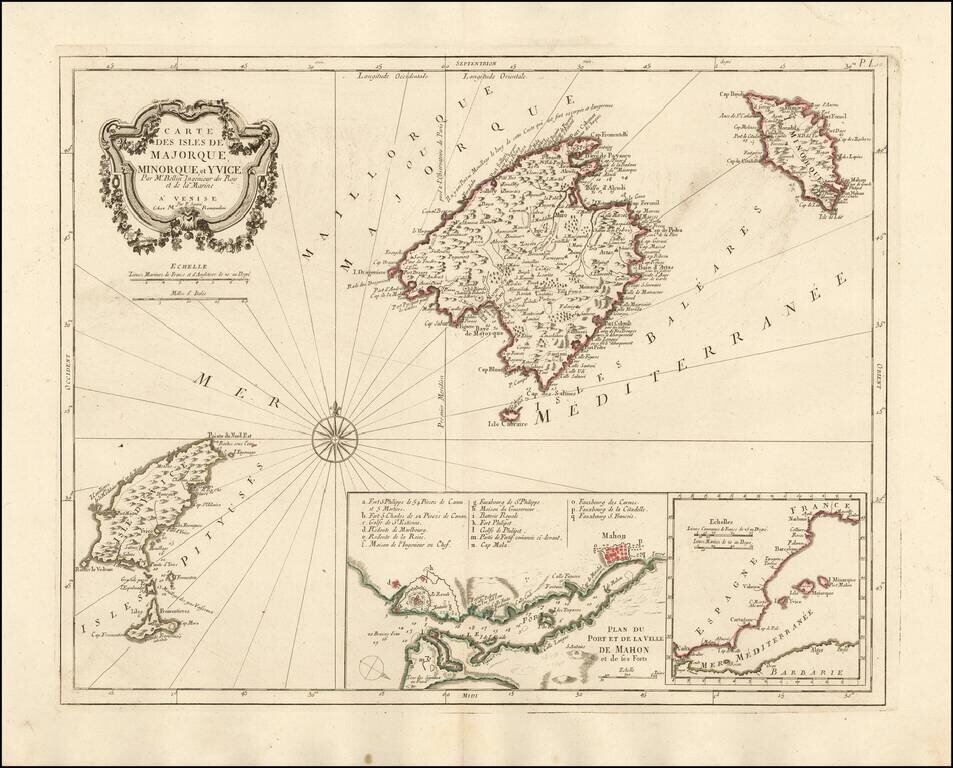
Nice example of the Paolo Santini edition of Nicolas Bellin's map of the Balearic Islands. Includes a map of Mahon Harbour and the position of the islands against the coast of Spain. A fine highly detailed map of Majorca, Menorca and Ibiza.
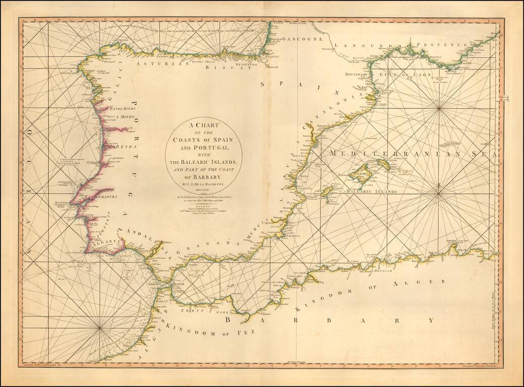
Detailed sea chart of the Balearic Islands, Spain, and Portugal. The chart extends to Provence and much of the Barbary coast to Bona. Good detail along coastal areas including the Straits of Gibraltar.
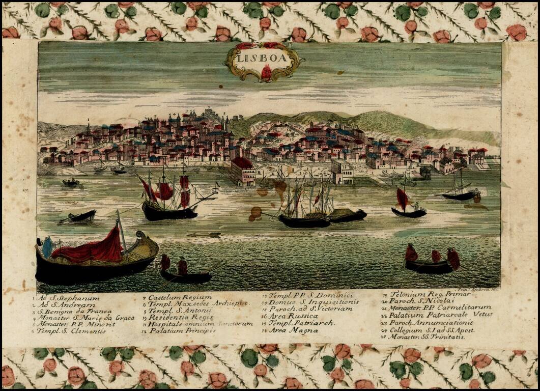
Rare view of Lisbon, Portugal, engraved by Francesco Ambrosi. The author is Giovanni Remondini (1713-1773), a Venetian cartographer and publisher. The Remondini dynasty operated in Bassano del Grappa (Vicenza province, Veneto), Italia in XVII - XIX...
![Carte de la Grece Dressee sur un grand nombre de memoires anciens et nouveaux, Sur ceux de Mrs. Whele et Tournefort . . . 1780 [includes Cyprus]](/map/small/24740.jpg)
Detailed map of Greece, Turkey and Cyprus, originally based upon the work of De L'Isle and Buache. Includes a substantial part of Cyprus.
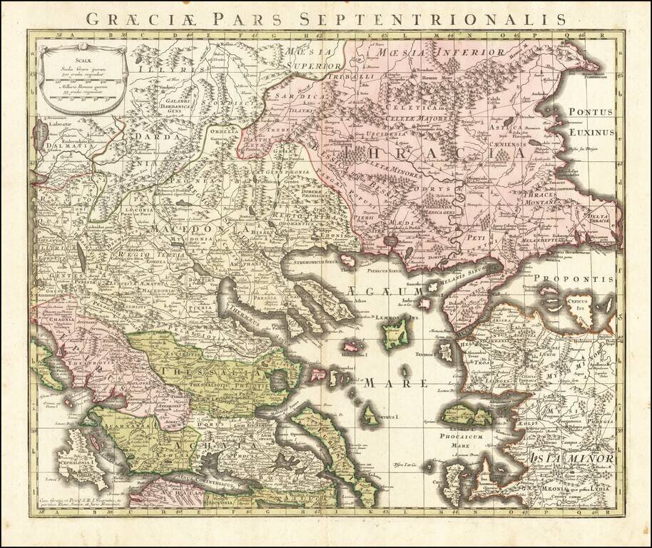
Detailed map of the northern part of Greece, published in Augsburg. Includes Roman Roads, towns and topographical information.

Very attractive engraved double-page sea chart of the Mediterranean Sea, with publisher's hand color in outline. Jean Lattre was one of the premier French mapmakers of the last quarter of the 18th century. This map features his characteristic vignette...
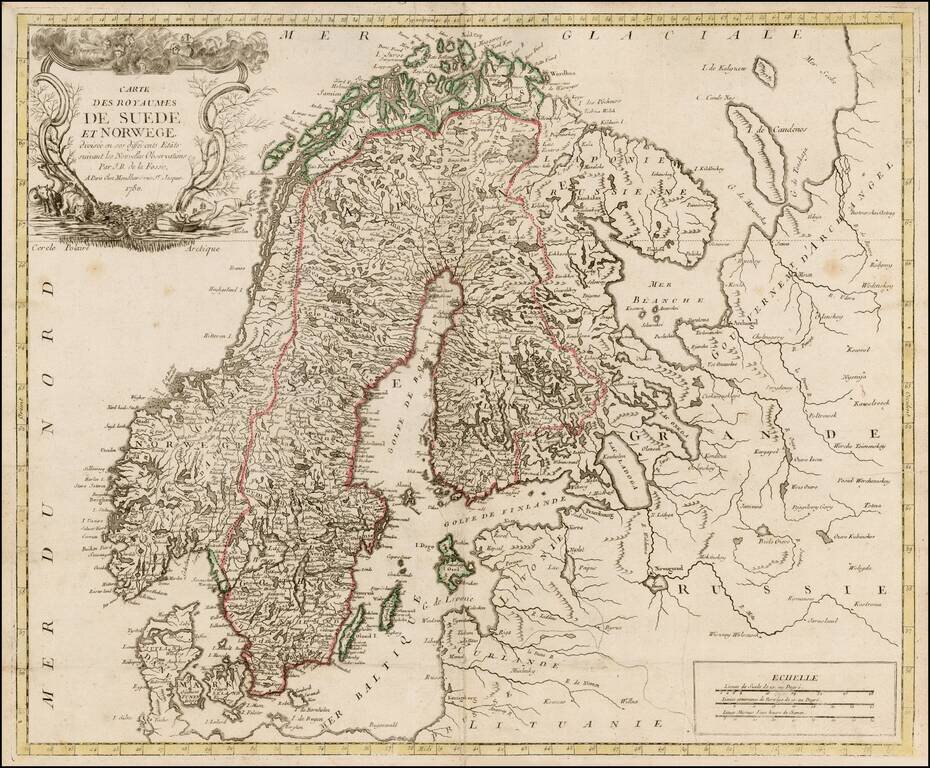
Rare map of Scandinavia by De La Fosse, one of the rarest of the late 18th Century French Mapmakers. This is only the third De La Fosse map we have seen in 20 years.
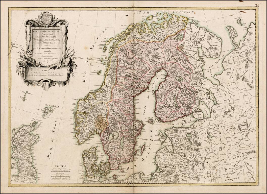
Scarce large format map of Scandinavia, by Janvier, published in Paris.
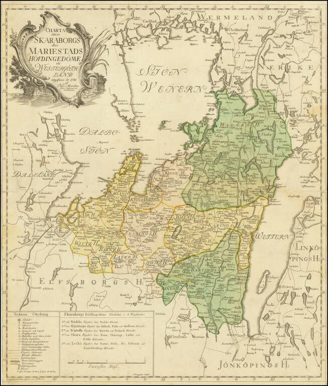
Detailed engraved map of Skaraborg, published in Sweden by Nils Marelius in 1780. The map depicts the area between the lakes Vanern and Vattern. The regional subdivisions, towns, and roads of the area are shown. The map was engraved by C. Bergquist,...
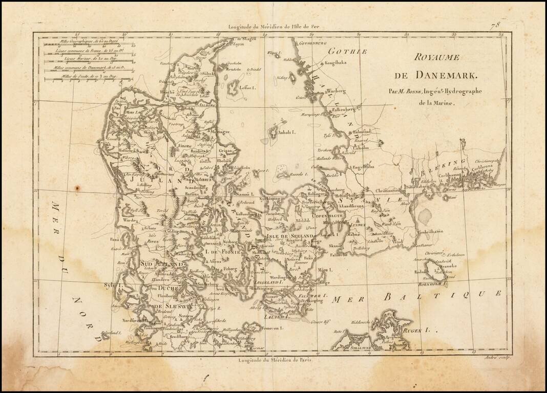
Attractive map of Denmark, with details of cities, rivers, land masses, and oceans. Rigobert Bonne was the official Hydrographer to the King of France.