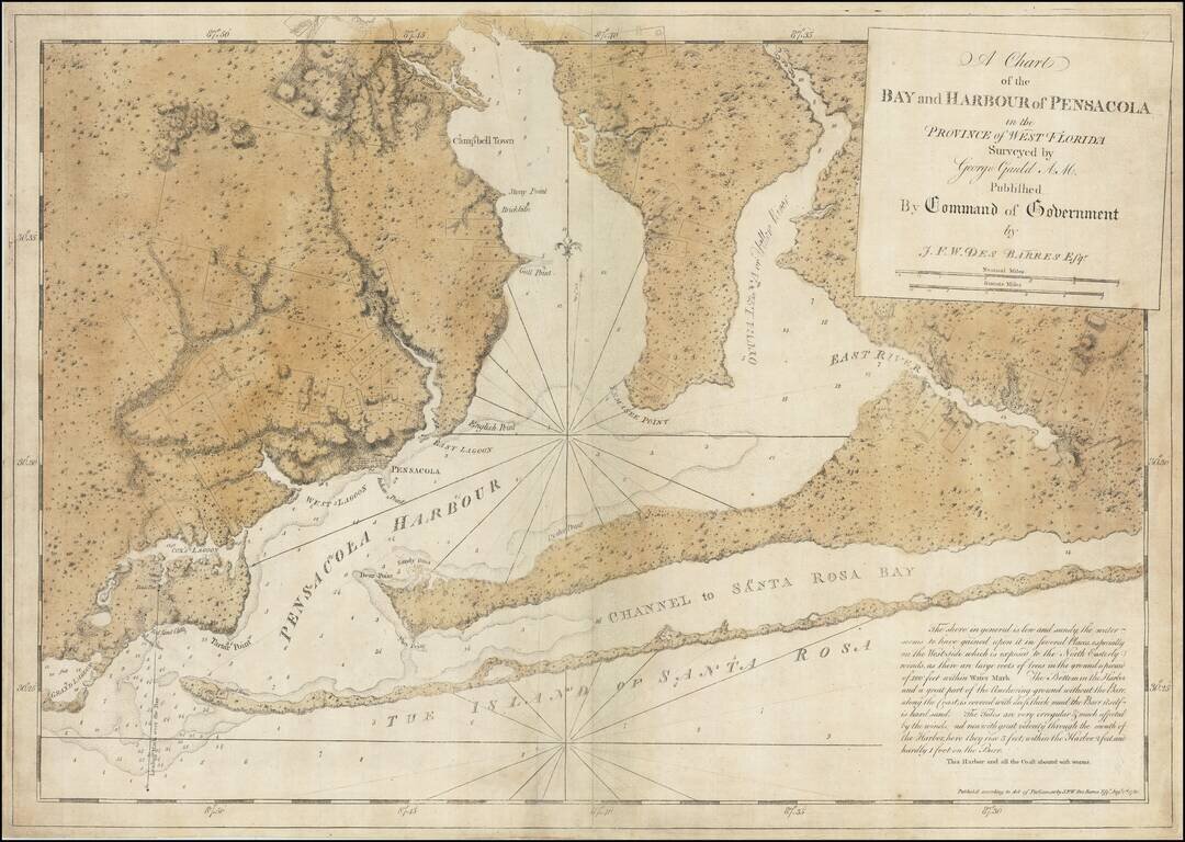
The Only George Gauld Chart Published During His Lifetime. Superb engraved chart of Pensacola Harbor in Florida, published during the American Revolution by J.F.W. Des Barres, from original surveys by George Gauld. The map extends from the eastern...
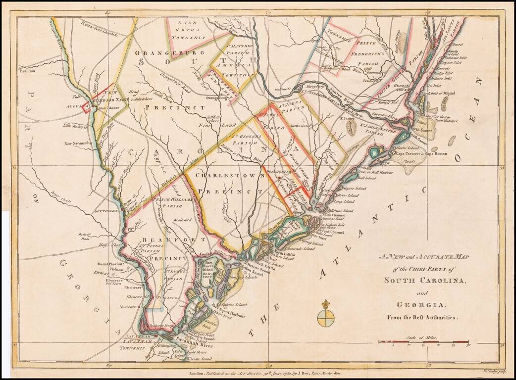
Fine early Revolutionary War map of South Carolina and part of Georgia, engraved by Jonathan Lodge for the Political Magazine of June 1780. The map shows early southern forts, counties, townships, parishes, precincts, towns, roads, rivers, and many...
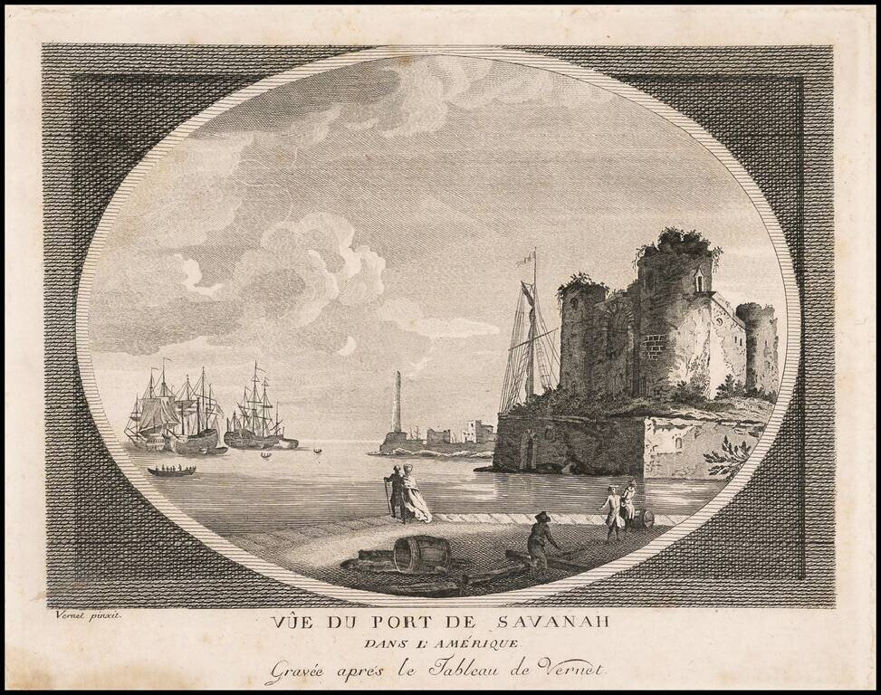
Rare view of the Port of Savannah, engraved by Claude Joseph Vernet in London. Vernet's separately published views were offered for sale individually and in albums. His American views are largely fanciful in nature, but very rare. One of the earliest...
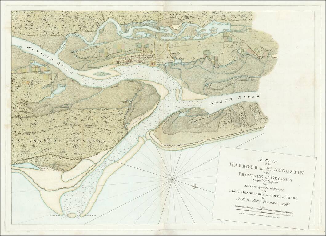
Striking, Intricate Map of St. Augustine, From the Atlantic Neptune Fine example of Des Barres’ massive two-sheet plan of St. Augustine, which featured in his famed and rare sea atlas, the Atlantic Neptune. The town is the oldest...
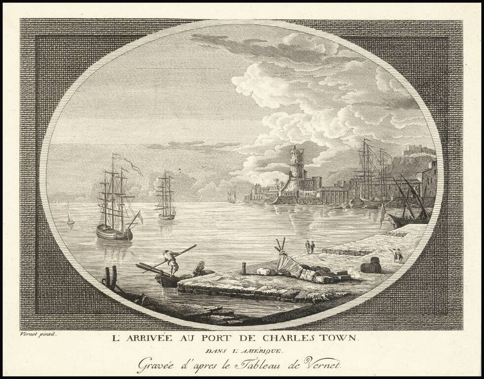
Rare view of the entrance to the port of Charleston, South Carolina, engraved by Claude Joseph Vernet in London. Vernet's separately published views were offered for sale individually and in albums. His American views are largely fanciful in nature,...
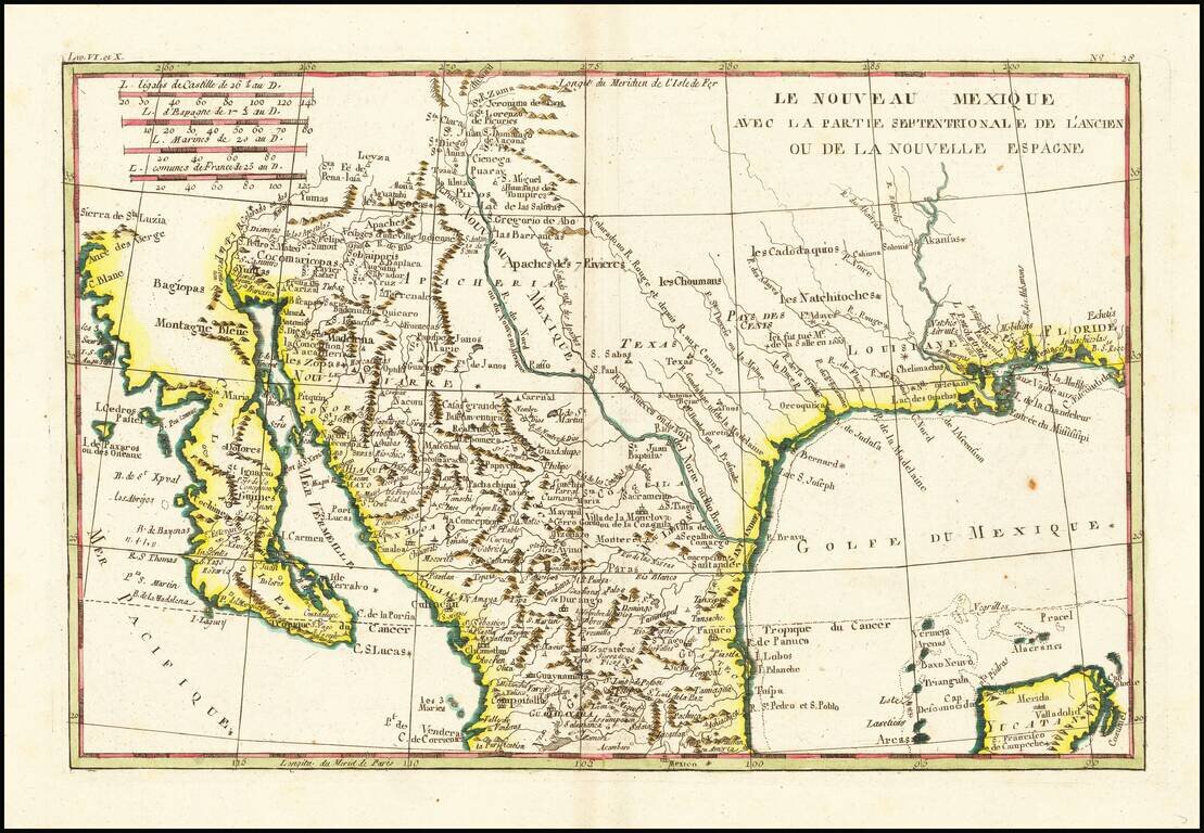
Fascinating map, showing excellent detail in Texas, Arizona and New Mexico. Includes a badly misprojected Baja California, as was normally the case with French maps of the period. Missions and settlements shown in the Texas interior. Indian tribes...
![[Jamaica, Grenada, Dominica and St. Vincent) Carte de L'Isle de la Dominique . . . [and] Carte de L'Isle de la Grenade . . . [and] Carte de L'Isle St. Vincent . . . [ and] Carte De L'Ise de la Jamaique . . .](/map/small/66139.jpg)
Caribbean Theater During the Anglo-French War Rare separately published broadside set of 4 maps of British Colonial islands in the Caribbean, published during Anglo-French Wars in the Carbbean. Invasion of Dominica The Invasion of Dominica on...
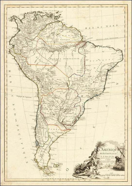
Fine large map of South America, illustrating the continent on the eve of its decades of revolution. The map illustrates the limited knowledge of Europeans in the interior parts of the continent. Among the more interesting features are the...
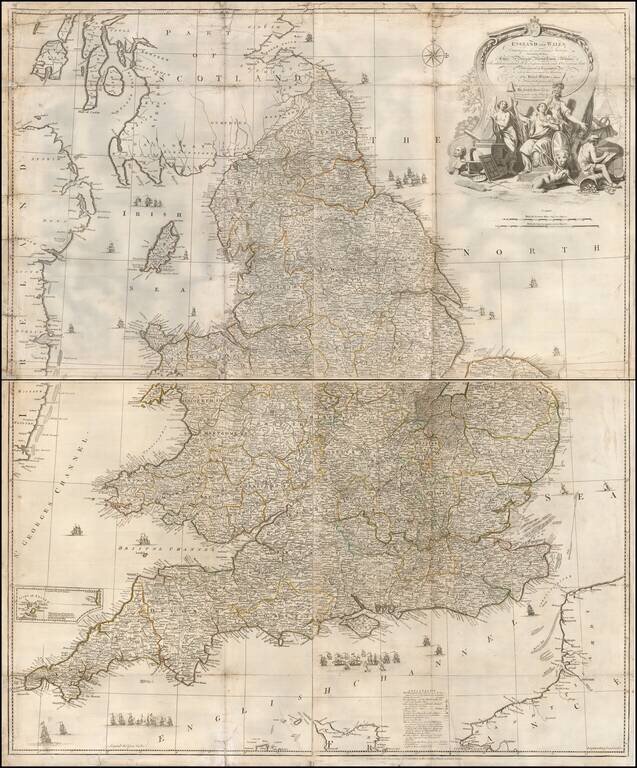
Detailed 4 sheet map of England and Wales, by John Rocque, an immigrant Huguenot who worked in London from 1735 to 1762. Little is known about the early life of Rocque, who worked as a surveyor, engraver and publisher, even though he is mentioned in...
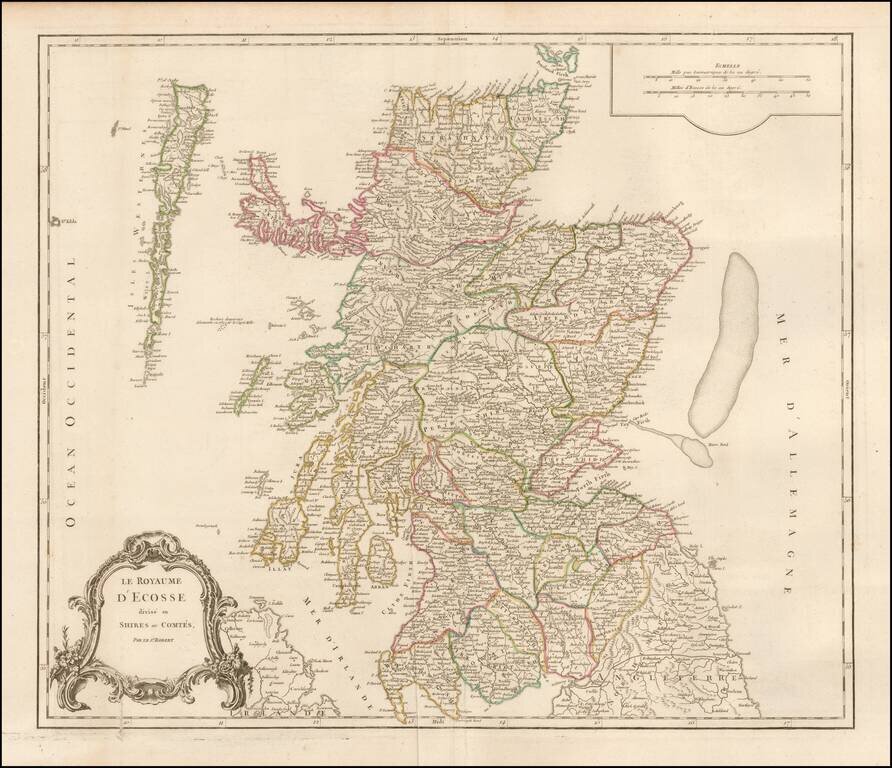
Detailed map of Scotland from a later edition of DeVaugondy's Atlas Universel. Includes towns, mountains, rivers, lakes and a host of other details.
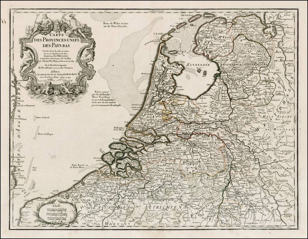
Detailed map of the Netherlands and Belgium, originally based upon the work of De L'Isle and Buache. Decorative Cartouche.
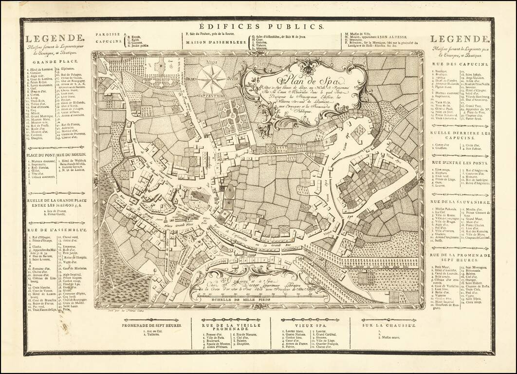
A remarkable early tourist map of Spa, locating its principal buildings, housing for foreigners and public promenades. The map was printed by Freres Caro in Liege and Spa for "Chez F. J. Desoer imprimeur Libraire à la Croix d'or, sur le Pont-d'Isle,...
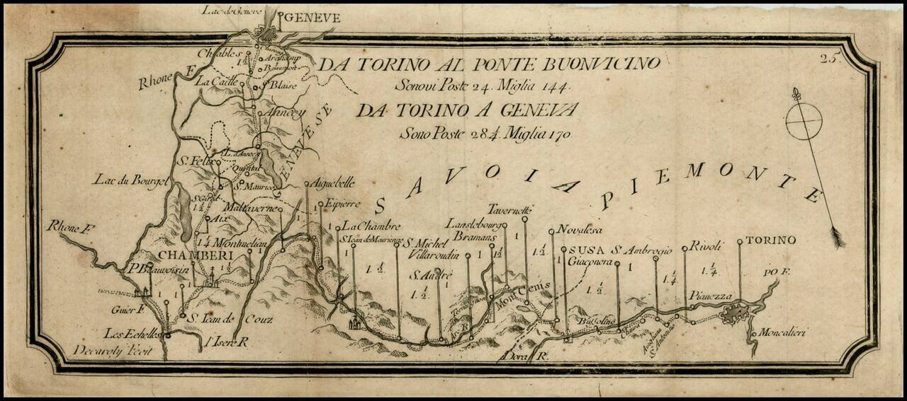
Rare postal roads map, showing the post roads from Torino to Geneva and Torino to Buonvincino. Includes distances, rivers and some topographical features.
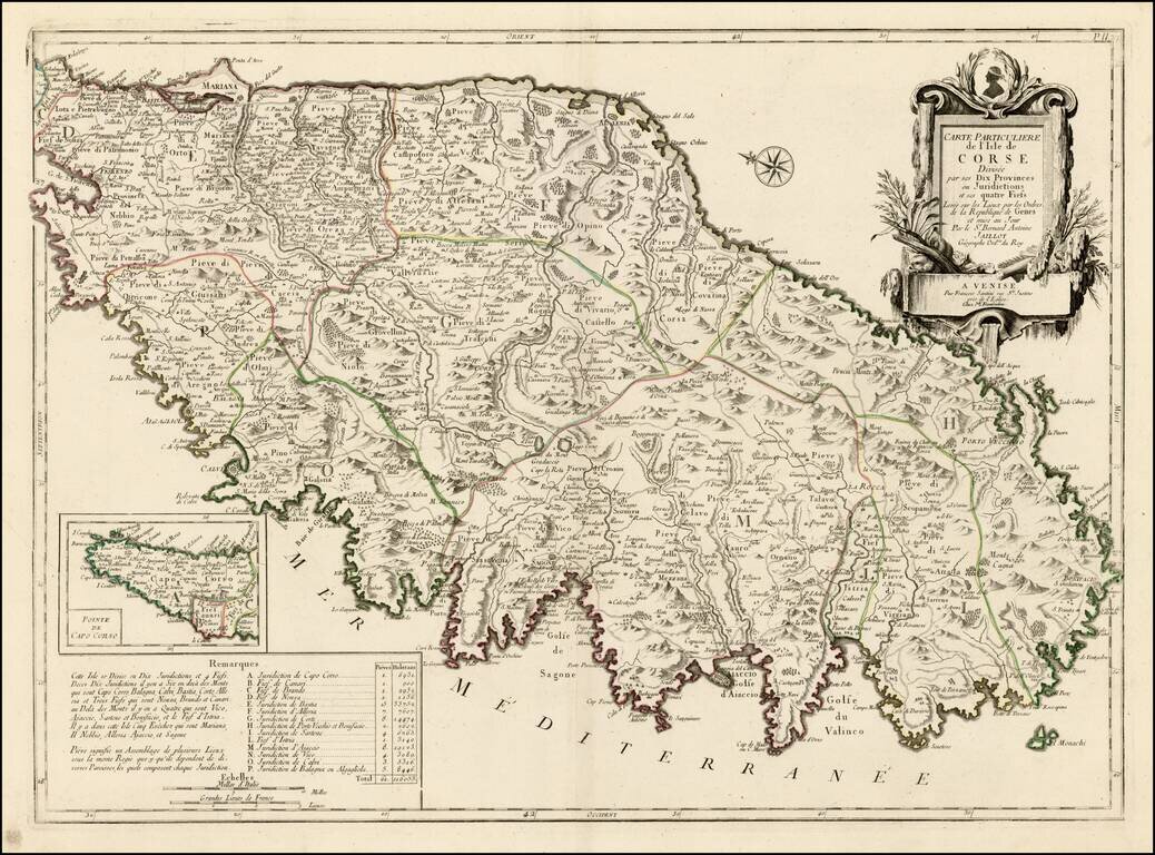
Striking large format map of Corsica, oriented with east at the top. Includes a large decorative cartouche and table showing details of the Jurisdictions and Fiefs. The map shows towns, roads, rivers, lakes, mountains, gulfs and many other details. A...
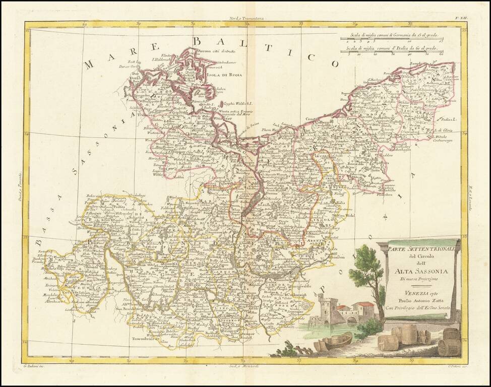
Detailed map of Upper Saxony (Obersachsen), published in Venice by Antonio Zatta in 1780.
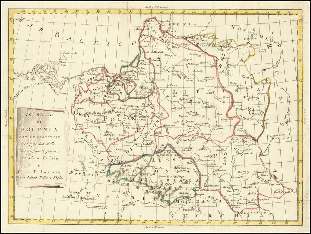
Rare map of Poland, in the midst of its dismemberments. The map locates the Polish territorial acquistions of Russia, Austria and Prussia in the second half of the 18th Century.