![[Odense Fyord Manuscript Map] Beschreibung dess Haffens beij Metsundt Indieser Haffen ist class wasser unterveilen . . .](/map/small/39966se.jpg)
Finely executed manuscript map of the Odense Fjord, prepared at the end of the 18th Century.
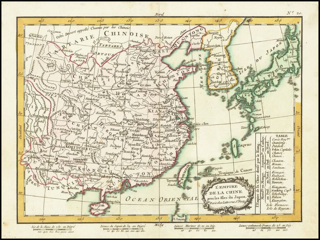
Detailed map of China, Korea and the Islands of Japan, showing the Provinces, towns, mountains, rivers, lakes, islands, published in Paris by Jean Lattre. The map is drawn from D'Anville's atlas of China, the first modern atlas of China and a work...
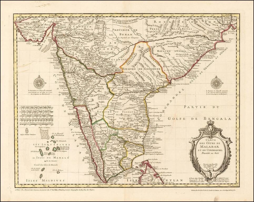
Finely Detailed Map of Southern India Emphasizing Trade Finely engraved map of the southern part of India, first issued in 1723 by acclaimed French mapmaker Guillaume De L’Isle. It focuses on trade routes within India, as well as the Coromandel and...
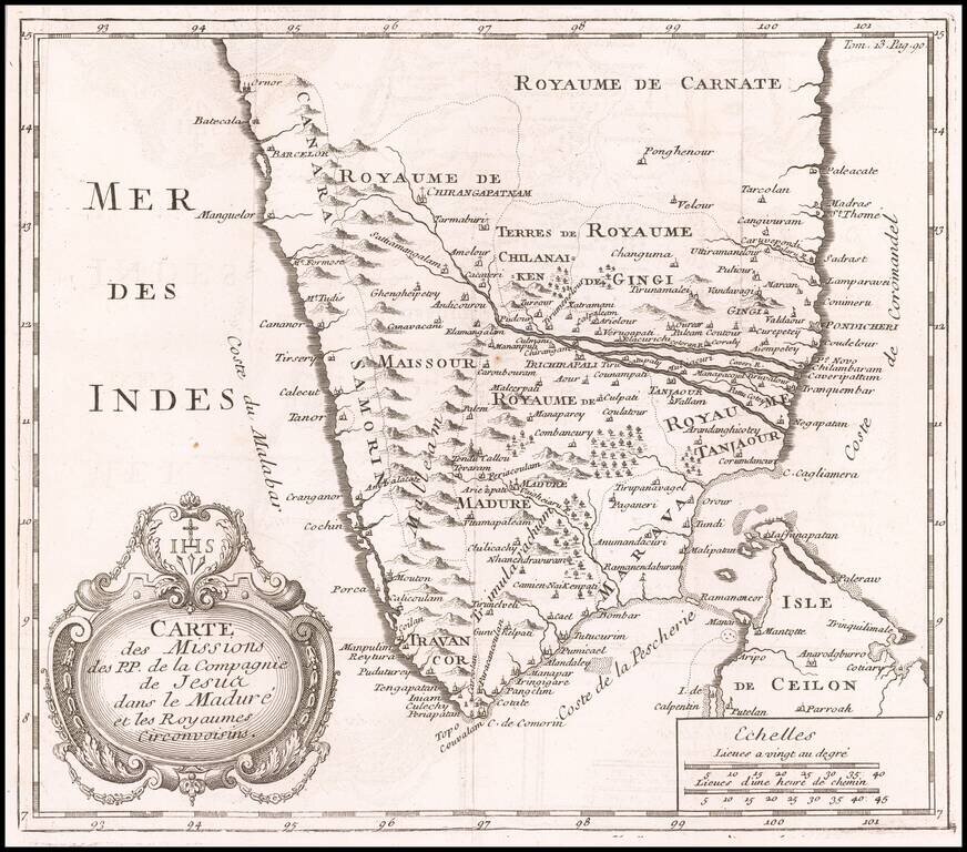
Antique Map of India -- Jesuit Sources Nice copper engraved map of the tip of India and northern part of Sri Lanka showing the Jesuit missions.
![[Philippines, Borneo, Java, etc] La Presqu'Isle De L'Inde Au Dela du Gange, avec L'Arcihpel Des Indes. Partie Orientale](/map/small/46196.jpg)
Fine example of Rigobert Bonne's map of the Philippines, Java, Borneo, Formosa, the Moluques, etc. Very detailed and interesting.
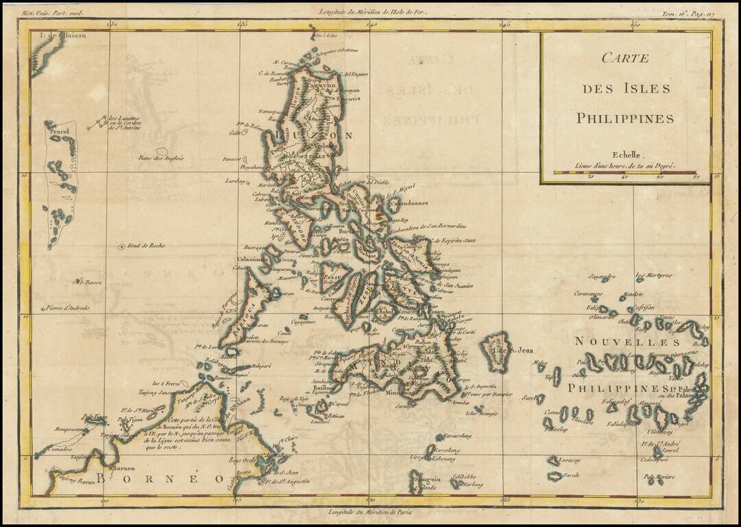
Detailed, scarce map of the Philippines published in Louis Brion de la Tour's Histoire Universel, circa 1780. The map names dozens of cities, shows Manila as the capital, and even includes an illustration of an erupting volcano. Scarborough Shoal and...
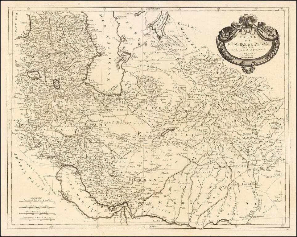
Remondini's edition of the Santini map of the Persian Empire Detailed map of the Persian Empire extending north to the Caspian Sea and Uzbekistan, and from Armenia and the Persian Gulf in the west to the Indus River and the Karachi area in the east....

Cook’s Map of the Southern Hemisphere, Highlighting Historic Exploration toward Antarctica--French Edition French edition of Cook’s highly-detailed, large-format map of the Southern Hemisphere, showing the tracks of major voyages of exploration in...