Map size in jpg-format: 58.8929MiB
Click to open in high resolution (open in new tab).
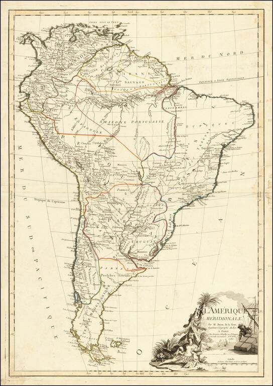
Fine large map of South America, illustrating the continent on the eve of its decades of revolution.
The map illustrates the limited knowledge of Europeans in the interior parts of the continent.
Among the more interesting features are the designations "Amazones Espagnole" and Amazones Portugaise," showing the regions of the Amazon controlled by the two major colonial powers, as divided in the 16th century by the Pope.
The map is finished with an elaborate allegorical cartouche, showing America as woman feeding her children, while an industrious European secures goods for the voyage across the Atlantic back to Europe.
If you are a student, write to us in telegram: @antiquemaps and indicate what material you need and for what work you need a map in high detail. We are ready to provide material on special terms. For students only!


![[Signed Political Satire Artwork] Vietnam ... Vietnam ... Vietnam ...](/map/small/68726.jpg)