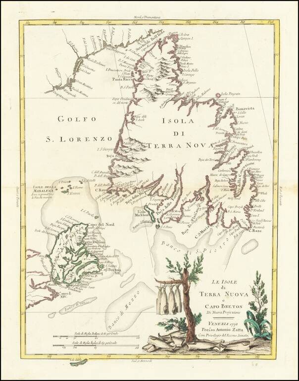
Gorgeous separate map of Newfoundland and Cape Breton Island, along with neighboring Islands, including St. Pierre Michelon. Antonio Zatta was a leading European cartographer and publisher, and his Atlante Novissimo was one of the most beautifully...
![[Hispaniola, Cuba, Martinique and Guadalupe] Carte de S.Domingue . . . / Carte de Cuba . . . / Carte de Martinique . . . / Carte de Guadalupe et des Isles de Saintes . .](/map/small/70543.jpg)
Fine, Detailed French Map of Prominent Caribbean Islands Rare, separately-published map illustrating Hispaniola, Cuba, Martinique and Guadaluope. Each inset map is nicely detailed and includes a description in the title block. This text offers a...
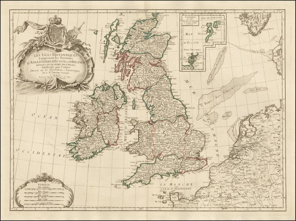
Decorative Italian map of the British Isles, published by Santini in Venice and engraved by Remondini. The map includes an elaborate cartouche, surmounted by a coat of arms, with a large inset of the Orkney and Shetland Islands. Scale of miles in the...
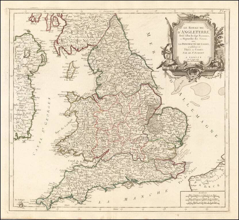
Detailed Santini/Remondini map of the English Heptarchy. An excellent large format map of England and Wales, divided by Heptarchies and showing towns, rivers, lakes, roads and many other details. Based upon De Vaugondy's map first issued in the early...
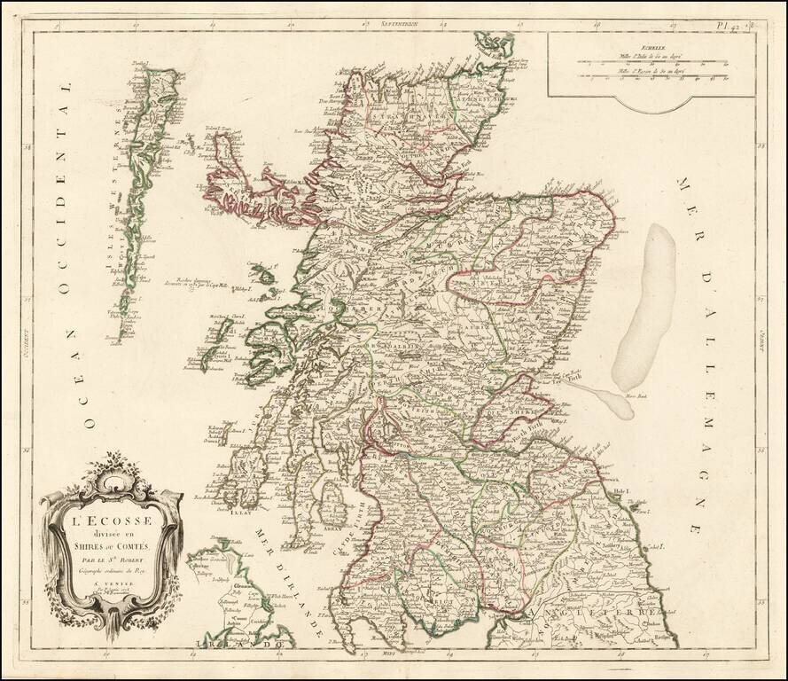
Decorative Italian map of Scotland, published by Santini in Venice and engraved by Remondini. The map includes a decorative cartouche and scale of miles in the top right corner. The map is colored by the early provinces and counties, with the...
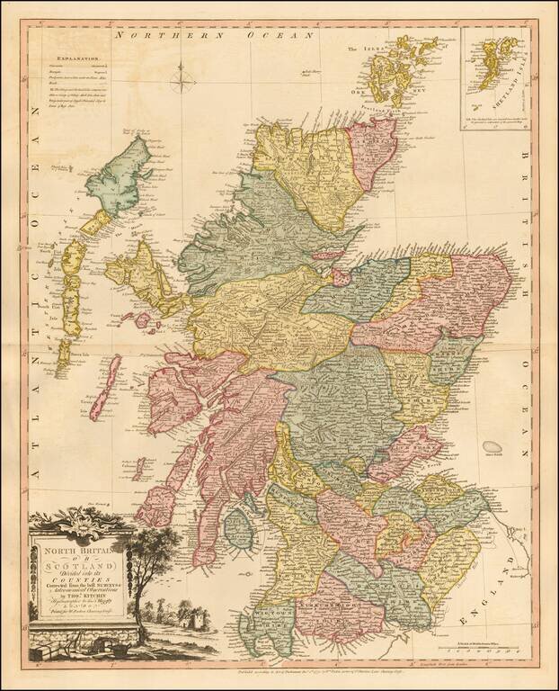
Striking map of Scotland, colored by shires, from Faden's General Atlas. One of the best late 18th Century maps of Scotland to appear in a commercial atlas.
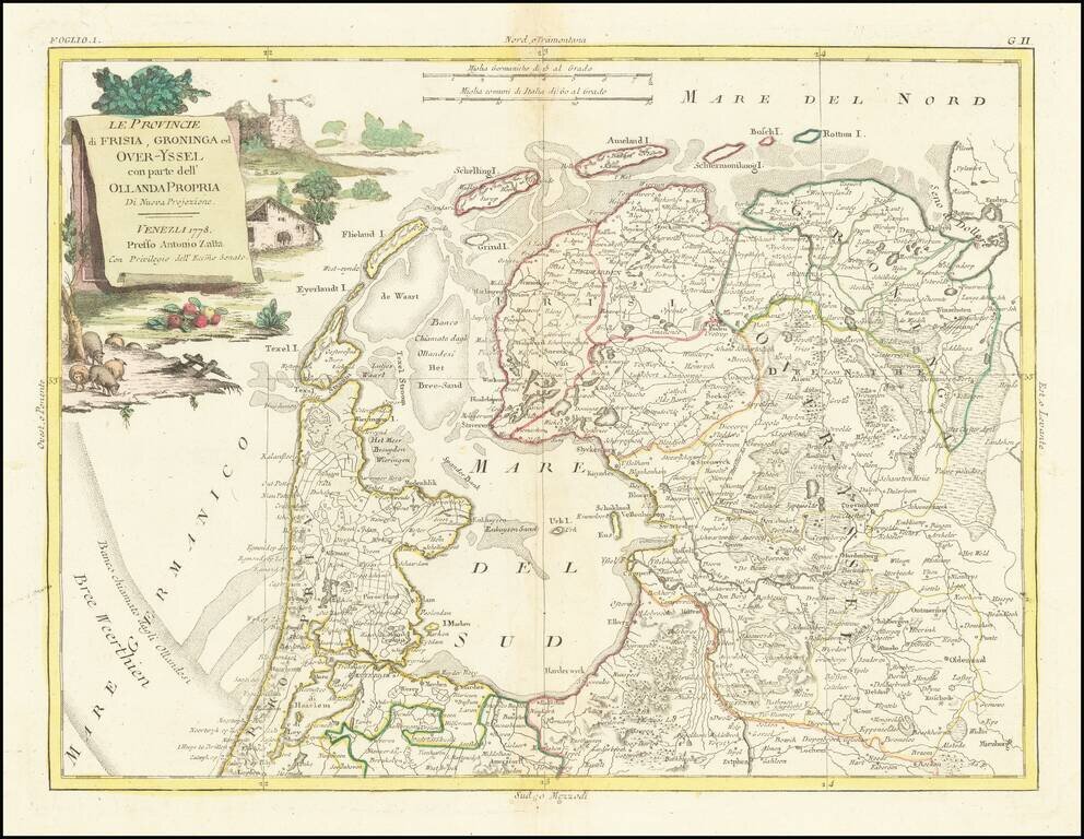
Decorative map of Dutch provinces of Frisia, Over-Yssel and Groningen, from Zatta's Atlante Novissimo.
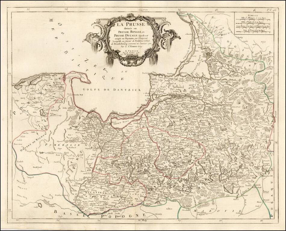
Fine and highly detailed map of parts of Poland, Kaliningrad, Lithuania, etc. Shows the Kingdom granted to Frederick I of Prussia, after Prussia was elevated by Leopold to the status of a Kingdom in 1700. Frederick made himself the King of Prussia on...
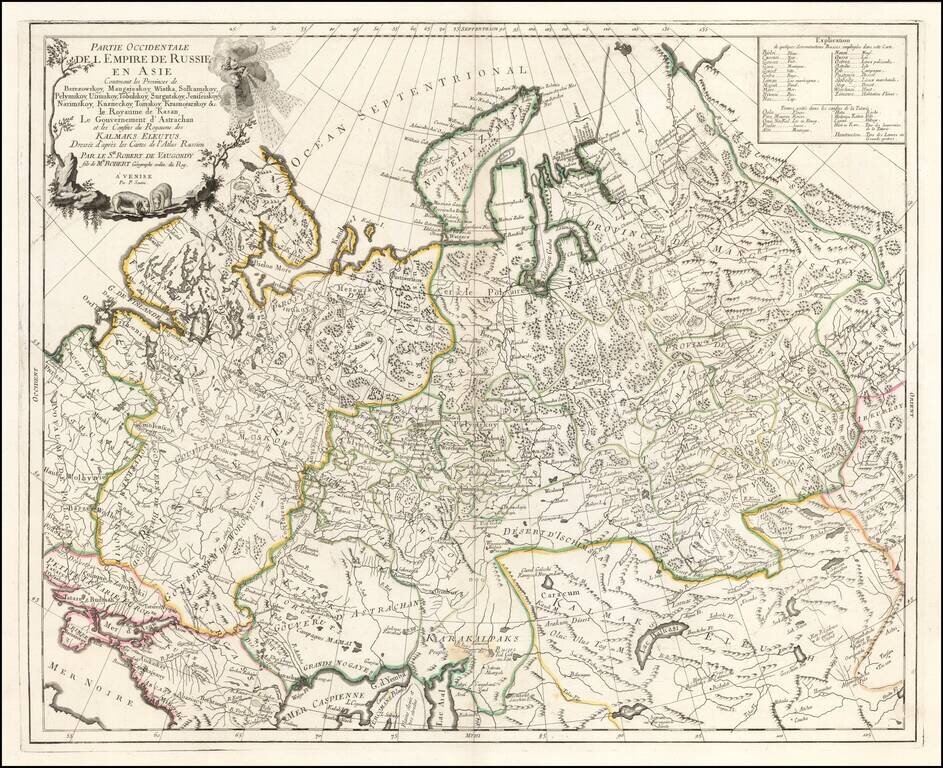
Highly detailed map of the Western Part of Russia, extending South to the Caspian and East to Irkurkoy and Ilimskoy. The map is drawn from the Atlas of Russia compiled under the direction of Joseph Nicolas De L'Isle in St. Petersburg.
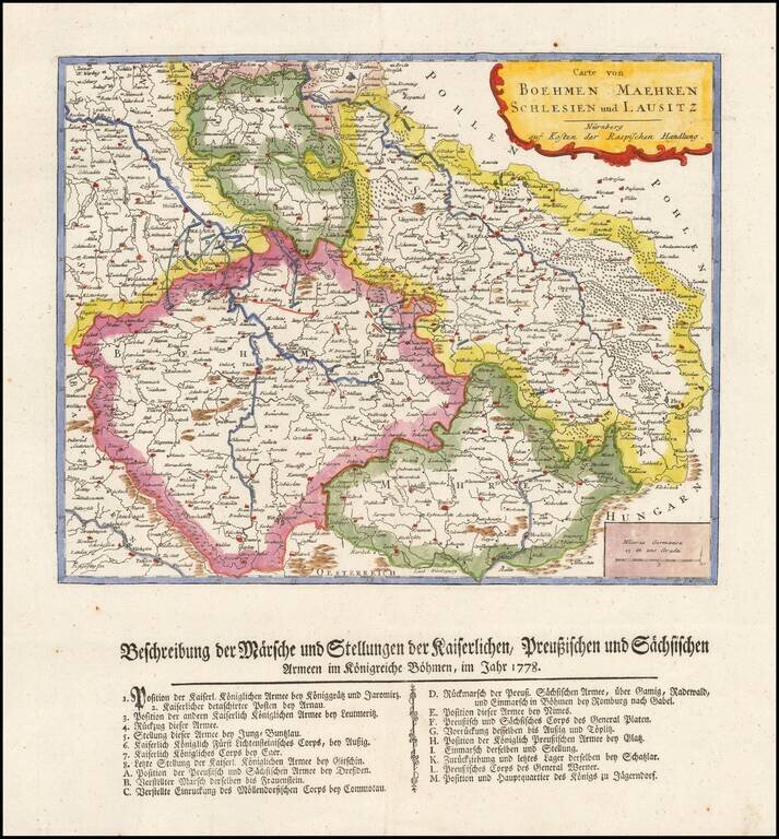
Rare separately published map showing a description of Marche and the position of the imperial Prussian and Sachis armies in Bohemia in 1778.
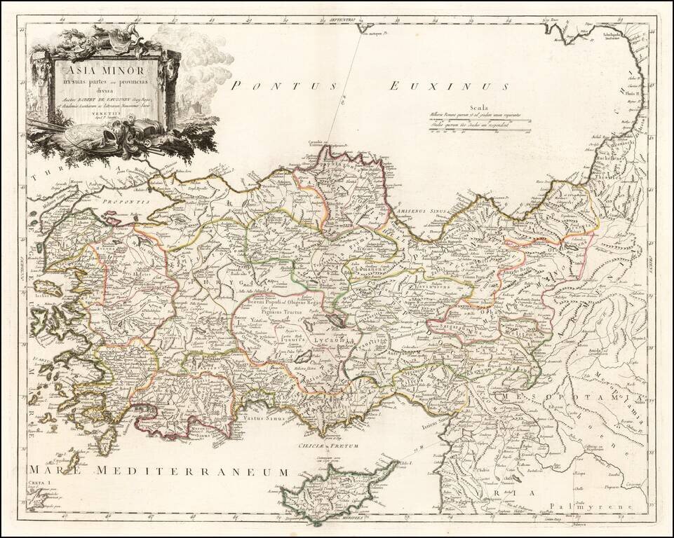
Detailed map of Cyprus, Asia Minor and contiguous Islands and the Black Sea region, from Paola Santini's large atlas, published in Venice.
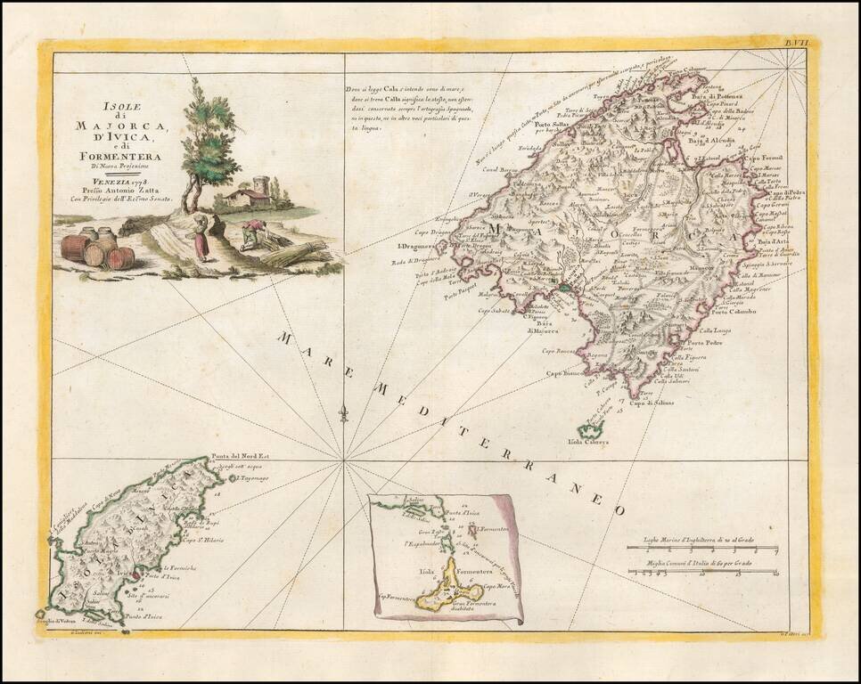
Detailed map of the the Balearic Islands of Ibiza and Majorca. Very interesting early map, with nice detail. Decorative title cartouche. From Zatta's monumental Altante Novissimo, one of the last great decorative atlases of the 18th Century.
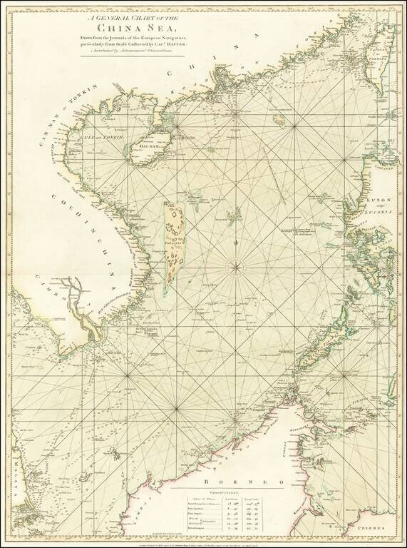
Stunning Original Hand-Color. Rare English sea chart of the South China Sea, published in London by Robert Sayer for an early edition of his The Oriental pilot, or, A select collection of charts and plans ... for the navigation of the country trade in...
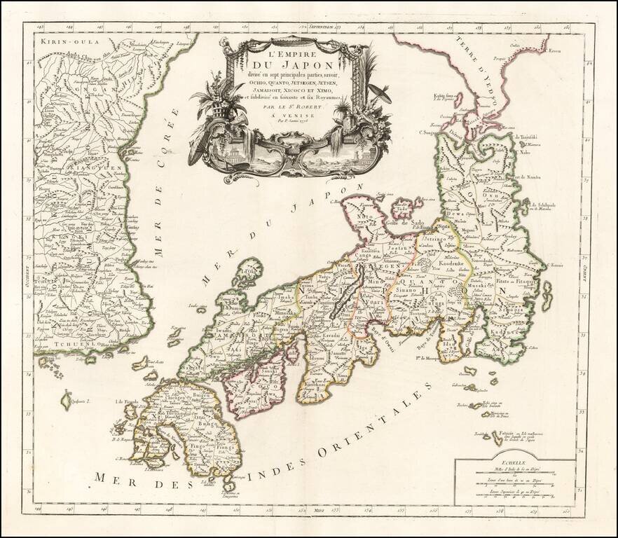
Fine early map of Japan and Korea published in Venice by Francois Santini. The sea between Japan and Korea is prominently labeled Mer de Coree. The map is one of the best large format maps of Japan and Korea to appear in a commercial atlas. One of...
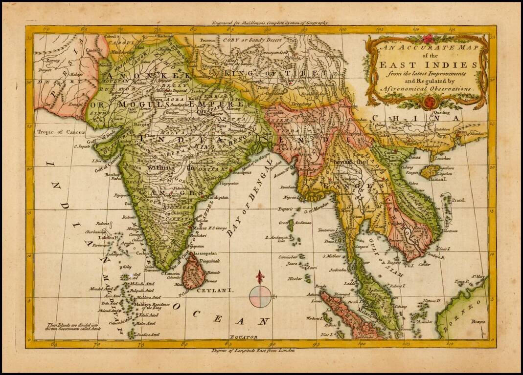
Detailed map of Southeast Asia and India, from Middleton's Geography. Includes a decorative title cartouche.
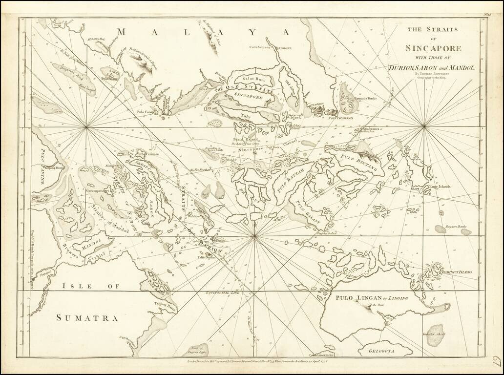
Extremely rare chart of Singapore and the surrounding region, compiled by Thomas Jefferys, and published by Sayer & Bennett in London in 1778. The map extends from Sumatra in the southwest to just north of Singapore in the north. Numerous islands...