logo

1778. An Accurate Map of the East Indies from the Latest Improvements and Regulated by Astronomical Observations

  • An Accurate Map of the East Indies from the Latest Improvements and Regulated by Astronomical Observations

An Accurate Map of the East Indies from the Latest Improvements and Regulated by Astronomical Observations information:

Year of creation: 
Resolution size (pixels): 
 2551x1832 px
Disk Size: 
 1.06131MiB
Number of pages: 
 1
Place: 
 London

Print information. Print size (Width x height in inches):
Printing at 72 dpi 
  35.43 х 25.44
Printing at 150 dpi 
 17.01 х 12.21
Printing at 300 dpi 
 8.5 х 6.11

An example of detailing the file of this map of in a printable high-resolution:

Click to open in high resolution (open in new tab).
Attention! this is just the central piece (central area 960x960 px) of the map file!
This is an example, so that you can see and study the level of detail of a given map. The entire Map will be fully available after payment!

An Accurate Map of the East Indies from the Latest Improvements and Regulated by Astronomical Observations

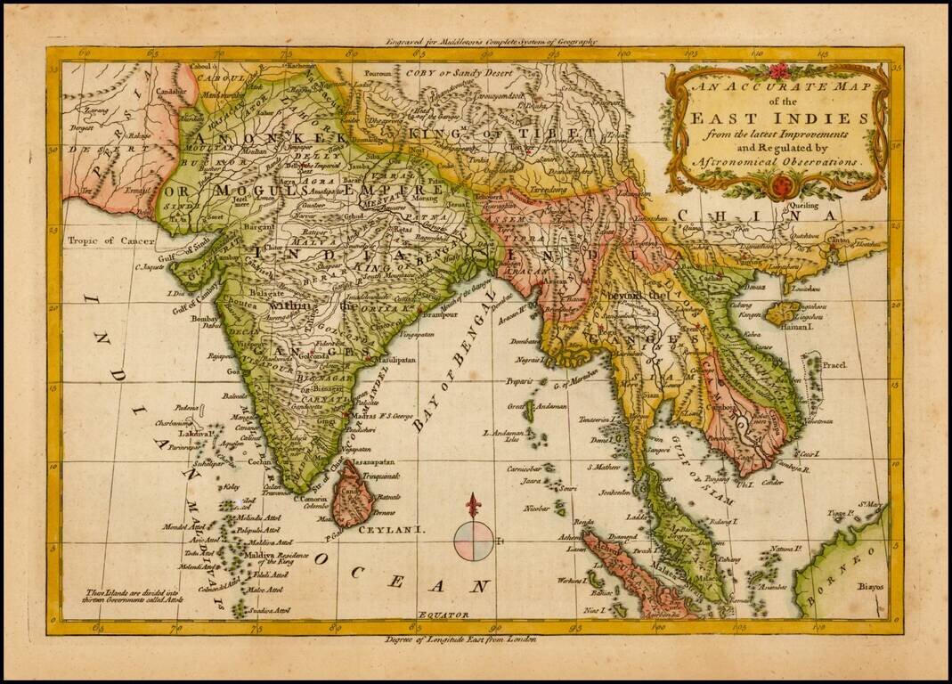
Detailed map of Southeast Asia and India, from Middleton's Geography.

Includes a decorative title cartouche.


Special conditions for students!

If you are a student, write to us in telegram: @antiquemaps and indicate what material you need and for what work you need a map in high detail. We are ready to provide material on special terms. For students only!

Item information:

Year of creation:
Size:
2551x1832 px
Disk:
1.06131MiB
Number of pages:
1
Place:
London
Author:
Christopher T. Middleton.
$9.99

Related item