![Sphere De Ptolemee [with] Rose De Boussole…](/map/small/63929.jpg)
Decorative chart, showing a compass rose, Ptolomaic Sphere and various other 18th Century spheres, from Janvier's Atlas.
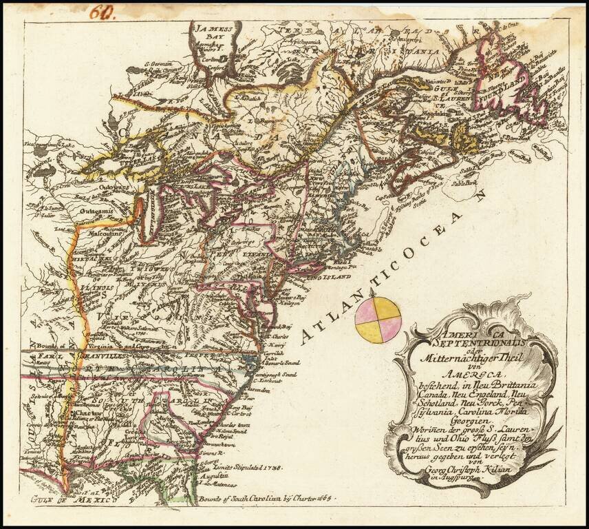
Rare map of the British Colonies at the conclusion of the French & Indian War, originally engraved by Georg Christoph Kilian and included in from Heiden's Americanische urquelle derer innerlichen kriege des bedrängten Teutschlands. . . The map...
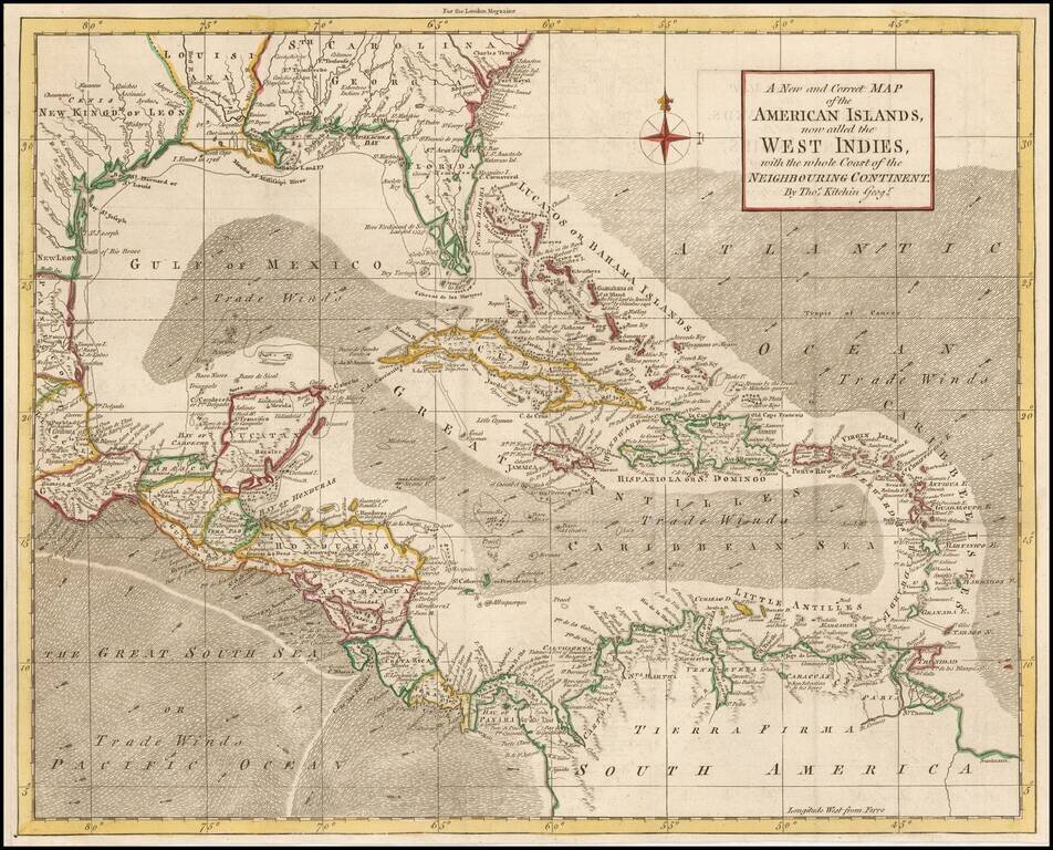
Detailed map of the Caribbean and Southeastern US, extending to Texas, Mexico, Central America and South America. Numerous annotations throughout.
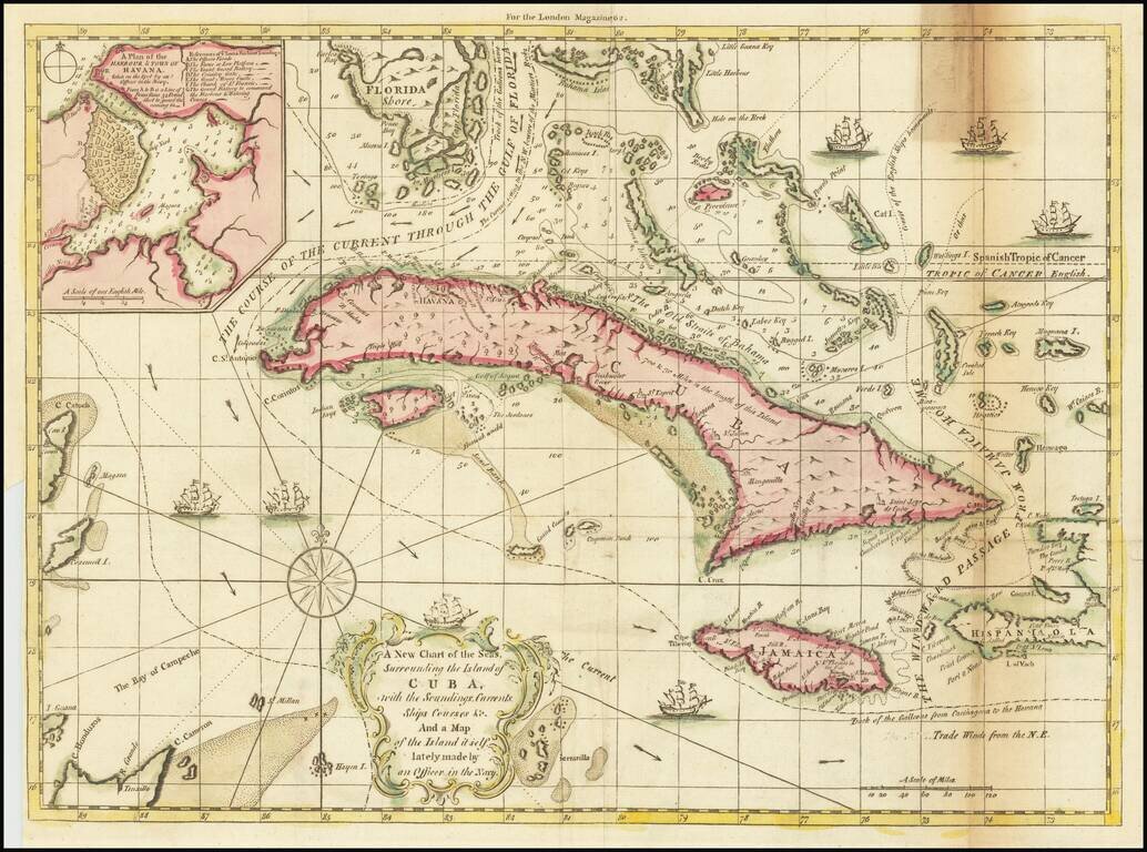
Scarce map of Cuba, the Bahamas, the southern tip of Florida and contiguous islands, highlighting the various trade routes in the Caribbean. "The Course of the Current Through The Gulf of Florida" is prominently labeled, as is the Track of the...
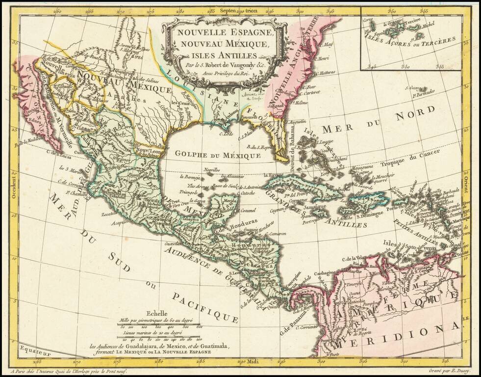
Antique Map of Texas, Mexico and the American Southwest, Florida and the Caribbean Scarce map of the Southwest, Caribbean and Gulf Coast, from De Vaugondy's Nouvel Atlas Portatif. Includes a marvelous contemporary cartographic representation of the...
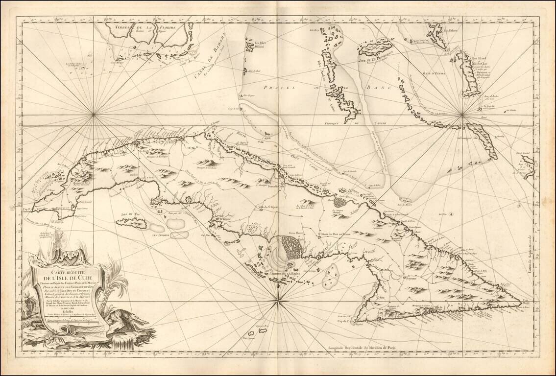
Fine Large Format Chart of Cuba By France's Royal Hydrographer Superb, large sea chart covering all of Cuba with the Florida Keys and the southern Bahamas from Bimini eastward, published in Paris for the Depot de la Marine, by Jacques Nicolas...
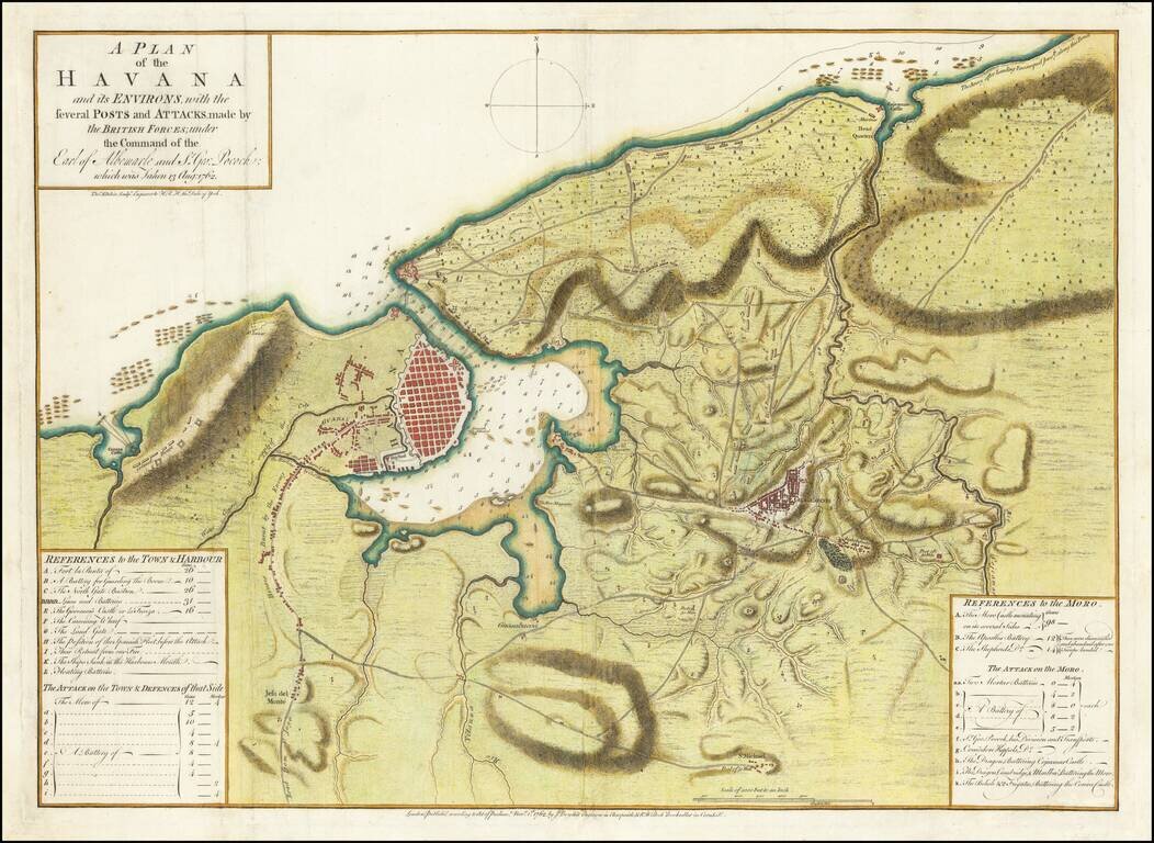
Perhaps the First Separate Map of the 1762 Siege of Havana. Extremely rare separately issued map of showing the British Siege of Havana, at the tail end of the French & Indian War. This map, published November 1, 1762, by John Boydell and R....
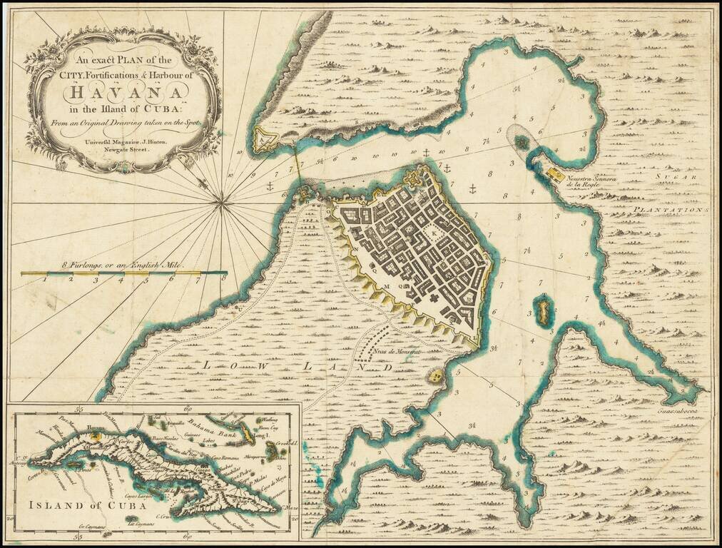
Detailed plan of Havana Harbor, showing fortifications, soundings, topographical details, etc. Includes a large inset of Cuba.
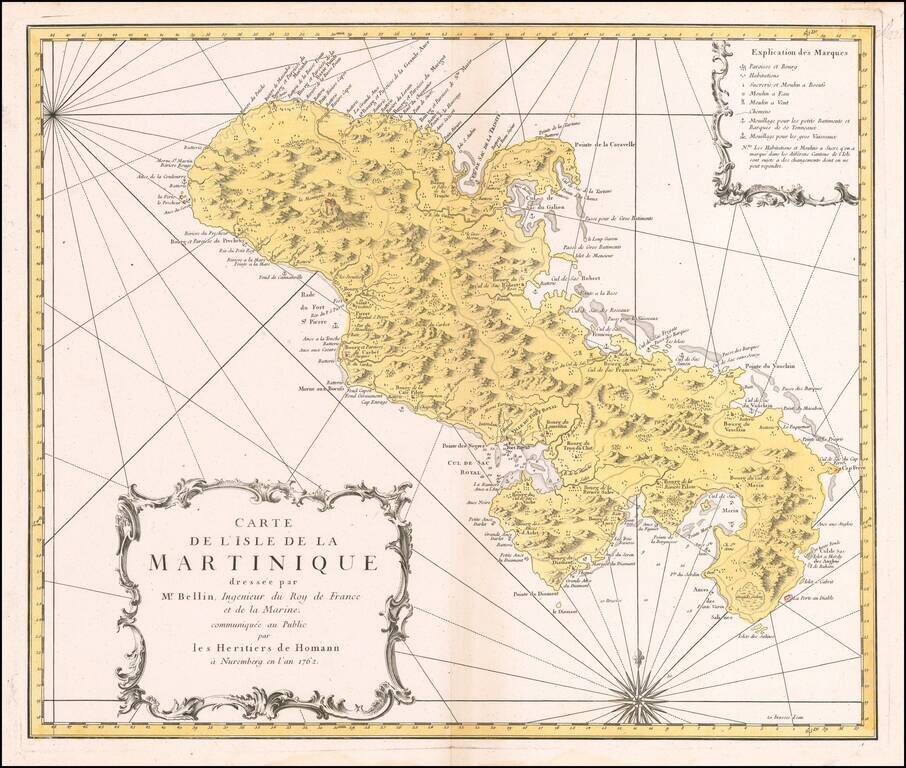
Decorative map of Martinique, published by the Homan Heirs in Paris. A highly detailed map of Martinique, based upon an earlier chart published by Nicholas Bellin in Paris. Depicted in the form of a sea chart with rhumb lines, the chart shows...
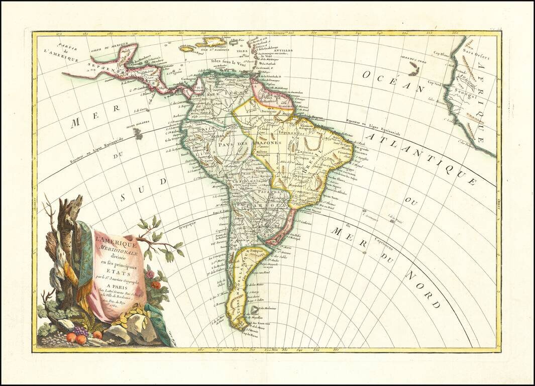
Decorative map of South America, published in Paris by Jean Janvier. A classic example of the French unwillingness to enhance maps with speculative cartography. Large decorative cartouche.
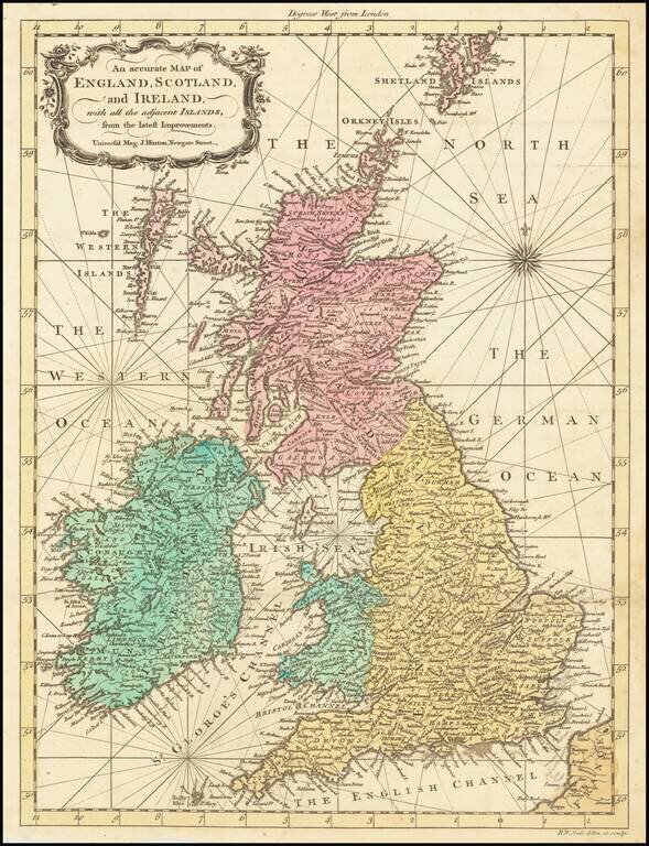
Scarce old color example of R.W. Seale's map of Great Britain, which appeared in the Universal Magazine in 1762. The map incorporate rhumb lines, a feature typical of working sea charts of the 18th Century.
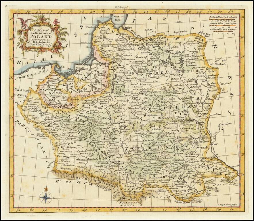
Scarce English map of the Kingdom of Poland (and Lithuania) on the eve of its initial dismemberment. The map appeared in Busching's A new system of geography: in which is given, a general account of the situation and limits... of the several kingdoms...
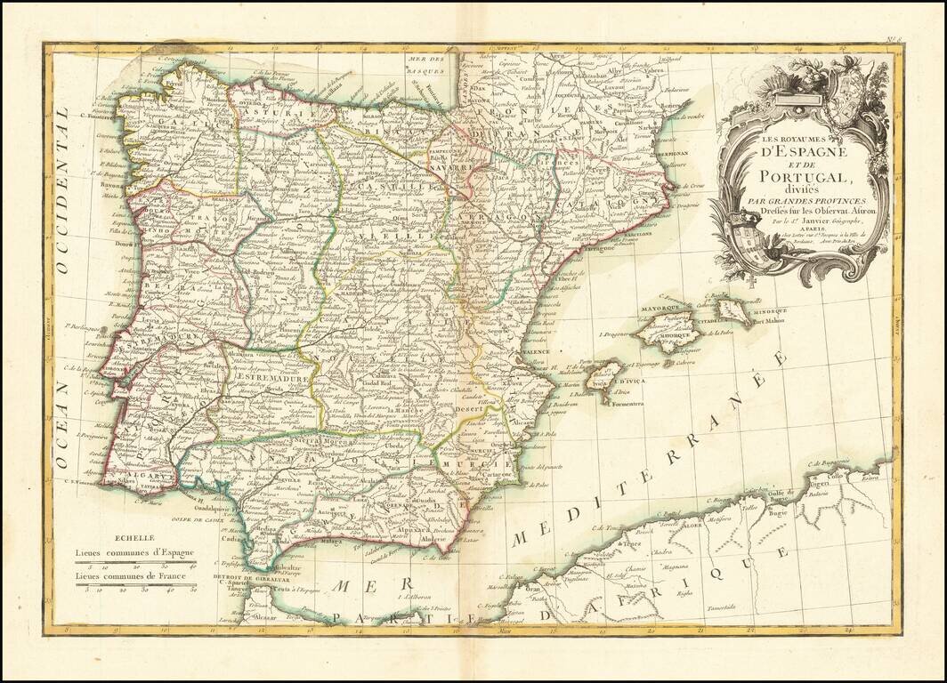
Attractive map of the Iberian Peninsula, colored by province in outline color. Includes the Balearic Islands. Shows towns, rivers, lakes, islands, mountains, etc. Large decorative cartouche.
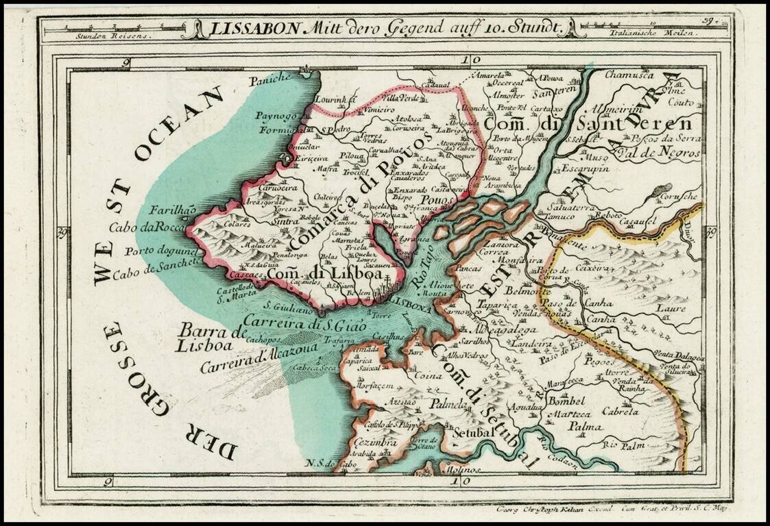
Detailed map of the Lisboa and the lower part of the Tago River, from Heiden's Americanische urquelle derer innerlichen kriege des bedrängten Teutschlands. . .
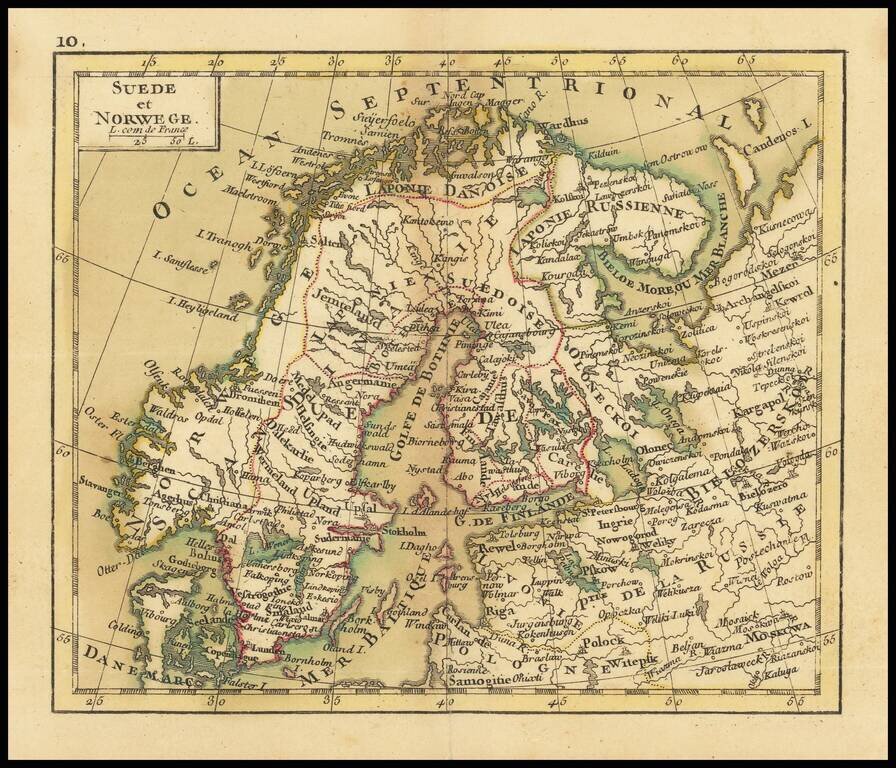
Small engraved map of Scandinavia and northwestern Russia. The map is scarce, this being the first time we have had it.