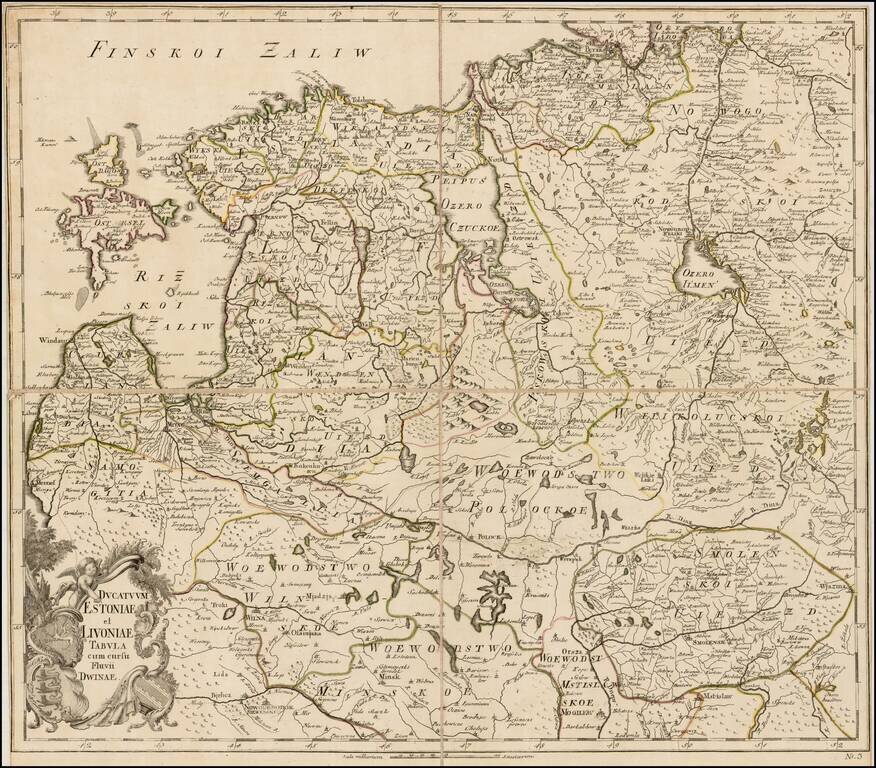
Rare separately issued map of Estonia, Latvia, Lithuania and contiguous parts of Russia and Belarus, published by the Akademiia nauk SSR (Russian Academy of Science) in St. Petersburg. The map extends south to Wilna and Minsk, showing remarkable...
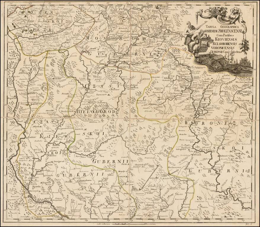
Fine separately issued example of JN De L'Isle's map extending from Moscow to the Ukraine, from the Atlas Russicus (Atlas Rossiiskoi). The first atlas of Russia, published by the Academy of Sciences in St. Petersburg, expanding on the cartographic...
![[The Course of the Neva River from Lake Lagoda to St. Petersburg] Теченїе Невы рѣки изъ-ладожского озера къ Ст: Петербургу.](/map/small/59696.jpg)
Russian-Language Map of the Neva River, Running Between Lake Lagoda and St. Petersburg. Engraved map of the Neva River from the 1745 Atlas Russicus. The cartouche includes allegorical figures and the coats of arms of St. Petersburg and the Russian...
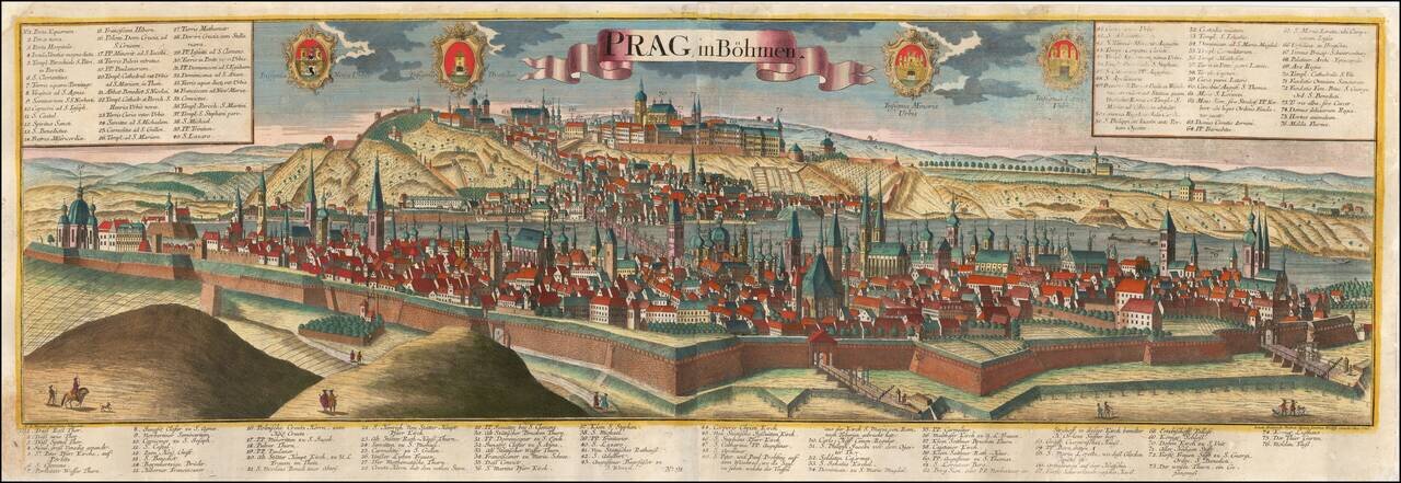
A Fine Large View of Prague Striking large format view of Prague, published by Johann Friedrich Probst (Heirs of Jeremiah Wolff), including 4 decorative coats of arms. Includes a key locating 76 places on the view. The view is based upon the...
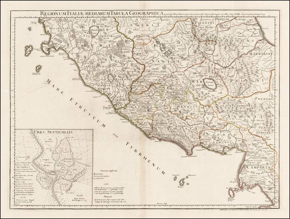
Detailed map of a portion of Italy, showing the regions in ancient times, including Etruscan Tuscany, Sabini, Vestini, Marruncini, Peligni, Latini, Henrici, Samnium, Volsci, Ausones and part of Ubria and Picentes. Many early towns, roads, rivers,...
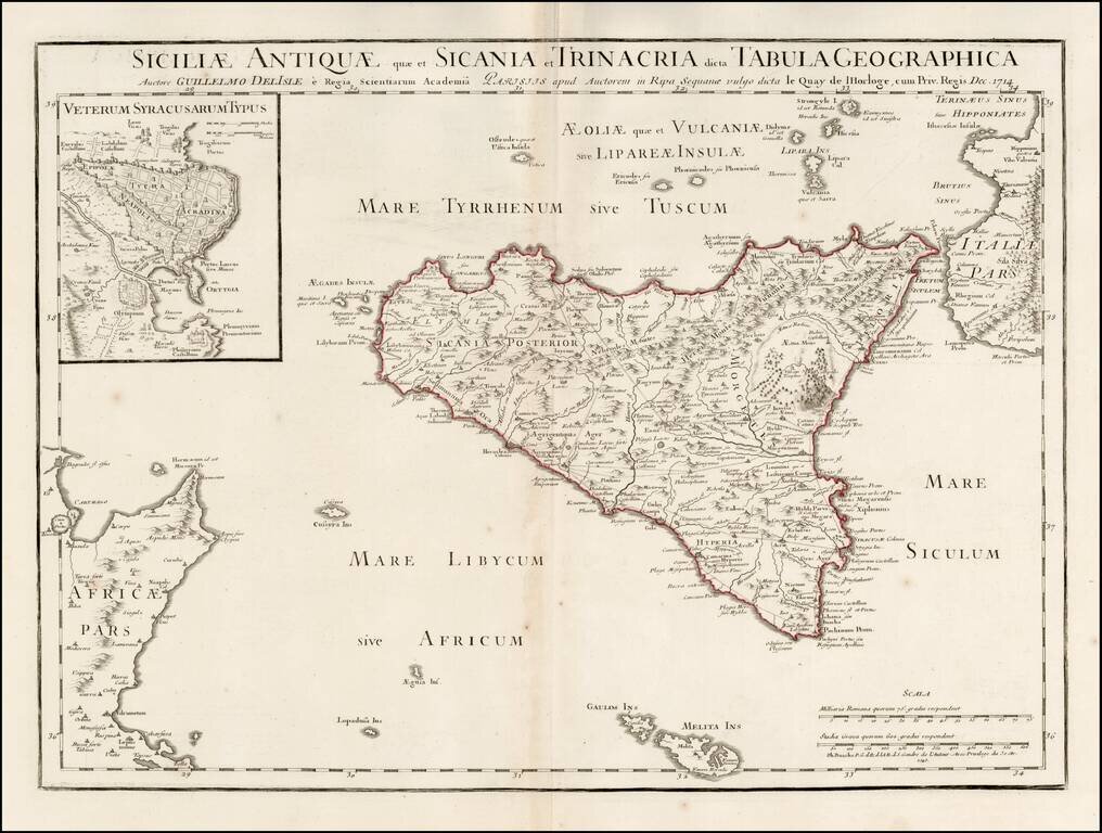
Scarce map of Ancient Sicily, with a large inset of Syracuse, originally published by Guillaume De L'Isle in 1714. Detailed map of ancient Sicily, showing roads, mountains, rivers, towns, harbors, smaller islands, etc. Extends south to Malta. Shows...
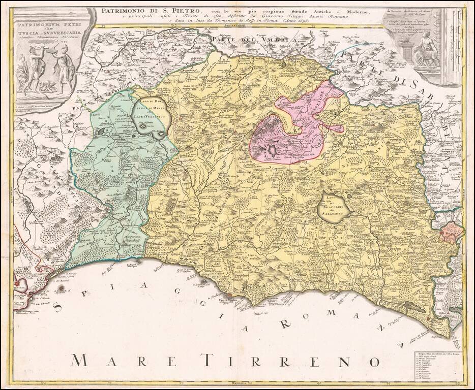
Decorative regional map of Tuscany and the northern part of Lazio, centered on Lago Bolseno and including a massive decorative cartouche. The map is based upon Giovanni Giacomo Rossi's 4-sheet map of the region, published in 1696.
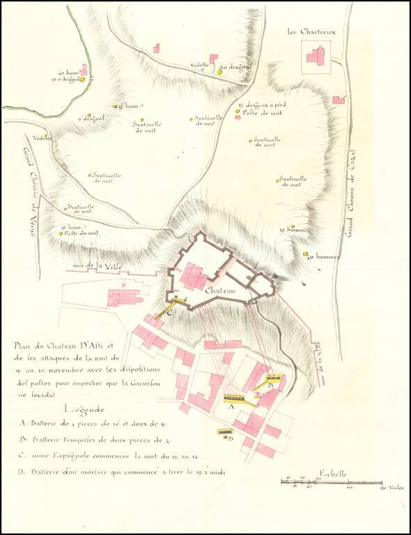
Manuscript Plan of The Defense of Asti in November 1745 -- War of Austrian Succession Finely executed area around Asti in the Piedmont region of Italy, drawn during the War of Spanish Succession. Asti was invaded a number of times by the French in...
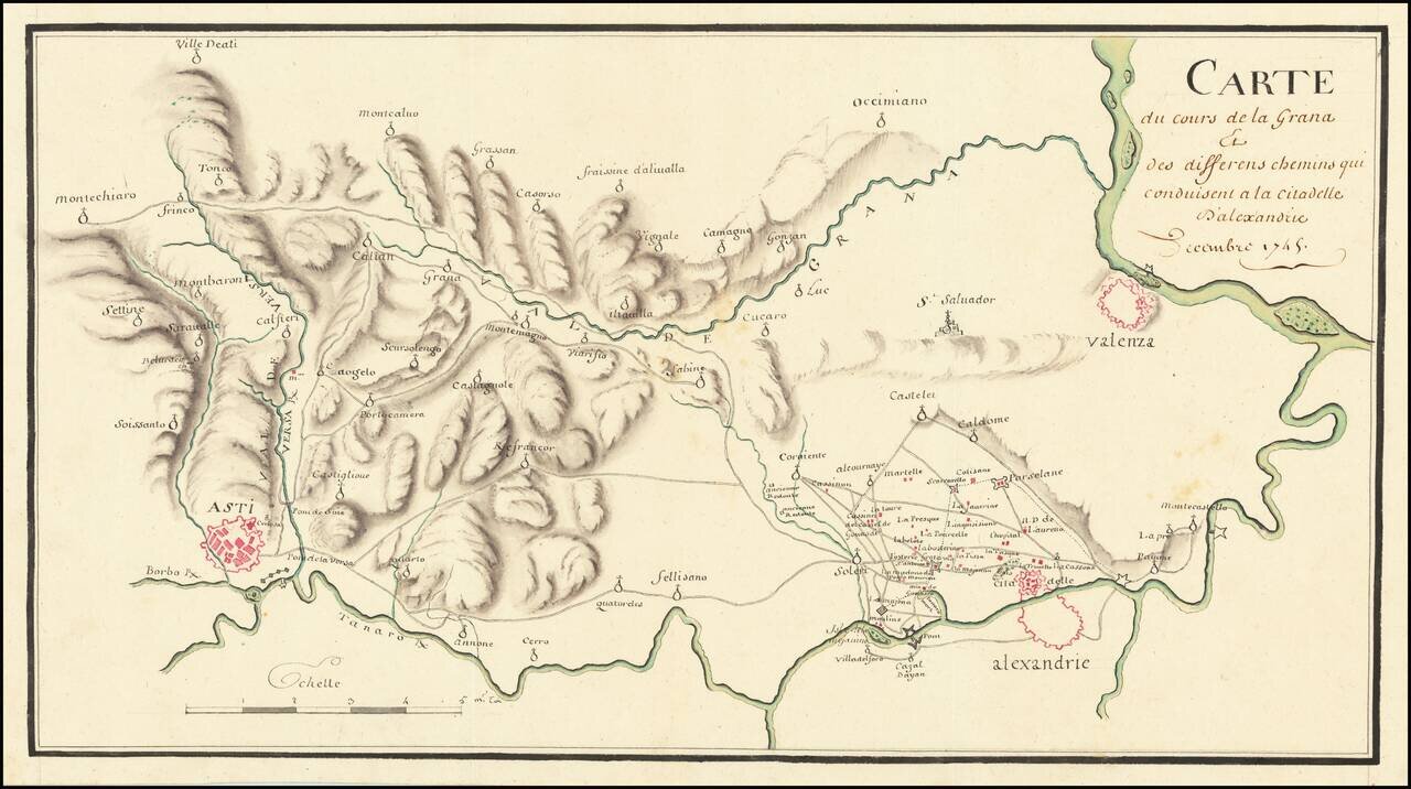
The Italian Campaign -- War of Austrian Succession Fine manuscript map of the area between Allesandria, Asti, Valenza and the Val de Grana, illustrating the theater of war during the War of Austrian Succession. The map illustrates the theater of war...
![[Savona Province and Environs]](/map/small/65400.jpg)
Detailed manuscript map of the Savona Province of Italy, drawn during the War of Spanish Succession. The map was drawn during the period when the region and all of the Republic of Genoa was overrun by Charles Emmanuel III. Italian Campaigns - War of...
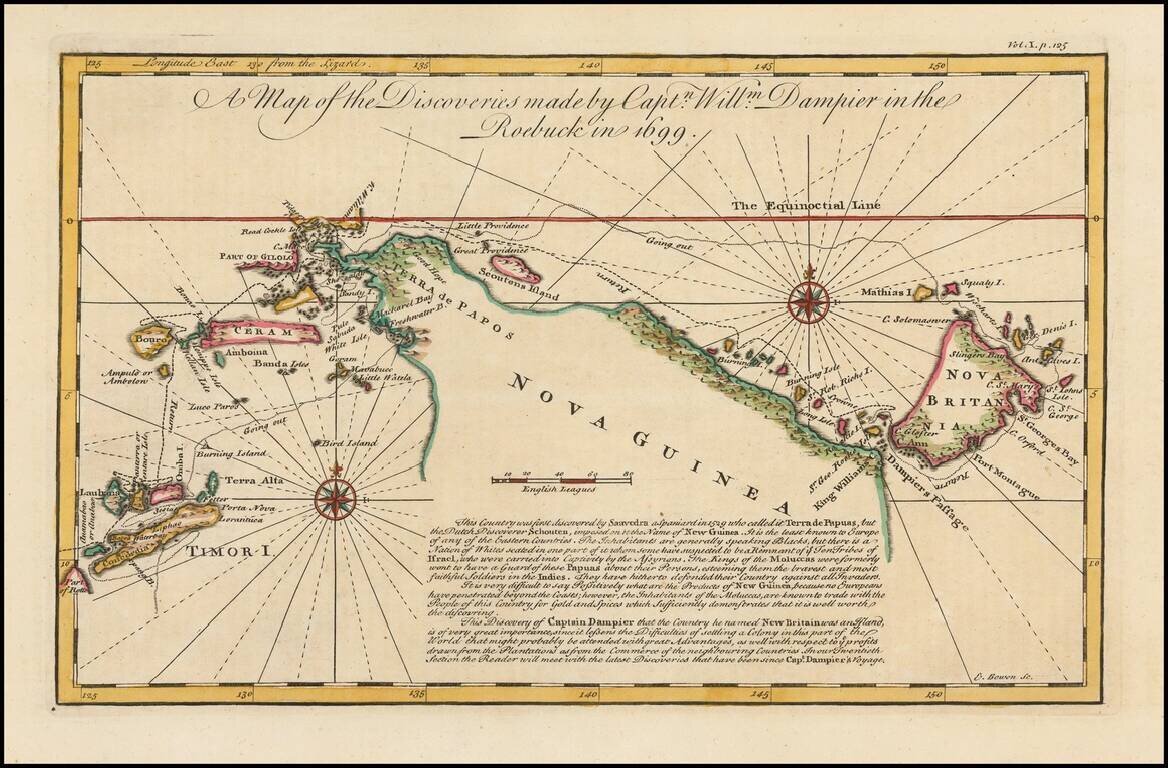
Detailed map of New Guinea as seen by William Dampier, first man to circumnavigate the world three times and first naturalist afloat This is a map of William Dampier's tracts aboard the Roebuck in 1699, included in the re-issue of John Harris'...
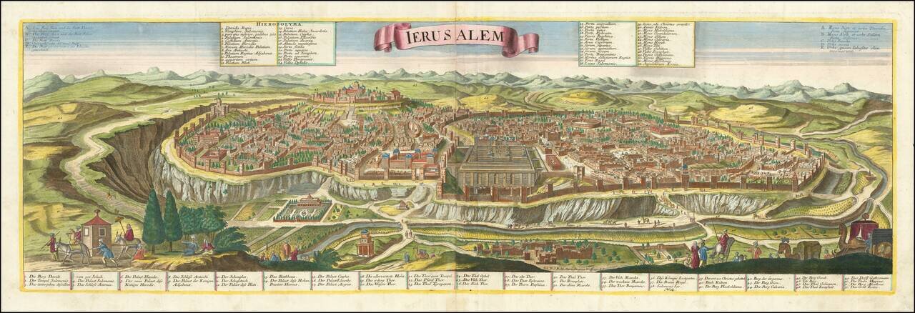
Striking example of the scarce Jermiah Wolff edition of Probst's fine large format view of Jerusalem. Printed on 2 sheets, the map shows Jerusalem from the east. Includes matching Latin and Germans key locating 52 important places within the view,...
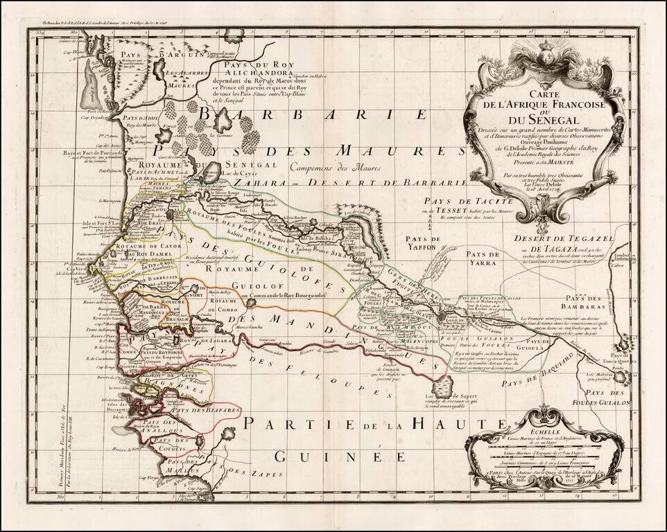
Fine example of Philppe Buache's edition of De L'Isle's highly detailed map of part of the West Coast of Africa, from Cap Blanc to the Pays des Mallus, centered on the Gambia River and Senegal River. Extraordinary detail along the two rivers, tracking...