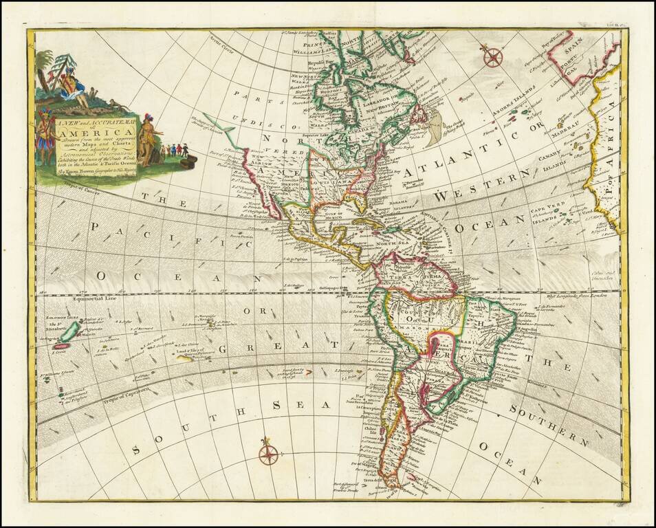
Decorative map of North & South America, published in London by Emanuel Bown. Shows the Parts Undiscovered in the Northwestern part of North America, locating the supposed Straits of Anian, Cape Mendocino, New Albion, Drake's Port, Monterrey, and...

This is a scarce map encompassing Poland and parts of the grater Baltic Region, Russian, and Ukraine. The map extends from the Gulf of Riga to the Black Sea at the mouth of the Dniepr. The map includes an attractive cartouche. This is only the second...
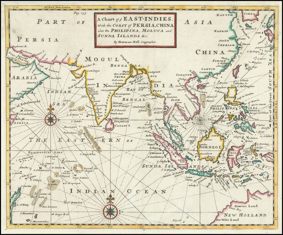
Detailed map of the Indian Ocean, Southeast Asia, China, Formosa, the Philippines and part of Australia. A classic example of Moll's fine engraving work. The map shows various sea routes, prevailing currents and other interesting features. The map...
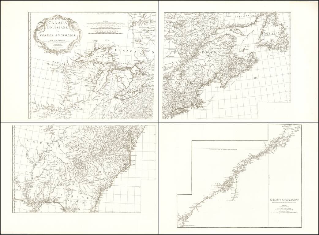
Fine example of this important early four sheet map of North America published by D'Anville. The map extends from James Bay to Florida and as far west as the Mississippi River. Portions of the map are drawn from John Mitchell's seminal map of North...
![Dominia Anglorum in America Septentrionali Specialibus Mappis Londini primum a Mollio… [4 maps--New England; Chesapeake, Georgia, Carolinas & Florida; and Nova Scotia…]](/map/small/53909.jpg)
In the mid 18th Century, the Homann Heirs issued this group of four maps on a single sheet, which are based upon earlier maps by Herman Moll, published in London. Each of the maps was separately issued in Moll's Atlas Minor. The map titles are New...
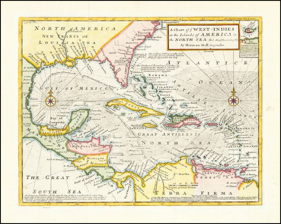
Detailed map designed to show the theater of war for the War of Jenkins's Ear. The War of Jenkins Ear got its name from an event that occurred in 1731, when Robert Jenkins, the captain of the Rebecca, was captured in the West Indies by the Spanish. He...
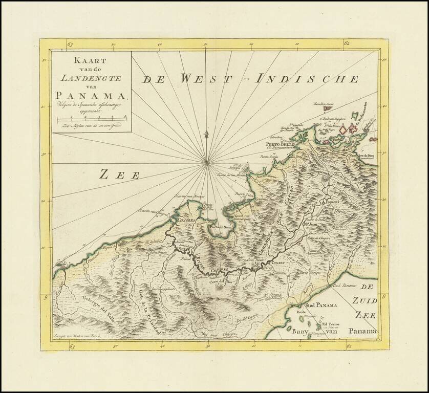
Detailed map of Panama, published in Amsterdam by Isaak Tirion. Extends from Panama City at the southeast, Chagres at the northwest and Porto-Bello at the northeast. Several missions are also located. Roads and the Chagres River connect them all.
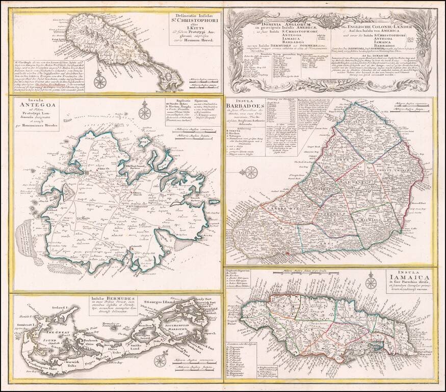
Interesting set of 5 maps on a single sheet, showing St. Kitts, Antigua, Bermuda, Barbados, and Jamaica, each in excellent detail. The maps area drawn from separate maps made by Herman Moll in 1729. Each is finely engraved and meticulously detailed...
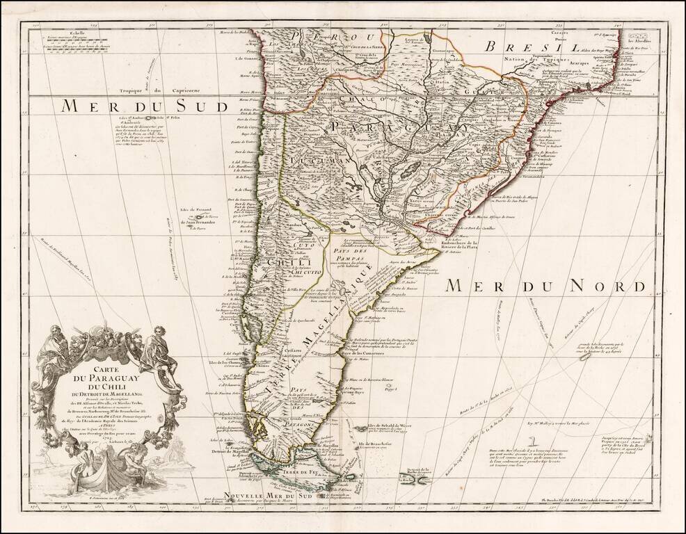
Nice example of Philippe Buache's edition of De L'Isle's map of the southern part of South America. The map shows the routes of a number of 17th century explorers in both the Atlantic and Pacific Oceans, as well as a marvelous and highly annotated...
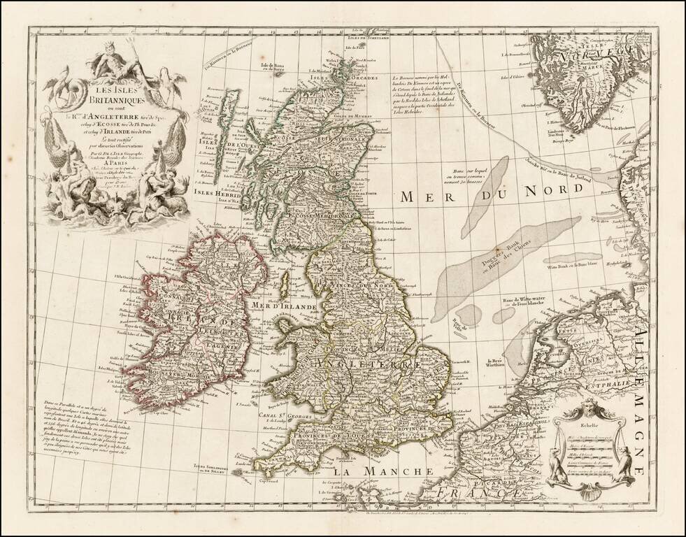
Nice example of one of Buache's editions of Guillaume De L'Isle's map of the British Isles. The map incorporates John Speed's information on England, Timothy Pont's mapping of Scotland and Petty's mapping of Ireland, as noted in the title.
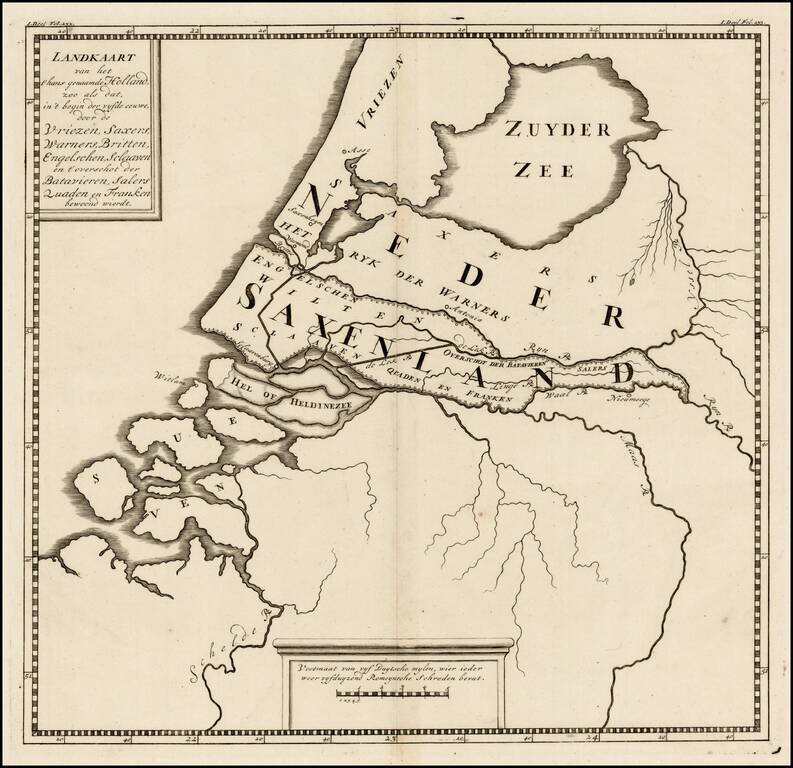
Rare ancient map of the Low Countries, with reference to the various tribes of early Europeans who came through the region. The map appeared in a 9 map atlas published in 1745 by Pieter de Hondt in Den Haag, entitled Atlas van het aloude Holland, En...
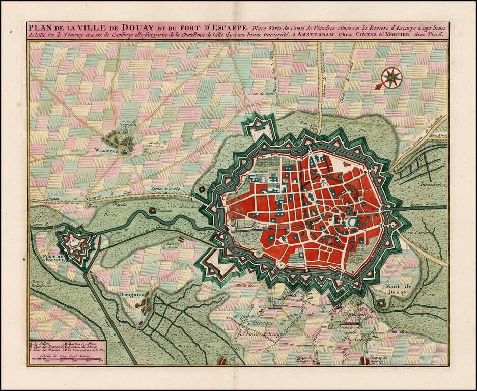
Striking old color example of Covens & Mortier's plan of Douay and the neighboring Fort D'Escape. The map focuses on the town fortifications and also includes details of the town plan, and neighboring fields and details. Coven's & Mortier's...
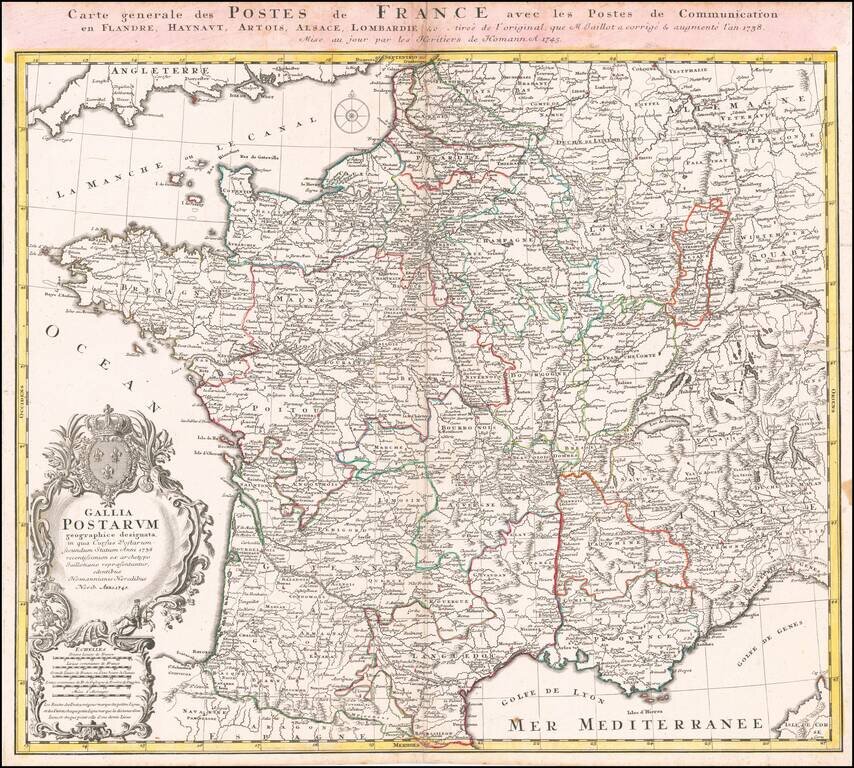
Scarce early postal map of France, published in Nuremberg. Includes an elaborate cartouche with coat of arms.
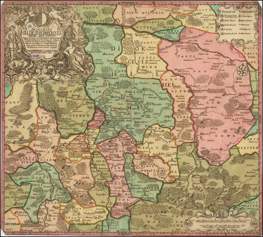
Rare map of the Diocese of Hildesheim by Joachim Lavenstein. Hannover, Brunswick and Wolfenbuttel also appear on the map. This is the first time we have ever seen the map. The mapmaker is not listed by Tooley.
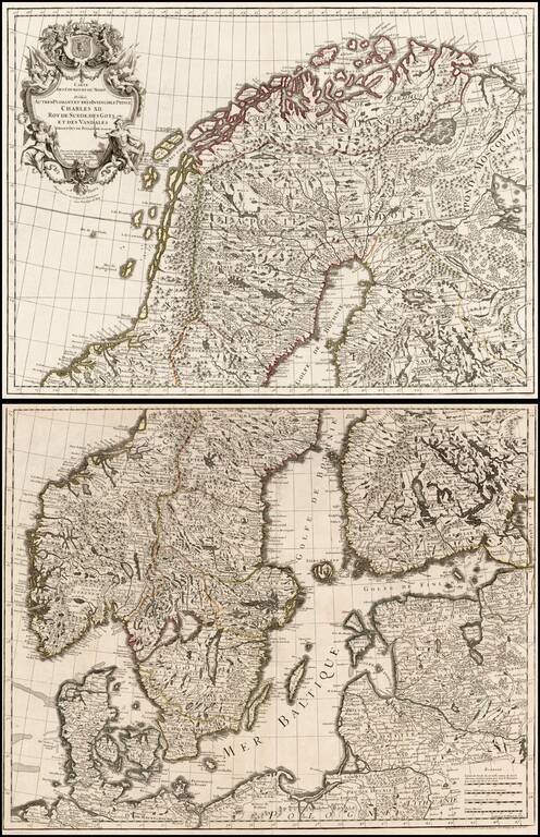
Large format 2-sheet map of the region from Scandinavia to the Baltic and part of Poland, originally issued by De L'Isle in 1708.
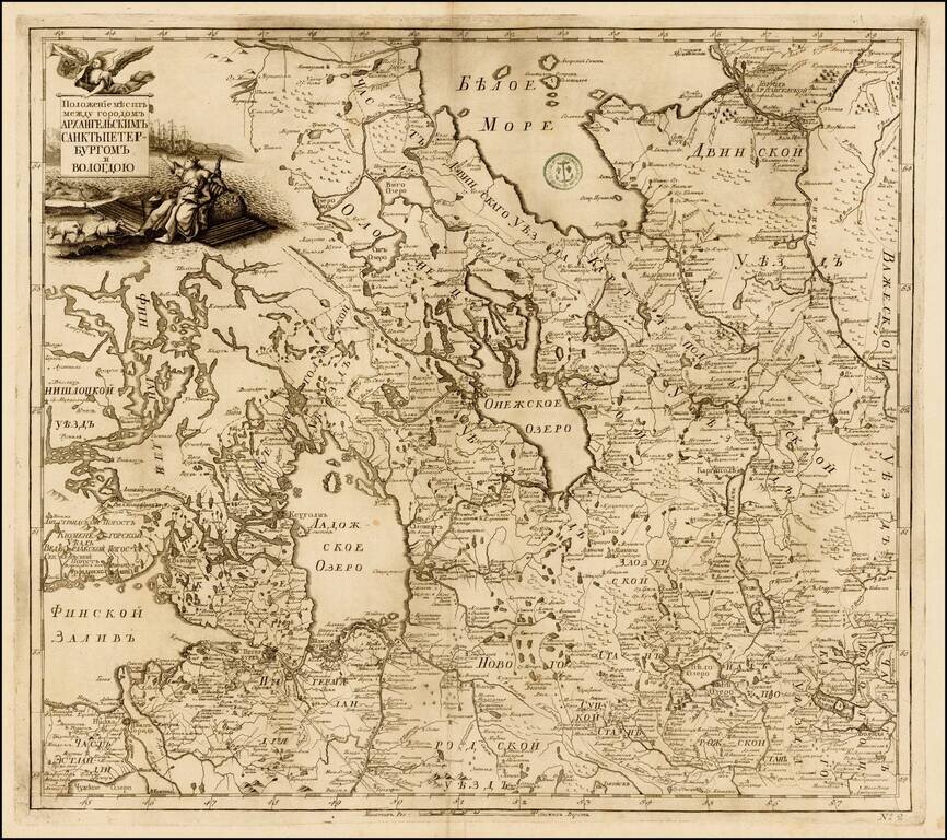
Fine example of the rare map of the region of Petroburgum, from the Russian Academy of Science's Russischer Atlas : Welcher in einer General-Charte und neunzehen Special-Charten das gesamte Russische Reich . . . , first pubished in St. Petersburg in...