
Decorative map from a scarce A.F. Zurner atlas. Full original color. Decorative armillary sphere with unique representations of the world below. A very unusual image, which we have never previously seen. A scarce decorative map.
![Americae Aucta Delineatio [California as an Island]](/map/small/67220.jpg)
Decorative map from a scarce A.F. Zurner atlas. Full original color. Shows a unique projection of California as an island, and marvelous Terra Iesso, running from Fretum Anian to Japan. Bits of Australia are shown as Quiri Regio. A nice scarce map.
![The West Part of Barbary... [on sheet with:] The East Part of Barbary...](/map/small/52496.jpg)
A nice example of Herman Moll's 1729 miniature engraved map of North Africa in two images on the same sheet, from his Atlas minor. Hand-colored by kingdom. Includes an inset of the harbor of Oran.

First Edition of the Most Important Celestial Atlas of the 18th Century, with the Engraved Portrait of Flamsteed. Engraved portrait of Flamsteed, title, dedication to George II, 9 pages of text, 1 page "A LIST of the SUBRIBERS." [sic], and 27 engraved...
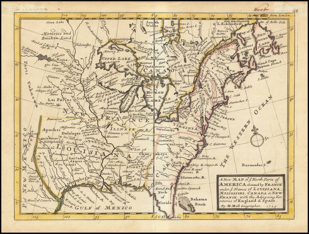
A nice example of Moll's map of the British, French and Spanish regions of North America, reduced from his landmark Sasquehanna Village map. The map, which appeared in Moll's Atlas Minor, is one of the smaller format English maps of the period, with...
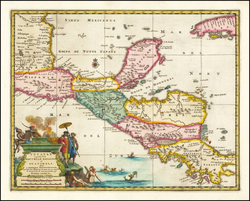
Rare early map of Central America and the Caribbean, published by Vander Aa in Amsterdam. Decorative map of the region from Mexico City to Panama City, extending to include part of Cuba, and is based on Blaeu's map of the Yucatan peninsula. Cozumel...
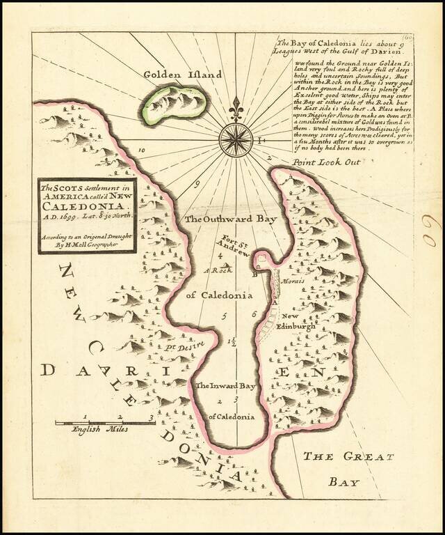
Interesting map depicting the site of the short-lived Scottish colony of New Edinburgh. In 1698, William Paterson, Scottish Governor and founder of the Bank of England, proposed a plan to create a colony in modern day Panama. The Company of Scotland...
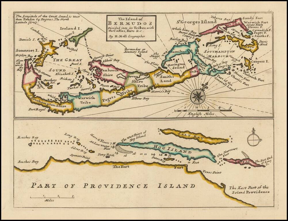
Striking full color example of this Moll's map of Bermuda and the North Coast of Providence Island, with Hog Island, Long Island, Salt Key, etc. The Bermuda map includes significant details, including Tribes, towns, bays, islands, sounds, and other...
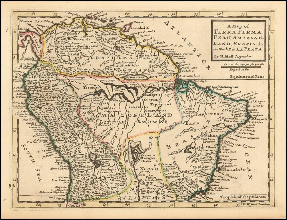
Interesting early 18th Century map of Columbia, Venezuela, Ecuador, and part of Peru, Brazil and Argentina (then La Plata).
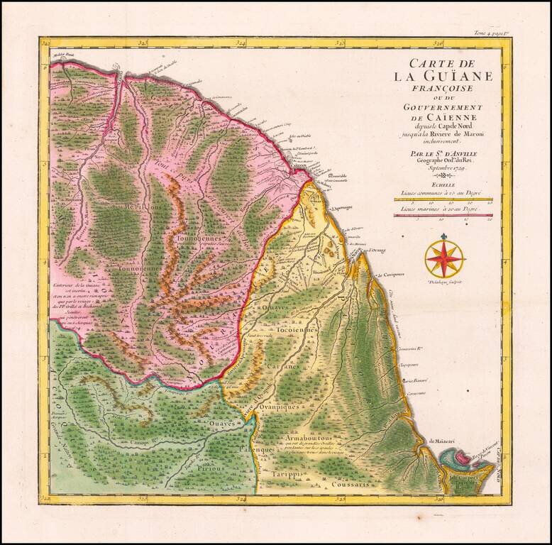
Striking Map of French Guiana Showing Jesuit Influence in the Region Fine, old color map of French Guiana by D’Anville showing this seldom-mapped region. The map was included in a travel account by the navigator and slave ship captain the Chevalier...
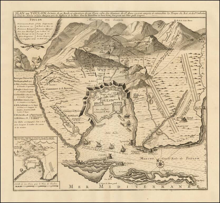
Fine battle plan of Toulon, showing the engagement at the Battle of Toulon in 1707. The map provides an exceptional overview of the engagement, showing fortifications, battery positions and the bombardments from the harbor by various named ships....
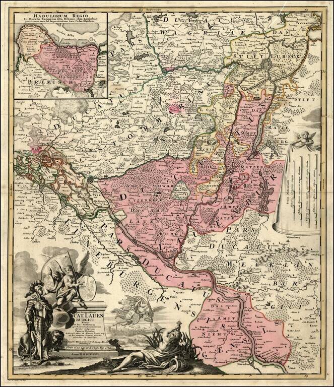
Detailed regional map, tracking the Elbe River from Hitzger to Hamburg and extending north to beyond Lubeck. Several eleborate decorative cartouches.
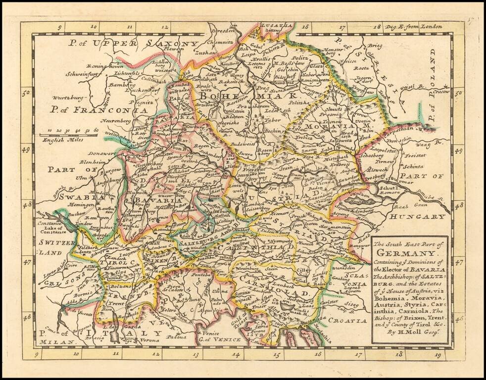
Interesting early 18th Century map of southeastern Germany. The map was published by one of London's leading mapmakers, Herman Moll.
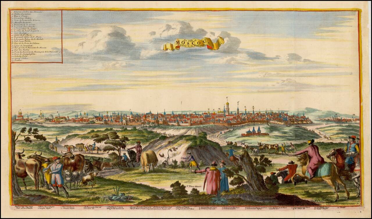
Fine view of Moscow, after Nicolas Witsen's view. The view includes a key identifying 24 locations.
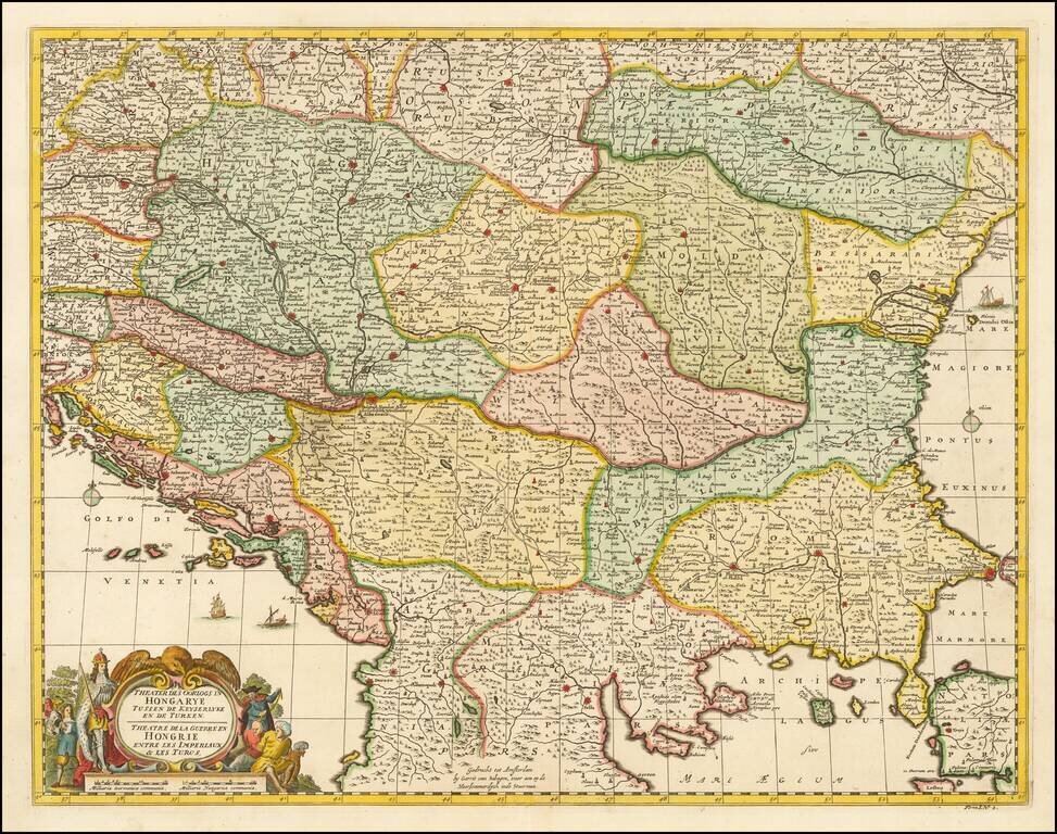
Gerrit van Schagen's hand-colored engraved map of the Balkans, showing Hungary, Romania, Bulgaria, Serbia, etc. Attractive cartouche in the lower left.
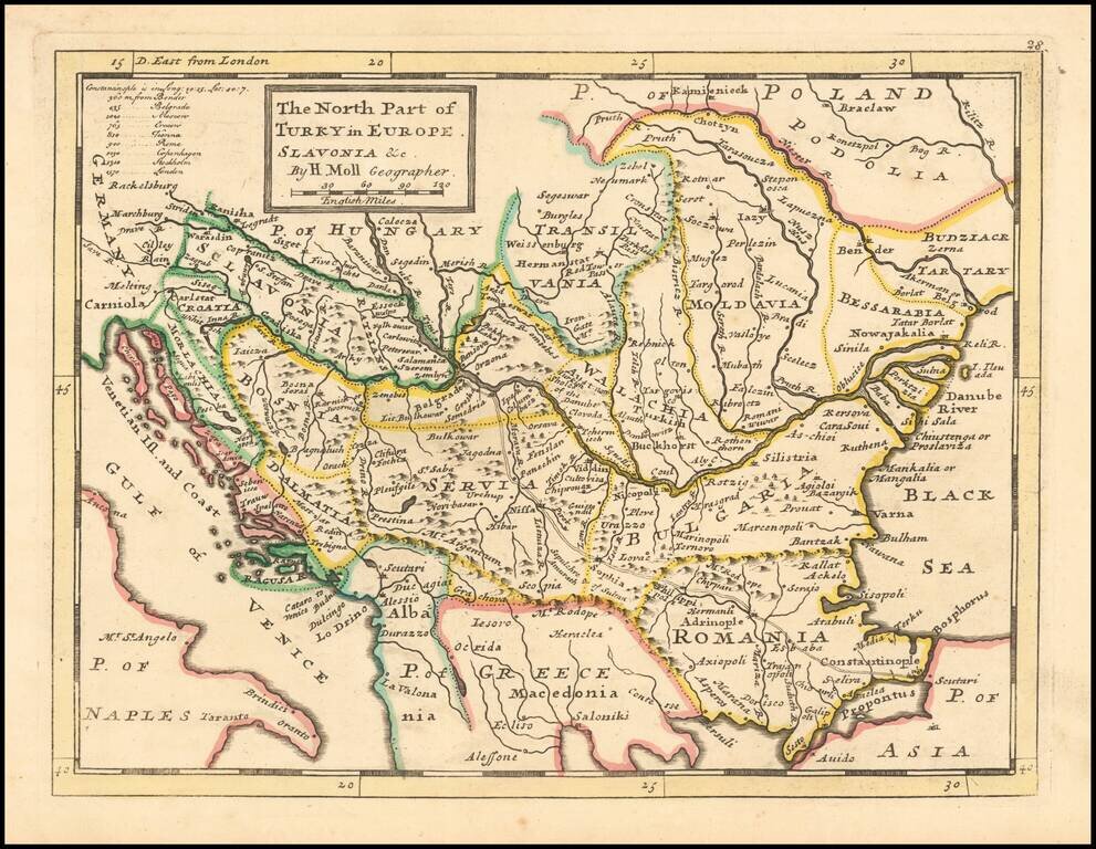
Interesting early 18th Century map of Balkans region, at a time when the region was still controlled by Turkey. The map extends from the Black Sea to Slovenia, Croatia and Dalmatia. The map was published by one of London's leading mapmakers, Herman Moll.