![[Wall Map of the World -- Totius Terrarum Orbis Geographica Descriptio . . . 1682]](/map/small/58871.jpg)
Unrecorded Wall Map of the World Based Upon Sanson's 6 Sheet Wall Map -- Not In Shirley! Rare separately published wall map of the World, published in Augsburg by Hans Georg Bodenehr in 1682. Originally issued in 60 small numbered sheets, the map was...
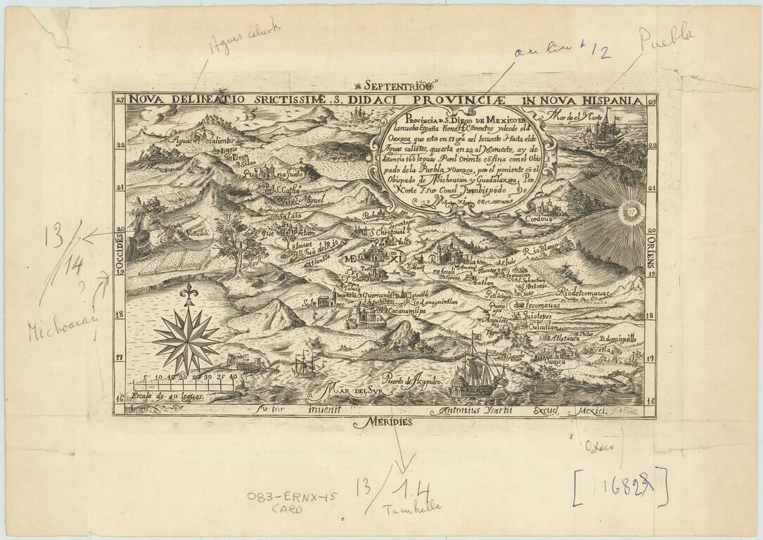
Fascinating later printing of the second state of "one of the first copper-engraved maps published in Mexico (the map that appeared in Montemayor y Cuenca's Discurso politico, historico, jurídico del derecho, (1658) is earlier (from Ken Ward, JCB)" -...
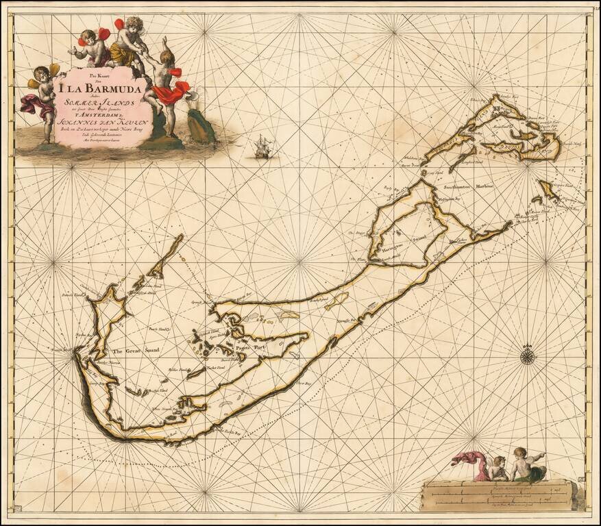
The Most Decorative Sea Chart of Bermuda published in the 17th Century. Striking early sea chart of Bermuda, published by Johannes Van Keulen. The chart includes remarkable early detail, including the fortifications in Southampton Harbor. As noted...
![[Dutch Wall Map] T Hoogh-Heemraetschap vande Uytwaterende Sluysen in Kennemerlant ende West-Frieslant](/map/small/30941.jpg)
Detailed water board (commission) map of the north part of Holland, based upon the 16 sheet map of Johannes Dou, published in 1680. A fine 4 sheet reduction of the 16 sheet map of the region, surveyed by Johannes Dou (1642-1682) in 1680, and engraved...
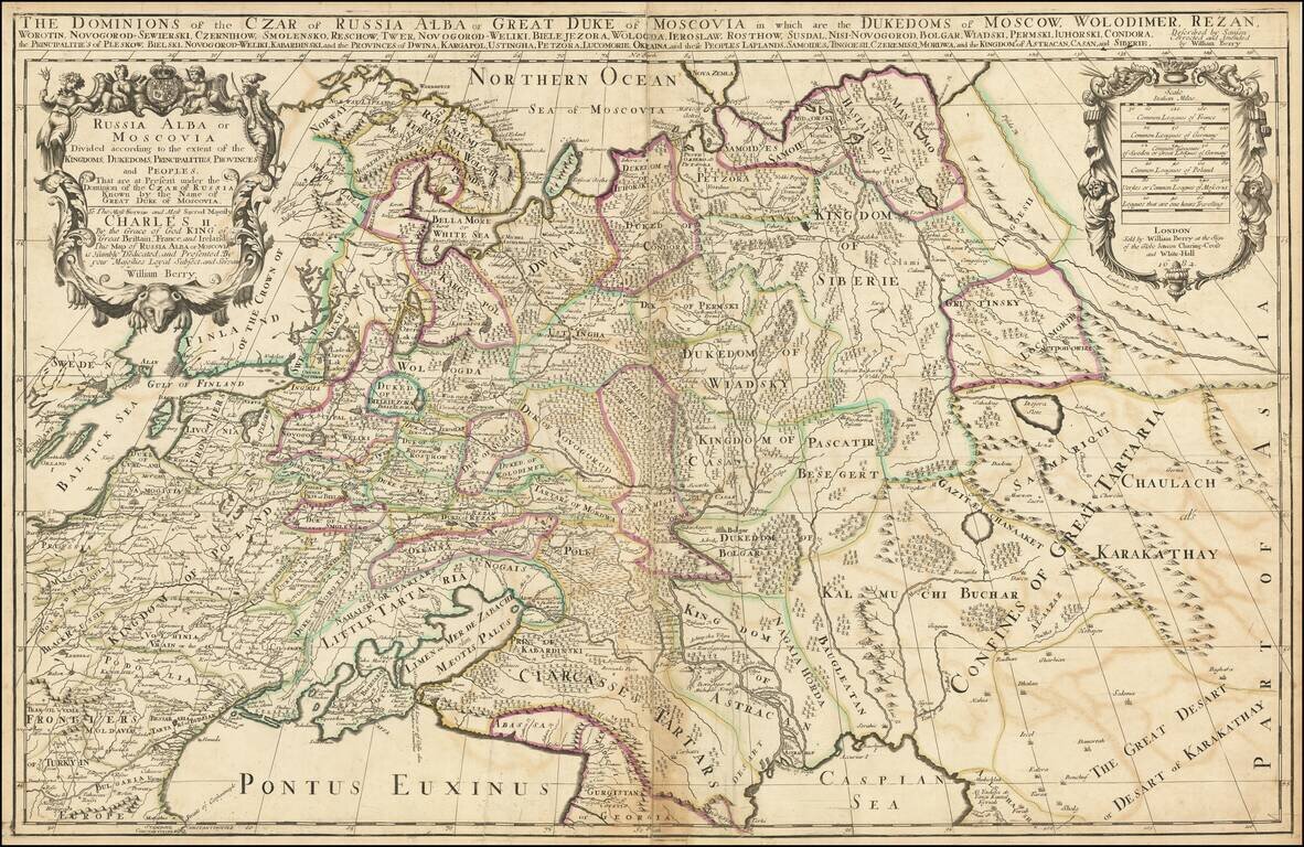
First state. Impressive two-sheet engraved antique map of Russia, published by the 17th century London mapmaker William Berry in 1682. The map covers all of Russia to the Ural Mountains and also depicts a large Kingdom of Poland dominating most of...
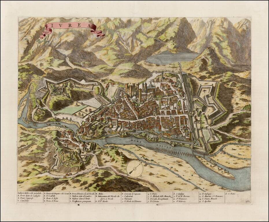
Fine example of Blaeu's view of Ivrea, from the Theatrum Statuum Regiae Celsitudinis Sabaudiae Ducis, Pedemontii Principis, published in 1682. The view was engraved by Johannes de Ram. Ivrea is a town in the modern Turin Province, in northwest Italy.
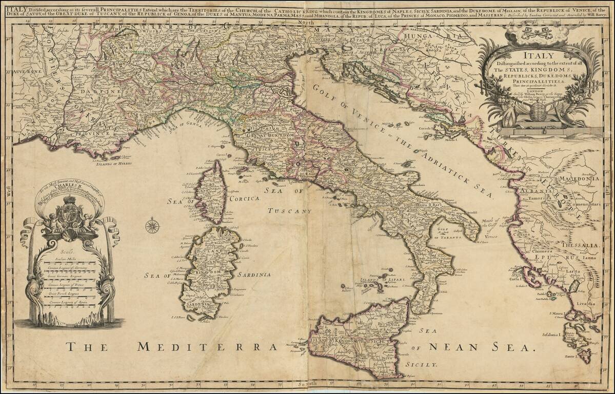
Rare example of William Berry's 2 sheet map of Italy, Corsica, Sardinia, Sicily, and adjoining regions. The map includes a large dedication cartouche to Charles II, King of England. Dated 1682, the map was issued shortly after Charles dissolved the...
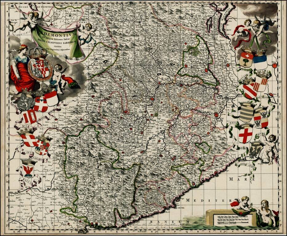
Nice old color example of Johannes Blaeu's map of the Pedemonte region, from Blaeu's Theatrum Sabaudiae, first published in 1680. The map includes 16 coats of arms of various regions depicted on the map. The map was engraved by J. de Broen and is...
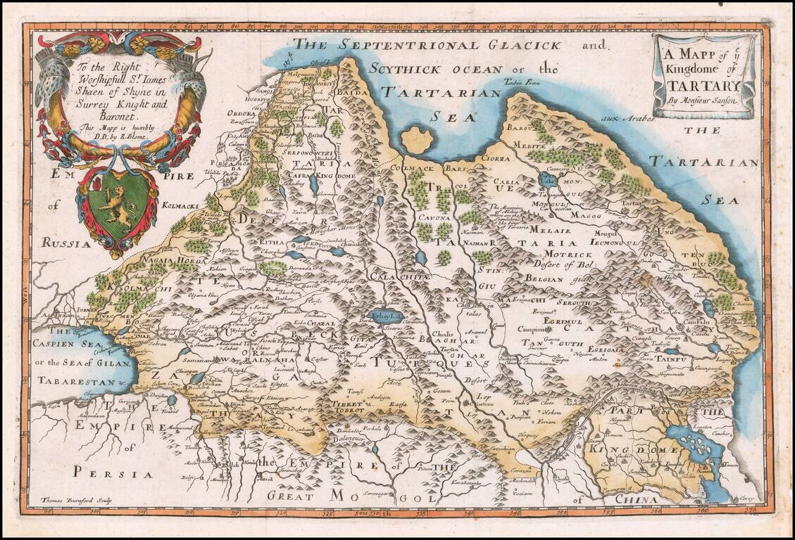
Rare Late State of the First Map of Tartaria Engraved In England. Nicely colored example of this scarce map of Tartaria. The present example is from a very late edition, where the title, dedication and coat of arms have been completely re-engraved....
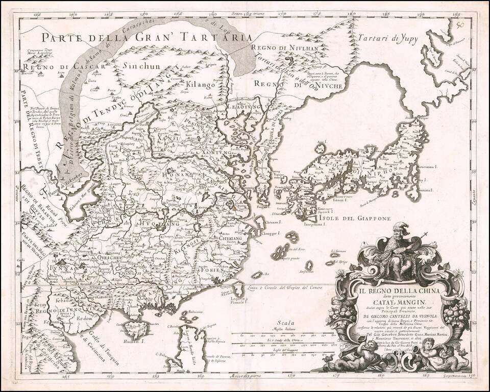
Rare 17th Century Italian Map of China Finely colored example of this rare early map of China, Japan and Korea, along with neighboring regions, by Cantelli da Vignola and published in Rome by Rossi. The map was engraved by Giorgio Widman for Rossi's...
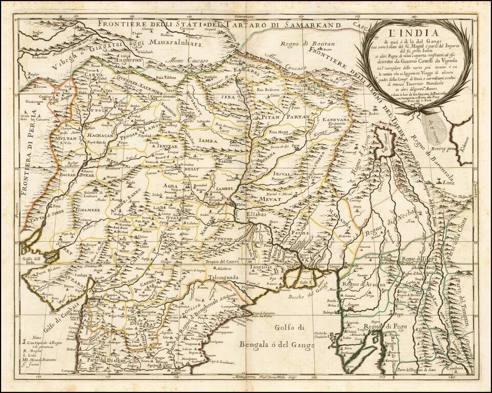
Nice example of the Cantelli-Rossi map of Northern India, Pakistan, Afghanistan and Tibet. The title carries a dedication to Jean-Baptiste Tavernier. Along the northern frontier, the map extends to Cabul, Samarkand, Nupal, Boutan and Lassa. The...
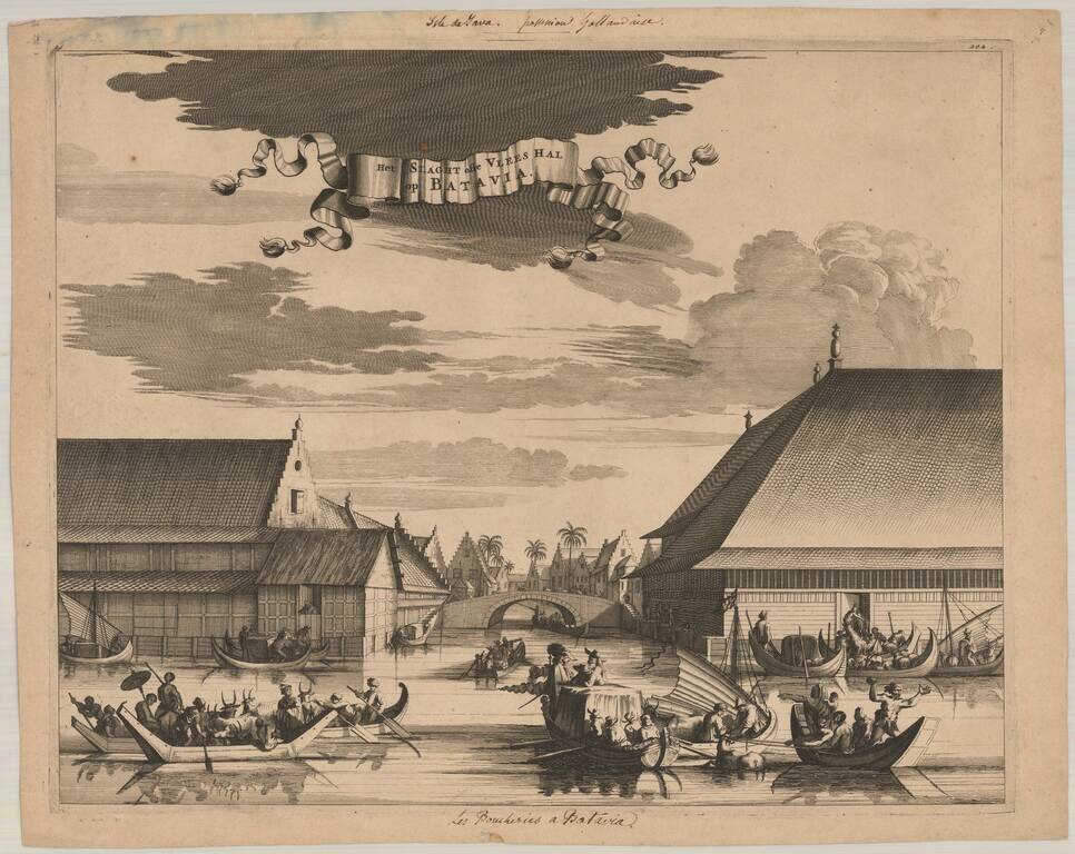
This interesting engraving shows the slaughterhouse at Batavia. The canal is filled with small boats filled with a variety of animals being brought to the large building. There is a commotion at right where a cow has fallen overboard.
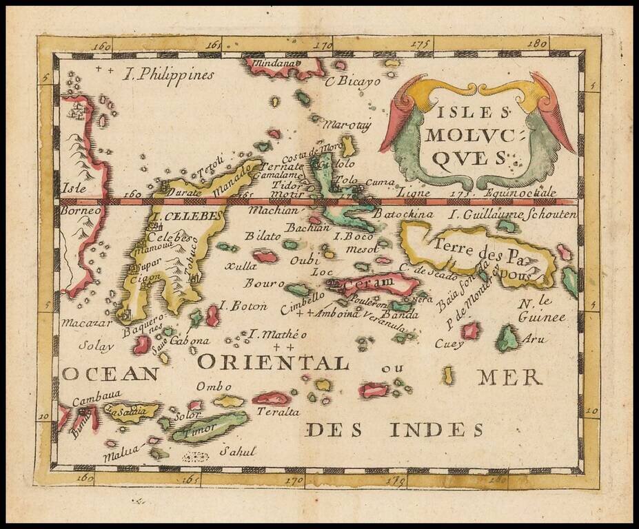
Scarce small format map of the Spice Islands, published by Pierre Du Val in Paris. One of the earliest obtainable maps to focus so closely on this region.
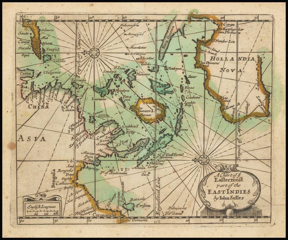
Extremely rare English map of the East Indies and Australia, oriented with the East at top of the map. The map covers the East Indies from India to Japan in the north and New Guinea and Australia in the south. Australia is named Hollandia Nova and...
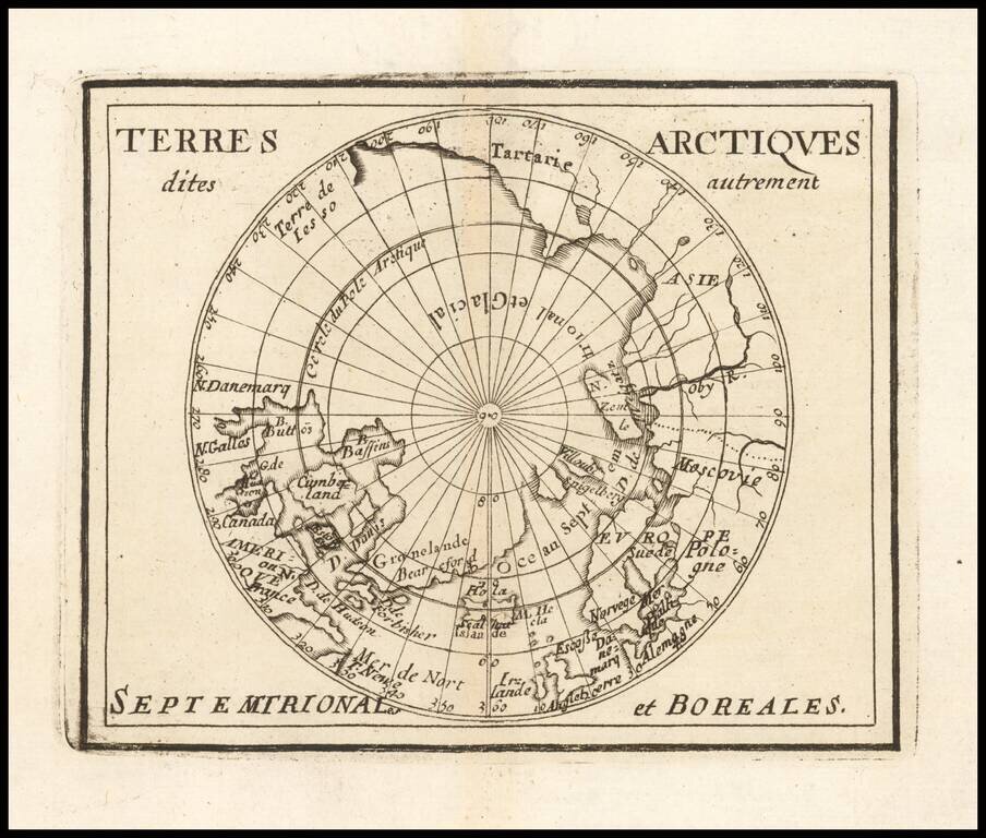
Rare map of the Northern Hemisphere, illustrating the known and imagined lands of the North Polar regions. The map provides a fine accounting of the lands of the North Polar regions, much of which were fictional.
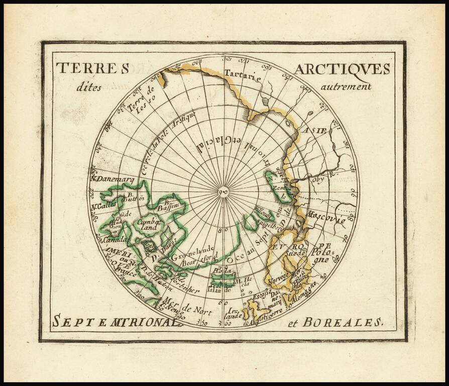
Du Val's Map of the Arctic Rare map of the north polar regions. The map provides a fine accounting of the lands of the Polar regions, which remained largely unexplored.