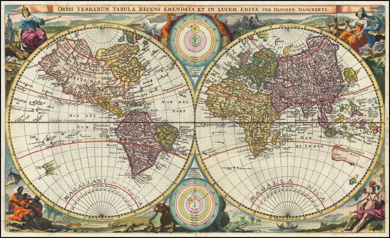
A World Map Unknown To Rodney Shirley This rare double hemisphere map of the world is among the earliest maps to depict both of Abel Tasman's Voyages to Australia and New Zealand and among the earliest to depict the New Zealand and Australian...
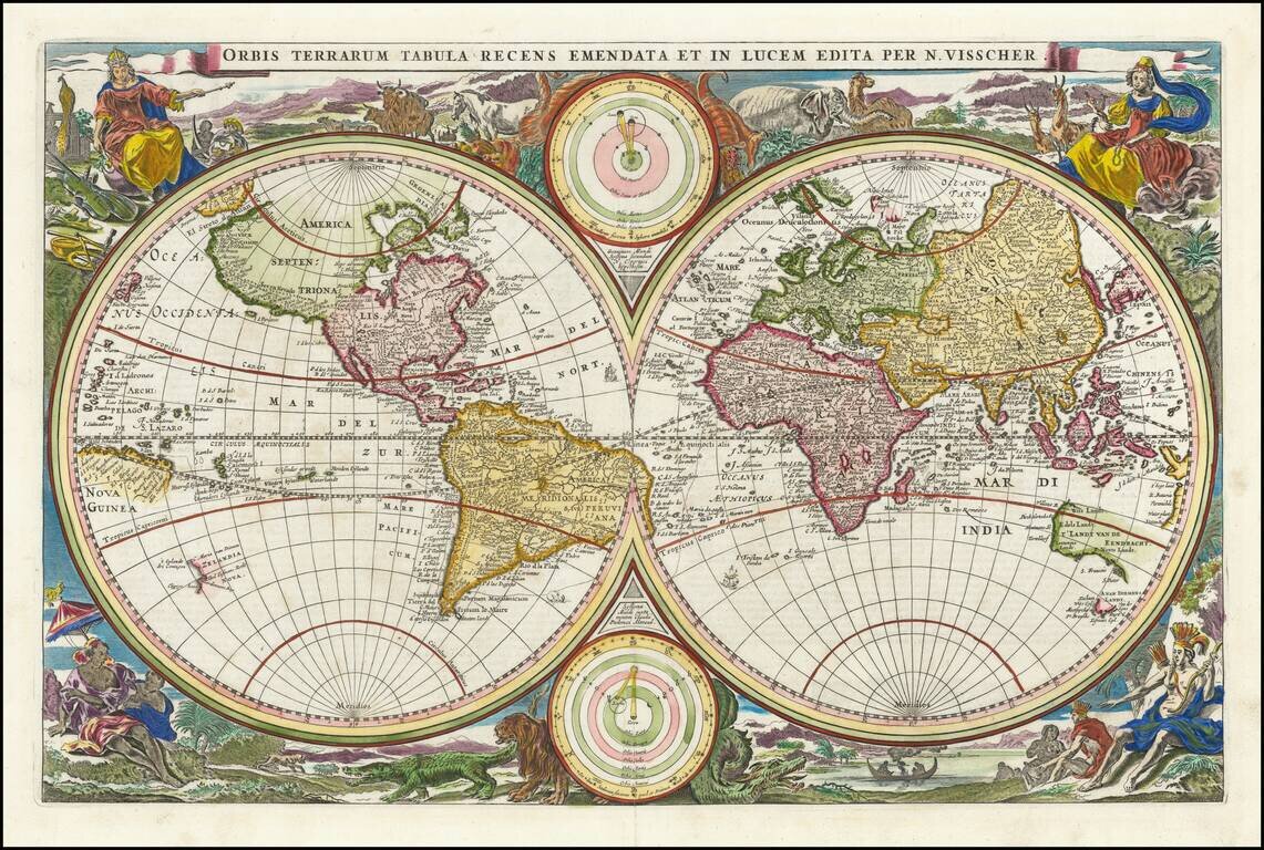
Scarce first state of Visscher's double hemisphere map of the world, which includes many of the great 17th Century cartographic myths and errors. A massive land extension north of California reaches nearly to Asia and shows the Straits of Anian and NW...
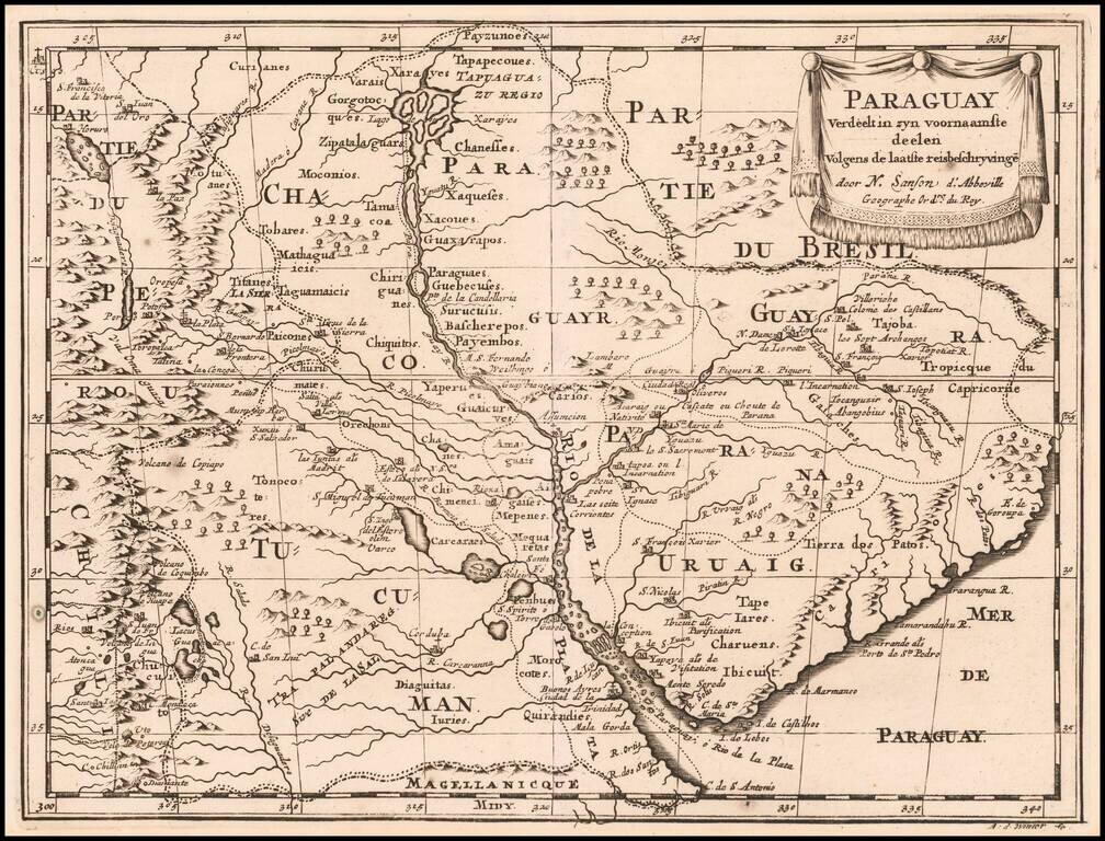
Antique Map of the Rio de La Plata Basin Early Dutch edition of this detailed early map of the Rio de la Plata Region, showing Buenos Aires, the source of the Rio de la Plata and Paraguay Rivers and extending west to Chile and Peru. Many major cities...
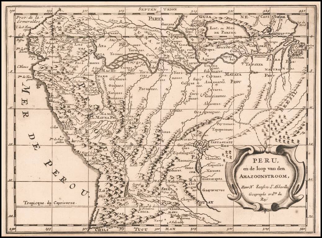
Dutch edition of Sanson's map of Peru and the Amazon region, showing the extensive rivers and tributaries which extend to the Andies, along with the rich details of the mountainous regions of Peru, then the most affluent of all of the Early Spanish...
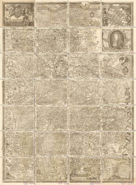
Nice example of G.P. Finckh's version of Philip Apian's 1568 map, the first printed map of Bavaria, Engraved by Ainling. Apian's map of Bavaria is considered to be a pioneering monument of modern cartography. In 1554, Duke Albrecht of Bavaria ordered...
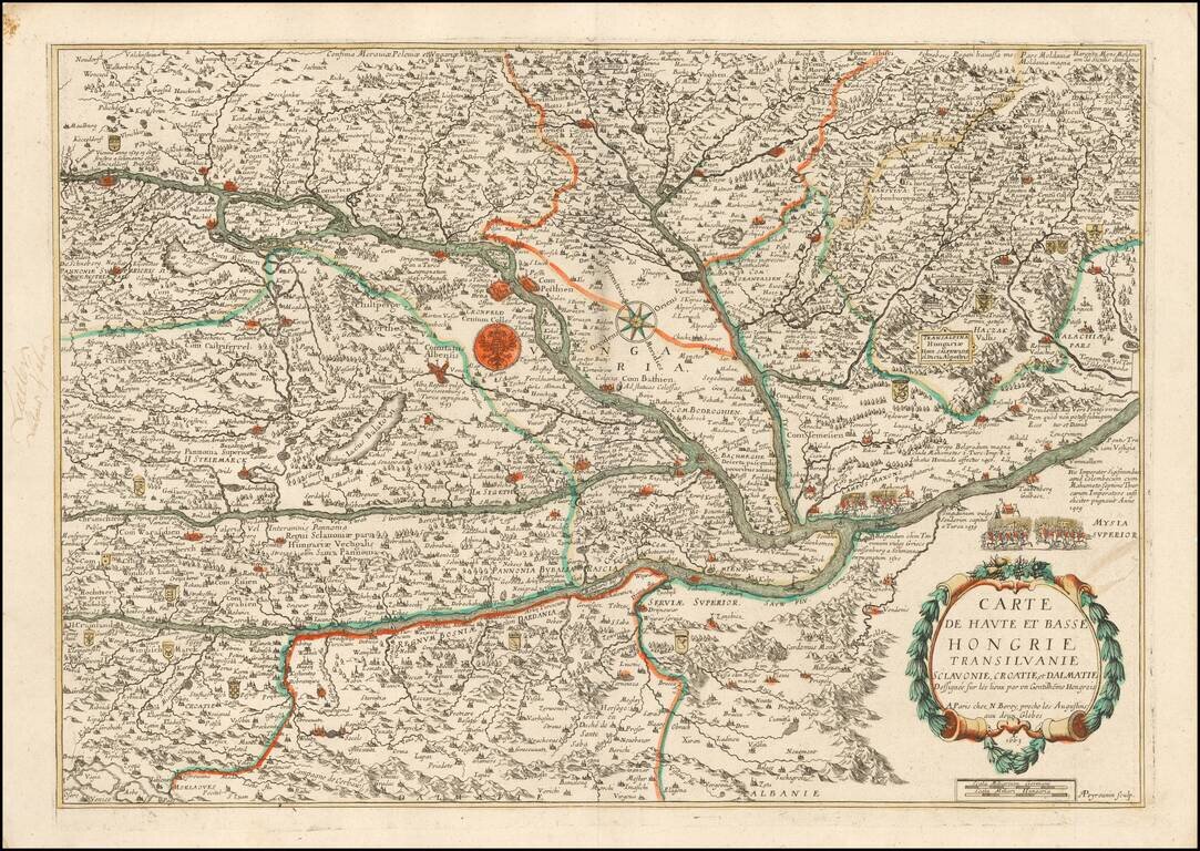
Rare map of Upper and Lower Hungary, Transylvania, Slovenia, Croatia and Dalmatia, published by Nicolas Berey in Paris. The map tracks the course of the Danube from Vienna to beyond Belgrad. The map includes several small vignettes depicting...
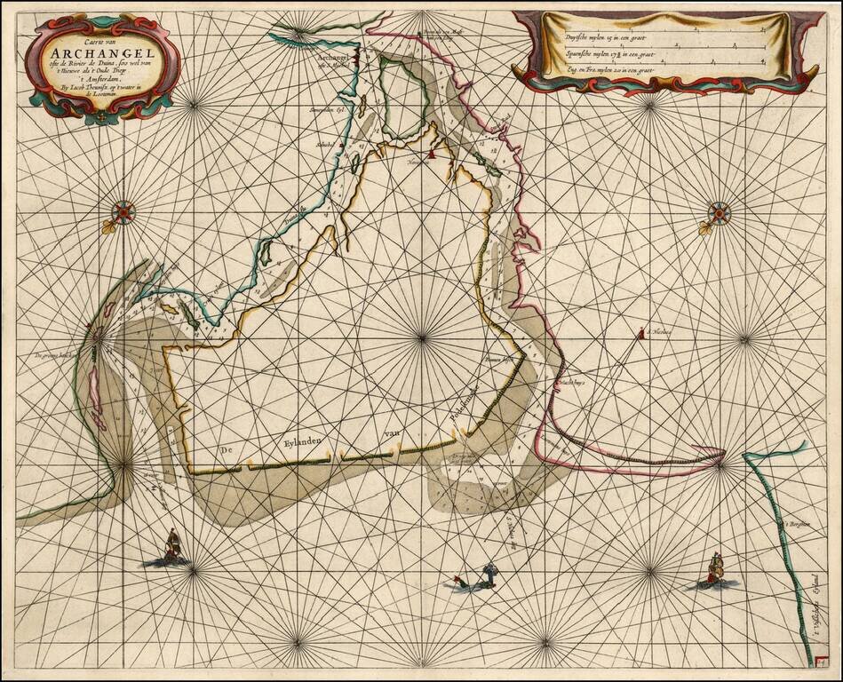
Rare sea chart of the mouth of the Duina River and the port town of Archangel, published by Jacob Theunisz (Lootsman). At first Jacob adopted his father Anthonie's name, being known as Jacob Theunisz. Later with his brother Caspar, in association,...
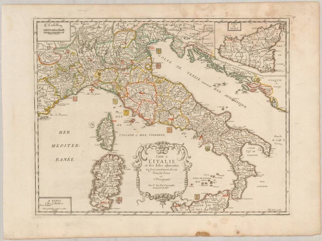
Scarce map of Italy, published in Paris by Pierre Du Val in 1663. The map is embellished by approximately 20 coats of arms of the various regions of Italy. Highly detailed, including towns, roads, rivers, castles, harbors, bays and a host of other...
![[Southeast Asia, Philippines & India] Nova Delineatio particularis Apostolicarum Peregrinationum noni Indiarum Apostoli in India Orientali](/map/small/51679.jpg)
Rare map of India, Southeast Asia and the Philippines, illustrating the travels of the earliest Jesuit Missionaries. The map includes a key locating the earliest Jesuit Missions in the region. The map was published to illustrate a book on the life of...
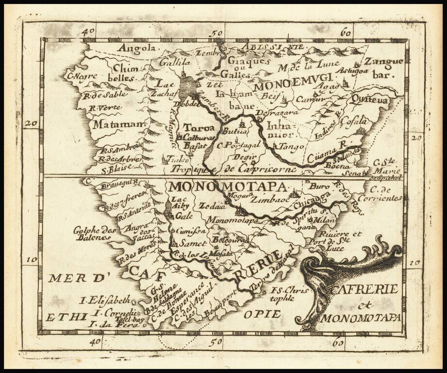
Rare engraved map of southern Africa, from Pierre Du Val's La Gegoraphie Universelle. This is a later state of a map that first appeared in 1663. In this state Table Bay and Aghulhas Bank are named. This map was published at the time that the first...