Rare old maps of the whole world. Secret knowledge, ancient worlds, ancient maps - discover the ancient world

Interesting broadside chart, consisting of a compass rose at the center and ringed with information on the earth and the solar system. As noted below, we have attributed this example to A.G. Dusauzet, who seems to have been the original creator,...

Decorative map from a scarce A.F. Zurner atlas. Full original color. Decorative armillary sphere with unique representations of the world below. A very unusual image, which we have never previously seen. A scarce decorative map.

A rare map of the North Sea (Atlantic Ocean) from the Polar Circle to the Equator, showing much of North America, the Caribbean, and parts of Europe and Africa. The detail in the British Colonies in North America includes Carolina, Virginia, Maryland,...
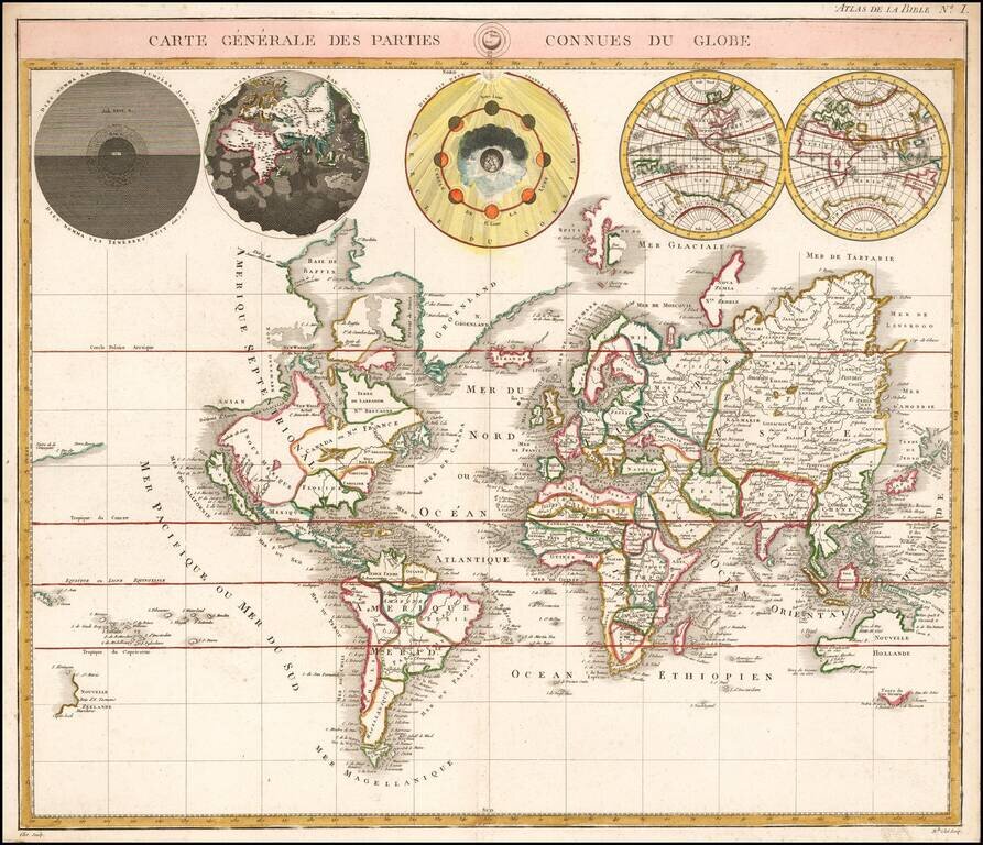
Striking example of this later edition of Mortier's double hemisphere map of the World, showing California as an island. The 5 additional spheres illustrate night and day; the earth without water, the phases of the moon, and the eastern and western...
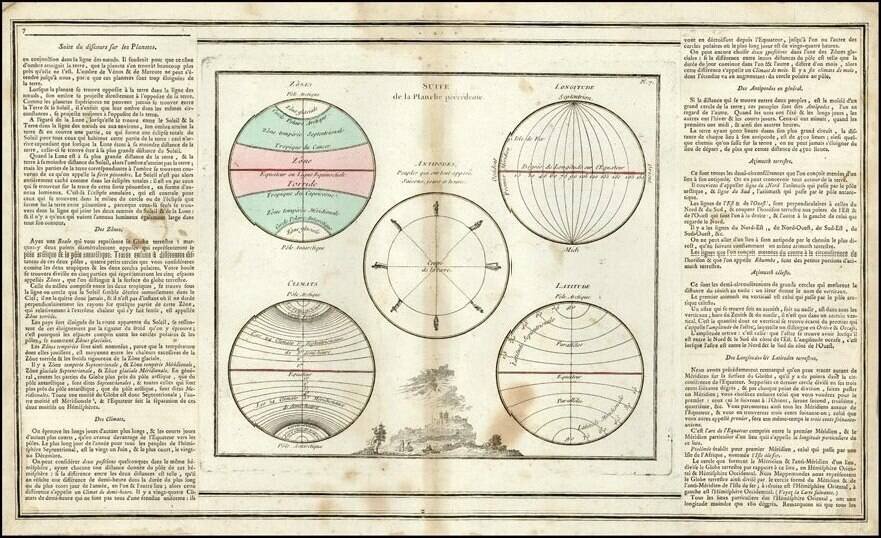
Interesting astronomical chart from Buy De Mornas' famous Atlas Methodique et Elementaire… Shows observations regarding the Climatic Zones, Longitude, Latitude, the Antipodes and has a decorative vignette at the bottom. Minor soiling.
![Globe Terrestre [and] Globe Celeste](/map/small/48094.jpg)
Attractive pair of engraved globes, illustrating the Terrestrial World and Celestial World. The Terrestrial Globe is oriented to show the Eastern Hemisphere, including a wild mid-18th Century illustarion of Australia. The Celestial Globe is oriented...
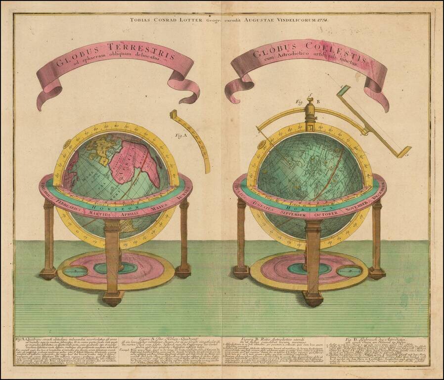
Finely engraved celestial and terrestrial globe, published in Augsburg by T.C. Lotter in 1774. Each of the spheres is described below the image in both Latin an German.

Interesting map of the Western Hemisphere showing explorers routes with dates, an early New Zealand and one very curious anomaly. At first look, the NW Coast of America has been updated to include the entire western coastline above Capo Mendocino and...

One of the Most Detailed and Important Map of the Americas made by a Scandalous Geographer This is a nice example of the 1775 edition of this important six sheet chart of North and South America, originally compiled by John Green (a.k.a. Bradock...
A good example of La Perouse's double hemisphere map of the World, which accompanied George Louis Leclerc Buffon's Histoire naturelle, generale et particulare, a monumental multi-volume treatise first published at the end of the 18th Century. Includes...
A good example of La Perouse's double hemisphere map of the World, which accompanied George Louis Leclerc Buffon's Histoire naturelle, generale et particulare, a monumental multi-volume treatise first published at the end of the 18th Century. Includes...

Fine example of this decorative map of the World on a Cassini projection, published by Jan Elwe. This is the second edition of the map, which was first published by Louis Renard circa 1715. The second edition can be identified by the removal of the...
![Oranda shinyaku chikyu zenzu. [The map of the whole world, newly translated from Dutch sources]](/map/small/41429.jpg)
California as an Island, in the 19th century. Fascinating hand-colored woodblock world map, reflecting the antiquated state of geographic knowledge in Edo period Japan. The map, which was printed around 1800, maintains a number of cartographic...
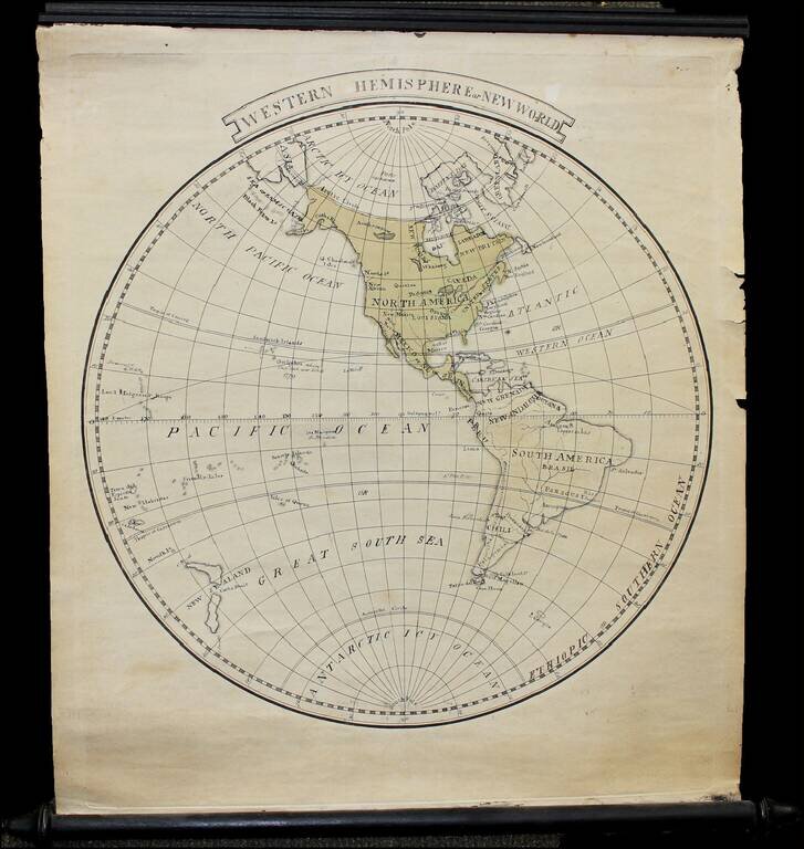
Finely executed manuscript small wall map of the Western Hemisphere on original rods, drawn shortly after Cook's last voyage. The map notes Louisiana as still not yet part of the United States. Hawail is shown (Sandwich Islands), with Owyhee named --...
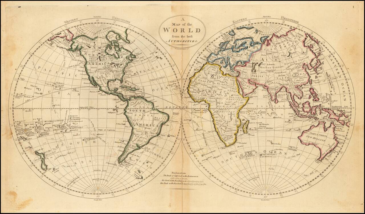
Rare Late Edition Showing Matthew Flinder's Discoveries in Australia Detailed double hemisphere map of the World, showing tracks of some of the contemporary explorers, including James Cook and George Anson. The map shows the "Corean Sea," along with...
Decorative double hemisphere map of the World, which appeared in Carey's General Atlas. The map shows some of the tracks of Captain James Cook in the Antarctic Regions and an interesting Northwest Coast of America, New Zealand and Australia.